
heneghan.peng.architects and Mittelrheinbruecke
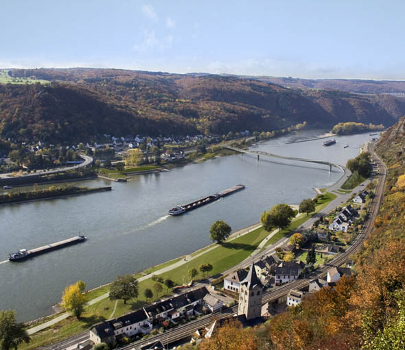
heneghan.peng.architects have won a competition to design a bridge over the Rhine on the UNESCO World Heritage site of the Rhine valley. The design for the new crossing takes a relatively simple approach, minimize the total visual impact along the river corridor; create a structure as low, as horizontal and as thin as possible.
The new crossing should be hidden from 3 key views; the view looking towards the castle and the town of Sankt Goars-Hausen from the west, the view from Sankt Goar-Hausen across the river towards St. Goar, and from both towns looking west towards the crossing. The green floodplain, between the road and the river on the northern bank, is preserved as a park for the town by the introduction of the bridge ramp at the end opposed to the midpoint of this park.
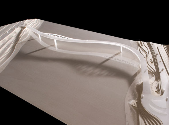
Though the central span of the bridge, which crosses the river, may seem at first glance most important in the context of an UNESCO World Heritage Site, the ramps that negotiate the level difference between the required ship clearance and the road levels, potentially have equal if not greater impact for the river valley than the central span. The proposal balances the two extremes of a structure above the deck and a structure below by locating the structure in-between these two extremes, minimizing the ramp lengths whilst simultaneously minimizing the visual impact of the new crossing along the “˜Valley’ corridor.
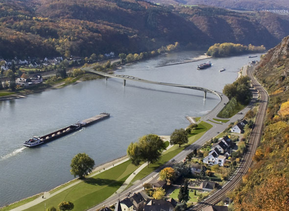
Unique to the valley is a continuous sinuous void that winds its way from north to south. In order to blend with the landscape, the crossing picks up on these gentle valley curves to bend the bridge into a smooth yet efficient structural solution that flows with the valley; so gentle that the total length of the crossing is only 5% longer when compared to a straight bridge counterpart in the same location. The structural upstands folding mirror the sloped undulating hillsides that create the habitat for the vineyards of the Rhine River Valley. The two upstands are kept low and opened up to minimize the visual impact and give the impression that the new crossing glides effortlessly with the lowest profile across the river and along the valley corridor. The holes carved into the upstands, given its unique geometry, orient the viewer from a view downwards to the water to a view upwards towards the hills and back down along the pedestrian path, located on the eastern side of the bridge facing Sankt Goars-Hausen and Sankt Goar.
Along the southern bank, the slope down to meet the road height is efficiently taken up in the distance between the edge of the shipping channel and the bank, minimising the impact of the bridge. On the northern bank, given its tight proximity to the shipping channel, the ramp runs parallel to the bank. The space under the ramp, often neglected, is landscaped by carving and planting the bank so that water flows under the ramp to create a micro habitat for wildlife. The existing leisure cycle route and walkway along the southern bank as well as the cycle routes along the road are maintained but merged at the connection to the pedestrian path at the start of the ramp. On the northern bank, the cycle route along the road is maintained yet a new leisure cycle route and pedestrian pathway is extended transforming the floodplain given its south-facing orientation into a new cultural park for Sankt Goars-Hausen and Sankt Goar.