
‘Dutch Billys’
- This topic has 715 replies, 64 voices, and was last updated 7 years, 9 months ago by
helvera.
-
AuthorPosts
-
-
April 30, 2003 at 5:04 pm #709923
Anonymous
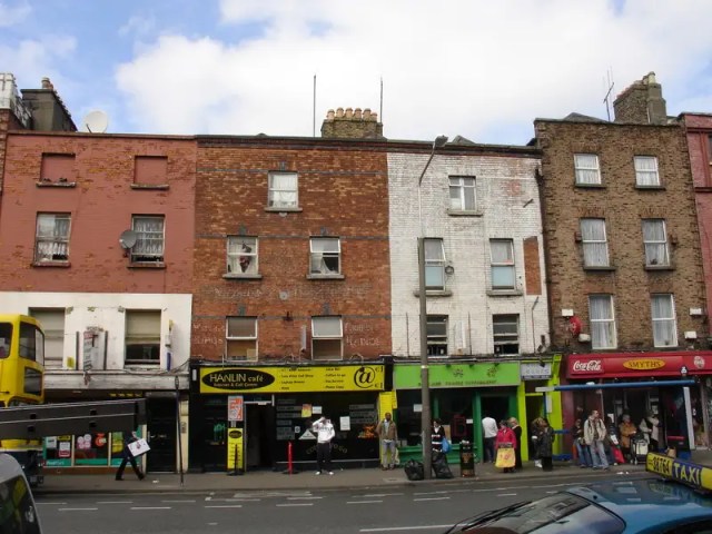
InactiveI’m curious about how many remaining examples of Dutch Billy architecture remain throughout Dublin city.
I was intrigued the first time I became aware that this architecture style (with its distinctive high front gables) had been so prevalent in Dublin – previously I had only associated such structures with the Netherlands. I have also seen pictures of some of the structures which existed – mainly in the Liberties. This style seemed to be the vernacular style of that area for a large part of its history until the early part of the 20th century when most were cleared.
In that area itself I am now only aware of one such building (on Kevin St.) which seems to have maintained its original architectural style and Dutch Billy gable. In the rest of the city I am only aware of one more such building, on Leeson St.
I’m curious – are there any more of these left?
-
April 30, 2003 at 5:14 pm #799165Inactive
Leeson Street one is a fake repro!
There remains several of these buildings at the south-side of Stephen’s Green – namely those past Newman House. The Parapets are straight, but the window sequences indicate that the parapet was at one stage of the “Dutch” Billy style.
College Green used to have loads – many have now got new exteriors – Number One shop as an example, but once were Dutch Billy Parapets – the interiors are still intact.
Some still exist on Camden St. – though the parapets were changed to flat-one’s in 19th c.
There ya go!
-
April 30, 2003 at 5:21 pm #799166Inactive
Thanks a lot Seerski.
I was suspicious of the Leeson St. one – its looked like too good of an example but does look well regardless.
From what you say though, there are very few which have the original exteriors which make them so unique? (I don’t think I’ll be seeing the interiors of any………..).
-
April 30, 2003 at 5:28 pm #799167Inactive
Loads of ‘Dutch Gables’ on High Street ….Oh I forgot that they are just contrivances fancifully harking back to an era long past…aka pastiche shite.
-
April 30, 2003 at 5:32 pm #799168Inactive
Pastiche seems to be a favoured word on this website.
I’ve seen them and think they don’t look that bad – though the car park on the ground floor ruins them and cuts them off from any real interaction with that street and doesn’t make them real.
-
April 30, 2003 at 5:33 pm #799169Inactive
Ouch!! Such vulgarity!
The one on Kevin Street that you mention is a 19th century replica of a building that was there before. Also, there are plenty of Dutch-style interiors still around in the Gorges St., Camden St., Stephen’s Green axis. Also I think there is one or two remaining on Molesworth Street – these especially deserve checking out.
-
April 30, 2003 at 5:40 pm #799170Inactive
The best ones (aka pastiche Georgian) are on Gardiner Street ……..Underground car park …….Rusticated timber featured gardens with classical cherub statues ……One doorway to the entire building block…….etc etc…
-
April 30, 2003 at 5:42 pm #799171Inactive
I know them – they are very poor.
-
April 30, 2003 at 8:07 pm #799172Inactive
there’s a rather fine example at the top of manor st. but like most it has a parapet at the top, the original roof is still clearly visible, and a rather peculiar tower at the rear!
-
May 1, 2003 at 9:29 am #799173Inactive
This house on Manor St. sounds very interesting – I’ll have to talk a wander up there soon.
One more question – was this architectural style unqiue to Dublin or does it exist in other parts of the country?
-
May 1, 2003 at 10:17 am #799174Inactive
I think some people on this site have a fixation with the word ‘pastiche’. One would almost think that designing a building in an established style is a bad thing! In fact worse – for some people here it is the ultimate faux pas in architectural terms. What a load of old cobblers! The established styles of architecture – Classical, Art Deco, Modernist whatever – are living styles. Their continued use should be encouraged not avoided.
-
May 1, 2003 at 10:31 am #799175Inactive
I would agree. I think what matters is the quality of materials and design.
For example, Seerski says above that the Dutch Billy style building on Leeson St. is a fake and that the one on Kevin St. is also a replica. These buildings look great from outside. They are replicas which from the outside appear to have used good building material and have stood the test of time. Now at this stage they are the only examples of exterior Dutch Billy style left in the city – even though they don’t date from the original building of this style of house in Dublin in the early 18th century, whilst those that were/are Dutch Billy, don’t look it from the exterior i.e. don’t have the distinctive gable.
-
May 1, 2003 at 11:23 am #799176Inactive
But why are they ‘fakes’ or ‘replicas’ or ‘pastiche’? Why not just a Dutch Billy style building built in xxxx year? What makes some buildings the ‘genuine article’ – the fact that they were built in the period in which the style was most prominent? Surely a building should be judged on its adherence to the architectural principles of a said style.
-
May 1, 2003 at 1:34 pm #799177Inactive
Quite a fewof these houses survive but most have lost their gables and roofs in favour of Parapets sometime in the last century.
The Leeson St House is grossly offensive to me – probably because I can remember the battles to save the original houses in 1979 (gorgeous things inside), in fact it was one of the reasons that I decided to become an architect.
Manor St has several of these particularly along the stretch accessed from Brunswick St – some stil have remnants of interior fittings.
A beautiful little one at 88 capel Street was demolished illegaly behind a retained facade only about two years ago (needless to say the City Council did nothing about it).
Smithfield had three very intact houses until about four years ago – complete with much of their interiors.
42 Manor St was originally (around 1700 a three storey hip roofed house (probably not unlike King James Mint in Capel St – it then acquired a pair of gables on the front facade chich seem to have survived until the late 18th early 19th centuries. Its in prety good condition internally and retains quite a lot of its oiginal fittings.
My favorite is a very simple side entrance houe on Montpelier Hill which is an 18th century re-facading of an early to mid 17th century building (possibly military – eg: barracks, armoury or garrison outpost). Most of the interior is a mish mash of 18th and 19th century work but the 17th century form is still very apparent.
The 1916 ‘surrender house’ so much in the news at present is a stripped out and re-facaded Dutch Billy.
Diffeneys Menswear was until about five years ago intact internally from first floor up and must have been externally re-facaded sometime in the 1950’s – 60’s.
I suspect that most of the ‘ornate ‘gabled houses which survive (eg: Molesworth St)were either substantially ‘tarted up’ or partially rebuilt in the 19th century, the pattern of gable fronted building in Dublin – from contemporary paintings and prints and old photographs seem to have been very ‘basic’ in configuration – simple triangles with granite copings. Still they’re a bit of fun.
-
May 1, 2003 at 1:47 pm #799178Inactive
From the sounds of all of this, no original 17th century gable seems to exist any more, apart from the ones on Molesworth St.
If the house on Leeson St. was only built after the 1970’s I am surprised at what a good quality replica it is. I don’t understand though why a group of people would tear down Georgian structures to build it though.
I think it would be fantastic if the 1916 Surrender House were incorporated into the new development planned for the area, whilst being refacaded back to its original Dutch Billy appearance. I think it would look something completely different in Moore St.
I would love to see some more of these gables restored as I find the style very interesting……………….but alas, its not likely.
-
May 1, 2003 at 2:41 pm #799179Inactive
There is one original in exceedingly tatty state on Market Street, just off Newmarket in the Coombe. Its next to the eircom depot – see it now before it gets swept away!
-
May 1, 2003 at 2:47 pm #799180Inactive
I live right around the corner from it! – its on Mill St. Its scheduled as a national monument according to An Taisce’s site. I’m not sure about the grading of buildings but would think National Monmument status has to be pretty high. But it is in a terrible state. Eircom own it and are quite happy to see it waste away – though I read that a lot of its interiors are in storage for the day it may be restored – which I certainly hope it in – within the context of the complete redevelopment of Mill St.
That street and Newmarket itself is a mess at the moment full of warehouses and, in a city with such amazingly high property prices, a huge record storage facility (surely this shoudl be out in the suburbs somewhere – can those paper records be that valuable!).
-
May 1, 2003 at 3:22 pm #799181Inactive
Fake/replica – the fact is they do not come from the era that those hoses were synonymous with – the late 17th/early 18th century. The Leeson Street one is from the early 1990s!!!!!!!
The dutch billy gable was the style typically employed by the Hugenot and Williamite families – very political!!!!
-
May 3, 2003 at 2:48 pm #799182Inactive
I remember that i was in the National gallery recently & i was intrigued to see a painting of a gathering of militia i think – around 1798 in Dublin in one of the squares and there were a few Dutch gable type houses in the backround. I thought they looked strange as they are a bit of an oddity nowadays. Maybe old paintings (& prints) would be the best way to research their past existence in Ireland.
-
May 3, 2003 at 5:21 pm #799183Inactive
Yep, the Volunteers on College Green, probably the best painting conveying what an area of Dublin was originally like.
Surprised nobodys mentioned the Rubrics in Trinity, dating from 1700 with their extremly convincing 1890 dutch gables, and overall the oldest structure on the Trinity campus.
I don’t think there are any standard 17th century townhouseinteriors left in the city, aside from a few staircases that have survived subsequent alterations.
Standard features included corner fireplaces, lower ceilings than the later Georgians and simple cornicing.
Oh,and the obligatory green or buff coloured panelling of course (yuck) -
May 4, 2003 at 5:09 pm #799184Inactive
There is a house with a dutch style gable on talbot street, its part of a furniture shop, i don’t know anything else about it.
-
December 30, 2005 at 2:55 pm #799186Inactive
10 Mill street is part of an application from Osprey Property(Eircom) to turn their large holding on Mill Street into Apartments. Part of the application mentions removing the existing flat roof from Nr. 10 and putting a slate roof back on it. There was a conservation report conducted by the Dublin Civic Trust – who no longer exist I think – but the website remains. .
I’m surpised to see 10 Mill Street in Red brick. I thought Red Brick only got popular in Victorian times.
Also on the way up to see it I came accross this other Meteor sponsored Dutch Billy.
However I don’t believe the everybody in Dublin in 1650/1700 lived in houses as grand as these. Is there a record of the vernaclular house for that period?
-
January 1, 2006 at 3:22 pm #799187Inactive
The Dublin Civic Trust http://www.dublincivictrust.ie/ remains extremely active, even if their News & Events page hasn’t been updated for a long time.
-
March 23, 2008 at 8:12 pm #799188Inactive
Our dwindling stock of gabled houses is a topic that has come up on various threads, ‘Dublin Vistas’, ‘Thomas St./James’s St.’ etc., but I think, as an endangered species, this forgotten remnant of our built heritage deserves a thread of it’s own.
The explosion in the construction of curvilinear gabled houses throughout Dublin, and across most of the other urban centres of Ireland, in the last decades of the 17th century, and which continued to be the dominant urban style in residential architecture into the 1740s, deserves a closer look.
The best published references that I know of are: the ‘Dutch Billys’ article by Peter walsh in the 1973 ‘Liberties of Dublin’ ed. Elgy Gillespie, and pgs. 29 -61 of McCullough’s ‘Dublin, an Urban History’. Maurice Craig ‘Dublin 1660 – 1860‘ just about acknowledges the presence of gabled houses but his passion was for the classical Georgian city.
So completely have the gabled streets of Dublin been lost, or masked, that the tendency has been to regard the dimly remembered curvilinear gabled houses as some kind of neanderthal off-shoot in the evolutionary process that shortly afterwards delivered the presumed perfection of ‘Georgian’ Dublin. Part of this may have been down to the agressive marketing of Luke Gardiner and his circle, who, in a very short space of time, managed to persuade upwardly mobile Dubliners that, not only were they living in the wrong part of town, but they were also living in the wrong design of house.
One of the ironies of the ‘Dutch Billy’ is that, by about 1730, the style was so ubiquitous and so well developed, that it must have constituted something very close to a national architectural style. Dispite having huge loyalist Williamite conatations, curvilinear gabled houses appear to be an Irish phenomenon, were fasionable in Dublin in the years before there was any consciousness of Dutch Billy himself, and most amazingly, the ‘Dutch Billy’ does not seem to exist in England at all. You can scan the backgrounds of all the Hogarth prints and Canneletto paintings of London you like, there are no Dutch gabled houses there!
McCullough points to the obvious trading links with Europe, and Holland in particular, as the likely source of the
initial outbreak, and Dutch architects were evident on the ground in Dublin in the period, but that can only be part of the story. On very few occassions, before or since, have Dublin and London taken such divergent routes.The fact that the pivotal battle of the era took place in Ireland, and the fact that it ushered in an unprecedented period of stability, prosperity and growth, may go towards explaining the extraordinary degree to which Loyalist Ireland took William of Orange to their hearts, perhaps up to and including the desire to live in houses that honoured his memory in bricks and mortar. In England, where William was probably more regarded as just another king, and where Holland was more directly perceived as a fierce trading rival, no particular desire may have emerged to go Dutch in house design.
Whatever about the origins of the style, what developed here was a full blown architectural movement with a complex language and a real urban vitality that none of Luke Gardiner’s sober ‘Georgian’ street would ever equal, in my opinion. To compare a complex ‘Dutch Billy’ corner with the half hearted efforts of the Georgians is to compare a piece of sculpture with a photocopy. The development of the close twin or ‘Siamese’ gabled house, as a response to the common urban phenominon of the wedge shaped corner site, may even have been a Dublin invention.
The loss that Dublin suffered in going over to the Luke Gardiner led English Palladian model, and turning it’s back on it’s indigenous urban tradition, is not just about the near irradication of the whole record of an architectural style, it’s also about the substitution of a slightly superficial, segregated and imported model, for a truely urban, mixed use and socially integrated model.
I don’t want to keep dumping on Luke Gardiner, given that he has attained such iconic status as the developer that all other developers are supposed to look up to, but his legacy is decidedly mixed at best. If we use the anology of red squirrels and grey squirrels. Imagine Dublin as a little wooded glade alive with happy little native red squirrels buzzing about in sylvan harmony. Then a man walks into the clearing with a sack of foreign ravenous grey squirrels and proceeds to dump them out. I’m just suggesting that, in that analogy, that man is Luke Gardiner, and he is an ugly man, and he smells.
I’ll stick up as many pictures as I can over the next while to try and illustrate the points I’ve made here, but the primary concern has to be to safeguard the few houses that remain, albeit in their altered Georgian form.

This stretch of James’s Street opposite the Fountain contains at least two originally gabled houses, the pink house was a simple small curvilinear gabled house and it’s neighbour to the right, dispite it’s minute size, was a twin gabled house, which I think illustrates the real consciousness of the urban rhythm that the sequence of gables were capable of creating.

No. 10 Mill Street now and as illustrated in the 19th century below.

-
March 24, 2008 at 10:23 pm #799189Inactive
aren’t we forgetting the pastiche apartments around back lane/cornmarket and the single building at 18 lwr leeson st that seems a bit bizarre-I have never ascertained if it is meant to be a replica of an original building on site or a folly? The only extant gable fronted buildings in D2 I can think of off the top of my head are on Molesworth st and Ely Place
-
March 27, 2008 at 11:03 pm #799190Inactive
@tommyt wrote:
aren’t we forgetting the pastiche apartments around back lane/cornmarket and the single building at 18 lwr leeson st that seems a bit bizarre-I have never ascertained if it is meant to be a replica of an original building on site or a folly? The only extant gable fronted buildings in D2 I can think of off the top of my head are on Molesworth st and Ely Place
Those two on Molesworth St. are original curvilinear gabled house that were masked, probably in late 18th century, with a flat parapet, and then subsequently had a bit of a gabled pedement top put back on. I have a lot of stuff on Molesworth St. I’ll post up when I get a chance.
There was an intact gabled house on Leeson St. up to about 1980. It was masked as a flat parapet, but in a way that you could still see the outline of the curvilinear gable, but it was down further towards Stephens Green than the present pastiche structure. It’s hard to know what the planning rational was for the new structure, same as with the Cornmarket scheme.
I couldn’t find the Rocque’s map sheet that covers the south west city but I scanned up a copy from the St. Lukes conservation report that shows Newmarket in all it’s glory and I stuck a red box around no. 10 Mill St. (which was never quite as off-axis at it looked here) and the corner house (now a pub) on Newmarket / Brabazon Place.

As narrow as Mill Lane was, it was still fronted by houses the whole way down to Mill Street.
A pair of Dutch Billys on Newmarket, after the roof had been trimmed down to a hip at the front and the gables trimmed to the profile of the roof.
The importance of this structure is hard to exagerate. Newmarket Square was slightly smaller than Smithfield but, whereas
Smithfield appears to have been mostly three storey, Newmarket was probably all four storey and coming east from triangular
gabled Chamber Street, it must have been stunning.
On both elevations the blocked up second floor windows (identifal size and spacing to the first floor) can just be made out behind the render, meaning that all this house is actually missing is the gabled top storey. -
March 28, 2008 at 2:40 am #799191
Paul Clerkin
KeymasterHere’s another possible candidate
-
March 28, 2008 at 10:16 am #799192Inactive
I always suspected there was something more going on with Gray’s of Newmarket- thanks for the info.
Isn’t it shut at the moment? The last few times I’ve passed it’s been boarded up, possibly dating from the shooting there a couple of years (?) ago. A cause for concern?
Your b&w photo reminds me of this old Lawrence one that I’m quite fond of- I used to live around the corner.
(From the NLI collection.)
-
March 28, 2008 at 10:55 am #799193Inactive
There were AFAIK two on Longford st. right up to the 1980s-they feature in a neville Johnson picture book or some other Dublin street scenes photo collection I have seen before
-
March 28, 2008 at 12:22 pm #799194Inactive
gunter (or should it be Sherlock Holmes?): good bit of sleuthing there. I find the ‘pastiche’ argument perplexing – this pub is a clear case for restoration to show what a DB would have looked like in this location (Dublin Civic Trust interested?). There is enough left to avoid the charge of Disneyfication. Come to that, Newmarket (great space waiting to be reborn) could be developed with tall, gabled bldgs not apeing some old style but getting inspiration from them, i.e a square of tall, gabled, narrow-plotted contemporary buildings recapturing the spirit of the place. Or is that too much of a challenge and we prefer a ‘mixed-use’, bigfoot slab with a few quirky (‘cutting edge’) details?
-
March 28, 2008 at 6:28 pm #799195Inactive
Good stuff on Gray’s, gunter. There may be more remains of these houses around than we think.
A common alteration to cruciform-roofed gabled houses seems to have been where the front gable was gived a hip and a flat parapet.

So what was originally this

… sometimes became this

… then maybe also the whole façade was given later-Georgian proportions, as seen here at No 30 Thomas Street (centre building).
-
March 28, 2008 at 9:35 pm #799196Inactive
Devin:
I completely forgot about those three houses on Haymarket. Weren’t they knocked for some appalling extension to Tully’s Tiles? without a wimper! Wasn’t there even some Emmet connection to one of them, or was that the Georgian on the Green beside the College of Surgeons? You’re absolutely right that a lot of these houses still exist behind altered or rebuilt facades, the whole of the east side of South Fredrick Street, seen from the Kilkenny Design block, (with I think only one exception), is cruciform roofed, former gable fronted, houses with panelled interiors.In most cases, the Georgian rebuilding of the facade, or the masking of the gable, is now an integral part of the story of the house, and you wouldn’t attempt to reverse back to the original design, but in a few cases, like 10 Mill St. or Gray’s of Newmarket, the case for a scholarly restoration has to be a very strong one.
In the case of Mill Street, neither version of the house now has a roof, so conservation will involve reconstruction, either way. The 1890s alterations were a pretty wilful act of mutilation on a wonderful, (by then nearly 200 year old), house, and to invest one cent in re-enacting this mutilation would be pretty hard to take when we’re dealing with a ‘last of it’s kind’ scenario.
I think the significance of Grays is that it represents a last chance to restore the one remaining house out of the 64 that lined the edges of this wonderful, European scale, 17th century urban space. I don’t know if there’s any immediate threat to Gray’s, but I wouldn’t like to bet against it. Maybe DCC are already on top of this, you’d like to think they would be, but, every time I go down there, like you, I half expect to see a pile of rubble.
I agree a disturbing 100% with johnglas, that what Newmarket needs urgently is a new vision with a comprehensive set of guidlines that would encourage the redevelopment of the remaining properties on the square in a way that respects the original plot widths and the scale of the original buildings with some tasty new in-fill.
Surely it’s not too late to rescue Newmarket with some creative contemporary interventions, and with a restored Gray’s in the mix, giving it, what Smithfield has lost, a tangible link to it’s original appearance, we could have a valuable, and largely forgotten, urban space restored to Dublin’s consciousness, and not just another anonymous mix and match apartmentscape.

Existing view looking west on Newmarket towards Chamber Street. The stone warehouses on the right form the west corner of Brabazon Place, opposite Gray’s on the east corner. The warehouses are derelict and look to be prep’d for re-development. They are 19th century replacements of the original gabled houses, but they are part of the story of the space and should be retained and worked into the redevelopment rather than bulldozed and forgotten.
The redeveloped east end of Newmarket, with Ward’s Hill off to the right.Whatever about the quality of the Zoe scheme at the east end of Newmarket, it does at least reflect the original scale of of the houses which were long gone by the time this apartment scheme was built in the early 90s. The most recent apartment block is the one on the left which rather crowds out the remains of St. Luke’s church behind and seems to muscles it’s way onto the square without a lot of obvious sensitivity to the historical context.
-
March 28, 2008 at 10:43 pm #799197Inactive
@johnglas wrote:
Come to that, Newmarket (great space waiting to be reborn) could be developed with tall, gabled bldgs not apeing some old style but getting inspiration from them, i.e a square of tall, gabled, narrow-plotted contemporary buildings recapturing the spirit of the place. Or is that too much of a challenge and we prefer a ‘mixed-use’, bigfoot slab with a few quirky (‘cutting edge’) details?
This level of agreement can’t last, but, while we’re at it, here’s a photograph of some modern gabled in-fill from Bremen that impressed me enough to get the camera out.
I’m not saying it’s perfect, but I think it illustrates your point.

The plaque on the wall records what this little square was like before the war.
There are times that I think we might have been better off if we had been bombed to dust on a single night, rather than suffer the slow grinding destruction of neglect over decades. At least then we might have had to take a long hard look at the city and we might have noticed that bits were missing and, just maybe, a bit of thought might have gone into putting that right.
-
March 29, 2008 at 10:54 pm #799198Inactive
gunter: I’m disturbed you’re disturbed, but I’ll try and keep up the good work! The Bremer Wohnungen are just fabulous – but do you see any Brit/Irish architect having the balls? Maybe that’s post-postmodern historical/contextual – no, that’s too hard isn’t it?
-
March 29, 2008 at 11:34 pm #799199Inactive
I’m not touching that.
Here’s that photograph of the door of no. 10 Mill Street. It was published in ‘The Heart of Dublin’, by Peter Pearson in 2000. A very good book, a great source for research on the city, and a real tear-jerker.

-
March 30, 2008 at 11:36 am #799200Inactive
@Zap wrote:
Thanks a lot Seerski.
I was suspicious of the Leeson St. one – its looked like too good of an example but does look well regardless.
I can’t find any photographs of the last surviving ‘Dutch Billy’ on Leeson St., but I found a drawing that shows it and a few of it’s neighbours, including the outline of a cruciform roofed house, shortly before demolition in 1981.
Also, I want to post up the front page of a pamphlet that protested about the demolition at the time and included a photograph of the panelled interior. I’m not sure if the scanned text is of readably quality (doesn’t look like it to me), but if people are interested in it, I could try it again bigger and scan up the other 4 pages, which cover more on the house and other planning issues, including why Dublin should have a light rail system!
It’s not that a lot of people weren’t making sense back then, it’s just that nobody in control was listening.

Also an old drawing of a ‘Dutch Billy’ and a triangular gabled neighbour behind the fountain in James’s St.
-
March 30, 2008 at 11:54 am #799201Inactive
Great drawing – it reflects one of my earliest conscious memories of Dublin, when I noticed an area south of St Stephen’s Green with row after row of derelict ‘Georgian’ houses, obviously waiting quietly for the bulldozer. In 1981, I was still a planner (I would stop doing that two years later) and had taken a complete scunner to the amount of destruction going on (Glasgow was a bombsite – like Dublin, it was scarcely bombed during the war, all the damage was home-grown).
So, however disturbing, I’m going to continue speaking out against bad development, no matter what ‘the establishment’ may think – have you seen how deadly dull most of the projects in this month’s AI are? Apart from the Killiney house (and that’s an exercise in over-salaried self-indulgence), the corporate stuff is worthy but unexciting. A whole town-full of that stuff would send us all to sleep. -
March 30, 2008 at 4:05 pm #799202Inactive
as much as it breaks my heart its clear we havent learnt from the mistakes made in the not too distant past. I have a real fear that the remianing areas of the cities with sizable concentrations of historic building are simply being left to rot.
The state of thomas street and the Northern gerogian quarter is a disgrace . The intentional dereliction that developers are permitted to get away with is a joke. Its time we take stock of what we have left and protect it.
-
March 30, 2008 at 7:18 pm #799203Inactive
aj: I’ve long thought that Dublin needs to define the city as the area within the canals and then adopt a strong policy with a presumption against demolition and for conservation. Your City Fathers (and Mothers) could do worse than have a trip to Edinburgh; it has its faults (oh, yes!) and can be very grey on a grey day, but it has a strong image of itself and takes no prisoners when it comes to conservation. The idea that ‘site accumulation’/demolition/rebuild/we-need -to-develop-the-whole-block-in-a-trendy-style equates with progress is just junk. It equates with making a fast buck and destroying the city’s patrimony, and too many architects seem prepared to go along with it.
-
March 30, 2008 at 10:35 pm #799204Inactive
@nono wrote:
there’s a rather fine example at the top of manor st. but like most it has a parapet at the top, the original roof is still clearly visible, and a rather peculiar tower at the rear!
That big house on Manor Street is a gem, but I would be 95% certain it was never a ‘Dutch Billy’. It’s in the same tradition, but I think it’s a transitional house using many of the features and building techniques of the gabled tradition, but with the new flat parapet from the start.
Almost every other house in Dublin with a pair of apex roofs was a twin ‘Dutch Billy’ (Bachelors Walk, James’s St. etc.), you simply didn’t go to the bother of constructing two roofs unless it was to exploit the potential for a pair of gables, but the Manor St. house is hipped front and back and has, what appears to be, an original moulded granite coping to the parapet, which is quite rare.
The orange brickwork around many of the windows could be considered an original feature in London, but here, it’s definitely a repair.
The scale of the windows on the second floor is inexplicable, you’d need to have a good rummage around the inside to begin to explain these. The building is a creche, so if anyone has a small kid . . .


This is the nearest London equivalent that I know of, Dr. Johnston’s house of circa. 1700. If this house was in Dublin, there is no question it would have had twin Dutch gables, like 10 Mill St., but there is no evidence that this was the case in London -
March 31, 2008 at 12:41 am #799205Inactive
This is an excellent thread gunter, keep it up 🙂
Not sure if Id necessarily agree with you about poor ol Luke Gardiner, but I certainly do think you have made a very worthwhile case as to the need to document and debate the Billys.
@gunter wrote:
That big house on Manor Street is a gem, but I would be 95% certain it was never a ‘Dutch Billy’.
I beg to differ – looking at that snap, it appears to me that the top two corners are of red brick, wheras the mass of the building is in brown brick, with a definate Billy outline as best seen by the gentle curves in the top left corner.
@aj wrote:
as much as it breaks my heart its clear we havent learnt from the mistakes made in the not too distant past. I have a real fear that the remianing areas of the cities with sizable concentrations of historic building are simply being left to rot.
The state of thomas street and the Northern gerogian quarter is a disgrace . The intentional dereliction that developers are permitted to get away with is a joke. Its time we take stock of what we have left and protect it.
Aj I 100% agree with you. The topic of Derelict Dublin may well merit a thread on its own. In the meantime, what are the primary reasons for dereliction in Dublin – is it the failure of the Derelict Sites Act to have worked, or the failure of the Living Over The Shop scheme, or the cuts/ under-resourcing of heritage protection?
-
March 31, 2008 at 9:56 am #799206Inactive
hutton:
I want this to be a ‘Billy’, I just don’t think it is. I think that newer brickwork is just a repair.
On the elevation, as I see it, there’s no real reason to see the top floor windows as anything but original. If it was a twin gabled house, I think the top floor would have reduced down to two windows and they would have moved them in to more closely line up with the apexes of the roofs. As well as that, in the gabled tradition, it was the practice for all windows to be of the same size no matter which floor they were on, the composition of the ‘Dutch Billy’ relied, very successfully, on the variety and rhythm of the gables. Once you leave the gabled tradition, the smaller top floor windows come in and, shortly after that, the full Georgian graded window heights according to the varied ceiling heights reflecting the importance of the rooms by floor which, I admit, was a nice little refinement if they hadn’t gone on for the next 100 years and flogged it to death.
For me, the matching front and back hip profiles to the roofs and the parapet details on the Manor Street house are the clincher. If this was an early make-over, would they have gone to the bother of hipping the roofs at the back as well? and sticking in a full flat parapet at the back? This didn’t happen to any other ‘Dutch Billy’ that I know of.
On your pal, Luke Gardiner, here’s a way you can get him off the hook:
They give a date of 1728 for Henrietta Street, which is the same date thats been given for Molesworth Street for example. This is the stark contrast that I see and the reason that the glowing legacy of Luke Gardiner need a radical revision. Molesworth Street is fully gabled, socially mixed (includes tripple gabled Lisle House) and it responsibly in-fills obvious development land between Stephen’s Green (a City enterprise) and Trinity College. Henrietta Street (the Luke Gardiner venture) is an exclusive up-market cul-de-sac of London type houses off an arterial route, with no attempt to integrate into the existing street or development pattern.
If it could be established, for example, that this Manor Street house was originally flat parapeted, and if it could be dated to before 1728, then I’d have lay off on Gardiner on that front anyway, and just concentrate on giving him a good kicking on the ‘shifting the city off it’s access’ point, and the ‘one house design fits all’ point.
Best of luck with that.
-
March 31, 2008 at 5:49 pm #799207Inactive
Great thread.
Molesworth Street was such a criminal loss to the city. As Freddie O’Dwyer noted in Lost Dublin: “Of the twenty-three Georgian houses on the north side, only four survive, two on each side of Edward Holmes’ Masonic Hall of 1868. The pair to the west, Nos 15 and 16, built by Benjamin Rudd, carpenter, have idential plans and were originally brick-fronted and gabled. The gable of No. 15 which was added in late Victorian times and was dated 1755 belies the origins of the house which Rudd sold to one Edward Deane of Terenure in 1740.”
This is them today, both with stunning panelled interiors. The rust colour has always been a delight.

One building I’m not sure about being a Dutch Billy is No. 32 directly across the road, prior to its bizarre Victorian – and probably later again – remodelling.

A picture of the building, possibly from the late 18th century, shows it as having a flat parapet and small window opes precisely matching those of the upper two floors.
Yet this house apparently dates from c. 1725, and fascinatingly a single wall of panelling survives with cornice to part of the entrance hall, in spite of the wholescale 19th century alterations, let alone the modern office interventions. Also as you move up the staircase which is late 18th century, you suddenly encounter a startling remnant of early Georgian Dublin in the form of a single stretch of barley-sugared balustrading with Corinthian newel posts! Thankfully some good old-fashioned Georgian penny-pinching dictated its survival high up in the house.
And as to the evidence of Dutch Billy, and a large one at that, surely such a fenestration pattern to the rear is suggesting something?

(I thought the pink rather eye-catching).
A house of this scale would not be out of place adjoining the tripartite gabled home of Speaker Foster that was once located right next door,
-
March 31, 2008 at 9:26 pm #799208Inactive
@GrahamH wrote:
Great thread.
One building I’m not sure about being a Dutch Billy is No. 32 directly across the road, prior to its bizarre Victorian – and probably later again – remodelling.
A picture of the building, possibly from the late 18th century, shows it as having a flat parapet and small window opes precisely matching those of the upper two floors.
Yet this house apparently dates from c. 1725,
And as to the evidence of Dutch Billy, and a large one at that, surely such a fenestration pattern to the rear is suggesting something?
A house of this scale would not be out of place adjoining the tripartite gabled home of Speaker Foster that was once located right next door,
Graham:
I think you’re spot on there on no. 32. I’m not familiar with the late 18th century print that you mentioned though, (unless it’s this one from ‘Lost Dublin’) and I hadn’t realized there were so many bits of the original structure left inside.
Freddy O’Dwyer had speculated that Speker Foster’s house was ‘something of a hybrid, with gables on top of the parapet’ and that it was to the left of the building in your photograph, no 32 (where 29, 30 & 31 are now), having been knocked and ‘replaced before 1821’ But actually Speker Foster’s triple gabled house was ‘Lisle House’ at 33 Molesworth Street, and it’s still there, the big five bay house to the right of your no. 32. So the yellow rendered house that you’ve shown and the five bay brick ‘Georgian’ to the right are the two gabled houses shown in Penny Journal print reproduced in Freddy’s book.


There are photographs from the early 1970s that show the original three perpendicular roofs to no. 33, that originally lined up with the three gables, peeping up behind the later Geoprgian parapet.
The shameful gutting and removal of the roofs from no. 33 took place as recently as 1974, under the direction of a firm of architects who are still prominent in the city. The recent planning application (reg. no. 2775/07) by Benson & Forsyth to build a large office blook to the rear and further alter the two houses, totally underplayed the importance of the two houses.

The planning application was refused by DCC following some withering comments by the conservation officer, the brilliant Clare Hogan again (she of the savage attack on the Clarance Hotel proposal, which unfortunately wasn’t listened to). I particularly liked her put down of the prestigeous Benson & Forsyth: ‘The National Gallery extension is not considered an acceptable precedent as it . . . is a major public institution’ and implied, this is an office block!
If only someone had pointed this out to our ‘DARE TO BE THE BLOODY SAME’ friends out on the Merrion Road.
Possibly the cruelist irony for the great ‘Dutch Billy’ that was no. 33 is that when it’s main staircase was ripped out in 1974, it was given a new home in 13 Henrietta Street!
I don’t know if great staircases have souls, but this must be like taking a lifelong Everton fan and burying him in a Liverpool jersey.
For the record, I very muched liked the Benson & Forsyth plan, except for the further alterations to the two houses, and I would be far more in favour of stuff like this, densifying up under-used sites in the city centre, than the random depositing of ‘urban’ centres on distant suburban and green field sites.
-
March 31, 2008 at 10:04 pm #799209Inactive
I am in number 33 every fews days and there is very little orginal features left. the entrance hall retains some panelling and plaster work thats it
-
March 31, 2008 at 10:19 pm #799210Inactive
Do any of the internal walls survive, or is it all open plan offices? What about the basement?
-
March 31, 2008 at 11:08 pm #799211Inactive
They appealed that Molesworth St refusal, but then withdrew. Revised proposal is awaited.
Feel free to return to Molesworth Street after this post!!
@gunter wrote:
completely forgot about those three houses on Haymarket. Weren’t they knocked for some appalling extension to Tully’s Tiles?
I don’t remember them myself]
Existing view looking west on Newmarket towards Chamber Street. The stone warehouses on the right form the west corner of Brabazon Place, opposite Gray’s on the east corner. The warehouses are derelict and look to be prep’d for re-development. They are 19th century replacements of the original gabled houses, but they are part of the story of the space and should be retained and worked into the redevelopment rather than bulldozed and forgotten.[/QUOTE]Yeah, the stone warehouse on the corner (‘the potato market’) is a protected structure and is being incorporated within approved Ref. 5410/04 (the other semi-demolished one beyond it is not protected & is not being kept), for a big scheme also including repair of the fine Georgian Brewer’s house round the corner, 10 Ardee Street – Image: http://img248.imageshack.us/img248/8113/sheehanimages8fe.png Although this scheme was approved 3 years ago, there’s no sign of anyting starting.If McCullough Mulvin have their way Newmarket will look quite different in the future (go to ‘view all projects’ and ‘masterplanning’): http://www.mcculloughmulvin.com/pages/moviepg.html

The early-18th century gabled house on Montpelier Hill deserves an appearance in the thread.
-
March 31, 2008 at 11:14 pm #799212Inactive
Reluctant as an alien (!) to intrude on this debate, but doesn’t the side of M’worth St opposite the Freemasons’ Hall (what an Aladdin’s Cave that is!) provide somrthing of a template for when the 80s (?) bland monstrosity at no. 14 is eventually knocked?
The newbuild B+S scheme looks very good and looks as though it would provide an internal court/garden to the rear of nos. 32 and 33, which they should leave well alone or, shock-horror, restore as part of a pro bono gesture. (What’s that? says the company accountant.) -
April 1, 2008 at 10:00 am #799213Inactive
What is up with all of the images not working (apart from the old Blackpitts)?
-
April 1, 2008 at 10:16 am #799214Inactive
Is the black and white building to the left of the Newmarket image Art Deco? Also, what is the interesting-looking tower peaking up above the awful utilitarian lamppost?
-
April 1, 2008 at 3:06 pm #799215Inactive
It’s Art Deco-ish, but I don’t know the date. I suspect gunter might?
Interestingly, although it appears to be used as a warehouse, one Sunday a few months ago while I was giving a friend a guided bike tour of parts of the city we noticed that it seems to be some sort of church for Africans- families were coming out of a ‘goods entrance’ in the most fantastic outfits, and the kids were running around the square. One of the few signs of real life in that part of town (I don’t count tyre skid marks).
-
April 1, 2008 at 3:24 pm #799216Keymaster
@Devin wrote:
The early-18th century gabled house on Montpelier Hill deserves an appearance in the thread.
Someone made a huge effort restoring that a few years ago – my business partner’s house is also in the picture so am very familiar with that street – some lovely period houses on it
-
April 1, 2008 at 3:43 pm #799217Inactive
Yes absolutely. The render around the opes has clearly been touched up following the insertion of what are perfect reproduction windows. What a gem of a house.
Though, eh, how do you get into it? Is it amalgamated with an adjoining house? Is it that little far door that’s actually in the other house?!
-
April 1, 2008 at 4:29 pm #799218Inactive
The houses on Montpelier would be immensely improved if either the cement render was removed or they were painted in almost any colour other than grey (and the trailing wires were removed, but I’ve given up commenting on that).
-
April 1, 2008 at 4:42 pm #799219Keymaster
Graham – its the little door
-
April 1, 2008 at 4:48 pm #799220Inactive
ooooh – I want it! 🙂
-
April 1, 2008 at 4:59 pm #799221Keymaster
It’s a big house – great backyard on that side.. slope down to back of garage on Parkgate street
-
April 1, 2008 at 5:30 pm #799222Inactive
What a weird, unexpected street Montpelier Hill is.
-
April 1, 2008 at 5:32 pm #799223Inactive
Cool. It looks quite big alright. You can easily see how everything else grew up around it too.
Thanks for that info gunter about Molesworth Street. Yes the print I referred to was that Penny Journal one you posted (I just couldn’t be bothered scanning it lol).

It would certainly explain a fact from Lost Dublin I found hard to reconcile with the street: when it was suggested that three c. 1800 houses now occupy the site of Speaker Foster’s house. It seemed excessive. Yes poor old Lisle House, utterly gutted and with a flat roof now too. I’d no idea it was Foster’s house – in hindsight it matches perfectly.

It was also a coincidence that the yellow building happens to roughly match that adjoining Foster’s in the picture, hence the confusion.
Now that we know the yellow building is indeed that smaller gabled house pictured above, as far as I know the panelling inside survives to the side entrance hall in the building, which would match with the location of the doorcase seen above. I must check that out. Out of interest, how did you know Lisle House was Foster’s house, gunter?
-
April 1, 2008 at 7:54 pm #799224Inactive
@GrahamH wrote:
Yes the print I referred to was that Penny Journal one you posted (I just couldn’t be bothered scanning it lol).
Out of interest, how did you know Lisle House was Foster’s house, gunter?You just couldn’t be bothered scanning the single most important print of Dutch Billys in existence! You’d rather hold discussions on coffee emporia!
We’ll move on.
On the Speaker Foster’s house, when I saw the1970s photograph with the three roof ridges peeping up over the parapet, the penny dropped.
For a bit of confirmation, the disposition of the windows on the back elevation of no. 32 is strikingly similar to the arrangement on the front elevation as shown in the Penny Journal print, which is the point that you were making at the start, surely no. 32 is a gabled house.
My render skills are primitive, but one of these days I want to have a go at creating a decent render of this stretch of Molesworth Street as it would have been originally using the the surviving fabric as a template.
missarchi could probably knock this up in a couple of hours.
-
April 5, 2008 at 8:10 pm #799225Inactive
Thanks for that (and I don’t recall talking about coffee outlets :confused:)
We have of course the most famous former Dutch Billies in the city, on St. Stephen’s Green south.
They couldn’t have made it more obvious if they tried really, could they? The 1750’s equivalent of sticking a fibreglass portico onto your Corpo house.

The attic storey clearly refaced yet again at a later date.

And their delightful Dublin merchant doorcases.

And next door – in this case it’s possible the attic storey is an entirely new storey, in spite of the clustered windows.

And half way down the Green, Georgian London makes a fleeting visit to Dublin.

Suspicious goings-on here. Also note the trademark enormous (partially crudely rebuilt) shared chimney stack which literally holds the buildings up.

Something very odd with this one too – anyone care to hazard a theory?

Its development looks upside down. I suspect this is an early parapeted house, c. 1740, built with many windows across the facade originally. Then it was modernised to the lower facade later in the 18th century and the brick unified across all floors, thus leaving the old-fashioned fenestration stranded above in an otherwise late Georgian elevation…
-
April 6, 2008 at 12:06 pm #799226Inactive
@GrahamH wrote:
And half way down the Green, Georgian London makes a fleeting visit to Dublin.

Graham, these are great photos. I think these two are the first of the terrace of five gabled houses we can see behind the tree on the right in the Malton view of Stephen’s Green to the right of the square block of ‘Newman House’. The first four are nice straight forward, four storey, ‘Dutch Billys,’ but the fifth one, if Malton is accurate, must have been a stunning five storey ‘Billy’ with an Amsterdam scale gable and pediment.
There are three more good ‘Billys’ on the east side of the Green beside the Bank of Ireland on the corner with Merrion Row, two standard cruciform roofed, four storey, houses and a little double gabled gem with a cute doodcase (the gables re-done as Victorian dormers). The interior of the double gabled house looks in mint condition. It was up for sale last year and if the Lotto had come through, this would now be gunter’s house.
-
April 6, 2008 at 12:55 pm #799227Inactive
Yes, Graham, great shots of these delightful houses. Just to the left you can see the polychrome brick entrance to the University Church – incongruent, but magnificently so. But that bellcote! Just stuck between the two gables and quietly oxydising away; an interesting rebuild project.
-
April 6, 2008 at 8:46 pm #799228Inactive
anyone else prefer the open-ness of the Green in that picture to today’s model? Not the entire prairie nature but there’s a good argument for opening it up more – remove the railings and give some visual permeability. Anyway great thread but that’s all I have to contribute 😉
-
April 7, 2008 at 12:05 pm #799229Inactive
I’ve been waiting for CologneMike to post this photograph of ‘Dutch Billys’ in Limerick, which was published in ‘Historic Limerick’ by Laurence Walsh in 1984, (a booklet that he clearly has), but since CologneMike is in denial of Limerick’s ‘Dutch Billy’ past, I”ll post it up myself.

Together with other glimpses of ‘Dutch Billys’ in paintings and prints of Limerick, the photograph shows how thoroughly the curvilinear gabled architectural movement had penetrated the urban areas of Ireland by the first half of the 18th century. I’m trying to trace a similar photograph, or possibly a print, that I saw once of a terrace of gabled houses in Belfast, which was described in a caption as ‘Dublin style houses’. -
April 11, 2008 at 9:47 pm #799230Inactive
Here’s a scan from ‘The New Neighbourhood of Dublin’ showing gable-fronted houses in Hendrick Street in 1952.
Apolgies for the quality of the scan.Anyone any opinions on the two Parnell Street buildings with single windows on the top floor?
Apologies for the ubiquitous buses. -
April 11, 2008 at 11:12 pm #799231Inactive
@newgrange wrote:
Anyone any opinions on the two Parnell Street buildings with single windows on the top floor?
Apologies for the ubiquitous buses.I think you’re right about the Parnell St. pair.

There isn’t a good vantage point to get a clear shot at the rear, but the stairs/return arrangement and the slightly arched window heads are consistent with gabled houses.Rocque’s map shows these two as having right hand returns, but they actually have a central ‘paired’ return. The massive central chimney stack is a good indicator that the pair belong to the gabled tradition.
The most facinating thing about this pair though, is the three roofs. Peter Walsh has a note in his ‘Liberties of Dublin’ Dutch Billys in the Liberties article to the effect that there was an ‘ . . example where three gables spanned two houses . . . in Bishop Street’. I can’t find any pictures of the Bishop Street example, but I think this could be another example here on Parnell Street.
The Parnell Street houses are not in great condition, and it’s really important that they get surveyed in detail before anything bad happens to them. If we’re right about these houses being another variation in the ‘Dutch Billy’ repertoire, it shows again, not only how widespread these houses were in Dublin, by the middle of the 18th century, but also, the degree to which the architectural language had developed, either to resolve issues that had emerged, like the troublesome shared valley gutter situation, or just to intensify the rhythm of the gables on the street frontage.
If this was, in fact, a pair of houses designed to form a triple gabled composition, it’s probable that the single windows on the upper floors were more closely lined up with the left and right roof volumes and that some kind of blind window , or panel, was inserted in the central gable. Around this time, or slightly later, something similar was being done with the pair of classical ‘Georgian’ houses on Stephen’s Green, near the College of Surgeons.
-
April 13, 2008 at 9:48 pm #799232Inactive
newgrange:
That shot of Hendrick street is a puzzle. I didn’t think there were that many houses on Hendrick St.Rocque just shows six conventional, probably gabled, houses and four shallower, probably vernacular type, house towards the corner with queen Street.
None of the houses in the photograph seems to match the one surviving house on Hendrick Street, which lost it’s gable a long time ago, and which had a real butcher job done on it around 1990 when a developer (possibly Zoe) absorbed it into an apartment scheme.


A drawing from the mid 80s shows the same last house on Hendrick Street (looking towards Haymarket with St Michan’s tower in the background) with original flush window frames and something odd going on with the entrance door, all of which were dumped or mutilated in the renovation. Back in the 1990s this probably counted as a ‘conservation gain’, -
April 15, 2008 at 11:09 am #799233Inactive
On Hendrick St. I thought I had posed up this recent pic of the last surviving gabled house (less it’s gable) on Hendrick Street for comparison with the 1980s sketch, a couple of days ago, but, since it didn’t stick, here it is again.

In slightly better condition, but this time altered almost beyond recognition by our 18th and 19th century predecessors, are these three, former ‘Billys’ on the east side of Stephen’s Green, near the Merrion Row corner.
At a guess, I think the cute one with the doll’s house door may have been a twin gabled composition, with the Victorian dormers replacing the original gable windows. The frilly plaster window surrounds are another example of the Victorians not being able to keep their grubby hands off other peoples’ buildings. The interior seems to be pretty intact, as was mentioned earlier in this thread.

-
April 15, 2008 at 12:14 pm #799234Inactive
@gunter wrote:
something odd going on with the entrance door,
Wouldn’t that be a carriage arch beside the front door in that drawing?
-
April 15, 2008 at 2:59 pm #799235Inactive
One of the well informed and intrepid posters on here should go down and check out No. 38 Fenian Street. It’s beside the gingerman pub. I have been intrigued by this building since this thread got a new lease of life
-
April 15, 2008 at 8:45 pm #799236Inactive
Let us not forget The Kingdom ; here is a Dutch gable (front entrance) on a house in South Kerry
K. -
April 16, 2008 at 8:52 am #799237Inactive
That was a house? It looks like some sentinel from McCaig’s Tower in Oban. 🙂
Where is it in Kerry? I might be down Tralee way this weekend.
tommyt- I have plans re your request. Pray the rain keeps off.
-
April 16, 2008 at 10:41 pm #799238Inactive
@tommyt wrote:
One of the well informed and intrepid posters on here should go down and check out No. 38 Fenian Street. It’s beside the gingerman pub. I have been intrigued by this building since this thread got a new lease of life
Not sure about this one tommyt. This one is just outside the range of the Rocque maps, so we don’t have that base level of certainty to rely on. The rule of thumb is ‘Dutch Billys’ stopped being built, even on secondary streets, by about 1745 and Rocque is 1756, so if its not on Rocque, it’s not a Dutch Billy.
The front is 19th century yellow brick and the window arrangement doesn’t really give any cause to believe that the the present simple triangular gable represents a rebuilding of an earlier ‘Dutch Billy’ gable. Having said that, the rear elevation retains one flush window frame which could just push it back into gabled house territory. Further east on Fenian Street is a fine early 5 bay, three storey over basement house, which I remember had a similar neighbour to the right which was destroyed by fire, maybe ten or fifteen years ago.


I hope that the office development that the auctioneers sign appears to advertise on this property doesn’t involve the demolition or disfigurement of this house. It would be unforgivable if a rare early house like this was lost, or diminished at this stage.Dedicated ‘Dutch Billy’ anoraks might be interested in that fabled 19th century photograph of no. 10 Mill Street that was discussed earlier in this thread. I think I have a copy of it tracked down and if it comes through, I’ll post it up.
-
April 16, 2008 at 11:37 pm #799239Inactive
cheers gunter- much obliged for the info. ‘Marita’s’ house I hope will retain some layout features at the very least. IIRC when you went into the shop for a sandwich the ground floor was laid out on 2 levels behind the counter from what you could make out. I can’t recall the story behind Cumberland House from ‘The Destruction of Dublin’ but the usual shenanigans went on when it was constructed that I would presume lost buildings of a similar calibre on the streetscape.
Coincedently I got the complete Rocque 1756 Map on 4 x A2 sheets the other day , I look forward to finally going over it in proper detail… -
April 17, 2008 at 8:13 am #799240Inactive
@ctesiphon wrote:
That was a house?
Where is it in Kerry? I might be down Tralee way this weekend.
.ctesiphon – it’s in S. Kerry, Knowing your love of a quiz, clues are (a) it is surprisingly recent, (b) by a well known Irish architect. Guesses?
Kb. -
April 17, 2008 at 8:53 am #799241Inactive
@tommyt wrote:
Coincedently I got the complete Rocque 1756 Map on 4 x A2 sheets the other day , I look forward to finally going over it in proper detail…
Are they printed on olde worlde yellow paper? I love those maps, they are a total treasure trove. I’ve lost my south-west sheet, it must have gotten rolled up with something else, I expect it’ll turn up some day.
Here’s that photograph of 10 Mill Street!

I am totally indebted to a local resident, Michael Kavanagh, for finally turning this up. This will cost gunter many pints of Guinness over the years.
-
April 18, 2008 at 10:37 pm #799242Inactive
There is a copy of the fantastic ‘Panoramic View of Waterford’, by Willem van der Hagen, dated 1736, in the the ‘Arts’ page of the Irish Times today. It show nearly half of the quay frontage occupied by three and four storey ‘Dutch Billys’. Sorry about the poor quality of the copy, but it’s still worth picking out a few of the bigger houses for comment.
The pink and yellow houses, marked with a red and a blue X respectively are five bay, central door compositions, each crowned by a single gable, with more than a passing resemblence to the Marrowbone lane and Ward’s Hill houses in Dublin, that have tended to be regarded as odd and rare manifestations of the ‘Dutch Billy’ tradition.
Further along the quays to the right, I marked with a green X another five bay mansion with a central door, but this time the composition is crowned by three uniform gables, very similar to Speaker Foster’s House on Molesworth Street, which has also been regarded as a bit of an oddball.

More evidence of how developed and widespread the ‘Dutch Billy’ tradition had become in Ireland by the third decade of the 18th century!
-
April 22, 2008 at 11:48 pm #799243Inactive
Given that Waterford’s quay still has a huge amount of old buildings standing, it’s likely that some of those gabled houses still exist behind later alterations, as you get in Dublin, eh?
Back to Dublin for a minute.
Cheers for putting up the 10 Mill St photo, gunter. See what you mean about the quality, though!!
@gunter wrote:
… the one surviving house on Hendrick Street, which lost it’s gable a long time ago, and which had a real butcher job done on it around 1990 when a developer (possibly Zoe) absorbed it into an apartment scheme.
A drawing from the mid 80s shows the same last house on Hendrick Street (looking towards Haymarket with St Michan’s tower in the background) with original flush window frames and something odd going on with the entrance door, all of which were dumped or mutilated in the renovation. Back in the 1990s this probably counted as a ‘conservation gain’,
On the subject of Hendrick Street, this proposed development lodged in December for the adjoining site to the east got a right drubbing of a refusal in February: <a href="http://195.218.114.214/swiftlg/apas/run/WPHAPPDETAIL.DisplayUrl?theApnID=6660/07&theTabNo=2&backURL=Search%20Criteria%20>%20Ref. 6660/07
Around the corner in Queen Street, this building (arrow) is another early ‘suspect’.
-
April 23, 2008 at 6:30 pm #799244Inactive
not von dutch but i have a question since im more victorian than georgian
if you where building a mock geogian joint in a well known spot conservation zone and the rest would you opt for vic windows???? The view is clearly better?
-
April 24, 2008 at 8:48 am #799245Inactive
@KerryBog2 wrote:
ctesiphon – it’s in S. Kerry, Knowing your love of a quiz, clues are (a) it is surprisingly recent, (b) by a well known Irish architect. Guesses?
Kb.Sorry for the delay. I will confess I’m stumped on this one.
Unless it was your good self, sir?
(I’m way better at setting this type of question than I am at answering it. :o)
-
April 24, 2008 at 12:05 pm #799246Inactive
@ctesiphon wrote:
Sorry for the delay. I will confess I’m stumped on this one.
Unless it was your good self, sir?)
:confused:I’ve no architectural link, professionally, just have an interest in buildings.:)
The ruin is that of Rossdohan House, and is between Kenmare/Sneem, near Parknasilla. The first house of note on the site was designed by John Pollard Seddon (architect of Univ. Coll. Wales, etc. ) about 1880. It was rather an odd building from the photos I’ve seen, a cross between gingerbread cottage and mock gothic. Thankfully much of it was ivy-clad. It was burned in late 1922 and ownership later passed to a Nicholas Fitzgerald, (born Sauer, in South Africa).
Fitzgerald/Sauer successively commissioned various architects – reputedly about 12 – to design him a Cape Dutch house. One was his cousin, Magda Sauer, whose proposal was declined as impracticable, as it called for the slaughtering of several oxen for thongs to tie the timbers in lieu of nails and blood for the plastering. The job was eventually taken on by Michael Scott, (yes, that one) who came up with what looks like a copy of Groot Constantia, complete with a thatched roof. Built in the late 1940’s, the main stonemasons were the Egans, same family as the Kerry footballers. It’s been a ruin since 1955, when it was again destroyed by fire. .According to local legend some butter-paper thrown on a fire, floated up the chimney, landed on the thatch and up it went.
Incidentally, Magda was the first female qualified architect to practice in South Africa and was married to the Scandinavian engineer who designed the Table Mountain cablecar.
Her bio is here http://books.google.ie/books?id=rl8nkyID3WsC&pg=PA223&lpg=PA223&dq=magda+sauer&source=web&ots=AHm-i3zz6W&sig=_WLXMCWPGfN0pnQa3EbEjtj7Maw&hl=enKB.
-
April 24, 2008 at 6:06 pm #799247Inactive
A couple of nice murials on the wall of the Belgard Luas stop, they’ve probably been there for ages, I just noticed them. That is definitely a ‘Billy’ in the centre of the first shot and a terrace of some nice steep triangular gables in the second. Don’t know about that yellow modernist block, there’s no attempt to address the urban grain, or established plot width and no attempt to harmonise with the predominant finish! Where were the planners?


It would be nice if the old gabled houses in these murials represented some deep folk memory at work, but it’s probably just that the artists come from Gdansk.
-
May 3, 2008 at 3:45 pm #799248Inactive
was just wondering what are the elements required for a building to be defined as a dutch billy?
There were just a few buildings I was wondering about if anyone could enlighten me:
eddie rockets on dame street (hopefully attached)
a building where capel street meets bolton street
and beside the loop line bridge on talbot street -
May 4, 2008 at 12:30 am #799249Inactive
@Pilear wrote:
was just wondering what are the elements required for a building to be defined as a dutch billy?
There were just a few buildings I was wondering about if anyone could enlighten me:
eddie rockets on dame street (hopefully attached)
a building where capel street meets bolton street
and beside the loop line bridge on talbot streetThe ‘Dutch Billy’ was a development of the simpler terraced houses illustrated in Speed’s map of Dublin of 1610. These earlier 17th century houses, being typically deeper than they were wide, were simply roofed with a triangular gable to front and rear. This common house type existed all over Europe and was itself a development of the early medieval house that would have started out as free standing, but, over time and as space became more critical, became joined up into terraces. The Germans say that they were the first to put a first floor on the slavic long house, but that doesn’t take into account possible surviving Roman and other early urban precedents.
About the time that the ‘Dutch Billy’ emerged, the cruciform roof appeared. The big advantage of the cruciform roof was that it was more suited to the terraced situation where it greatly shortened the length of valley gutters between adjoining houses. As well as that, the cruciform roof dramatically increased the amount of usable floor area in the attic storey, an attribute that was utilized to the full in the ‘Weaver’ houses common in the Liberties. The weaver houses were typically very frugal in appearance and though contemporary with the ‘Dutch Billy’ resolutely stuck to the simple triangular gable.
The standard layout of the ‘Dutch Billy’ saw front and back rooms share a huge central chimney stack in the form of corner fireplaces, with a tiny return room entered off the main back room. The stairwell was always on the opposite side to the return. The return is a very important identifying feature, because the subsequent standard ‘Georgian’ house didn’t have any and also because the pitch of the roof of the return can give a clear indication of the angle of pitch of the main roof, where this is often now missing, or altered. In the standard ‘Dutch Billy’, entrance hallways were often very narrow and the hall, stairs and most of the rooms were panelled.
Another identifying feature is the brickwork. The standard ‘Dutch Billy’ was constructed entirely in imported rich red brickwork. Later ‘Georgian’ house usually used cheaper local bricks (usually more yellow in colour) on the rear elevations. Even on front elevations, ‘Georgian’ brickwork, (except very early examples, as on Henrietta Street etc.) were seldomr as deep red in colour.
Obviously the most characteristic feature of the ‘Dutch Billy’ was the curvilinear, or sometimes stepped, gable topped with a small pediment. There are a bunch of lesser characteristics, but I think that’s the gist of it.
Your Dame Street house is a possible Victorian rebuilding of a ‘Dutch Billy’, but I’m not sure. Malton shows one good quality, 5 storey, ‘Dutch Billy’ at a similar location in his print of the City Hall (Royal Exchange), but his house is three bay wide, diminishing down to two on the fourth floor, with a single window, or possibly a plaque, in the actual gable. I don’t think it’s your house though, as it seems to be on the corner of a side street, presumably Sycamore St.
The Capel Street house is an authentic ‘Billy’ that has had it’s missing top storey rebuilt very recently. I don’t think they set out to match the original detail, maybe they felt they didn’t have enough information to attempt an accurate ‘restoration’. At least this important house has been saved, next door could use some attention now.

A couple of nice ‘Billys’ on Thomas Street, that are due for the chop soon, are these two beside the old library, now ‘The Brewery Hostel’. I’ve faintly sketched in a possible configuration of the gable on the nice three bay on the right. The rear elevation shows this one is missing it’s return, but the bright red brickwork of this return structure is still evident in the party wall of the adjoining ‘Georgian’ house.
The cute little return structure on the other, slightly wider, house (adjoining the old library) is almost the only identifying feature left to indicate that this house was also a probable ‘Dutch Billy’. That and the very low hopper heads and down pipes on the rebuilt front elevation. The rear view shows that the angle of pitch of the main roof had subsequently been greatly lowered, when compared to the roof pitch of the return.


-
May 4, 2008 at 1:24 am #799250Inactive
Thanks for that gunter – an excellent summation. Lovely little sketch-up there too.
Yes these two structures have intrigued me also re Billy status – never had a chance to go snooping around the back. Generally the sparcer and cruder the alterations to the front, the more likely it is that the building is particularly ancient – particularly true of Thomas Street. It’d be very interesting to get hold of a couple of those red bricks in the adjoining party wall and get a date on them. Yes I’m absolutely convinced the adjoining ‘Georgian’ was orginally a Dutch Billy also. Time after time in the city proper you see Dutch Billys coming to the end of their life in the early 19th century (sole surviving original sash in this case typical c. 1830), by which time even the lowest rank of self-respecting merchant would refuse to live in such an outdated house – exactly the same of which happened with Georgian refacings in the 1930s-1950s. So interesting how these waves of alterations take place – usually every 150 years.
I see no reason why that gable should not be reinserted – it’s done all over Europe. But why talk about gables when the building itself is unlikely to be there in a couple of years.
The little Georgian squeezed in to the left of Pilear’s suggested Billy is also of great intrigue, though not for the same reason. Far too much fenestration for a building to be healthy. I love passing it by – never fails to catch the eye.
-
May 4, 2008 at 9:55 pm #799251Inactive
@GrahamH wrote:
I see no reason why that gable should not be reinserted – it’s done all over Europe. But why talk about gables when the building itself is unlikely to be there in a couple of years.
.it facsinates me how building of 200+ years old can simply be pulled down when they have clearly some architectural importance no matter what their current state.
Surely there is something that can be done to protect the little that we have left ?
-
May 4, 2008 at 11:09 pm #799252Inactive
@aj wrote:
it facsinates me how building of 200+ years old can simply be pulled down when they have clearly some architectural importance no matter what their current state.
Surely there is something that can be done to protect the little that we have left ?
This site is part of the Digital Hub. When the state chose not to lead the development of the Digital Hub itself, in 2005, but rather to put out the holdings to tender in two lots, part of the advertisement included a 3D render which showed this reasonably intact section of Thomas Street retained with some contemporary in-fill in the gaps with some ‘medium rise’ in the mix. Unfortunately, the developers who bought Lot 1, (the south side of Thomas Street) threw out these modest proposals and went into full slash and burn mode, proposing the demolition of all the ordinary houses on Thomas Street, leaving only the old library on this stretch, and throwing in a battery of Shanghai style high rise towers on the former Guinness site to the rear.
This application was refused permission, but you can sense a air of regret in the planner’s report that permission couldn’t have been granted. Essentially the dense cluster of high rise was a step too far.
In the current proposal for Lot 1, I think some of the houses on this stretch of Thomas Street may have got a reprieve, but I don’t think these two former ‘Billys’ are included. To be honest I’ve lost track of this proposal. I remember looking at some of the elevation drawings and literally not being able to figure out what they were actually proposing. I’ll have to try and get another look at it.

Less threatened by development, but still in danger from neglect, is this fine little probable former ‘Billy’ at 25 Aungier Street. The proportions here are very similar to the 3 bay Thomas Street house. The rear has lost it return, but the slight recess in the rear elevation (right side) is a good indication of it’s original existence. The left, or stairwell, side of the rear elevation retains a piece of the original gable which is quite steep and should give a clear indication of the original profile of the main roof.


-
May 5, 2008 at 11:19 am #799253Inactive
gunter: what is DCC about allowing that level of neglect and dereliction on Aungier St? ‘Bridal Designs’ and its next-door neighbour are just too dire to live; by contrast, the pub is doing a good job retaining its Victorian (you know what I mean) credentials. Surely DCC should have some kind of grants scheme to enable commercial premises to retain their historic character, even if they don’t avail of the Living over the Shop scheme (does it still exist)?
-
May 5, 2008 at 11:20 am #799254Inactive
@gunter wrote:
This site is part of the Digital Hub. When the state chose not to lead the development of the Digital Hub itself, in 2005, but rather to put out the holdings to tender in two lots, part of the advertisement included a 3D render which showed this reasonably intact section of Thomas Street retained with some contemporary in-fill in the gaps with some ‘medium rise’ in the mix. Unfortunately, the developers who bought Lot 1, (the south side of Thomas Street) threw out these modest proposals and went into full slash and burn mode, proposing the demolition of all the ordinary houses on Thomas Street, leaving only the old library on this stretch, and throwing in a battery of Shanghai style high rise towers on the former Guinness site to the rear.
This application was refused permission, but you can sense a air of regret in the planner’s report that permission couldn’t have been granted. Essentially the dense cluster of high rise was a step too far.
In the current proposal for Lot 1, I think some of the houses on this stretch of Thomas Street may have got a reprieve, but I don’t think these two former ‘Billys’ are included. To be honest I’ve lost track of this proposal. I remember looking at some of the elevation drawings and literally not being able to figure out what they were actually proposing. I’ll have to try and get another look at it.
Less threatened by development, but still in danger from neglect, is this fine little probable former ‘Billy’ at 25 Aungier Street. The proportions here are very similar to the 3 bay Thomas Street house. The rear has lost it return, but the slight recess in the rear elevation (right side) is a good indication of it’s original existence. The left, or stairwell, side of the rear elevation retains a piece of the original gable which is quite steep and should give a clear indication of the original profile of the main roof.
thanks Gunter
-
May 5, 2008 at 8:41 pm #799255Inactive
@gunter wrote:

Yeah these two are most interesting. Despite the heavy alterations/rebuilding of the façade of No. 21, an original gable front is still discernible in the pattern of windows. There’s an interesting photograph in the EIS of the original Manor Park application for the site (53-storey etc. buildings), showing its 2nd floor front room where you can see the ‘inside’ of the gable front, although as you said gunter the pitch has been lowered somewhat.
Also there are photographs of the interior of No. 20 and it has an original heavy early 18th century staircase with barley sugar balusters … at least for the first 10 steps. After that the balusters have been ripped out, and the scars are conspicuously new and raw looking … hmm
No 21 may also have an early staircase however in the photos it’s covered over with sheet timber.
Re demolition, the houses have a stay of execution at the moment as the latest (and third) Manor Park application has just gone in for a portion of the site which does not include them, in order to deliver the space required under the Digital Hub contract before the deadline of May ’08 (9 month extension in the case of an appeal), however the previous two applications sought their demolition …. not to mention inappropriate replacement!!! Might be worth putting elevations up if I get time.
-
May 6, 2008 at 10:38 pm #799256Inactive
@Devin wrote:
There’s an interesting photograph in the EIS of the original Manor Park application for the site (53-storey etc. buildings), showing its 2nd floor front room where you can see the ‘inside’ of the gable front
Also there are photographs of the interior of No. 20 and it has an original heavy early 18th century staircase with barley sugar balusters … at least for the first 10 steps. After that the balusters have been ripped out, and the scars are conspicuously new and raw looking … hmm
No 21 may also have an early staircase however in the photos it’s covered over with sheet timber.
Re demolition, the houses have a stay of execution at the moment as the latest (and third) Manor Park application has just gone in for a portion of the site which does not include them, in order to deliver the space required under the Digital Hub contract before the deadline of May ’08 (9 month extension in the case of an appeal), however the previous two applications sought their demolition …. not to mention inappropriate replacement!!! Might be worth putting elevations up if I get time.
Devin: I had a quick look through the planning files earlier today and I posted up some info on these applications on the Thomas St./James St. thread. There didn’t seem to be an EIS with the second application and I could find nothing in the file on the houses to be demolished incl. 20 & 21. There was a ‘Record of Historic Structures’ document, but it just covered the Protected Structures and skipped from no. 19 to nos. 22-23 (the old library).
No. 21 is a facinating little house, but the complete rebuilding of the front elevation, in comparatively recent times, is going to make it difficult to unravel. This house is very low and possibly suggestive of an older still triangular gabled type structure, like the Marrowbone Lane houses, rather than a curvilinear ‘Dutch Billy’.
The interesting thing about no. 20 is that, as you say, a significant amount of the interior arrangement survives and I didn’t realise, a piece of the staircase too. The survey plans show a massive pair of corner fireplaces on each level. Most original ‘Dutch Billys’ were altered in the late 18th century and this Georgian masking is now an integral part of the history of these houses, but no. 20 has lost it’s entire top storey and like the Capel St. house, is therefore a good candidate for restoration to it’s original condition, without the dilemma of reversing later alterations. I’d much prefer to see a retained streetscape here with some careful restoration of rare and valuable house types than the bizarre brick curtain that deBlacham & Meagher have proposed to bring down over most of this streetscape.
I took one quick copy of this proposed elevation (which is still a live planning application) and I’ll see if I can stick it up on the Thomas St. thread.
-
May 7, 2008 at 6:23 pm #799257Inactive
I’ll try and scan & post those interior pictures I was talking about later in the week.
The second application may have been under the EIS threshold.
-
May 8, 2008 at 8:58 pm #799258Inactive
Gunter said:
“Less threatened by development, but still in danger from neglect, is this fine little probable former ‘Billy’ at 25 Aungier Street.”
Not directly threatened Gunter, but the current application in for its neighbours will surely have something of an impact on it?
I am referring to application 2651/08, (lodged on 2nd May) where Flanagan’s funeral home plan to demolish part of 19-22 Aungier street (themselves protected structures) and to build:
“a new 26m high / 9 storey hotel building (with various building line/height and setbacks at lower levels) comprising: – 232 ensuite bedrooms, with all associated entrances, corridors exits, ramps, reception, foyer, licensed restaurant/bar, delivery areas, service areas, ESB substation and switch room with separate ramped access to 2 no. different basement levels ie: The upper basement parking to be accessed from existing archway between 22 and 23 Aungier Street will be for the sole use of Fanagan Funeral Directors to provide…”etc.
Surely development of these will be shortly followed by the redevelopment of neighbouring 25 Aungier St.?
-
May 10, 2008 at 1:59 pm #799259Inactive
What a fantastic thread this has become. And Gunter – what fantastic detective and reconstruction work on those photos from Thomas Street.
Thomas Street is a fantastic street – how more fantastic it would become if these two Dutch Billys were restored – or at the very least the one on the right which is very easy to imagine as a Dutch Billy due to Gunter’s sketch. The street is an easy match for Dame Street, with more life.
I am fascinated by the Capel Street recent reconstruction. Of course the end result isn’t great – the brick work used looks like they will be able to weather into a good match for the rest of the building – but you do have to give marks for the effort. Also, a re-rendering of the badly matched reconstruction could easily right this.
I had no idea that Dutch Billys do still exist – though of course in just a handful of numbers compared to 50 years ago.
Does anyone have a scan of Marlboro Lane in the LIberties? The past buildings from that area do seem quite interesting. I’d love to know their history.
So, how could we campaign the developers of Thomas Street for the reinstatement of these buildings? I hate the obvious retentions – of course you’d keep the old library – but its all the building on that part of Thomas Street that makes the street. Why can’t people realise that? Do the planners and developers ever visit Europe? Or what do they think when they see cities such as previously mentioned Gdansk – just a waste when they could have 20 storey glass boxes instead of heritage vernacular architecture?
-
May 10, 2008 at 5:57 pm #799260Inactive
It’s certainly worth a trip to Gdansk, I was there last October. The restorations are mostly 50+ years-old now and look as ‘authentic’ as you’ll get (the main street in particular is as good as any in Europe). Interestingly, at least 50% of the old centre is unrestored and the restorers did not reinstate the ‘service lanes’ behind the grand city houses ( they are now mostly parking areas and nondescript open space). So Gdansk can cash in on its heritage even more than it has. (And the people are courteous and are not falling dead drunk all over the place, as in Ireland and GB.)
There are areas where restoration and even ‘pastiche’ are not just acceptable, but probably the best option – Thomas St and Newmarket are two of them. -
May 11, 2008 at 2:37 am #799261Inactive
@Zap wrote:
Thomas Street is a fantastic street – how more fantastic it would become if these two Dutch Billys were restored – or at the very least the one on the right which is very easy to imagine as a Dutch Billy
Zap: That sketch of a Dutch Billy top on no. 20 was a bit conjectural. I don’t have enough information to be sure that this was the original arrangement. That isn’t to say that a restoration isn’t posible, just that much more detailed survey work would be needed.
I agree with you completely that some sort of campaign is needed to raise consciousness of this vanishing (and immensly valuable) layer of our built heritage, before there just won’t be enough left to ever be able to read this chapter at all.
For example, there was blanket coverage in the media this week of issues to do with the Battle of the Boyne and the enduring impact on this country of William of Orange, but there wasn’t a single mention of the remarkable architectural legacy (bearing his nick name) that is inextricably intertwined with this political and historical heritage.
I think if you go into the story of ‘Dutch Billy’ architecture, you find that there are probably two identifiable sources:
1.
A common North European source that developed out of the common desire to advance beyond the medieval vernacular building traditions and build modern, comfortable and impressive houses on tight urban plots. This source connects the ‘Dutch Billy’ in Ireland with the traditions that gave rise to tall gabled brick houses in parts of England, Holland and across the Baltic coast from Lubeck to Gdansk.2.
The political statement source. What appears to have happened is that a small number of Dublin gentry made the remarkable decision to celebrate the triumph (on Irish soil) of William of Orange, and their own ascendancy that this event ensured, in the bricks and mortar of their own new houses.My gut feeling is that the second source is the one more critical to the ‘Dutch Billy’ story, but it is what happened next that is really remarkable. Within a handful of years, a full blown indigenous architectural movement had evolved, that took this initial willful idea and combined it with elements of pre-existing building tradition (in part, eminating from the first source) and brought it way beyond any two dimensional, political statement, or pattern book concept. In no time, the movement had developed a complex language to tackle and exploit tricky urban challenges like the awkward corner, or how to replace repitition with rhythm and, to a standard not equalled since, how to address and definin urban space.
McCullough makes the point in Dublin, an Urban History, that had poverty come in the1750s, it is this version of Dublin (and the other urban centres of Ireland) that we would be familiar with today. Instead, however, the outrageous self confidence that had given rise to the movement in the first place, increasingly turned to self consciousness about it’s ever more apparent divergence from English practice. What had been architectural daring began to be percieved as backward provinciality and pride increasingly turned to embarrassment as neighbour after neighbour, either moved to more modern ‘Georgian’ addresses, or hastely modernised their homes to try to conform to the new minimalist palladian doctrine. In this way, a heavy Georgian curtain came down on this vibrant urban tradition, a curtain that it’s not easy to peep through. So thoroughly has this phase of our architectural development been erased from the urban record, that, to all intents and purposes, one of the brightest chapters in our story has been reduced to little more than a footnote.
What I think we badly need now is a detailed inventory of our surviving stock. I’m pretty certain that enough survives to develop accurate typologies. Archaeologists do this all the time, once the typologies are cateloged and understood, it doesn’t matter how miserable the shard of pottery you find is, you can quite easily compare it’s characteristics to your typology database and the original shape and form can be deduced with very little conjecture. Buildings might be more complex than neolithic pots, but the principle is the same and they come with many more clues.
I’m not saying we should start the wholesale restoration / reconstruction of Dutch Billys across the city, but there are examples which might merit this attention and, in any case, a 3D computer model wouldn’t be beyond our capabilities. What ever else we do, we’ve got to stop knocking these things down before we even know what we have.
This is all too much talk and not enough pictures. Here’s another nice pair of ‘Billys’ on the north side of Thomas Street, nearly opposite the two we discussed earlier. I understand that the one on the left has a nearly intact panelled interior. Notice the very steeply pitched roof and the absolutely massive single central cruciform chimney stack.


-
May 20, 2008 at 10:52 pm #799262Inactive
@forrestreid wrote:
25 Aungier Street, not directly threatened Gunter, but the current application in for its neighbours will surely have something of an impact on it?
I am referring to application 2651/08, (lodged on 2nd May) where Flanagan’s funeral home plan to demolish part of 19-22 Aungier street (themselves protected structures) and to build:
“a new 26m high / 9 storey hotel building (with various building line/height and setbacks at lower levels) comprising: – 232 ensuite bedrooms, with all associated entrances, corridors exits, ramps, reception, foyer, licensed restaurant/bar, delivery areas, service areas, ESB substation and switch room with separate ramped access to 2 no. different basement levels ie: The upper basement parking to be accessed from existing archway between 22 and 23 Aungier Street will be for the sole use of Fanagan Funeral Directors to provide…”etc.
I haven’t had a good look at this application, but it does appear to be for development mostly to the rear of Aungier Street, rather than directly impacting on the old houses, including protected structures, on Aungier Street itself. The fact that they don’t appear to be addressing the existing poor state of no. 22 is itself a cause for concern though. I hope somebody in An Taisce is on top of this one.
I checked out the Hendrick Street situation, as originally posted by newgrange earlier in this thread. That 1950s photograph does appear to show the six ‘Dutch Billys’ that also appear on Rocque’s map (1756). My confusion was that the one surviving house (if you could call it that) isn’t one of the six. What now seems clear is that this last surviving house is the first of the 3, three storey, houses seen in the distance beyond the last of the 6 gabled houses. The bad news for ‘Billy’ watchers is that it appears that this house was never a Dutch Billy!
The last three houses look very very 1740s, but Rocque shows only open space here and there is a rear view of one of the three houses in the Architectural Archive and it shows a flat rear elevation, without a return and with a tall hipped roof, just like the front. This, despite the flush window frames, would put this house, and it’s two neighbours, into the transitional category that followed the phasing out of gables. Obviously some builders clung onto some of the earlier gabled house characteristics decades after the standard ‘Georgian’ house had become established elsewhere in the city.
I’ll post up the Hendrick St. picture again, together with a close up of the three transitional houses. The closest of the 3 three storey houses (no. 12) is the sole survivor today.

Below is a 1960s photograph of transitional houses on James Street which show some of the characteristics a bit clearer. Tall hipped roofs, square chimney stacks (again serving corner fireplaces), but a much more frugal simplicity to the elevations. Only one of the terrace of four similar three storey houses, (no. 164) survives today, but in an increasingly derelict state. There is also a fine four storey example on Bachelor’s Walk.


-
May 28, 2008 at 2:10 am #799263Inactive
There has long been an assumption that the construction of ‘Dutch Billys’ petered out in Dublin around the 1740s once the standard Georgian house type, with it’s uncompromisingly flat parapet, had become established, but there are conflicting messages in the documentary evidence.
On the one hand there are various brief references from the 1770s and 80s to ‘old houses’, definitively ‘Dutch Billys’ which we know from other sources, had only been built in the 1740s, suggesting that, by then, the style of house itself was unmistakebly from a previous era, and then, on the other hand, there is the evidence of the likes of the Moore Street terrace.
This terrace, including the 1916 associated recently designated ‘National Monument’ houses at 15, 16 & 17, in plan, section and rear elevation, is standard ‘Dutch Billy’. Even the loss of front gable pediment and the re-fronting in late 19th century brickwork could be regarded as consistant with the characteristic fate of the ‘Billy’. The remarkable thing about the terrace is that it doesn’t appear to have been built until some time after 1756! Rocque’s map clearly shows a vacant lot, labelled ‘The Old Brick Field’, on this stretch of Moore Street.
The evidence of the Moore Street houses leads to the inescapable conclusion that the gabled tradition flourished into a sixth, or possibly even a seventh, decade. For this terrace of, brand new, gabled houses to have been built a decade or so after, and in close proximity to, the development of Gardiner’s high status Sackville Mall, is a huge testament to the depth and rigour of the gabled tradition in 18th century Dublin.
Unlike the Hendrick St. houses, there is nothing to suggest that the Moore St. terrace was, in any way, a hybrid, or transitional development, the only typological model that these houses fit comfortably is the standard ‘Dutch Billy’ model. Gardiner’s influence and the impact of Richard Cassells may have taken the aristocracy class down the English Palladian road, but ordinary Dubliners obviously liked their ‘Billys’.


Survey drawings submitted with the O’Connell Street application. The rear elevation drawing illustrates the characteristic narrow return projection on the opposite side to the stairwell. The floor plans of nos. 16 & 17 have a characteristic massive central chimney stack formed by a cluster of corner fireplaces. -
June 4, 2008 at 4:32 pm #799264Inactive
Long shot, perhaps- I noticed in the Commercial Property pages of the IT today that 71 Camden Street (a butcher’s shop) is for sale. In the accompanying photo (page 2, sidebar), the single half-moon window in the centre of the top floor made me go ‘Hmmm’. Am I way off?
Might try and have a look on the way home.
-
June 5, 2008 at 12:09 am #799265Inactive
ctesiphon: I saw that in the paper too. The bit that worried me was the last three words ‘. . . obvious development potential’
I think DCC are aware of 71 Camden Street, it may even be a PS, I must check it out. One of the books, possibly McCullough, flagged it as a masked ‘Billy’. It has all the attributes, the low floor to ceiling heights, the steeply pitched cruciform roof, corner fireplaces, gable to the rear. I’d love to see the inside, must make an appointment with the auctioneer. Better polish the shoes though, if I’m supposed to look like I have €1.75 million.


-
June 5, 2008 at 8:56 am #799266Inactive
Always loved that one – what a gem. The window is such a token gesture 🙂
Back on Dame Street there are suspicious goings-on in respect of the gable of this previous featured suspect.


However the main brick of the facade would appear to be Victorian machine-made brick.- and not just suggested by the darker bands, but the red brick itself is clearly ‘modern’. Bizarrely the rebuilt portions to the top appear older – perhaps just an inferior replacement brick was used. Water damage appears to be the cause of the venerable appearance to the sides. Given the somewhat dated fenestration, it’s possible the lower portion of the building was a Billy that was refaced in the late 19th century, and subsequently repaired to the gable.
Why the building is being ‘aired’ to the extent that it is is a cause for concern 😡Next door is a delight.

An18th century window clinging on in there at the top.

-
June 5, 2008 at 10:27 am #799267Inactive
You guys keep identifying these examples of ‘Dutch Billies’ (there, I’ve exercised my schoolmarm tendency), which is really what a properly proactive planning section in DCC should be doing. Every time there’s some hint of works applied for or suggested, they should be in there with help and advice about how to ‘conserve’ them (in the widest possible sense). Here, these two buildings need to read as two separate volumes – the SEIKO sign should go, the entrance to the ground floor modified to reflect the difference (I presume all original detailing here is lost), any remaining interiors conserved and the brick properly repaired. These buildings are gems and part of the patrimony of the city. You can argue about the presentation of the buildings on either side, but at least they are all in good repair and have not the derelict look of, say, Thomas St.
-
June 5, 2008 at 2:33 pm #799268Inactive
Westview in Cobh with a full set of terraced houses rising up the hill
A few more on Shandon St.in Cork City ion various states of disrepair & a few more in the city centre itself.
There is a fuine pair of houses with ornate gables on the Ennis Road in Limerick.
-
June 5, 2008 at 3:37 pm #799269Inactive
there was a fire in these two buildings recently which probably is the cause of this activity
-
June 10, 2008 at 12:56 pm #799270Inactive
It was said earlier is this thread that the ‘Dutch Billy’ developed into a full blown building tradition with a highly developed range of typologies developed to address particular site conditions.
A particular favourite appears to have been the tappered corner site. Unlike their Georgian successors, who were often clueless when faced with anything other than a square site, Dublin’s ‘Dutch Billy’ builders absolutely revelled in angled corners.
We can only speculate about the treatment of many of the angled corners that appear in Rocque’s map, but one or two examples survived long enough to be photographed and these few examples hint at the depth and ingenuity of the tradition.
Probably the best example to study is the junction of New Row South, Ward’s Hill, Mill Street and Blackpits, in the Liberties. Three of the four corners here produced angled building plots that appear to have been developed simultaneously and with real synergy and must have appeared in the 1720s as a genuine urban declaration of intent. We have scant information on the two western corners, but a series of early photograps record glimpses of the original appearance and, subsequently, the sad decline of the two brilliant structures, (each a pair of houses), on the two eastern corners. [Red X = site of current proposed development] [Blue X = corner developed by Zoe, in the 90s]

The New Row corner with Blackpits is now going forward for redevelopment (site notice posted last week) after being in a development hiatus since the pair of houses, known locally as the ‘7 Gables’, was substantially demolished in 1903.
I will post up below some of the sequence of photographs that illustrates these two eastern corners together with a drawing of what I believe was the original appearance of the ‘7 Gables’ corner.

This vista up New Row towards St. Patricks Cathedral, records a terrace of ‘Billys’ and the corner with Ward’s Hill, on the left. On the right is a former distillery building, known as ‘the Laundry building’ in the 20th century, and a Protected Structure, which it is proposed to refurbish and convert to office use. In the right foreground is what then remained of ‘7 Gables’ with original 18 pane flush sash windows still evident on the first floor.

This older photograph shows the same Ward’s Hill corner on the left, but this time with the elegant curvininear gables still intact, if only just. The New Row facade is four bay and is capped by a Siamese twin gable arrangement reflecting the fact that the tappered site has been resolved by the ingeneous device of splicing the primary roof structure into two, with the junction probable covered by a central common chimney stack.


The little axonometric drawing of the Ward’s Hill corner, I did a long time ago and I think I need to review some aspects of it.

The least that we should look for, if this development is to be granted planning permission, is a thorough archaeological investigation of the corner site to record and recover the exact original floor plans of the houses and any other information that a dig might reveal. We know so little about these ‘Dutch Billy’ houses and especially the complex corner houses, that it would be unforgivable if this corner was to follow the Zoe corner under concrete without every last original detail being recorded and published.
-
June 13, 2008 at 7:36 pm #799271Inactive
[ATTACH]7588[/ATTACH]
Not sure but i think this is one? -
June 13, 2008 at 8:13 pm #799272Inactive
Paul: That group on Amien Street and a Dutch gabled house around the corner on Talbot Street appear to be examples of a late19th century revival of interest in the gabled house. The trend seems to have been across the board in Victorian cities, but the Talbot Street example (posted last year by Devin on the Talbot St. thread) looks much more connected to the characteristic Dublin ‘Dutch Billy’ that was, about then, vanishing everywhere from the building record.
The Talbot Street house was probably designed by some, out of touch, third rate, architect with an unhealthy interest in out of date building types.
Ha!, how sad is that?
oh fuck
-
June 13, 2008 at 8:51 pm #799273Inactive
gunter: did the ‘oh fuck’ just creep in there? You realise I want to eat your heart out for doing drawings like that!
-
June 17, 2008 at 11:27 am #799274Inactive
The old axo drawing of the Ward’s Hill / New Row South corner was an attempt to get to grips with the twin, gable ended, roof plan on a tappered site, but I know it still isn’t right because we don’t have enough information on the floor plans of the two houses. Rocque’s map shows the corner house as the bigger of the pair with a tiny corner yard to the rear of a tiny house taking up the right-hand half of the New Row frontage, but that is an inprobable arrangement and it doesn’t accord with the division line on the early Ordnance Survey maps, which show the right hand house as the bigger of the two, wrapping around the the rear of the corner unit!. There is also the possibility that, unlike the ‘Seven Gables’ corner opposite, which was always a pair of houses, the Ward’s Hill corner may have started out as a single large house and was subsequently divided into two.
This is where recovery of the foundation plan, in a detailed archaeological investigation, is critical.
The planning application (Reg. no. 3072/08) for the ‘Seven Gables’ site was declared invalid, so the clock hasn’t started ticking on that one yet. The ‘Seven Gables’ corner encapsulates so much that is inventive and characteristic in the Dublin ‘Dutch Billy’ tradition, that It really should be investigated thoroughly first, including archaeological trial holes, before any decision to permit the redevelopment of the site is granted.
Here are a few more pics of the site today and of the ‘Seven Gables’ before demolition. The 19th century view from Mill Street with the ‘Seven Gables’ just visible in the distance on the right is wrongly labelled ‘Marrowbone Lane with William Jameson’s Distillery’ from Freddie O’Dwyer’s Lost Dublin.


-
June 17, 2008 at 11:50 am #799275Inactive
Hard to believe that an area with so much character has become so banal; let’s hope that at least the founds can be identified and recorded before the inevitable.
Incidentally, I have been aware of the newbuilds on the left in the middle illustration since construction; it’s what I would call ‘decent’ domestic architecture – not great, not ‘progressive’, but which sits very comfortably into its site and provides a good living environment in the city. -
June 19, 2008 at 6:46 pm #799276Inactive
There’s a particularly beautiful pub around the corner from Marrowbone Lane – not sure of the name of the street, but if you kind of swing left then right into Thomas Street you come on this pub on a corner with a most beautiful curved aspect.
I wonder would the Tenters be a likely place for the Dutch Billys to be, seeing as the Huguenots and their ilk hung out there?
Perhaps my view of them is inaccurate, but they seem to me like the housing of sturdy upper-working-class people, shopkeepers, artisans and the like?
-
June 27, 2008 at 1:49 pm #799277Inactive
Speaking of pubs in the Liberties, DCC recently granted permission for demolition of the Ardee House pub, which closes the view west on Newmarket (see bottom picture). It’s been appealed by An Taisce – http://www.pleanala.ie/casenum/229648.htm. How is the area supposed to maintain what’s left of its character and sense of historic layering if we go demolishing the remaining older buildings?

@gunter wrote:
Existing view looking west on Newmarket towards Chamber Street. The stone warehouses on the right form the west corner of Brabazon Place, opposite Gray’s on the east corner. The warehouses are derelict and look to be prep’d for re-development. They are 19th century replacements of the original gabled houses, but they are part of the story of the space and should be retained and worked into the redevelopment rather than bulldozed and forgotten. -
June 28, 2008 at 12:15 am #799278Inactive
Devin: I saw that there was a previous application for the demolition of this corner pub which, I thought, had been refused. It’s hard to believe that DCC would grant permission for this. This building is an example of a perfectly decent corner structure in good condition and of a scale that reflects the original scale of the streetscape.
The last remaining former gabled house on Chamber Street virtually adjoins this pub and is currently in a perilous condition, having been vacant and on the market for about a year now. If the corner gets demolished and redeveloped, the context in which you could make a reasonable case for the retention and restoration of the gabled house will disappear.


Detail of the ground floor showing the lovely shop window and the decay in the timber beam above it. -
June 28, 2008 at 12:29 am #799279Inactive
Yep – one of the most extraordinary buildings in Dublin to happen upon at the moment. Well worth a look on curiosity grounds alone. The layers of peeling paint on the shopfront are extraordinary – rarely will you come across such an intact example of a generational fruitless exercise in maintenance. It’s like cardboard in parts it’s that thick. The Victorian arched window is a real delight, while the first floors’ shout alteration of an early structure.
Suffice to say this building is also not protected. The decision on the pub was a real shame – leading the charge for more of the same blandness from Cork Street. Ironically it’s also one of the fre buildings in this area – new or old – that’s actually in good condition.
-
June 30, 2008 at 11:55 am #799280Inactive
Yeah its scale is appropriate to its location. It’s not suitable for a Coombe Bypass-style apartment block, which is what they want to replace it with.
-
July 1, 2008 at 12:24 am #799281Inactive
@Devin wrote:
Yeah its scale is appropriate to its location. It’s not suitable for a Coombe Bypass-style apartment block, which is what they want to replace it with.
This is the dilemma that the planning system is struggling with at the moment.
We know that Dublin is failing the density test and has been since the process of slum clearance, to solve a different problem, created the sprawling, traffic choked, city we have now. Everyone is agreed that densification is the solution, but that prescription is being interpreted by developers as a licence to replace the existing street scale with a much higher street scale and, in the absence of a clear directive from the planning authorities, they’re doing it the only way they know how, which is randomly, piecemeal, opportunistically using corner sites as bridgeheads.
We must have seen fifty examples in the last six months. Here’s the one for the corner site on New Row South / Blackpitts that was previously the location of the famous ‘Dutch Billy’ pair known locally as the ‘Seven Gables’ (posted earlier)


The proposal is for a ten storey composite curved apartment block, justified presumably on the basis that it is a ‘corner site’ and it delivers ‘densification’ and the developers had to work around retaining a ‘Protected Structure’ elsewhere on the site.
My view on this, as expressed on other threads, is that this is an established streetscape, now approximately 300years old, that has fallen on hard times and what is required here is urban mending, not the introduction of a mega-block that ignores the established scale of the streetscape. There is an argument for height on the site, as there is for a vista capturing element given the potential for exploiting the view down Ward’s Hill from Newmarket, but these elements, to be justifiable, have to respect the scale of the streetscape first and foremost.
It the easy way out to say that the Zoe apartments opposite are low quality shoe boxes that have little design merit and they shouldn’t enter any discussion on the shape and form of the redevelopment on the current site, but, as johnglas has pointed out, these buildings and the ‘Tenters Pub’ on the Mill St. corner are the streetscape reference point and they effectively reproduce the scale, if not the astonishing heritage and detail of the original gabled houses from the period when these streets were first laid out.
Repairing streetscapes and delivering densification are not mutually exclusive objectives, but I think that we need to develop design and planning approaches that are much more sensitive and imaginative, if we’re not to loose what little character we have left and replace it with little more than the gap toothed, imbalanced, cityscape that we would have had anyway, if there was no planning control system in place at all and redevelopment was happening, restricted only by the means available to the owner and the fashion of the day.
-
July 1, 2008 at 9:05 am #799282Inactive
Couldn’t agree more. Which is why I was more than a little surprised to find out yesterday that De Blacam and Meagher have just lodged an application for a seven storey block right next door to St. Catherine’s Church on Thomas Court.


Proposed setbacks could however mitigate much of the impact.
-
July 1, 2008 at 9:54 am #799283Inactive
I blame the development plan…
you need style/material overlays and height overlays
and photographic vision…
-
July 1, 2008 at 10:35 am #799284Inactive
St. Catherine’s Bakery, there was a real throwback, tiny shop, creaky floor, turnovers 3 for £1.

this would be a view of the rear of the site with the tower of St. Catherine’s rising up on the far side of Thomas’s Court.Must get a closer look at the building. No matter how prestigous the architects, I just dont trust the building record reports that are being submitted with planning applications at the moment.
The Frawleys development Building Record Report states that ’34 -35 is a 3 bay symmetrical facade in a muted, vaguely Art Deco style’ and it reports of no. 36, (Fade’s early 18th century mansion) ‘The building is Victorian in character’! and that the rear elevation ‘ . . has blocked up windows in various styles’! No. 32, which I would put my mortgage on being a rare twin ‘Dutch Billy’, is just an early Georgian with a double hipped roof apparently.
The one interesting thing from the Frawley’s application was an archaeological report from Claire Walsh which included a trial trench as well as a desk top survey. Nothing outstanding turned up but the extent of the monastery is clear and they are at least trying to find it.

An extract from the archaeological report with the monastery that GP was asking about overlaid on Rocque. -
July 1, 2008 at 12:18 pm #799285Inactive
The sketch of the rear of the Marrowbone Lane building reminds me of the rear of a building on Aungier Street. I don’t live in Ireland so I can’t go and check the details but the back of this building was visible when the new hostel was being built on Little Longford Street. If you are on Little Longford Street, going west, you need to turn right on to Aungier Street and it is the second building on the right. The maps. live.com page shows scaffolding a year or so ago. Worth looking up?
-
July 3, 2008 at 4:10 pm #799286Inactive
This isn’t really the right thread for this, but the point I want to make relates to the site of the ‘Seven Gables’ which we’ve been dealing with a couple of posts back on this thread.
This is one of the promotional images for the ‘Millcourt’ development that looms up behind the retained ‘Tenters’ pub at the corner of Mill Street and Blackpitts.

The development was granted planning permission last year and you can see why, the image is very compelling.
The view down New Row South uses, to the maximum, the framework of the stone ‘Laundry building’ (former distillery and Protected Structure) on the left and the similarly scaled, red brick, Zoe apartment development, on the right, to set off the sharp looking, blue tinted contrasting contemporary vertical vista closer in the distance. The colour scheme is an advertising executive’s dream, even the double yellow lines look like ‘go faster stripes’ into the future.
But this is still haphazzard planning, it’s still represents a random jump in the scale of the streetscape that can’t be readily followed without knocking everything else down and starting again. The Mill Street view is much less compelling. The developers weren’t going to waste any subtlety down a back street like this and loose valuable floor area breaking up the scale.


Mill Street looking north towards the Millcourt development. Looking north up New Row from Mill Street.The new proposal for the ‘Seven Gables’ site follows directly from the ‘Millcourt’ decision. Naturally it’s one storey higher at 10 storeys just to squeeze the last ounce out of it, but even at nine storeys it would have been more than twice the height of the original streetscape and any gestures towards subtlety have been dispensed with now that the precedent has been set.
It’s hard to believe that streets that started off with such cutting edge urban intentions in the late 17thy century and which were fully developed by the early 18th century, through the vagaries of the shifting sands of fashion and a long decline into tenement squalor, are now on the point of ending up with a disconnected mixture of decent, but suburban scaled, two storey terraces and brash over-scaled multi-storey apartment blocks.
If this process of development without apparent guidance is allowed to proceed unchecked, in a few years time, the only scale of development which won’t be represented on these streets (except by the much maligned Zoe schemes of the 1990s) will be the (average) four storey scale that is the one that is patently the most appropriate to the existing street widths and urban patterns and also, the most responsive to a respect for the heritage of this area of the Liberties.
The Liberties is one of the few areas of Dublin where people still believe in the concept of Heritage, as something real, something to stay connected to. The last thing you want in the Liberties is a random scattering of over-scaled apartment blocks that could have been designed for any site in Dublin from the airport to Sandyford.
-
July 6, 2008 at 10:51 pm #799287Inactive
This is a stab at a mock up of the original appearance of 41 Stephen’s Green, which is one of the five remaining former twin ‘Dutch Billys’ that I’ve been able to identify. and the corresponding existing view showing the present Victorian dormers. The two houses to the right are standard ‘Dutch Billys’ altered in Georgian times to conform to the flat parapet fashion of the day.

existing
a reconstruction of the facade as I believe it to have appeared.

The rear of no. 41 showing the twin gables and original return (on the right) and the rear of no. 43 showing a standard ‘Billy’ in mint condition.
Some interior shots of no. 41 showing the panelling and the fine staircase which, like the Bachelor’s walk example, was located at the front of the house (up to first floor level) -
July 16, 2008 at 2:44 pm #799288Inactive
I was just having a quick root around the Treasury Holdings website and it appears that TH own half the ‘Dutch Billys’ in Dublin!


I’m not sure if I mentioned earlier, but I have the highest regard for Treasury Holdings and I always think of them as splendid people who consistantly have the best interests of this city at heart. Anything that they might wish to do down the docks is entirely their own business and fine by me.
-
July 16, 2008 at 6:56 pm #799289Inactive
@gunter wrote:
I’m not sure if I mentioned earlier, but I have the highest regard for Treasury Holdings and I always think of them as splendid people who consistantly have the best interests of this city at heart.
LOL 😀
Come on Gunter, it’s July 17th not April 1st… Some of the more novice readers of this site may think that you’re actually being serious! :p
-
July 28, 2008 at 7:51 pm #799290Inactive
Can anyone tell me anything about these?; they are in Castle Lane in Limerick, right beside the Castle funnily enough.
[ATTACH]7772[/ATTACH]
I’m ignorant about dutch billys so these could be recreations for all I know but the brick looks very fine for that.
-
July 28, 2008 at 9:05 pm #799291Inactive
@ake wrote:
Can anyone tell me anything about these?; they are in Castle Lane in Limerick, right beside the Castle funnily enough.
[ATTACH]7772[/ATTACH]
I’m ignorant about dutch billys so these could be recreations for all I know but the brick looks very fine for that.
After Dublin, I gather Limerick was ‘Billy’ central. I’m not aware of any studies or publications on Dutch Billys in Limerick, just the odd glimpse in old photographs, same as Dublin.
I think the pair you’ve shown beside the castle were just built about ten years ago as some kind of olde worlde backdrop to a pub, I don’t think they’re supposed to be reconstructions of actual houses on that site, just worthy enough echos of a lost building type. Somebody down there will know, but they probably keep that kind of information to themselves.
Back in Dublin, here’s a great old grainy photograph of a solitary ‘Billy’ in Pimlico, (kindly supplied by the man). It’s just a modest three storey house, but what beautiful proportions and what a urban presence for such a small house.

-
August 9, 2008 at 9:27 am #799292Inactive
Here’s a little more info on the Parnell Street Billys.

The facade to Parnell St. with the roof layout that can only have been faced by the rare ‘three gables shared by two houses’ arrangement and the massive central chimney stack.
The stairs of no. 157 (righ hand house) showing quite light bannisters, but a nice heavy low hand rail with characteristic early sweeping curve up to the knewel post.
The pair as they appeared in Shaw’s directory of 1850 with a half round? window in the attic storey of 158, not unlike the Camden Street house.
The pair as shown on Rocque’s map, 1756. The returns are shown each on the right hand side, but in reality they are paired in the centre. -
August 9, 2008 at 3:25 pm #799293Inactive
Oooh – intriguing as always gunter 🙂
I must admit to the shame of passing these about twice a week and never having checked them out properly other than acknowledging they were ‘suspicious’, as with much of this terrace. The permanent rank of buses outside eases the conscience somewhat.
Both the location of the houses and particularly the sneaky staircase shot (always helpful) dates this pair as amongst the last gabled houses to be built in the city – the staircase in particular scraping them into the 1740s. The triple gable is most interesting – here’s the roof form today.

The paired returns to the centre as you say gunter are clearly evident.
Brooking shows the terrace as being entirely developed in 1728, but he’s not exactly renowned as Mr Accurate.

We also see yet another example of a gabled house being replaced by a tall early Victorian, to the right at No. 156.
More than likely what happened with No. 19 on Thomas Street too.
@gunter wrote:
The fact that both of the Parnell Street houses were refaced at the same time in the 19th century suggests they remained in single ownership ever since they were built, probably in the typical part-speculative fashion of the builder living in one and leasing the other. And while most pairs of Billies were built as an entity, these pointers still help to reinforce the llklihood that these were triple gabled – built as a grand architectural unit.
They are protected structures.
-
August 9, 2008 at 6:08 pm #799294Inactive
I didn’t realize they were PSs, that’s a step in the right direction.
Shaw’s Directory is a fund of information. Quite a lot of the Billys on Henry Street made it into the 1850s almost unaltered and even more survived with just a simple flat parapet masking.

This is the south side of Henry street where the main block of Arnott’s is now (on top and the opposing streetscape upside down below)
The west end of Henry Street with no. 1 (upside down) being the corner with Liffey Street. Arnott’s starts at no. 7. The caption on the street beside no. 62 say ‘Denmark Street’, but it can only be the upper end of Liffey Street where the Ilac Centre / corner of Roche’s is now.It reinforces the view that pretty much everything shown on Rocque’s Map, with the exception of the Gardiner developments on Henrietta Street, Sackville Mall, Cavendish Street and bits of Malborough Street, consisted of terraces of Dutch Billys with some vernacular structures on the outskirts and a few terraces of triangular gabled houses in the older parts of the centre and in the weaving areas of the Liberties.
-
August 11, 2008 at 8:28 pm #799295Inactive
@ake wrote:
Can anyone tell me anything about these?; they are in Castle Lane in Limerick, right beside the Castle funnily enough.
Castle Lane
Some critics saw it so . . . . .
Castle Lane received what is probably the single most dubious “heritage” development in the entire country, the £3.8 million EU and Shannon Development Castle Lane beside King Johns Castle.
This includes the “reconstruction” of a 19th. century warehouse of the very type still being demolished in the Milk Market area. It is a Disneyesque piece of historical conceit basically designed as a large tour bus stop pub, while the real heritage of the city suffers progressively accelerating mutilation.
Others i.e. the traditionalists detested the modern castle “Visitors Centre†next door and called it “the thingâ€. They appear to have no problems with the castle lane theme extension.
Irrespective what Shannon Development / City Council did here (modern or olde worlde) it would have been wrong anyway. Sad reality was the area was in dire need of regeneration with very little of Medieval Limerick left let alone to compliment the castle itself. So they cheated a bit here to re-invent itself!
-
August 11, 2008 at 8:36 pm #799296Inactive
@gunter wrote:
After Dublin, I gather Limerick was ‘Billy’ central. I’m not aware of any studies or publications on Dutch Billys in Limerick, just the odd glimpse in old photographs, same as Dublin.
I think the pair you’ve shown beside the castle were just built about ten years ago as some kind of olde worlde backdrop to a pub, I don’t think they’re supposed to be reconstructions of actual houses on that site, just worthy enough echos of a lost building type. Somebody down there will know, but they probably keep that kind of information to themselves.
Jim Kemmy / Larry Walsh wrote the following in a book called “old Limerick in Postcardsâ€.
After the 1651 Siege of Limerick, all the Catholic merchants were banished, and their places taken by English and Dutch merchants. The Earl of Orrery, governor of the city, brought over dozens of Dutch families, who prospered, particularly in the woollen industry.
The best known of the Dutch families were the Verekers, Vandeleurs, Yorkes, Foxons and D’Esterres, who rose to prominence in local politics. They also influenced the city’s architecture. Tall Dutch-gabled houses were built in many parts of Limerick in the late seventeenth and early eighteenth centuries.
In Broad Street, the houses had steeply pitched gables, while those in the Meat Market and Castle Street and John’s Square had rounded, pointed or pedimented gables. Only two of these gables have survived and can be seen at the rear of the John’s Square houses, beside Brennan’s Row.
With the increasing availability of brick, most of these houses were built with the products of local brickworks, but many retained stone trimmings. They fell into decay when the merchant owners moved out of the Englishtown and Irishtown in the nineteenth century and the new landlords failed to maintain them. The houses became tenements and most were demolished in the 1930’s.
Here a few examples of Dutch-gabled houses from Limerick Museum online.
Building alongside Exchange, rear of St. Mary’s Cathedral (illustration above and first picture below) The second one below is from Mary Street and the last one Castle Street?
-
August 11, 2008 at 10:14 pm #799297Inactive
Outstanding stuff CologneMike.
That five storey beside the exchange is astonishing, and totally Dutch in the proportions of solid to void on the first floor (second and third floors altered to 3 windows?).
(There is a serious warning here not to trust prints, if that Exchange print is supposed to represent the same house)
Direct Dutch immigration into the Limerick civic elite would help explain the degree to which the city went ‘Dutch Billy’ mad at a time when Cork City appeared to stay more provincial English. (that’s goin’ to annoy them down there).
*must add Cork to my list of insultees*
-
August 12, 2008 at 7:22 am #799298Inactive
@gunter wrote:
The caption on the street beside no. 62 say ‘Denmark Street’, but it can only be the upper end of Liffey Street where the Ilac Centre / corner of Roche’s is now.
I believe Little Denmark Street ran from there to Parnell Street.
-
August 12, 2008 at 9:56 am #799299Inactive
@newgrange wrote:
I believe Little Denmark Street ran from there to Parnell Street.
Indeed. Now incorporated into the ILAC.
Discussed previously here.
-
August 15, 2008 at 10:38 pm #799300Inactive
Fantastic gabled houses in Limerick, CologneMike. That five storey is incredible. Very ‘pure’ influence there. A high grade import from the Netherlands of a different kind…
Just passing the Parnell Street Billies this evening, I just knew given their dishevelled state that they’d have to retain their original corner chimney breasts in the shops. And just like clockwork :):

Back to back.

Wonderful stuff. Billies are so predictable: where they do survive they nearly always follow a common pattern of being a black sheep for nearly all of their life – always the budget conversion, never the bride. Hence the common survial of the basic structure, with basic cosmetic changes.
What I love about the first shop above is you can sense as clear as anything the smallness and intimacy of the original living room when you stand in the shop. It’s got a lovely domestic scale – you can just imagine a roaring corner fire, cosy timber panelling, a heavy timber cornice, and creaky floorboards beneath you feet. Love to get exploring in there.
It’s very interesting gunter that you should highlight the proliferation of Billies formerly on Henry Street prior to eradication in 1916. I’ve often wondered the reasoning for the popularity of Billy Revival along the southern side of the street in the late 1910s – it didn’t feature anywhere else in the extensive post-1916 reconstructions.


(there are better examples than this)

There seems little doubt that a clear reference was being drawn from past forms by Dublin architects as far back as the early 20th century. Pity we’ve become so unimaginative in the ensuing 90 years.
-
August 16, 2008 at 12:35 am #799301Inactive
@GrahamH wrote:
Wonderful stuff. Billies are so predictable: where they do survive they nearly always follow a common pattern of being a black sheep for nearly all of their life – always the budget conversion, never the bride. Hence the common survial of the basic structure, with basic cosmetic changes.
Except- couldn’t it be the case that the more lavish conversions are no longer detectable from visual evidence? i.e. just because all we see today are the budget ones doesn’t mean they’re all that survived.
-
August 16, 2008 at 12:54 am #799302Inactive
Absolutely. Only in those elaborate cases the corner fireplaces, pokey returns, panelled stud hall walls and other more structural elements would be definition be knocked out for reasons of fashion. But good point, presumably there’s many Georgians around that retain the side and back walls of Billies…
-
August 16, 2008 at 2:32 am #799303Inactive
Trying to track the pattern of alterations can be very difficult. In a lot of cases there was simply the removal of the front curvilinear gable and pediment and it’s replacement by a flat parapet. In other cases the whole pitch of the roof was altered in what seems like over-kill, but which may have been renovation ‘best practice’ at the time. Depending on how thoroughly the roof alterations were carried out, it can be difficult to decide whether we’re dealing with an altered Billy, or instead, a transitional Georgian that just retains some lingering characterists of the earlier Billy building tradition.
5 & 6 Benburb Street would be a case in point. On one level they look like unremarkable later 18th, or even early 19th century houses, but on another level, if the roof pitch was steeper (and ideally cruciform), this pair would be obvious Dutch Billys.

No. 6 Benburb St.
No. 5
Rear of 5 & 6 (obviously built as a pair) seen through gates on Hendrick Street.The deep red brick of no. 6 is another clue, and the feature which may have tipped the balance with DCC to give this one Protected Structure status. The rear elevation and return arrangement, assuming the roof pitch has been lowered, is classic Dutch Billy, as is the central shared chimney stack.
Hopefully the interior of these houses preserves some intact early features to settle the matter.
The interesting thing is that these two house appear today, on plan, exactly how they appear on Rocque’s map (1756) and if we go further back to Brooking’s map, these streets are shown fully developed in 1728. Taking the map evidence together with the external visual evidence, it would be hard to argue that these two aren’t a nice pair of, slightly altered, 280 year old Dutch Billys waiting for a bit of TLC.

Rocque with 5 & 6 Benburb Street (Gravel Walk) outlined in red. (Sorry copy of Brooking is not postable quality) -
August 17, 2008 at 12:52 pm #799304Inactive
@gunter wrote:
Direct Dutch immigration into the Limerick civic elite would help explain the degree to which the city went ‘Dutch Billy’ mad at a time when Cork City appeared to stay more provincial English.
Judith Hill writes in her book “The Building of Limerick†how much the gabled houses owe to the Dutch inhabitants of Limerick is debatable.
The Pacata map of 1633 showed gables fronting Broad Street in Irish Town. If this was an established tradition it was continued when the Dutch gabled houses were built in the late seventeenth or early eighteenth century.
I summarise here as to what she basically wrote in that after the 1691 treaty, the city’s housing stock was severally damaged.
The new Dutch immigrants built their houses using lighter materials, rectangular windows which improved lighting etc, etc thus giving them a fashionable appearance.
It seems reasonable that the existing inhabitants might have found this new style to be an improvement and adopt it for themselves. That much of the existing housing stock had roof ridges at right angles to the street so that each house presented a separate gable at the front. Such buildings could be easily ‘converted’ into Dutch houses i.e. old stoned houses received a new façade with a red brick skin, with large vertical windows.
I was unsure of the street location of this picture. It was not Castle Street but in fact take at Meat Market Lane, off Sheep St.
The Limerick Museum reveals a print with Dutch Gables on Castle Street. See below.
Print, lithograph, b/w framed. “King John’s Castle/ Limerick/ Dublin Published by S. Brocas, 15 Henry St., Jan 7 1826″, at centre bottom, at left “Drawn on Stone by S. Brocas” at right “Printed by M.H. & J.W. Allen, 32 Dame St.,” View from on Thomond Bridge looking towards Nicholas Street, with a carriage drawn by four horses, with 4 men on top, about to enter onto the bridge; at left tall Dutch gabled buildings line the street, at right lower seemingly semi-derelict buildings in front of castle; at right the two towers of the castle gatehouse are in ruinous state, and the N.W. tower is cut at edge of frame.
-
August 17, 2008 at 9:34 pm #799305Inactive
@ake wrote:
Can anyone tell me anything about these?; they are in Castle Lane in Limerick, right beside the Castle funnily enough.

I’m ignorant about dutch billys so these could be recreations for all I know but the brick looks very fine for that.
Article on that from the time:
Historical pastiche a dubious tribute to Limerick’s heritage
Shannon Development rolled out the red carpet last weekend for the official opening of its latest flagship project, a £3.8 million tourism development involving the construction of a street beside King John’s Castle and the refurbishment of its visitor centre.
Castle Lane contains “a blend of several different examples of Limerick’s architectural heritage” – a mid-18th century granary, two early 18th century “Dutch Billy” gabled houses, a more humble urban labourer’s cottage and a stone-fronted merchant’s house with a 17th century appearance.
All beautifully built by Michael McNamara and Company, the complex is the end-product of market research commissioned by Shannon Development which identified the need for a “magnet tourism project” for Limerick that might transform it into an “international tourist destination”.
The State’s only regional development company had a problem. The grey metal-clad visitor centre at the castle, built in 1990, had never won public approval; Cllr John Gilligan, an independent member of Limerick Corporation, once invited “the entire populace” to throw stones at the offending structure.
Browbeaten by this continuing controversy, Shannon Development turned away from contemporary architecture towards quasihistorical pastiche when it came to building Castle Lane – despite strenuous objections from the Heritage Council, which felt such a solution would lack authenticity.
The National Monuments Service opposes the scheme because it meant building in the early 13th century castle moat, parallel to its southern wall. This involved abandoning earlier plans to line Castle Lane with “medieval” buildings, forcing Shannon Development to pick a later period for its project.
Murray O’Laoire, the award-winning architects’ firm which designed the castle’s visitor centre, believed a contemporary building would be the most appropriate solution. But its advice was rejected, although it was persuaded to stay on, at least, as project managers, leaving the design work for others.
Mr Hugh Murray, who heads the firm’s Limerick office, said last weekend he was unhappy about a Shannon Development press release listing Murray O’Laoire as the architects. “I’ve always said that, no matter what happens, I’ll be defending the visitor centre but I won’t be defending [Castle Lane].”
To counter public loathing of the visitor centre, Event Ireland – which specialises in heritage projects – was commissioned to improve its appearance by fixing a series of full-height heraldic banners on both sides of the structure. These give the building a lift, making it look more festive.
The visitor centre forecourt has also been re-ordered, with the moat and bridge removed and steel handrails replaced by timber. Inside, the “complete refurbishment” includes covering up the main windows to provide space for wax dummies in full regalia of James II, William III and others involved in the Siege of Limerick.
As for the buildings on Castle Lane, the “mid-18th century” granary at the corner of Nicholas Street will be the new home of Limerick City Museum; it is relocating there from a real Georgian house on John’s Square. The remaining buildings constitute a very large “themed pub”.
The pair of Dutch Billys, nicely tuck-pointed and “authentic” in every detail, house the kitchen and toilets of the new Castle Lane Tavern; one entrance is a fire exit from the pub. And the humble labourer’s house next door is also part of this “re-created early 18th century tavern”.
Executed by McNally Design, responsible for numerous Irish “themed pubs” abroad, it has beams decorated with old carpenter’s tools to evoke a workshop while upstairs visitors are seated at trestle tables in a room with painted trompe l’oeil blockwork on the walls and even the ceiling.
At both levels, the “labourer’s cottage” opens out into the “17th century merchant’s house”, which contains a “gentry bar” with a stone-built fireplace on the ground-floor and an even larger one upstairs, where the high ceiling, supported by king-post trusses, is decorated in mid-19th century Gothic Revival style, after Pugin.
The piece de resistance is an oriel window in the corner, which offers a panoramic view over the River Shannon; otherwise, because the windows are relatively small and there are few of them, the building fails to capitalise on its location – though Castle Lane does link Nicholas Street with the riverside walk.
“In essence, from an architectural viewpoint, the buildings which make up Castle Lane represent different examples of Limerick’s built heritage of which some [notably the Dutch gables] are now largely lost to us,” says Shannon Development. “They represent a tribute to an architectural legacy which is being increasingly destroyed.”
This is part of the problem. While the new quasi-historical complex was clad in brick and stone salvaged from buildings demolished in Limerick, it is clear the city is failing to look after its real architectural heritage; a plethora of PVC windows deface the Crescent, centrepiece of Georgian Limerick.
Shannon Development is on firmer ground with its latest project at Bunratty Folk Park. This involved re-erecting a redundant Regency Gothic Church of Ireland parish church from Ardcroney, near Borrisokane, Co Tipperary. There are even plans to plant yew trees to make it look as if it has always been there.
Bunratty Folk Park also contains several invented buildings, and there is nothing wrong with that because they stand within a corral. But was it right to build quasi-historical buildings at Castle Lane in the heart of Limerick?
Frank McDonald
© The Irish Times, May 22, 1998
http://www.irishtimes.com/newspaper/ireland/1998/0522/98052200005.html
-
August 19, 2008 at 9:02 pm #799306Inactive
Found this today.
Browne Street off Weaver Square.
No date, sorry. -
August 19, 2008 at 11:43 pm #799307Inactive
@newgrange wrote:
Found this today.
Browne Street off Weaver Square.
No date, sorry.newgrange: that solves a puzzle that’s been bothering me for ages. The house I posted earlier in the thread that’s always been published as Pimlico, is actually your Billy on Brown Street. This explains why I could never get a location on Pimlico to exactly match.
CologneMike: Those three Billys you say were on Meat Market Lane in Limerick are astonishing. Dutch Billys that weren’t faced in red brick are almost unknown, but these three houses appear to have been constructed in rubble stone, with just some brick in the window surrounds.
There was a great house in Kilmainham, known locally as ‘Shakespeare House’, that has been speculated to have been gable fronted, due to the top floor window arrangement, and we know it was built by a Dublin lawyer around 1725 putting it right in the middle of the Dutch Billy boom, but the problem is that it was built entirely in stone. It always seemed to be a bit fancyful to speculate that Shakespeare House (real name; Riversdale House) had a tripple gabled facade and even more so to suggest that the gables were curvilinear and pedimented, but your photograph of the Limerick houses puts a different complexion on this.
That there may have been a vernacular baroque wing of the Dutch Billy movement adds another chapter to the story.

A few remnants of Riversdale House (no. 40 Old Kilmainham) survive, but the bulk of the house was pulled down about 1965. The statue over the front door was of Shakespeare, but that’s too long a story to get into tonight. -
August 20, 2008 at 12:35 am #799308Inactive
The 4-storey house on the left foreground of Newgrange’s pic is still standing, isn’t it?
Just a general point on this thread: While we are calling these gable-fronted houses of Dublin “Dutch Billys”, probably most of them date to after King Billy’s reign (1689-1702). Probably many of them seen in old photographs aren’t any older than about 1730.
And of course anything after 1715 is technically “Georgian”.
-
August 20, 2008 at 1:18 am #799309Inactive
‘Dutch Billy’ isn’t a technical term Devin, it’s a nickname, but it seems to be an authentic nickname from the period in question.
The Brown Street house, or houses?, opposite the ‘gable fronted house’ (you see this is why we call them Billys) in newgrange’s picture is still there. The right hand half has a number of ‘Billy’ characteristics, but I don’t think it’s shown on Rocque, which puts it well into your Georgian period.
We did talk about this ages ago, I’m going to have to check your homework.


-
August 21, 2008 at 12:08 pm #799310Inactive
Yes I know “Dutch Billy” is is a generic term, just not a very accurate one.
I recall searching for the Brown Street house on old maps and finding it didn’t appear any earlier than the middle 19th century.
-
August 21, 2008 at 12:42 pm #799311Inactive
@Devin wrote:
Yes I know “Dutch Billy” is is a generic term, just not a very accurate one.
I recall searching for the Brown Street house on old maps and finding it didn’t appear any earlier than the middle 19th century.
Trying to get architectural movements to fit the actual life span of individual English monarchs was never going to be easy ;).
The Brown Street house is an oddity. It had a classic 1760s -80s pillared & pedimented door case (in newgrange’s pic) but, as you say the 1797 map just shows gardens here, when the houses on the other side of the street are clearly shown.
Personally I’d be inclined to doubt the accuracy of the map in this case. Between Rocque and the first Ordnance Survey in 1838, the maps are not great on detail and the focus was all on the Georgian expansion and the big infra-structural projects, like the Quays, the canals and the Circular Roads, individual houses in secondary locations may just not have registered with them.
Must go back down to Brown St. and see if there’s any remains of the ‘Pimlico’ house, I don’t think that site has been redeveloped.
-
August 21, 2008 at 2:06 pm #799312Inactive
looked up (what I believe) the approximate location of the house on Browne steet on Microsoft Maps and it looks like there is nothing but a modern wall left on the site
-
August 21, 2008 at 2:59 pm #799313Inactive
-
August 21, 2008 at 3:22 pm #799314Inactive
Apartment block so.
I don’t suppose they recovered the house plan from the foundation layout!
-
August 22, 2008 at 11:05 am #799315Inactive
No, it’s there. At the corner of Brown St & Brickfield Lane. Can yis not see it? It hasn’t been demolished.
Re ‘Dutch Billys’. gunter I can tell you suffer from last-word-itus so I’m not saying anything else 🙂
-
August 22, 2008 at 11:18 am #799316Inactive
It’s the Billy that’s gone- other side of the road from the extant mystery house.
-
August 22, 2008 at 11:33 am #799317Inactive
Ok. Well it’d be something to find that still there !
-
August 22, 2008 at 11:34 am #799318Inactive
@Devin wrote:
gunter I can tell you suffer from last-word-itus so I’m not saying anything else 🙂
or else what?
-
August 23, 2008 at 12:13 am #799319Inactive
Just off Brown Street is Weaver Square. Now a desolate space to the south side of Cork Street, its form was obliterated by slum clearance and 1960s social housing.
1880s

Today

The Billies were probably of c. 1700 date, while the Victorians were pretty much brand new.
Here’s the terrace just a few years later. Two of the already-delapidated Billys were by then truncated. It looks like one collapsed and both were subsequently ‘made good’.

Interestingly for the 19th century Liberties, it appears even these buildings were considered out of bounds for the most wretched of potential tenants.

Just another typical day. I wonder where these ladies were off to. What a beautiful lamp.

I thought I’d (crudely) layer the modern-day scene from precisely the same position of the 1880s.


It is an extraordinary sensation to stand right on the site of the houses, with the foundations probably still concealed beneath your feet. The crudeness of the urban form at this location – essentially a cleared site unresolved from the 1960s (or should that be resolved 1960s style) – makes the former presence of these houses all the more vivid. Some forms can even still be made out on the gable of the adjoining Victorian.

The site of the houses is just poured concrete.
The Victorians still standing are curiously grand and middle class given the dereliction formerly directly adjacent. These were by no means artisan housing.

The central house owners are particularly deserving of credit for their beautiful maintenance.

The flat complex that replaced the Billies is now vacant and awaits demolition. Plans are currently being drafted – surely any half-decent contextual development would acknowledge through design reference both the former significance and the dominant architectural idiom of this place and that of the adjacent Chamber Street which it principally fronts.
-
August 23, 2008 at 12:25 am #799320Inactive
Indeed here is that block.

And an aerial view with the Billy sites partly outlined.

Also, of some concern are works being carried out to the unprotected probable former gabled house beside the pub around the corner on the Chamber Street.

The former timber beam has been taken out, the void plugged with breeze bloacks, and the beam chopped into pieces for the skip.
A lot of hammering and banging was coming from the interior also.

-
August 23, 2008 at 1:45 am #799321Inactive
That’s disturbing about the Chamber St. house Graham. No Bob the Builder should be allowed butcher the last original house on a three hundred year old street. This is a brick house, you can’t just bang in concrete lintels and concrete bricks.

The beam was decayed, in part, but there are conservation experts to deal with this kind of thing.

A postcard view down Chamber Street from Weavers Square, with Newmarket in the distance. I hadn’t realized that the Weavers Square block of flats was up for demolition. As you say, the opportunity to replace it with a sensitive scheme that respects the original urban intentions should not be missed this time.
-
August 23, 2008 at 1:55 am #799322Inactive
Absolutely. A great opportunity coupled with the other more attractive 60s blocks across the road.
Any chance you could zoom in on the Chamber Street house there gunter. The dominance of three-bayers all the way down certainly explains the replacement pair of big plate Victorian windows at first floor level today.
-
August 23, 2008 at 11:48 am #799323Inactive
@GrahamH wrote:
Any chance you could zoom in on the Chamber Street house there gunter.
I’m not a machine, you know.
No, I have zoomed in, but it’s just a brown blur. It’s the house with the white gable party wall in the distance at the far end of the derelict site.
The 1935/6 O.S. map shows the street pretty much intact with only the corner house on Ormond Street (of the terrace of 14 houses in the postcard) not shaded, indicating that it had been demolished.

I’ve outlined your house in red and shaded the Corporation terrace, that in-filled the derelict site, in orange.
Since I had the map out, I put a blue line around that probable ‘twin Billy’ on Cork Street, the one with the ‘Whelan’ part of ‘Paddy Whelan’ sign. Every time I go down Cork Street, I half expect to see this one gone.


The ‘Paddy’ house was probably also a gabled house ,but looks to be totally derelict. It must have had very low floor to ceiling heights and it may be the remains of a very early house, possibly of the semi-vernacular, triangular gabled, Marrowbone Lane type, of which there are few, if any, remnants left. -
August 23, 2008 at 8:46 pm #799324Inactive
Here’s a couple of other old photos – taken about 1905. The Weaver Sq one is from a postcard which stated the houses were for demolition.

Weaver Square
Poole Street -
August 25, 2008 at 12:03 am #799325Inactive
So sad. The sequence of streets and spaces of Brown Street / Weaver Square / Chamber Street / Newmarket / Ward’s Hill & related is enough to get any planner’s juices going. Talk about undervalued. Though DCC did put out a Use Strategy Discussion Paper for Newmarket a couple of years ago, suggesting, among other things, that it was a suitable space for events.
And would be great to see Weaver Square restored to something of the jump-off-the-map clarity and definition it had in Rocque (below), with quality buildings. Already a bad, cheap redbrick & PVC building was built on the west side 5 or 10 years ago, which can be partly seen in some of GrahamH’s photos above.

The fascia and cornice of the Chamber Street house (below) were taken off about 4 years ago. Presumably they noticed some movement in the front fa̤ade and decided to investigate the state of the bressumer beam Рand only got around to doing something (butchery) about it now.
Hard to know what this house originally looked like (if gabled or not) as it seems to have a different appearance to the other gabled houses on the street in the old photos. But it’s clearly very old because you can see it and the single-bay one next door on Rocque, 1756 (above), also corresponding fairly much to the 1935 OS posted above. I was passing by the single-bay house one day and you could see an angled chimney breast in the front room.

-
August 25, 2008 at 1:30 am #799326Inactive
@Devin wrote:
So sad. The sequence of streets and spaces of Brown Street / Weaver Square / Chamber Street / Newmarket / Ward’s Hill & related is enough to get any planner’s juices going. Talk about undervalued.
It’s depressing to think that had those streets survived another 70 odd years, the Liberties could be basking in UNESCO World Heritage Site status today!
The fact that this area has not been intensively redeveloped, and the fact that it still preserves fragments of its original fabric that could be restored as representative examples of it’s unique building legacy, presents us with a huge opportunity to regenerate the area in ways that respect and do justice to the wonderful streetscapes that we’ve lost.
If we put our minds to it and stopped throwing in generic apartment blocks with outsized corner tower features on every site that once had sublime examples of varied and ordered urbanism, we could yet turn the Liberties into something special again.
-
August 26, 2008 at 9:29 am #799327Inactive
Fascinating to see the old street patterns in such detail, and the almost domestic-Hanseatic feel of Weaver’s Square in particular.
A few minor things that caught my eye in the images above:
I know the gables are the thrust of this thread, but the house that really interests me on the east side of the square is the odd 3 1/2 bay one with the split pitch roof to the north of the Billies. Is it just (just!) a vernacular oddball? Is it even older? I sense a bit of history there… And it seems to have persisted until the 1930s map above too.
Also, there’s an odd little feature or discrepancy on Rocque’s map- the east side of the square is the only street front on the whole map that is not a hard black line. A simple mistake, presumably?
Finally, if they’re the same houses on Rocque and the OS 1930s map, how come the carriage arches have moved? Lazy mapping on Mr Rocque’s part?
-
August 29, 2008 at 7:18 pm #799328Inactive
By the way, despite its obvious urban design and historic significance as ‘weaver central’, and the existence of some decent late 19th century buildings on it, Weaver Square doesn’t have one scrap of conservation provision at present; it’s not a Conservation Area or a Residential Conservation Area, let alone an ACA, and it doesn’t have any Protected Structures, apart from a convent building on the adjoining Ormond Street. It presently has a mixture of three different zonings: residential, mixed services facilities and institutional & community use. Getting Conservation Area status for it in the next development plan would be a start.


Some more weavers’ houses above on Ardee Street, or ‘Crooked Staff’ as it was in the 18th century, with the same view today. We really did a terrific job of eliminating every last one of these houses out of a whole network of streets of them in the area. There was probably some sniveling pen-pusher in the 1940s or ’50s who was personally seeing to it that every one of them was gotten down. How else can it be explained? They were over 200 years old at this point, so their antique value was not to be sniffed at, whereas a lot of Georgian was only 100-150 years old (maybe a bit like the difference between Georgian & Victorian now).
You can see the Ardee House pub at the corner of Chamber Street in both pictures, subject of a current planning appeal. I do hope An Bord P don’t permit its demolition because, as well as being a decent corner pub, it represents the weavers’ houses. It was there when they were there; it is a ‘witness building’.
-
September 1, 2008 at 3:14 pm #799329Inactive
@Devin wrote:
There was probably some sniveling pen-pusher in the 1940s or ’50s who was personally seeing to it that every one of them was gotten down. How else can it be explained? They were over 200 years old at this point, so their antique value was not to be sniffed at, whereas a lot of Georgian was only 100-150 years old (maybe a bit like the difference between Georgian & Victorian now).
I think the fact that they had degenerated into some of the most appaling slums in Europe their demolition was welcomed by the masses (although the break up of communities wasn’t).
-
September 2, 2008 at 4:56 pm #799330Keymaster
@Rory W wrote:
I think the fact that they had degenerated into some of the most appaling slums in Europe their demolition was welcomed by the masses (although the break up of communities wasn’t).
Exactly – old photography doesn’t always capture the squalor of these places (I have been in some seriously poor areas of Winnipeg, and when photographed, they don’t look as bad as they obviously are.). It could quite easily have been the aim of some progressive liberal type to get the areas cleared as opposed to “some sniveling pen-pusher”.
-
September 2, 2008 at 10:13 pm #799331Inactive
@Paul Clerkin wrote:
Exactly – old photography doesn’t always capture the squalor of these places . . .
It could quite easily have been the aim of some progressive liberal type to get the areas cleared as opposed to “some sniveling pen-pusher”.There was definitely some slum clearance as epidemic preventative measure and there was some slum clearance as an expression of civic responsibility, but there must also have been a hugh amount of casual destruction just for the want of any civic understanding of the urban heritage involved.
The fact that these streets were repeatedly photographed in the 19th and early 20th centuries, suggests that there must have been an appreciation of their antiquity value at least, even if that appreciation may have mixed architectural curiosity with the quaintness of the squalor.
I think Devin’s point is that, if these streets were significant enough to be photographed and even postcarded, they should have been significant enough to be protected from demolition, especially when, in most cases, nothing of any significance replaced them. How exactly did other cities hang onto their tumbledown gabled buildings? The civic authorities across Europe from Amsterdam to Danzig must have exercised some form of protective regime over their urban fabric, why were we so different?
Whatever excuses we offer, it’s hard to deny that, In Dublin in the 20th century, destruction of old houses, became a kind of orgy. In previous generations, the alteration, or destruction of urban fabric, was almost always for the purpose of expounding a newer vision, eg the demolition of a swath of Abbey street was carried out for the purposes of extending Sackville Street to the Quays, or the destruction of the pair of grand new Georgian houses at the top of Sackville Mall was carried out to facilitate the construction of the Rotunda.
That process of re-planning and renewal continued throughout the 18th and 19th centuries, but then a couple of decades into the 20th century, the elements of the process seemed to get forgotten. The connection between ‘destruction’ and ‘replacement vision’ was lost. Destruction seemed to become an end in itself and, freed from any connection to a replacement vision, it became viral as it accelerated.
So little more than a hundred years after the production of that 1817 WSC map, (the one that specifically targeted areas of streetscape to be ‘improved’), we went from an aspiration to fix and complete the city, to a state where we had almost no appreciation of the city as an intricate artifact at all.
Just with a view to keeping our terminology straight, strictly speaking these triangular gabled houses, whether of the vernacular Marrowbone Lane type, or the red brick Chamber Street type, are not ‘Dutch Billys’. In fact these houses, which were concentrated in areas of the Liberties, would have been the only real pre-Georgian stylistic opposition to the Dutch Billy, whose prerequisite characteristic would have been the curvilinear, or stepped gable.
-
September 3, 2008 at 9:19 am #799332Inactive
Not wishing to go on about this but one of the main things that the first free state government was applauded for (and subsequent FF govts) was the clearance of these slums. Yes they were historic, but they were also rat infested pits of squalor, riddled with TB and vermin with often 20 families sharing the one house and wc. Poorly maintained, they were demolished before they fell down. Pre WWI Dublin was notorious in Europe as having slums second only to Calcutta – how far we fell from being second city in the empire.
To get a house of your own in one of the grand schemes like Marino, Crumlin or Cabra would have been an amazing change for the people who lived there and though they missed the sense of community that living that close together afforded, the change in health and life expectation was well worth the loss of some buildings. At the end of the day people’s lives are far more important, the buildings could not have been repaired by the state (who were broke anyway) so clearance was necessary. Amsterdam was once the capital of the Dutch empire, Dublin wasn’t even the capital of an independent Ireland until 1949. These houses were slums and not the houses of the merchantile class. To compare likle with like is wrong.
There are many great books about the decline of Dublin post the Act of Union and Kevin C. Kearns oral history books on Dublin Tenement life are a real eye opener
-
September 3, 2008 at 10:22 am #799333Inactive
I accept that the slums were bad, but that stock phrase that Dublin’s slums ‘were the worst in Europe’, or ‘second only to Calcutta’ gets trotted out almost as often as the one that ascerted that O’Connell Street was once one of the ‘Finest streets in Europe’. There is actually no basis for these statements. It’s part of our insular mind-set that anything that we have that’s moderately good, we’re convinced is ‘outstanding’ and anything that’s poor is ‘horrendous’.
I remember having to research a meat packing plant for a Bolton Street project and each meat factory owner I phoned, without prompting, described his operation as ‘the most modern in Europe’! Maybe they were, but I suspect that an average 20 year old facility in Holland or Germany would have given them a run for their money.
I’m not convinced that we had any unique housing conditions in Dublin, there were grim slums, and ghettos, in almost every city in Europe.
The weavers houses of the Liberties were never high status houses, but they were merchantile houses in the European tradition and they had been recognised as unique and duly recorded in photographs and yet we still we allowed these houses, and numerous Dutch Billys, to vanish almost without a murmur of protest. We even knocked down sound houses of known historical importance, such as the row of early 18th century houses on Cornmarket complete with historical plaque recording the birth place of 1798 leader Napper Tandy.
I’m not saying that Dublin was unique in casting off a chunk of it’s heritage, other cities and towns in Britain and elsewhere did this too, but the smart cities didn’t and planning applications like the current one for the demolition of Frawleys, shows us that this destructive mind-set is still out there. I get the impression sometimes that, in some circles, this is actually the default position and, IMO, we need to recognise this and tackle it head on.
-
September 3, 2008 at 11:37 am #799334Inactive
Summed up very well.
What is central to this debate was the potential for these buildings, and indeed typical Georgian structures across the city, to be made habitable rather than demolished. There is clear evidence from the 1930s that the initial flat schemes the Corporation were building were not only of a derisory standard, but were more expensive to build that the cost of refurbishing existing buildings. This became increasingly apparent in the early years of slum clearance yet the demolition squads ploughed on clearing for the creation of anonymous housing schemes in place of socially layered and immensely flexible accommodation in converted townhouses.
It also must be remembered that there were two fundamental types of ‘tenement’ (the term is used loosely): ranks of squalid cottages which were landlord purpose-built rubbish to cater for the masses who had no choice but to take what was on offer, and secondly converted townhouses in once-affluent areas. Naturally the later developments of the Guinness Trust/Iveagh Trust, Dublin Artisans Dwellings Company and others form a third but very different category. The loss of the former type is generally not to be mourned, however the eradication of so many streetscapes of townhouses from vernacular to Dutch Billy to Georgian, all of which exhibited an architectural character and distinctive urban form worth retaining, was as regrettable as it was insanely wasteful.
It doesn’t take a rocket scientist to work out that wiping out of enormous masses of brick and masonry, often built in heavy barn-like formations in the case of Georgian terraces, and in the case of Dutch Billies with substantial chimney substructures, for the sake of a cleared site on which to build upon all over again was in many cases economics and social engineering from the School of Raving Lunacy. With many of these buildings there was clearly substantial scope for rehabilitation and adaptation, but simply the will, the imagination and probably a broad intellect simply wasn’t there to make this happen. There are good quotes of some officials from the time advocating this policy that are probably worth digging out.
-
September 3, 2008 at 12:47 pm #799335Inactive
Gunter,
The Weaver square picture reminds me slightly of another street that used to be at the foot of Cromwell’s Quarters (40 steps) just off Bow Lane W,.. think it was called Kennedy’s Villas ?
Last time I passed by there, the street appeared to have vanished, the « Corpo-Waffe » again?
I can’t tell if there were any Billies on the street,.. curious to see a picture of it before it’s destruction though if any exists. -
September 3, 2008 at 1:36 pm #799336Inactive
@gunter wrote:
The weavers houses of the Liberties were never high status houses, but they were merchantile houses in the European tradition and they had been recognised as unique and duly recorded in photographs and yet we still we allowed these houses, and numerous Dutch Billys, to vanish almost without a murmur of protest.
They were indeed merchantile houses until the weaving industry collapsed in the 19th century, following this the houses degenerated to slums and at the time were condemned as the ‘worst slums in europe’ by the types of people like the Guinnesses who built the Iveagh schemes.
We didn’t allow these houses to fall into disrepair and slum status it was ruthless landlords. We didn’t fight for their retention as they were squalid. At the time of the slum clearances in Ireland the school of thought as per many other european cities was to get people out of the squalid areas and into new worker housing (see some of the Amsterdam school of Apartments on the continent, and some famous examples in Berlin, Vienna and indeed most european cities) London too got rid of places of character where Jack the ripper did his work but they needed to go as people lived in appaling conditions.
The fine buildings that survived in most European cities, London included were, like merrion square, the hoses of the better off. Almost all the slums deteriorated and were cleared. It was much later in the 20th century (70s onwards) that the thought of restoration came on board in theses Isles, something that we in Ireland have only caught on to recently.
Yes it would have been wonderful to have an intact group of fantasticly restored weavers houses in Dublin, but given the economic, political and academic thought conditions at the time of the free state’s foundation this was never going to happen. Grieve for the loss of the streetscape by all means but don’t beat yourself up over it.
GrahamH – I wouldn’t class the early corporation schemes as derisory or substandard. The effect of poor maintenace on some and later schemes built around road engineers plans and flinging people out to the new towns without infrastructure were far more detrimental.
-
September 3, 2008 at 7:37 pm #799337Inactive
@Rory W wrote:
The fine buildings that survived in most European cities, London included were, like merrion square, the hoses of the better off. Almost all the slums deteriorated and were cleared.
OK you’re probably right there, but I’m still goin’ to grumble any chance I get.
@constat wrote:
The Weaver square picture reminds me slightly of another street that used to be at the foot of Cromwell’s Quarters (40 steps) just off Bow Lane W,.. think it was called Kennedy’s Villas ?
Kennedy’s Villas on Bow Lane was a strange mass concrete development that I believe was constructed as early as about 1910. It did have the look of being the surviving lower storeys of much older houses now that you mention it. I’ll have to go searching for photographs.
I think Bow Lane was probably a mixture of gabled houses and low vernacular cottages and two storey houses, the likes of which we can see in the distance in this photograph of Bow Bridge from the Kennedy’s Villas site.
The pub on the corner became May Murrays and survived with a new front elevation up to about ten years ago. The next house to the pub was, I believe, a twin Billy and we can see a nice pair of steeply pitched hipped roofs peeping up over the parapet. Notice on the 1872 map how a simple urban space had been created by pulling back the northern building line from the edge of the bridge. Irwin Street was created about 1710 as a second approach to the Royal Hospital. Dutch Billys a plenty here I think.


-
September 3, 2008 at 8:09 pm #799338Inactive
Hey, I missed this thread! Where was it. It’s been taken off the Ireland/Dublin section? @Rory W wrote:
I think the fact that they had degenerated into some of the most appaling slums in Europe their demolition was welcomed by the masses (although the break up of communities wasn’t).
Oh yeah trot out the old ‘appalling slums’ line. Look I know all about the slums. My grandfather’s street, Hardwicke Street, was demolished for slum clearance. There were obviously some raging philistines around if this street and the crescent in front of St. George’s Church was demolished ……. not even bricked up if it had to be evacuated.
-
September 4, 2008 at 10:31 am #799339Inactive
@Devin wrote:
Hey, I missed this thread! Where was it. It’s been taken off the Ireland/Dublin section?Oh yeah trot out the old ‘appalling slums’ line. Look I know all about the slums. My grandfather’s street, Hardwicke Street, was demolished for slum clearance. There were obviously some raging philistines around if this street and the crescent in front of St. George’s Church was demolished ……. not even bricked up if it had to be evacuated.
You’re missing the point that between the building of the Billies in the liberties (merchantile houses at first and very pretty) and the demolision of the buildings they had deteriorated through lack of upkeep and ruthless landlords.
And anyone from Dublin can all trot out the my grandfather’s street in the rare auld times excuse – conditions in slums in Dublin were appaling. Yeah maybe it was the bleeding heart liberals that read it into the parliamentary records in Westminster and later to the Dail, perhaps it was like living in a branch of Smyths Toystore? How should I know I’m not old enough to remember and merely relying on historical records and books by historians – and what do they know? Look I’m not excusing the actions of the Corpo in all areas but the clearances were considered a good idea at the time – I think they and the politicians were (rightly) more concerned with peoples heath and wellbeing than aesthetics
-
September 5, 2008 at 6:44 pm #799340Inactive
Here’s a clearer detail of the Van der Hagen painting of Waterford City, seen earlier in the thread.
[ATTACH]8191[/ATTACH]
As for surviving structures, is it naive of me to conclude that since the Buildings of Ireland Survey has no records for any of these residential types long before 1720 that none exists?
Now I wonder if there are any interesting old photographs in this respect?
-
September 7, 2008 at 11:27 am #799341Inactive
@ake wrote:
. . . a clearer detail of the Van der Hagen painting of Waterford City, seen earlier in the thread. Now I wonder if there are any interesting old photographs in this respect?
That’s a much better copy, ake.
I can’t find any photographs on the web of the Waterford Quays, either now or in the past. Google earth don’t seem to cover Waterford. If I hadn’t a bunch of other things to do at the moment, today would have been a good day to go down there and have a look see, all the traffic would would be going the other way.
On the regional spread of Dutch Billys, I tracked down a copy of a 1786 painting of High Street in Belfast, by John Nixon (who, lets hope had a day job) and some nice standard three storey Billys show up. There’s a group on the left and, in the distance, another low terrace of two or three. The houses at right centre may simply have dormer windows, it’s hard to tell.

There’s at least one other print, or painting, of Billys in Belfast that I recall seeing, but that I haven’t tracked down yet. They seem to be extraordinarily disinterested in them up there, you would have thought that Dutch Billys would be right up their street, as it were.
-
September 8, 2008 at 11:51 am #799342Inactive
I was up in the Weavers Square / Cork Street area yesterday to have a look at some of it in the flesh.
Interesting to see how succcessive alterations have utterly undermined any sense of enclosure in Weavers Square, from the removal of terraces on the east side and especially the south side, to the blocks of flats set 5 metres behind the old building line. Even the ‘chamfering’ of the north west corner, which now means Ormond Street just flows into the square instead of entering it.
(Also, the block of flats on the corner of Chamber Street and Weavers Square seemed still to have people living in it; or, at least, people coming out of it- a mother and three small kids.)
Anyway, more on topic- I saw this house on Cork Street, just opposite the junction with Ormond Street, and it set me thinking- a candidate? I don’t think it’s been mentioned on here before.

Low ground floor, slightly odd proportions, windows slightly closer than usual, possible removal of upper floor; and then, from Virtual Earth (just above the R110 label), it seems the roof is split in two, with one part of the plan projecting further than the other.

Maybe my eyes have been opened by this thread, or maybe my mind has been poisoned. 😉 gunter (or anyone else, for that matter)- your thoughts?
-
September 8, 2008 at 11:16 pm #799343Inactive
The Cork Street house would be a possibility, the entrance door is on the right side of the facade diagonally opposite the rear return, but the return looks a little wide (could have been re-built). In a standard Billy, the return has to be narrow enough to still leave room on the rear elevation for a window to the main back room as well as the full width of the stairwell.
This is a good example at 56 Capel Street. A unremarkable 19th century re-built brick facade conseals a classic Billy arrangement to the rear.


Forcing people to see things that aren’t there, poisoning minds, none of that would stand up in court. -
September 9, 2008 at 12:17 am #799344Inactive
Oooh that’s a real beauty! gunter must start organising Billy Hunts around the city – it’d be like Pat Liddy Tours, sprinkled liberally with added nerdism.
In reference to ctesiphon’s picture, passing the other day I noticed the large house in front of the red shed (with the roller shutter) is identical to the Victorian houses on Weaver’s Square. It’s located just across the road from the entrance to the square. I suspect it was the intention to clear all of Weaver’s Square and replace it with these houses, but the developer halted mid-way, hence the survival of the ruined Billies on the square beside otherwise well-to-do housing. Is it any wonder a later picture of these houses from the 20th century shows them in poor condition.
-
September 10, 2008 at 10:21 pm #799345Inactive
just as an aside, would anybody have any good links to material on Dutch architecture 17th/18thc with good pictures? can’t find anthing online myself.
-
September 11, 2008 at 11:08 am #799346Inactive
ake; no obvious web link comes to mind, but I do have an old fashioned book that might be of some use to you. It’s just a simple ‘Amsterdam Canal Guide’ published in 1978, but it has accurate line drawings of every house on the four circular canals and it gives the dates and details of any alterations or re-buildings.
Interestingly it charts restorations by the ‘Stadsherstel’ from as early as 1940, when you would have thought that they might have had other problems on their hands.
I’ve found the book to be an invaluable source in trying to understand the stylistic development of the gabled house, from the 16th century onwards, in the city where the development of the gabled house type probably reached it’s zenith..
I’m sure a short loan spell could be organized.
If you want to get your people to talk to my people . . .
-
September 12, 2008 at 12:02 pm #799347Inactive
@ctesiphon wrote:
I saw this house on Cork Street, just opposite the junction with Ormond Street, and it set me thinking- a candidate? I don’t think it’s been mentioned on here before.
Had a look at the back today and sure enough, it does fit the pattern!
Rear return on the opposite side to the stairwell with window to main back room in between. Not much sign of original brickwork, but interesting remnant none the less.

Here’s one of those well known views of the three ‘Dutch Billys’ on Sweeney’s Lane (continuation of Ardee Street to the south), just to re-acquaint ourselves with the complete article.

Apparently the small square plaque on the left side of the first gable recorded the date 1721. Date stones themselves are a bit of a Dutch characteristic. These houses were among the most drawn and photographed houses in the city until they were knocked down in 1932 and replaced by a yard. -
September 12, 2008 at 10:20 pm #799348Inactive
Gunter, you musn’t have a pair of trousers with the arse left in them at this stage from sneaking round the back of various inner city gaffs to investigate the bona-fides of our heritage- I would doubt many of the local guard mutts are of Nederlands stock-more likely of Alsatian or Staffordshire lineage!!!
-
September 13, 2008 at 12:06 am #799349Inactive
It’s a funeral home next door, I could have been looking for a loved one.
-
September 17, 2008 at 8:53 am #799350Inactive
I have been reading this thread whenever I get a chance over the last few months and find it fascinating. It has led me to all sorts of questions about the history of Dublin’s urban form. One broad theme that I see emerging is the manner in which many of these buildings may still exist, yet remain almost invisible. It has got me wondering if this is one of the defining characteristics of Dublin’s urban morphology. Whether it is the re-facading of Dutch Billy’s, older Georgians getting a Victorian make-over, or, more recently, the ‘facadist’ approach to some of our built heritage, this form of layering seems to be a constant in the development of Dublin through the ages. Added to this could be the present trend of placing a more ‘contemporary’ facade on modernist buildings, or a box on top of older stock. Maybe I am way off the mark, but it is just something that struck me and got me rethinking my opinion on some present trends.
-
October 2, 2008 at 12:46 am #799351Inactive
Re-fronting has probably always been there as an option when decisions about renovation, or rebuilding, were being considered, as it is today, but I suspect that the trend to re-front ‘Dutch Billys’ as flat parapeted ‘Georgians’, as well as reflecting a desire to conform to the prevailing architectural orthodoxy, involved the other motivation of simple practicality. Exposed projecting pediment topped gables must have been particularly prone to severe weathering and/or occassionally falling into the street.
Whereas Billys survive today in their Georgial altered form all over Dublin, It’s interesting to note that where Billys survived long enough to be protographed in their original unaltered state was only in the depressed areas of the city where the houses had become tenements and no investment in the building fabric was being made. This is why ‘Dutch Billys’ have long been associated with the Liberties in particular, when in fact there are far more Billys (albeit re-fronted) to be seen today in Dublin 1 and 2.
South Fredrick Street is a case in point.
Of the 10 surviving houses on the east side of the street, probably 7 or 8 of them are essentially ‘Dutch Billys’ built between the early 1740s and the mid 1750s.

The east side of the street looking north. At first glance, this just looks like a normal small scale Georgian Street.
The same terrace from the rear. The cruciform roofs, single shared central chimney stacks and gabled return structures are all classic ‘Dutch Billy’. The lengths to which the Georgian owners of no. 27 went to modernize their ‘Billy’ included not just replacing the whole cruciform roof and front gable, but also the back gable and they even re-roof the tiny return to get rid of it’s rear gable.
(There’s a nice piece of original timber panelling to be seen in the front room and hallway in Brubaker’s Cafe at no. 22)
No. 24 with the very low rain water outlets giving away the profile of the axial volume of the cruciform roof behind the altered flat parapet. The quite unGeorgian window proportions, particularly on the second floor, are also interesting.
South Fredrick’s Street in Rocques’ time (1756). The street was a slightly lower status version of Molesworth Street, where curvilinear gabled house of all sizes must have presented a stunning contrast to the sober palladianism of Leinster House.Because of the largely convincing ‘Georgian’ appearance of the street frontage, it could be argued that the South Fredrick Street terrace were ‘transitional’ houses that utilized a ‘Dutch Billy’ plan and rear elevation, but were always flat parapeted and hipped roofed to the front, but I don’t buy that. ‘Transitional’ houses are a distinct group (more endangered even than ‘Billys’) and there’s no evidence that there was ever a house type in Dublin that was designed to be hipped roofed to the front and gabled to the back.
These are photographs from 1995 of a terrace of ‘Transitional’ houses on James’ Street (one of which still survives, just).

The steeply pitched roofs and shared central chimney stacks survive from the ‘Dutch Billy’ tradition, but there is no exploitation of the attic space and the reduction in window height towards the top storey is original to the construction and ‘Georgian’ in character. The brickwork is also a mottled yellow/red as opposed to the deep red that is characteristic of the ‘Billy’.
As with the three ‘Transitional’ houses at the west end of Hendrick Street, the flat parapet and hipped roof to the front of these James’ Street houses is reflected in an even simpler hipped roof arrangement to the rear. The return is still there, but it’s litterally starting to disappear, no longer an essential element, it only reaches to the first floor, or even just the ground floor in some instances. -
October 2, 2008 at 10:43 am #799352Inactive
@gunter wrote:
(There’s a nice piece of original timber panelling to be seen in the front room and hallway in Brubaker’s Cafe at no. 22)
No. 26 retains many internal features too, at least in the hallway and stairs- heavy stair handrail with swan necks, door and window architraves, etc.
And the door on the top floor leading to the room in the return is about 5’10” high- a lesson learned the hard way.
(Interesting also to see that the archway from Sth Frederick St to Stable Lane [which one!] is an original feature- I wasn’t aware.)
-
October 2, 2008 at 2:52 pm #799353Inactive
@ctesiphon wrote:
No. 26 South Fredrick St. . . . door on the top floor leading to the room in the return is about 5’10” high- a lesson learned the hard way.
Tall people get what’s coming to them, as far as I’m concerned.
I found some of my pics of that extraordinary house in Mountrath which, if built in 1713 as stated, comes right from that period when builders were grappling with the challenge of ornamental gables and complicated roof structures.


I wonder does anyone have any local knowledge. or old prints, of this house?
-
October 3, 2008 at 12:22 pm #799354Inactivectesiphon wrote:No. 26 retains many internal features too, at least in the hallway and stairs- heavy stair handrail with swan necks, door and window architraves, etc.
And the door on the top floor leading to the room in the return is about 5’10” high- a lesson learned the hard way.
Must google old news stories to see if the re was ever an attempted break in at the PDs office by a confused looking, tall gentleman :p
-
October 3, 2008 at 1:10 pm #799355Inactive
Tall? I’m the same height as Joe Jordan was in the football Top Trumps! 😀
(26 is actually the building opposite PDHQ, so I deny your accusation! I was, in fact, trying to spy on their AGM, but the lack of visible evidence suggests it was being held in, how shall I put it… a cupboard?)
-
October 7, 2008 at 3:46 am #799356Keymaster
The birthplace of Swift in Hoey’s Court
-
October 7, 2008 at 11:07 am #799357Inactive
Nice sketch.
Interesting to note the ‘S’ shaped binders/retainers used here (wrong word, and would be very grateful for proper word here). Still see quite a few of them around Dublin. A house on Drumcondra Road comes to mind, and I recall seeing them at various other locations that I can’t think of at the moment too.
-
October 7, 2008 at 2:55 pm #799358Inactive
@Paul Clerkin wrote:
The birthplace of Swift in Hoey’s Court
That house is a bit of a puzzle! Swift was born in 1667 and his birth place is always given as 7 Hoey’s Court, but I’m not sure that the house in this print could be that early.
Of course this could always be another example of that long tradition of commemorating the birth place of famous people by attaching the historical footnote, or the plaque as the case may be, to the nearest decent house still standing at the time of the commemoration. (The Beethoven House in Bonn would be a good example)
This is Hoey’s Court in 1756 and again in 1872, after half the houses, probably including no. 7, had been demolished.


@phil wrote:
Interesting to note the ‘S’ shaped binders/retainers used here .
I can’t think what the special name for these things might be, but it’s ‘Tie Bars’ that connect them and hold the building together. I know people who lived in a house on the quays that was held together by tie-bars and they used to be terrified in storms because the tie-bars would ‘sing’.
-
October 8, 2008 at 2:40 pm #799359Inactive
Thanks for that Gunter. I would say they make a very interesting noise in the wind!
-
October 10, 2008 at 4:31 pm #799360Inactive
Loving this thread. I noticed a building on Queen Street this morning that is almost defo a Dutch Billy. It’s one of the Bargaintown buildings and it looks like it’s more or less intact at the roof line at the front of the building.
You can see it on this link: http://maps.live.com/default.aspx?v=2&FORM=LMLTCP&cp=swr0r9gg8zsn&style=b&lvl=2&tilt=-90&dir=0&alt=-1000&scene=29506912&phx=0&phy=0&phscl=1&where1=dublin%2C%20ireland&encType=1
The building in question is beside the white building that is on the corner of Queen and Arran. You see the top floor windows are different. Also the roof line/parapet still has the classic Dutch Billy shape, in other words rounded off rather than squared off.
Has this building been discussed? It looks like its rather original to me. -
October 11, 2008 at 6:39 pm #799361Inactive
@ggeraghty wrote:
. . . I noticed a building on Queen Street this morning that is almost defo a Dutch Billy. It’s one of the Bargaintown buildings . . . .
I think Devin might have put up a better picture of this one, but I can’t just locate it at the moment.

Queen Street.Not sure about it though. This house, and another similar one in Mary Street, could be Billys with a Victorian make over, or they could just be Victorian. Both are close to corners which might explain why the characteristic rear returns appear to be absent (in the circumstances where the building plots converge and space to the rear was restricted). For sure, both Queen Street and Mary Street were first developed in the period when the curvilinear gabled house was pretty much the the only show in town, so it is possible that they are, at least in part, surviving Billys.

Mary Street.While most Dutch Billys were either three of four storeys, there appears to have been a significant sub-group that were five storey and also more specifically ‘Dutch’ in their detailing. The tall house behind the tree in Malton’s print of Stephen’s Green (posted earlier) and a house on the south side of Haymarket would be Dublin examples and then there’s that amazing five storey house besisd the exchange in Limerick that CologneMike posted up a fews pages back.
It would be a interesting exercise to gather together the known five storey Billys and get a look at them and see if we can stick dates on any of them.
-
October 12, 2008 at 12:38 am #799362Inactive
Wouldn’t it just. Indeed an entire city survey for that matter, piecing together all surviving fragments and documentary evidence as an establishing baseline study. There’s a couple of hours whiled away for ya gunter, allbeit minus the €120k.
I agree that both Mary Street and Queen Street are sadly dubious cases (you can throw Dame Street into that category too for what it’s worth). Although in the case of Queen Street, quite why you would build such an ugly structure with actual intent is not entirely clear. Perhaps it’s a thorough rebuild of a Billy where like with modern-day replacement plastic windows, a tenuous element of reproduction is incorporated for the sake of reassuring continuity – in this case the clustered central windows are the dodgy plastic glazing bars of the 1870s.
So many interesting earlier postings there – Mountrath a gem! And an interesting point raised by Phil regarding facadisim (we won’t go down that road again), but it does indeed appear we have been at it a long time in this city. I suppose the central difference today however is that erecting a reproduction facade on a modern-framed building aspires to a much greater level of ‘deception’ than the make-do-and-mend improving efforts carried out on Billies. Conversely, reinstating a Billy facade on a thoroughly altered former Billy such as those of Thomas Street is a move of great integrity and arguably the easiest of all decisions to make in the reproduction debate.
Good to see South Frederick Street posted – saves me having to upload my pics :). Is it disturbing I’m now getting excited every time I encounter a downpipe serving a low outlet in a parapet? This was very helpful in identifying South Frederick houses that aren’t easily visible from the rear. Also now that the PDs are ordering in the parcel tape, one doubts many of them will miss their stunning early Georgian scalloped chimneypiece in their front room mounted on a corner chimneybreast. It’s well worth a gawk in their window if anyone hasn’t seen it already. An extremely rare survivor.
I have been Billy hunting about Dublin over the past while and hope to post some pictures soon – some known and one perhaps not (and right slap bang in the midst of one of the main streets of the city). Also, MSN Live Search Maps should be renamed Billy Camâ„¢. A purpose-designed program if ever there was one.
-
October 13, 2008 at 1:49 pm #799363Inactive
@GrahamH wrote:
There’s a couple of hours whiled away for ya gunter, allbeit minus the €120k.
I’d only squander it on food and bills anyway.
We’re on much firmer ground here with this house at 31 Aungier Street. This is a Protected Structure and is actually called up as a ‘Hugenot house’ on DCC record of PSs no less.
The flush windows are a clue, but the very high ground floor is initially confusing until we factor in that it probably incorporates a half sunken basement with original front railings and front area having probably been removed when the street went commercial. The back is classic ‘Billy’ with the cut-off upper landing window giving clear evidence that there was another storey and not just a gabled roof.


Initially there’s not much to base a reconstruction on though; are we dealing with a four storey, or even a rare five storey? If a standard four storey, did it have a single window in the attic storey or did it have another pair of windows in another full storey, either in line with those below, or slightly pinched together under three quarter height wall plates?

I’ve ghosted in a simple curvilinear gable with a single window, based on the evidence of a 1950s photograph that shows this house, no. 31, still shorn of it’s top storey, but at a time when the adjoining streetscape was still relatively intact. In this photograph there is a striking resemblence between no. 31 and no. 30 (beyond Aungier Lane) with the same unusually high floor levels and general proportions. There’s enough in that to convince me that these two houses were designed as a pair, or at least were designed to be consistant with each other.
The 1950s photograph of Aungier Street taken from the triangle at the junction with Bishop Street with no. 30 (reduced at the time to a simple triangular gable) in the distance.In isolation the ‘Dutch Billy’ can look a bit flaky, but in their original context, the rhythm of the gables would have created fantastic streetscapes full of energy and variety.

This is a rough stab at a reconstruction of the gables on these houses. Obviously the rendered elevations and the shop fronts belong to a period after the gables had disappeared, but there’s a limit to what I’m goin’ to do without my €120k. -
October 13, 2008 at 2:18 pm #799364Inactive
Good stuff gunter.
I remember the Dublin Civic Trust discovered a number of late-17th century houses on Aungier Street in the 1990s – at least four with heavy pear or barley-sugar staircases from ground to top.
-
November 5, 2008 at 7:45 pm #799365Inactive
Just a quick correction and an up-date on 31 Aungier Street thanks to it’s wonderfully helpful owner, Mr. Stanley Siev.
No. 31 is actually the house beyond the house I had identified. I mistook a set back between it and the next house as the laneway (Aungier Place) when in fact, that laneway can be seen in the form of a surviving archway on the far side of this house in front of the gable end of the Corpo flats beyond. The fact that the house three doors up is clearly labelled ’34’ should have been a clue.
Mr. Siev recalls that there had been talk of a road widening scheme in the ’60s resulting in the terrace we see in the b+w photograph falling into dereliction, in which state several were subsequently burned out by vandals. The already altered top storey to no. 31 itself sucumbed to fire damage when no. 32 was destroyed by fire about 1972.

No. 31, and the truncated remains on no. 32, amid a sea of surface car parks from an 1970s aerial view.Fortunately the lower floors were not seriously damaged and consequently the house retains many original features. In fact the top flights of stairs to the attic storey also survive as well as the top storey floor joists which were simply flat roofed over after the fire.


Details from the first floor showing some lovely chunky early features, including a heavy cornise moulding which, reportedly, is not plasterwork but timber! The banister profiles and swan-neck handrail feature are very similar to the Parnel St. ‘Billys’ discussed earlier. I love the tie bars (inserted by the Corporation after the supporting archway(s) to the side laneway were removed).As suspected, the exceptionally high ground floor is actually the result of the lowering of the originally raised ground floor into the space occupied by a half basement level to create a commercial unit at street level.
Another feature, which I wouldn’t have previously thought of as original, is vertical plank panelling to the lower flights of the stairwell. A similar feature is noted in the recent ‘Building Condition Report’ on the Frawleys development, at no. 32 Thomas Street, which was almost certainly a ‘Dutch Billy’ of similar date.
-
November 5, 2008 at 11:45 pm #799366Inactive
Fantastic stuff as always, gunter 🙂
I think we can safely say going by the balustrading of the stairs that the house dates to the 1730s or 1740s, i.e. not as early some of the ancient houses further down Aungier Street. Its positioning slightly further out towards the end of the street, presumably amongst the last to be developed, would lend support to this.
Timber cornicing is spot on too. All internal mouldings in modest houses were hewn from timber until the mid 18th century. The vertical timber panelling is interesting if original alright. Indeed its primitive character would suggest that it is the continuation of more elaborate full scale panelling – perhaps former panelling? – to the ground floor, which typically ended at first floor level.
It’d be interesting to see just how common raised ground floors were in Dutch Billies. I suspect they really only emerged in the later houses of the 1730s and 1740s with the wider emergence of Georgian notions. Again that would help establish the date of this house if the case…
-
November 9, 2008 at 6:38 pm #799367Inactive
Limerick ~ Irishtown
This is a rear view image of a row of gabled houses from Broad Street (Limerick’s Irishtown).
Below the Pacata map of 1633 showed gables fronting Broad Street (see black arrow) in Irish Town. If this was an established tradition it was continued when the Dutch gabled houses were built in the late seventeenth or early eighteenth century (Pacata Hibernia 1633) ~ Judith Hill
Limerick Museum Online: Broad Street / Cittie of Limerick 1633 (1599?)
-
November 9, 2008 at 6:45 pm #799368Inactive
Limerick ~ Irishtown
Sean Spellissy in his book “Limerick – In Old Photographs†displays a few Dutch Billy images on page 3 and pages 17-20. He mentions Stan Stewart as the photographer for some of the Irishtown images and an online search on the Limerick Museum web reveals quite a few images from him.
29 Broad Street, shop of J Murphy. There is stone plaque with coat of arms (1642) to be seen between the windows above.
Limerick Museum Online
Brazen Head pub, No 24, rear of John Street (Continuation of Broad Street)
The name of a red-haired woman beheaded in the fighting of 1690 against King Billy’s forces. She died near an Inn which was renamed in her honour and rebuilt in 1794.Limerick Museum Online
Below Broad Street ~ Stan Stewart
-
November 9, 2008 at 8:45 pm #799369Inactive
CologneMike: that’s astonishing stuff again from Limerick.
That last image (from John Street) is fantastic. The tall narrow three bay has moulded cills, like 10 Mill Street, (regarded as exclusively an early feature), and also a tiny lunette window in the attic storey just like 91 Camden Street and probably also 158-7 Parnell Street (all in Dublin).


Cill details at no. 10 Mill Street . . . . . . . . . . . . . .91 Camden Street . . . . . . . . . . .158 Parnell StreetThe broad four bay beside it (nearer the camera) with the plaque between the first floor windows, is also fascinating. The width of the facade and the profile of the curves suggests that, either there was a tall single attic storey (a little bit like the Marrowbone Lane house), or more likely, that the house was a ‘twin Billy’.
If we have classic ‘Dutch Billys’ in Broad Street and John Street, in the late 17th and early 18th centuries, I take it the concept of the ‘Irishtown’ district as a native catholic ghetto, had long vanished by this time!
-
November 10, 2008 at 9:35 pm #799370Inactive
@gunter wrote:
CologneMike: that’s astonishing stuff again from Limerick.
On the contrary Gunter it’s your appraisal of these historic images that makes posting them worthwhile. As a non-architect, it’s interesting to learn about the finer details of these images. One can’t beat the trained-eye.
@gunter wrote:
If we have classic ‘Dutch Billys’ in Broad Street and John Street, in the late 17th and early 18th centuries, I take it the concept of the ‘Irishtown’ district as a native catholic ghetto, had long vanished by this time!
Gunter, I don’t know. But that is one “can of worms†you could be opening up here.
Here an excerpt from another of Sean Spellissy’s books “The History of Limerick Cityâ€.
The Irishtown came into existence as the Anglo-Norman invaders of the old city forced the earlier inhabitants out of their island homes, across to the opposite bank of the Abbey River.
This second settlement dates back to the days of King John. The streets were wider and some of the houses more modern but it became part of the walled city even though it retained a separate identity.
From about 1320 the fortifications were extended to enclose the Irishtown, work that was completed with the erection of John’s gate in 1495. In 1654 only one Irishtown landlord, Christopher Sexton, was considered to be acting in “English interestsâ€, as the others, landlords and tenants alike, were classed as “Irish papistsâ€.
When the old city walls were knocked in the mid-1700’s Mungret Street and John’s Square became elite residential areas. The development of Newtownpery led to the downgrading of the Irishtown.
Timeline of Irish History ~ Richard Killeen.
1690 Siege of Limerick, which refuses to surrender to Williamites.
1690 Patrick Sarsfield, Jacobite commander, destroys the Williamite siege train at Ballyneety, near Limerick, in a daring raid that results in the raising of the siege of Limerick.
1691 Second siege of Limerick. Following a truce, the treaty of Limerick formally ends the war. The generous terms offered by the Williamite military commanders to the Jacobites enrage Irish Protestant opinion.
1695 Act forbidding Catholics to educate their children abroad or to open schools in Ireland.
1697 Irish parliament finally approves the treaty of Limerick, but with material changes to the terms originally agreed. These changes and omissions were all to the disadvantage of Catholics.
1697 First of the major penal laws against Catholics enacted by the Irish Parliament: “all papists exercising any ecclesiastical jurisdiction and all regulars of the popish clergy†to leave Ireland within the year.
1699 Woollen Act passed at Westminister bans export of Irish wool to any destination except England.
1704 “Act to Prevent the Further Growth of Poperyâ€, one of the key penal laws, enacted. It forbids Catholics to buy land; to lease it for longer than 31 years; obliges partible inheritance unless one son conforms to the Established Church, in which case he inherits all; provides a sacramental test for public office.
So without freedom of religion, education, land ownership and free trade it must have been a pretty bleak period to remain a defiant stubborn Catholic Gael!
-
November 29, 2008 at 1:08 am #799371Inactive
😉
Great pics there. The sheer scale of the Limerick Billies never fails to impress. The presence of the lunette window in that early picture begs the question if in fact some Billies were actually built with such a feature in their gables, and not a later ploy to retain some curvilinear form in their straight-jacketed reincarnations?
That type of moulded cill was a common characteristic of most grand buildings of the early 18th century, including classically ‘correct’ facades.
What has to be amongst the most curious terraces in Dublin is this suspicious display of Victoriana on Kildare Street, opposite the National Museum.

These houses are no doubt a puzzle to the many inquisitive sort standing at the bus stop across the road, as they were for me for quite a few years waiting endlessly on the 15. A freak instance of Victorian domesticity in a city that was otherwise in decay at the time of their construction, these late 19th century houses of distinctly odd proportions and charming manageable scale have always stood out as an incongruous late addition to a street that was supposedly the most fashionable thoroughfare in the capital for over half a century. This would immediately lead one to conclude that these are remodellings of much earlier, possibly gabled, buildings constructed in the 1730s as part of the Molesworth estate development.
Not so. Rocque shows the plots vacant in 1756. Only the pink block had been built.

I haven’t had a chance to check OS from the 19th century. I think we can safely conclude that little appears until the 1870s. But the question remains – why?
In spite of this, some structures did emerge. Notably this highly suspect house with charmingly squat door huddled at the bottom corner. The early 19th century doorcase in what is clearly an older building immediately sets alarm bells ringing.

What brought this house to my attention was when passing by at dusk one evening, the house was in shadow, yet the bright evening sky was oddly apparent through the attic window. On closer inspection another day, it proved to be a skylight in a pitched roof behind the attic storey and parapet.

The building also features low downpipe outlets characteristic of a formerly gabled house.

-
November 29, 2008 at 1:13 am #799372Inactive
Part of the attic storey is of course clearly rebuilt in yellow brick.
Taking in the wider context, it would appear that this house was built as a pair with the adjacent rendered house.

The window levels match, as do the positioning of the doors. The smaller windows of the rendered house suggest what the originals were like in the other.
The render was thickly pasted over the original brickwork.

The easily passed over wrought iron date stamp ties in perfectly with immediately post-Rocque.

The exposed sash boxes of these reproduction windows suggest these were very old fashioned houses.
Is it therefore possible that we have encountered the last Dutch Billies built in Dublin? Personally I think that’s stretching matters, bringing gables into the late 1750s on the most fashionable street in the city, and when Henrietta Street with flat parapets was entirely complete by this stage. Though we certainly have evidence of gables being erected on Molesworth Street in the mid 1740s, long after Henrietta Street began setting trends…
What’s the likelihood of these houses being of the transitional type, as gunter has discussed elsewhere?
Here’s the all-important distinctive cruciform shaped roof. The rendered house has been, one suspects, extensively altered from the original form.

The adjoining houses also have suspicious roof forms…


-
November 30, 2008 at 12:30 am #799373Inactive

We can get a reasonably good look at the back of those two Kildare Street houses from the roof of the multi-storey car park behind Molesworth St.Unfortunately this doesn’t really help!
The brick fronted house has a cruciform roof, but no central chimney stack (corner fireplace), unless this has been removed, and it’s rear elevation shows no sign of a return. I remember the adjoining rendered house when it was renovated as the new ‘Taylor’s Gallery’ premises, and it was the architect, Ross Cahill-O’Brien, who did an amazingly inventive job on the house, that adding those pointy roof lights and the wrought iron date to the facade, if I’m not mistaken.
The door surround of the rendered house is pretty conclusive evidence that the design of this house, and no doubt it’s neighbour, was, in the late 1750s, following a very traditional (old-fashioned) path rather than dabbling with any of this, cutting edge, ‘Georgian’ nonsense.
The other prime candidates for being post Rocque ‘Billies’ are the Moore Street national monument houses, and those houses are even more ‘Billy’ like in that they have, both, the returns, and the corner fire places, of the characteristic ‘Billy’
One perplexing aspect of both the Moore Street houses and these Kildare Street houses is that they all have top floor window arrangements that don’t hint at ever having been pinched inwards to acknowledge that they were confined into the profile of a gable,
There’s two possible explanations for this: (a) They were’t ‘Billies’ and never had front gables, or (b) They had ‘Billy’ gables that solely fronted the triangle of the roof and were essentially independent of the top storey.
Naturally, I’m going to go with (b)!
. . . for two reasons: Firstly, we know that a category of ‘Dutch Billy’ existed where there wasn’t an actual attic storey, just an attic, often with little, semi-ornamental, openings like the little lunette window on the Camden St. house, or the similar feature on the recently posted example from Limerick.
Secondly we know that, throughout the ‘Billy’ period, curvilinear gabled houses were built where the gables were totally blank, without any openings into the attic spaces, and without any impact on the spacing of the windows below. No. 10 Mill Street would be a very early example of this (there is pinching of the upper floor windows by virtue of the second floor windows being perhaps 120mm narrower than the first floor windows, but the degree of pinching is minimal), and Speaker Foster’s house (around the corner on Molesworth Street) would be a 1730s example, where three Dutch gables, supported by three separate roof volumes, rose over a perfectly evenly spaced 5 bay facade in a way that, had photographs and prints not existed, we would never guess was the original arrangement.
Speaking of Limerick, there’s a great painting from c. 1837 of the quays with the cathedral tower in the background, by William Turner de Lond, which shows two fine ‘Billies’, one still intact and the other, masked by a flat parapet.

This painting is published in ‘Ireland’s Painters 1600-1940’, which I’m putting on my list for Santa.I wonder is the house I’ve marked with an X in this 1960s aerial view, posted by Tuborg, one of the two ‘Billies’ depicted in the painting, the steps in the quay wall appear to roughly correspond!

-
December 2, 2008 at 11:10 pm #799374Inactive
@gunter wrote:
I wonder is the house I’ve marked with an X in this 1960s aerial view, posted by Tuborg, one of the two ‘Billies’ depicted in the painting, the steps in the quay wall appear to roughly correspond!
Gunter, the location you marked X on Georges Quay was known as Moll Darby’s fish market (today a restaurant) and it also marks Creagh Lane where an Augustinian Church once stood (right foreground painting). Therefore I would be inclined to tip that “The Locke Bar†is our Dutch Billy here, which would be two houses further to the left in Tuborg’s image.
The Locke Bar is one of Limericks oldest pubs dating back to 1724. It is a very popular watering hole today unfortunately in my opinion it is spoilt by a long street-front conservatory awning. I could not find a decent image of the building today as it is hidden by trees. Here are a few from Limerick.com, fústar 1, fústar 2
The painting below is by Samuel Frederick Brocas (1819) and both are very similar in content in that one could trust its authenticity. (Book Cover ~ Limerick Historical Reflections ~ Kevin Hannan)
Also below is an image that would show Georgian buildings (1760s) appearing to the right of Creagh Lane. There are also semicircular niches (attic) to be seen on some of them, a little expression of Dutch Billy nostalgia 😉 by the architect?
-
December 2, 2008 at 11:20 pm #799375Inactive
Graham, I wonder if fire regulations could have played some role in the “façade changes†of those Dutch Billy houses into Georgian ones.
The use of parapets being derived from a number of building regulations introduced by the British Parliament to reduce the risk of fire spreading from one house to another. For instance, the 1707 Building Act insisted that a party wall parapet should not stand eighteen inches above the roof line. This safety feature was soon continued around the front and rear of houses and came to be an essential feature of the Georgian town house, giving a block of terrace houses a “box-like†appearance.
Book Georgian Limerick ~ David Lee / Bob Kelly
-
December 4, 2008 at 11:53 am #799376Inactive
@CologneMike wrote:
. . . I would be inclined to tip that “The Locke Bar†is our Dutch Billy here, which would be two houses further to the left in Tuborg’s image.
The Locke Bar is one of Limericks oldest pubs dating back to 1724.
Ah!, I see that now.


The right hand house (with the flat parapet) seems to have been completely rebuilt, but ‘The Locke Bar’ seems to retain the lower three storeys of the left hand ‘Billy’, wow! what’s it like inside? any internal features, mouldings, fireplaces etc.? Stone built, except for the front, that’s interesting!
There was a much smaller house, of about the same period, at no. 75 Old Kilmainham, which was also stone built, but which also had a bright red brick facade (almost certain it was a ‘Billy’) and it also had a central chimney stack on the line of the roof ridge, as indicated here in the second painting. This could be a nice provincial variation that we don’t see in mainstream Dublin ‘Billies’.
That other terrace on Georges Quay is amazing.

As you say, the half round attic storey windows look more like a throw-back to the gabled tradition rather than that we’re dealing with an actual terrace of ‘Billies’ that was later altered to have the latest flat parapet, but then again, keystones and skew-backs are early features you wouldn’t normally associate with the modernity of the flat parapet.
-
December 5, 2008 at 12:22 am #799377Inactive
wow! what’s it like inside? any internal features, mouldings, fireplaces etc.? Stone built, except for the front, that’s interesting!
I was in it years ago. I can’t remember when exactly but I went in to watch some obscure rugby match while visiting Limerick – Wales and New Zealand or something like that which wouldn’t have been of general interest. My memory isn’t great but I don’t recall there being any interesting features at the time; I think the entire ground floor has been gutted (i.e. “opened up”). I’ll make an effort to cast a more critical eye around the interior the next opportunity I get which will be just after Christmas. This Billy hunting thread is one of the best things on this forum.
-
December 7, 2008 at 7:27 pm #799378Inactive
Gunter, I browsed through Sean Curtin’s books “a Stroll down Memory Lane†and came across in volume 1 a 1950 photo of the Locke Bar (Curtin’s Pub) which would show that the right hand house (with the flat parapet) was in fact the site of the bar. Interestingly enough it had been fully intact up until then. To the left next door, all that remains of the classical Billy was just the ground floor wall.
Another image revealed that the Moll Darby site had four (3-storey) Georgian buildings on it. Hopefully a 1900 picture might crop up sometime and reveal a bit more of George’s Quay, like this one a little further down on Merchant’s Quay.
I must also correct this from above where I misquoted . . .
For instance, the 1707 Building Act insisted that a party wall parapet should not stand eighteen inches above the roof line.
Of course it should have been . . .
For instance, the 1707 Building Act insisted that a party wall parapet should stand eighteen inches above the roof line.
-
December 9, 2008 at 10:16 pm #799379Inactive
Jim Kemmy / Larry Walsh wrote the following in a book called “old Limerick in Postcardsâ€.
In Broad Street, the houses had steeply pitched gables, while those in the Meat Market and Castle Street and John’s Square had rounded, pointed or pedimented gables. Only two of these gables have survived and can be seen at the rear of the John’s Square houses, beside Brennan’s Row.Photograph, b/w print. View of two Dutch gables with long chimney stack behind; St. John’s Sq., S. side.
These Dutch gables are to be found at the rear of this house which was recently restored. I’m not sure if these two gables existed before this house / square was built or are an original part of this house?
End-of-terrace five-bay three-storey over basement limestone townhouse, built in 1751, distinguished on this side of the square by a limestone ashlar symmetrical façade. Attached building to the east. Hipped slate roof. Limestone ashlar eaves cornice supporting cast-iron rainwater goods. Square-headed window openings to front elevation with limestone flat arch voussoirs, limestone ashlar sills, patent rendered reveals and six-over-six and three-over-six timber sash windows. Two-over-two timber sash window to lancet opening. Square-headed front door opening, with limestone voussoirs above original lugged limestone architrave and replacement flat-panelled timber door. Front site basement area currently opening directly onto the pavement.

Interesting the NIAH also reveals a similar banister swan-neck handrail feature as in Gunter’s post #201 above in a house on the opposite side of the square.
Aerial view overlooking Brennan’s Row.
-
December 11, 2008 at 11:34 pm #799380Inactive
@CologneMike wrote:
. . a 1950 photo of the Locke Bar (Curtin’s Pub) . . . shows that the right hand house (with the flat parapet) was in fact the site of the bar. Interestingly enough it had been fully intact up until then. To the left next door, all that remains of the classical Billy was just the ground floor wall.

CM, I think we’re getting mixed up here, surely your ’50s photo does show the current ‘Locke Bar’, but, at that stage it’s front gable was gone completely and it had been given a flat parapet and hipped roof treatment to match the right hand house, on the other side of the laneway (out of shot). The two storey brick house beyond the single storey wall seems to match the house in the current view and there’s no other way to explain the surviving three storey stone elevation of ‘The Locke Bar’ premises to the laneway. Some time after the 1950s picture was taken the building must have lost it’s whole top storey, but below that, the fabric is probably substantially intact.On the little half round, attic storey, window feature we were discussing earlier, this seems to be quite a common motif in the more provincial branches of the mainstream European gabled tradition. I spotted this little cluster of examples in Travemunde, which is the outer harbour of Lubeck on the Baltic.


I think these German houses date from about the same time as the Limerick and Dublin examples, i.e. the first half of the 18th century, but they’re in a block that also contains some 16th century half timbered houses, as well as some clearly 19th century and more recent structures.As cute as these German houses are, there not as cute at that pair of Dutch gables on the back of the John’s Square house! Does your aerial shot indicate that these little gables are still there?
-
December 14, 2008 at 11:25 am #799381Inactive
@gunter wrote:
CM, I think we’re getting mixed up here, surely your ’50s photo does show the current ‘Locke Bar’, but, at that stage it’s front gable was gone completely and it had been given a flat parapet and hipped roof treatment to match the right hand house, on the other side of the laneway (out of shot). The two storey brick house beyond the single storey wall seems to match the house in the current view and there’s no other way to explain the surviving three storey stone elevation of ‘The Locke Bar’ premises to the laneway. Some time after the 1950s picture was taken the building must have lost it’s whole top storey, but below that, the fabric is probably substantially intact.
Damn . . . . . . I thought my “Fifty-Fifty†option on which house the Locke Bar was a certain bet, maybe we should “Ask the Audience†or “Phone-A-Friend†to confirm this one? 😉
When comparing both images above, I looked at both possibilities and opted for the simplistic 1:1 comparison.
On the other hand again, both Dutch gables have the same number of windows per floor (i.e. first floor has 3; second floor has 3; third floor has 2) and replacement work on the curvilinear gable top by a flat parapet and hipped roof treatment to match the right hand house is very plausible, as this appears to have happened a lot in the past as seen in previous posts.
I wonder what motives were there in general to change the façade of these houses from one with a curvilinear gable top to one with a flat parapet?
Fire regulations? Maybe Georgian conformity with the rest of the street?
Does your aerial shot indicate that these little gables are still there?
Yes, the aerial image is somewhat blurred but one can make out a sketchy outline of them at the foot of the large chimney stack (see black arrow). Those houses in Travemunde are really neat.
-
December 15, 2008 at 1:04 am #799382Keymaster
@CologneMike wrote:
I wonder what motives were there in general to change the façade of these houses from one with a curvilinear gable top to one with a flat parapet?
Fire regulations? Maybe Georgian conformity with the rest of the street? .
never underestimate the urge to be fashionable
-
December 15, 2008 at 10:07 am #799383Inactive
@gunter wrote:
On the little half round, attic storey, window feature we were discussing earlier, this seems to be quite a common motif in the more provincial branches of the mainstream European gabled tradition.
There are a few houses with the half moon window on Tuckley Street in Cork, opposite the entrance to Bishop Lucey Park ………… Cork people, where are you??
@GrahamH wrote:
These houses are no doubt a puzzle to the many inquisitive sort standing at the bus stop across the road, as they were for me for quite a few years waiting endlessly on the 15. A freak instance of Victorian domesticity in a city that was otherwise in decay at the time of their construction, these late 19th century houses of distinctly odd proportions and charming manageable scale have always stood out as an incongruous late addition to a street that was supposedly the most fashionable thoroughfare in the capital for over half a century. This would immediately lead one to conclude that these are remodellings of much earlier, possibly gabled, buildings constructed in the 1730s as part of the Molesworth estate development.
Not so. Rocque shows the plots vacant in 1756.
There was a 1773 update of Rocque by Bernard Scale. Might be worth checking to see if they’re on that. I recall that they are a mid 18th cen terrace refronted.
-
December 15, 2008 at 11:34 am #799384Inactive
@Paul Clerkin wrote:
never underestimate the urge to be fashionable
The only slightly surprising thing about the ‘Locke Bar’ re-modelling is that the typical flat parapet and hipped roof we associate with the standard ‘Georgian’ moderisation of ‘Dutch Billies’, in this case, apparently happened much later in the 19th century, replacing not the original gable, but a ‘Victorian’, barge-board gable treatment, which had, in turn, replaced the original ‘Dutch’ gable. (that is, if the 19th century paintings are to be relied upon).
On the subject of gabled house re-modelling, I spotted a nice example in Lubeck last week. The Koberg is a small square at the northern end of the city, two sides of which are late medieval -16th Century, while the other two sides appear to date to the Nepoleonic era neo-classical period. On one of the neo-classical sides is a posh hotel called the ‘Hoghehus’, and the first tell-tale sign here is the lop-sided lateral roof with a suspiciously steep pitch.


The right hand picture, (from the handy vantage point of a Christmas Ferris wheel), shows how thin the neo-classical veneer is on these original (probably) 16th century gabled houses. I particularly liked that the centre hopper head and rain-water pipe, on the line of the division between the original two houses, has been carelessly retained, giving away the original gabled profiles!
-
December 15, 2008 at 1:41 pm #799385Inactive
gunter: what strikes me her is that after the (very deliberate) ‘culture bombing’ of Luebeck by the RAF in WW II much of this stuff – indeed ANY of this stuff – actually survives; it’s almost certainly been rebuilt and that it was done with such care to the historical development of the fabric speaks volumes for German conservation practice. This marvellous thread on DBs just leaves us to ponder on what might have been. Why is ‘development’ in Ireland and GB so destructive and contemptuous of the past?
-
December 15, 2008 at 2:34 pm #799386Inactive
johnglas: Apparently as a key German port, Lubeck was hit early in the war in 1942, which was before the RAF had perfected obliteration from the air, so a surprising amount of it was undamaged.
Having said that, you’ve hit the nail on the head in the matter of German funding for the care of their architectural heritage. Oddly they seem to see their old houses as an asset rather than a burden!
They have an agency called the Deutsche Bundesstiftung Umwelt http://Deutsche Bundesstiftung Umwelt.de which assists the funding of the restoration of ‘cultural assets’, among other environmental and cultural projects.

Around the corner from the Koberg, there’s a fine example of one of Lubeck’s more ‘Dutch’ gabled houses receiving some TLC from the DBU, as we speak. -
December 15, 2008 at 10:49 pm #799387Inactive
I need to get out of this foul humour, so here’s a ‘How well do you know your Billy’ quiz!

An authentic Irish ‘Dutch’ gable, still intact and un-photoshopped. Who can identify it?
-
December 16, 2008 at 12:08 am #799388Inactive
Gunter- have you ever had a shufty at 18 Duke st.?
-
December 16, 2008 at 12:40 am #799389Inactive
tommy, I don’t believe I have had a . . shufty! .. . at 18 Duke St.
Would it improve my humour?
When I mentioned earlier about passing around a joint at a hippy fest, you realize that this is not something that I would ever do!
-
December 16, 2008 at 9:20 am #799390Inactive
@gunter wrote:
tommy, I don’t believe I have had a . . shufty! .. . at 18 Duke St.
Would it improve my humour?
When I mentioned earlier about passing around a joint at a hippy fest, you realize that this is not something that I would ever do!
Sorry ’bout the cockney geezah speak guv – wot i meant wuz would you ever hop it dahn there on shank’s mare and give it a good ole’ appraisal with yer expert mince pies;)
-
December 21, 2008 at 10:05 pm #799391Inactive
@tommyt wrote:
Sorry ’bout the cockney geezah speak guv. . . .
I can put away my Latin dictionary so! . . . and yes 18 Duke St. is a dead cert, I’ll come back to that, and the M&S ‘Billy’, later.
When we were speculating earlier on the missing top storey of 31 Aungier Street, we only had the 1950s photograph showing a triangular gable fronting some kind of altered roof with a side dormer to go on, but now, there’s a great new book out on Dublin slums, by Chriatiaan Corlett, called ‘Darkest Dublin’ and it has a view looking up Aungier Place showing the rear of no. 30 (the corresponding house on the north side of the laneway) and a bit of the rear of no. 31.
There should be enough in this view to acurately reconfigure the original roof profile which, as we can just see behind the lantern, was standard ‘Dutch Billy’ cruciform shaped, interestingly unlike no. 30 which appeared not to have had a cross profile.

Most of the photographs in the ‘Darkest Dublin’ book come from the Royal Society Of Antiquaries of Ireland collection and I hope they don’t mind it being posted here. The RSAI are a great outfit, they opened up their house on Merrion Square on ‘Culture Night’ last time out and provided coffee and expensive free chocies.

Apparently, far from being an old fuddy duddy society, RSAI membership is open to all, and there’s also a junior membership (for anyone under sixty :))
-
December 28, 2008 at 10:02 pm #799392Inactive
There’s a 1760s painting of Cork, by a artist called Butt, that depicts a good number of Dutch gabled buildings across the city skyline, with a particularly nice group located in the vicinity of Lavitt’s Quay.

A general view over Lavitt’s Quay, from Patrick’s Street on the left to the old Custom House on the right.
Rocque’s (nearly contemporary) map of Cork with a X marking the little group of buildings on the corner of Lavitt’s Quay and Percy Street.
That block in more detail from Butt’s painting.
The current aerial view of the site with an outline of the 18th century buildings, as depicted by Butt and Rocque, overlaid on the existing buildings.In the mid 18th century, this section of Lavitt’s Quay seems to have been occupied by an architectural set-piece comprising a recessed, 7 bay, hipped roofed mansion flanked by a pair of Dutch gabled, three storey, warehouses (complete with shuttered openings and winch hoists) forming a gated forecourt that wouldn’t have looked out of place in any late 17th, or early 18th, century Dutch colony from the far east to the Caribbean.
It’s interesting that the footprint and, to some extent, the configuration of the original buildings appears to be reflected in the form of the existing buildings, I wonder if any original fabric is identifiable in the present structures? The same block appears to have potential Dutch Billy’s fronting onto Patrick Street!
Perhaps we were being unfair to Cork after all!
-
December 29, 2008 at 12:28 am #799393Inactive
Fantastic detective work gunter! 🙂
What is it with Billies and bizarre 1960s treatments?! And very odd indeed to have a supposedly fashionable and more sophisticated Carolean-style dolls house in the midst of two Billies. What’s going on there? The regular placement of the warehouses might suggest the house was built at the same time, but on the other hand its modern design and slight increase in height suggests it filled the vacant plot at a later date…
The adjoining buildings at the corner with Patrick’s Street also appear to follow the plot divisions, if not quite the bays, of that terrace depicted by Butt. He shows a distinct break in the dormer roofs in the same place as the modern-day division. The seemingly truncated building second from the corner may just retain some early elements…
-
December 30, 2008 at 6:14 pm #799394Inactive
This magnificent pair of early 18th century houses in Dundalk are famous for their curious goings-on.

Slap bang in the town centre, adjacent to St, Patrick’s Church, they predate almost everything around them by nearly a century. The gables and Tudoresque chimneystack are very much of the late 19th century, as with the plate glass windows below, however the likelihood of them being gabled before this remodelling is quite high. They feature extraordinarily enormous roof forms to the rear, of such a bulk and prominence that they are either of the transitional house type, or formed gables of some sort from the very beginning. I have a Victorian photograph of the houses to dig out where the caption expressly notes that the current gables either have or have not been added – I can’t remember which at the minute!


The gaping valley outlet to the front elevation, with chimney pots visible to the rear!

The Victorian stack was a rebuild of an earlier stack, and a late Georgian sash is also visible in the dormer. The large first floor window opes in the front facade are also probably of late 18th century origin.

As the houses were clearly altered in the late 18th century and probably again c. 1830, it’s unlikely that the Victorian photograph shows them in their original form either way, so they may well have been gabled. Here’s the side elevation which is strangely English in detailing. The chimneystack is also an early rebuild.

This extension appears to have been added in the early 19th century going by the sashes, but they can be deceptive, as with the supposedly early exposed sash boxes.

These were added/changed during the c. 1880s picturesque remodelling.

In spite of all the changes, the tiny window opes of the front elevation remain, and feature wonderfully poor quality shimmering sheet glass 🙂

Oh to get inside for a root…
-
January 3, 2009 at 11:27 pm #799395Inactive
John’s Square
Here is another view of the two gables to the rear of John’s Square / Brennan’s Row.
5 Broad Street / Flag Lane (1800/1920)
Although not an original Dutch gable but the architect / property owner back in 1920 had a sense for the historical context of the street.
NIAH describes no. 5 as an attached two-bay two-storey building, built c. 1800, with a curvilinear gabled façade c. 1920, and rubble limestone exposed side elevation. A plain modestly-scaled industrial building given an early twentieth-century flourish with a curvilinear gabled façade, which adds significantly to the architectural heritage of Broad Street.
Lock Quay / Baal’s Bridge
Just around the corner on Lock Quay from no. 5 Broad Street above is a b/w photograph of a print from James Henry Brocas (1790-1846) / Old Baal’s Bridge (looking downstream). On the left are two Dutch gables to be seen on the Irishtown side.
This photograph (ca. 1900) would seem to confirm the factual existence of those two Dutch gables in the print above rather than some romantic depiction evoking an imagined past. This time the view of Baal’s Bridge is in the upstream direction and the Irshtown is on the right. There is only one gable to be seen.
300 Year Treaty Commemoration (1691-1991)
There is a map, birds eye view of Limerick 1691 from south by Richard Ahern, 1991, sponsored by Treaty 300 and Powers Whiskey. Based on the 1591 map in the Hardiman Collection, TCD.
The buildings in the city numbered 1-101 with key to Englishtown (1-69) to right and Irishtown (70-101) to left.
Parishes lettered A-E
Alas the detail in the Limerick Museum image below is blurred as the original was probably in poster format size. It would be interesting to see how the gabled houses were depicted on it along John St, Broad St, Mary St, Nicholas St and Castle St.

-
January 4, 2009 at 12:03 am #799396Inactive
Great stuff CologneMike. It would appear in the Brocas print that there’s a gap between the first Billy and the hefty building on the corner, but the photograph suggests otherwise. In which case, both Billies appear in the photo, along with the gable-less narrow building immediately to the left? The next building with the Wyatt-like windows is also in the photo.

What’s there today do you know, CologneMike?
-
January 4, 2009 at 12:56 am #799397Inactive
A shed, by the looks of it.

-
January 4, 2009 at 3:18 pm #799398Inactive
@GrahamH wrote:
What’s there today do you know?
GrahamH, I had a quick look but found nothing. I doubt very much if there is any thing left there today. This early 1980’s aerial photo shows the total dereliction of the Irishtown (Broad St) and the Englishtown on the other side of the Abbey River was just as bad.
Image from book “The Irish Landscape in Photographs and Maps” by Patrick E. F. O’Dwyer
-
January 4, 2009 at 3:28 pm #799399Inactive
@gunter wrote:
A detail showing the rear of tall gabled houses on St. Nicholas Street at a location perhaps corresponding to the (slightly later ?) five storey Dutch gabled house seen in a 19th century photograph of the Exchange
Gunter, that Thomas Philips panorama of the city is quite interesting for detail.
Thomas Philips with Francis Place was one of the first topographical painters of Irish scenes. The long flat prospect and the intention to record the appearance of the city as accurately as possible was characteristic of such painters. (Judith Hill ~ The Building of Limerick)
Here is how that Dutch gable house looked like to its rear ca. 1890 before it was demolished by the Cathedral’s authority. The house was known as Galwey’s/ Ireton’s House.
Judith Hill wrote also the following account about this house.
One of the largest (five storeys) of the old stone houses stood next to the Exchange in Mary Street and had been occupied by the Galweys, a prominent patrician family, in the seventeenth century. This house was later given a Dutch façade: a brick skin, regularly placed timber sash windows and the curved and pedimented gable. A drawing made in 1894 from the Cathedral grave-yard shows the original stone house behind the brick façade with its irregularly placed stone-mullion windows and battlemented gable facing the grave stones.
-
January 6, 2009 at 9:05 am #799400Inactive
-
January 15, 2009 at 10:48 pm #799401Inactive
Galwey’s / Ireton’s House
Much to my delight the Limerick Museum Online have added a few more images when searching “Dutch†as a keyword. Here are two more views to complete the “Galwey’s / Ireton’s House“ set on Nicholas Street.
-
January 15, 2009 at 10:52 pm #799402Inactive
Lock Quay / Baal’s Bridge
Again the Limerick Museum Online made my day with this one too. Dated 1898.
See original
-
January 19, 2009 at 12:18 am #799403Inactive
Am I right in saying that the whole corner fireplace thing never really took off in Limerick?
. . . and that nearly full height, gable ended, returns (on the opposite side to the stairwell), which in Dublin would be one of the sure identifying features of a ‘Dutch Billy’, in Limerick, were standard on mid-late 18th century Georgian terraces?
All of this, and the practice (as at your Galwey’s House) of rebuilding the front elevation of late medieval urban tower houses with facades straight out of Amsterdam, make ‘Billy’ hunting in Limerick a little bit more challenging than I was anticipating.


Aerial view of Broad Street showing what looks like a surviving medieval plot pattern, with perhaps the plots subsequently subdivided into two properties? The substantial remains on one medieval town house survive in the laneway to the rear (the green enclosure at the top of the aerial view).
How many of these present structures on Broad Street were rebuilt as Dutch gabled houses in the early 18th century? . . . and may still retain fabric from this period? . . . From the evidence of the photographs of demolished Broad Street houses, posted by CologneMike earlier in the thread, you’d have to suspect that most were.


The white painted, four storey, pair would be prime candidates, but they look like they’ve been totally gutted and turned into apartments.
-
January 19, 2009 at 11:14 pm #799404Inactive
@gunter wrote:
Am I right in saying that the whole corner fireplace thing never really took off in Limerick?
. . . and that nearly full height, gable ended, returns (on the opposite side to the stairwell), which in Dublin would be one of the sure identifying features of a ‘Dutch Billy’, in Limerick, were standard on mid-late 18th century Georgian terraces?
All of this, and the practice (as at your Galwey’s House) of rebuilding the front elevation of late medieval urban tower houses with facades straight out of Amsterdam, make ‘Billy’ hunting in Limerick a little bit more challenging than I was anticipating.
Aerial view of Broad Street showing what looks like a surviving medieval plot pattern, with perhaps the plots subsequently subdivided into two properties? The substantial remains on one medieval town house survive in the laneway to the rear (the green enclosure at the top of the aerial view).
How many of these present structures on Broad Street were rebuilt as Dutch gabled houses in the early 18th century? . . . and may still retain fabric from this period? . . .
From the evidence of the photographs of demolished Broad Street houses, posted by CologneMike earlier in the thread, you’d have to suspect that most were.
The white painted, four storey, pair would be prime candidates, but they look like they’ve been totally gutted and turned into apartments.
I would have to re-quote that good woman again . . . .
Judith Hill writes in her book “The Building of Limerick†how much the gabled houses owe to the Dutch inhabitants of Limerick is debatable.
The Pacata map of 1633 showed gables fronting Broad Street in Irish Town. If this was an established tradition it was continued when the Dutch gabled houses were built in the late seventeenth or early eighteenth century.
Therefore, are the Broad Street gables of Dutch origin or an established Irish tradition? Or just a bit of both?
Maybe somebody could encourage Judith Hill to organise a “Dutch Gable†talk / seminar some evening that would enlighten us a bit more on that era!
Below are few fragments of Broad Street. Günter maybe you can determine Limerick’s preferred chimney of choice from them. 😉 Must keep an eye on Sean Curtin’s web site “Limerick ~ a stroll down Memory Laneâ€, as this is also an excellent source for old Limerick images (Dutch Gable hunting).
-
January 19, 2009 at 11:38 pm #799405Inactive
They’re great aerial shots, you don’t know how long I spent looking at distant grainy shots of Broad street, and all this time you you were sitting on a hat full of crisp clear images :rolleyes:
I’m still not seeing chunky central chimney stacks though, so what’s the answer? Are there any corner fireplaces in Limerick?
I like the correlation between the Broad Street roof scapes and that posted copy of the 1633 Pacata Map, but I have a sneaking feeling that this copy may be a dodgy 19th century ‘antique’ version. I have a vague recollection of seeing another version which didn’t show quite so many gable fronted houses, but instead had much more of the mini-castle type tower houses that we know existed up the lenght of Mary St./Nicholas St. and I think some of Broad St. as well.
As usual, I can’t remember where I put the note of where I saw it, or where I saw it!
-
January 20, 2009 at 10:35 pm #799406Inactive
Broad Street
I thought it might be of some help to show the house numbers from Broad Street and name the laneways (A-E) in between them. Referencing them to older images is then made much easier. The lane at the rear of the houses and that runs parallel to Broad Street is called Curry Lane.
(A) Flag Lane
(B) Sullivan’s Lane
(C) Bell Tavern Lane
(D) Campbell’s Bow
(E) Joynt’s Lane -
January 20, 2009 at 10:40 pm #799407Inactive
Broad Street ~ Campbell’s Bow
Günter, your “Canton†Chinese Take-Away (house number 12) is at the entrance of Campbell’s Bow (D). The red coloured pub (house no. 11) confusingly enough was once called the Bell Tavern even though the Lane Bell Tavern (C) is situated two houses further down!
Source Limerick Museum #1 #2 #3
Below one rear and one front view of Campbell’s Bow.
-
January 21, 2009 at 12:38 am #799408Inactive
@CologneMike wrote:
I thought it might be of some help to show the house numbers from Broad Street
That is useful, and more pictures too!
So, no. 8 has been truncated by the loss of the roof and one storey and has been re-faced, no. 9 survives in it’s 19th century? state, and no. 10 has been rebuilt (entirely?)


The surviving areas of good stonework at ground floor level of nos. 8 & 9 suggest that these two at least retain, probably substantial, fabric from the pre-brick, late medieval or early seventeenth century, castellated town house development that also lined much of Mary St./Nicholas St.
Presumably then, like the ‘Galwey’s House’ these earlier stone structures were up-dated to have the ornamental gable topped brick facades with sash windows that the early photographs suggest. That would help explain why they’re so hard to read!
If these houses were ‘Dutch Billys’, this would have been just a phase that they went through, as it were.
-
January 31, 2009 at 9:14 pm #799409Inactive
I must correct this previous post where I quoted that the site of this image was in Broad Street (Sean Spellissy ~ Limerick In Old Photographs). In fact according to the Limerick Museum it was a few hundred yards further down on Mary Street.
Dutch Gables. View of houses and shopfronts on Mary St, east side near Balls Bridge, including Pawn Office with three balls and sign. Man and woman on footpath, laundry hanging out one window. Road unpaved. Slides of Old Limerick, 1898
Limerick Museum: Larger image
-
January 31, 2009 at 9:23 pm #799410Inactive
Meat Market Lane / Sheep Street
I found another pair of Dutch Gables below to match the three above which I had previously posted. It seems that a little cluster of them had existed there.
Titled: Sarsfield’s House, Sheep Street View across rough ground of two whitewashed Dutch gabled houses in derelict condition, many windows broken, open shutters on lower window. The house to r. has two doorways, to l. (closed) with rectangular top, a boy standing in front, that to r. with triangular top, the door open, a cat in doorway. Remains of house walls l. Slides of Old Limerick, 1898
-
January 31, 2009 at 9:30 pm #799411Keymaster
wow – thats a great pair of photos – look at the slope in those sills
-
January 31, 2009 at 11:24 pm #799412Inactive
An incredibly ambitious doorcase for a modest Billy, never mind its obvious jarring in style. Clearly this was salvaged from a demolished classical pile and proudly tacked on as a prized catch!
-
January 31, 2009 at 11:54 pm #799413Inactive
I wish you’d give some advance warning CologneMike when you’re going to post new Limerick ‘Billys’, I’ve just drooled on my keypad !
Like Graham, I love that pedimented doorway and wherever it comes from, if it’s not actually original to the house (and I’m thinking of that single ornate doorcase on Chamber Street) it is very close in style to the Bank Place doorway! . . . and that new pair on Sheep Street? is also the closest we’ve seen in Limerick to a chunky central chimney stack. Am I right in saying that the site of the three Billys on Sheep Street is the site that is currently still vacant with just a palisade fence surrounding it?
These fantastic photographs from Limerick would tend to support the contention that there really was an extensive period when the urban landscape of Ireland, right across the social spectrum, was completely dominated by a single architectural style, the ‘Dutch Billy’!
I quoted the American travel writer, J Stirling Coyne on one of the Limerick threads recently, this was what he had to say about ‘King’s Island’ on his visit to Limerick in 1841:
”The English-town has all the antiquated appearance of a close-built fortress, of the latter part of the seventeenth century: it’s venerable cathedral, narrow streets, and lofty houses, chiefly built in the Dutch or Flemish fashion . . ”
To what extent could Billys have been present in the early phases of the outward expansion of the city, beyond the walled city of 1691, and before a standard Georgian pattern emerged in Newtown Perry?
The Bank Place houses are not standard Georgian, they have ‘Billy’, or certainly transitional, features, as have several examples at this end of the new town including surviving houses on Gerald Griffin Street and Denmark Street and there’s even that suggestion of masked ‘Billys’ in the old photographs of Georges Street (demolished).
And what about Cork?
Remember the detail of the Butt painting from about 1757! It turns out that there’s a similar view, in print form, by Anthony Chearnley from a few years earlier (I think 1750) and it seems to depict a urban landscape that is totally dominated by curvilinear gables.

Detail of Butt’s view of Cork (c. 1757)
Chearnley’s view from about the same vantage point in 1750I marked an interesting five bay house on the left hand side, that in Butt’s view has some kind of Mansard roof, or vertically hung slatework on the third floor and dorners on the fourth. In Chearnley’s earlier view, this house is depicted as a classic five bay, three storey, twin Dutch Billy, just like the Francis Place drawn Queen Street house and no. 10 Mill Street, both in Dublin.
Most of the houses seen in the distance over the rooftops of the Quay-front buildings, including a great arc I take to be present day Patrick Street, are recognisably ‘Billys’.
-
February 1, 2009 at 12:07 am #799414Inactive
Tholsel ~ Mary Street / Gaol Lane (Emily Place)
The Tholsel (Queen Anne’s Prison) could be a little guide to help pin-point some Dutch Gable images on Mary Street.
The first image below of the Tholsel building reveals an interesting shadow on its façade. It seems to resemble the top of a Dutch gable similar to those in the last image below of Dutch Gables from Mary Street. To date I have not managed to identify their exact location on Mary Street but I always had a hunch (speculation) that they were sited on that side of the street.
The second image of the Tholsel shows its neighbouring shop fronts. The second building reveals a shop front with a 2-2-1 window format overhead.
The third image is unfortunately quite faded in quality. It was taken to the rear of the Tholsel on Gaol Lane and reveals the outlines of more Dutch Gables from Mary Street.
Emly Place (Jail Lane Bow), View of area behind the tholsel, a one storey whitewashed cottage l., lane up centre derelick land beyond cottage, whitewashed cottages poorly shown up r. of lane, back of dutch gabled houses on Mary St in distance. Two girls l. foreground and boy sitting on ground at beginning of lane.
Source Limerick Museum: Tholsel-1 , Tholsel-2 , Gaol Lane , Mary Street.
-
February 1, 2009 at 12:37 am #799415Inactive
CologneMike,
More drool!
The ‘Billys’ in the third image and the fourth have to be the same (adjoining a five storey on the left). So the reasonably regular terrace of four ‘Billys’ (4th image) with the central shared laneway (very unusual) directly faced the gaol, hence the shadow you’ve pointed out.
I think I recognise the cottages in the distance in the first image, They’re the cottages on Mary Street with the 1893 94 plaque!
That’s great stuff. This was wrecking my head too!
-
February 1, 2009 at 3:14 pm #799416Inactive
@gunter wrote:
The ‘Billys’ in the third image and the fourth have to be the same (adjoining a five storey on the left). So the reasonably regular terrace of four ‘Billys’ (4th image) with the central shared laneway (very unusual) directly faced the gaol, hence the shadow you’ve pointed out.
Limerick Museum
Emly Place (Jail Lane Bow), View of area behind the tholsel, a one storey whitewashed cottage l., lane up centre derelick land beyond cottage, whitewashed cottages poorly shown up r. of lane, back of dutch gabled houses on Mary St in distance. :confused:Two girls l. foreground and boy sitting on ground at beginning of lane.
Then we could say that the outline of those houses are not the “back of Dutch gabled houses on Mary St in distance†but in fact they are their front façades facing onto Mary Street . (i.e. on the other side of the street). The Tholsel is highlighted (black line) at the corner (junction Mary Street / Gaol Lane).
Arrow indicating Mary Street.
See also Junction of Long Lane with Gaol Lane and Sheep Street (1971)
-
February 1, 2009 at 3:28 pm #799417Inactive
I thought it might be useful to map and link what was recently posted. The black lines denote roughly the path of the walls of Limerick.
Englishtown
(1) Abbey River Brocas print ~ Locke Bar
(2) Nicholas Street Galwey ~ Ireton House
(3) Meat Market Lane / Sheep Street #1 , #2
(4) Tholsel and neighbouring buildings.
(5) Gaol Lane (Emily Place) ~ Rear of Tholsel
(?) Possible location for these buildings?
(7) Buildings near Baals Bridge
Irishtown
(8) Lock Quay ~ Brocas print
Map of Limerick 1740
Sources Limerick Museum
-
February 1, 2009 at 10:39 pm #799418Inactive
CologneMike: I think your no. 6 is spot on.

This would mean that the site of the four Billys (and the probable altered five storey Billy in the foreground) has essentially not been redeveloped yet!
It seems that the Tholsel/gaol building, seen from the rear in this view, more or less lined up (marked with a red arrow) with the first of the terrace of four Billys on the opposite side of Mary Street (marked in red).

Emily Place (Jail Lane) today with the gable wall of an early 20th century house, set back a little bit on the Tholsel corner. To the rear of the modern house some late medieval stonework survives corresponding to the location marked X on the 19th century photograph.
A recent photograph looking up Mary Street towards the cathedral. The terrace of Billys must have been located on the site with the railings, past the stone wall and gate, beyond the 1925 green building on the left. The terrace of four cottages on the right appear in the distance in one of the Tholsel photographs and they were built in 1893 – 94 according to the stone plaque.

The Billys would have front the site that includes the remains of ‘Fanning’s Castle’ to the rear. -
February 2, 2009 at 8:28 pm #799419Inactive
@gunter wrote:
It seems that the Tholsel/gaol building, seen from the rear in this view, more or less lined up (marked with a red arrow) with the first of the terrace of four Billys on the opposite side of Mary Street (marked in red).
Günter, this was a classical example of where I could not see the wood for the trees! I must have looked at this image a dozen times in the last six months and every time I considered what you quite rightly marked as the Tholsel building, as nothing more than a damaged faded smudge part of the photo! Your trained eye excels once again! 😎 I wonder can such photographs undergo some form of detail enhancement. It really documents a lost era.
-
February 2, 2009 at 9:56 pm #799420Inactive
Castle Street / Nicholas Street
This Brocas Print from 1826 shows Dutch Gables on Castle Street and on Nicholas Street in the background. The image below shows corresponding gabled houses on Nicholas Street. I know that another gabled building existed to the left as well. Today the main relief road runs right through them. I’m sure there must be more material on Nicholas Street out there as this was the main street of the Englishtown.
-
March 2, 2009 at 2:02 am #799421Inactive
@gunter wrote:
That big house on Manor Street is a gem, but I would be 95% certain it was never a ‘Dutch Billy’. It’s in the same tradition, but I think it’s a transitional house using many of the features and building techniques of the gabled tradition, but with the new flat parapet from the start.
Almost every other house in Dublin with a pair of apex roofs was a twin ‘Dutch Billy’ (Bachelors Walk, James’s St. etc.), you simply didn’t go to the bother of constructing two roofs unless it was to exploit the potential for a pair of gables, but the Manor St. house is hipped front and back and has, what appears to be, an original moulded granite coping to the parapet, which is quite rare.
I’m going to back-track on this assessment, but we’ll come back to that in a minute.
@hutton wrote:
I beg to differ – looking at that snap, it appears to me that the top two corners are of red brick, wheras the mass of the building is in brown brick, with a definate Billy outline as best seen by the gentle curves in the top left corner.
There’s been a disturbing development with this important house, and early indications are that hutton must have been a consultant on the job 😉
The facade of no. 42 Manor Street had been shrouded in scaffolding for months and, in my innocence, I’d assumed that, given that the house is a Protected Structure, some meticulous conservation was going on.
Unfortunately this appears not to have been the case.


No. 42 Manor Street as it appeared last April and today.I don’t know what exactly they were at here, they seem to have decided that the obviously renewed brickwork at both ends of the parapet masked some kind of scroll profiles that simply weren’t present in Dublin in the 18th century building record (except on wings to the sides of major gabled mansions). The only way that you can even begin to argue the case for scrolls is by asserting that the remaining, un-renewed, brickwork to the top storey is original, but then, inexplicably, they’ve taken out the three ‘original’ top floor windows and replaced them with three lunettes?
To achieve the new profile, they’ve taken out and chopped up the very rare, almost certainly 18th century, moulded stone cornice.
This is supposed to be a ‘Protected Structure’ for Christ sake!
I struggled with interpreting this house the last time it came up for discussion and that moulded parapet and the square proportions of the upper storey windows were the main stumbling blocks.
On reflection, I think that I was wrong to suggest that this house was not a twin ‘Billy’, for these reasons.
When you see the house on Google Earth it’s clear that the main axial twin roof volumes, even though they are hipped to front and rear (with apparently early cornice details), incorporate one defining twin ‘Billy’ characteristic that would be unnecessary if the hipped roofs and parapet gutters had been there at the start. The central transverse roof volume, (the equivalent of the cruciform roof of the standard Billy) which we can see (from the side elevations) the house wants to have, is absent, as it is absent from almost every known twin ‘Billy’ in Dublin. This was done in order to allow the central valley to drain to the rear and to avoid repeating the mess of wandering drain pipes across the facade of the house, coming from centrally located rain water outlets, often over centrally located windows, that can be seen in the earliest attempts to design twin ‘Billys’, most notably at no. 10 Mill Street.


The facade and roof profile of 42 Manor Street, 7 Bachelor’s Walk and 30 Jervis Street (Leask) for comparison.The only convincing way to explain a roof profile like this is to recognise that originally the axial roofs must have run to gables to front and rear. In the ‘Dutch Billy’ tradition, roofs were designed, or contrived, to serve the gabled facades, not the other way round. Later, or narrower, twin ‘Billys’, like 32 Thomas Street and 25 James’s Street, dispensed with the remaining bits of tranverse roof altogether, as they must have come to be recognised as essentially useless as attic spaces and also largely unnecessary as chimney supports, given the robustness of the central corner chimney stack.
What I think may have happened with this house, and the surviving, but similarly altered, Bachelor’s Walk twin ‘Billy’, is that, as still fashionable addresses later in the 18th century, these houses were modernised in a very deliberate and professional manner with the original early 18th century pedimented gables taken off and the existing roof structure modified and essentially designed-out of the composition with replacement, low-key, hipped profiles installed and with new flat parapets given even greater emphasis by the addition of expensive moulded parapet copings. There may even have been Georgian building firms specializing in this field; the similarities between the parapet treatment of no. 7 Bachelor’s Walk and that of no. 42 Manor Street, is striking.

A detail of the moulded parapet coping to no. 42 Manor Street, before alteration.
A detail of the similar moulded parapet coping to no. 7 Bachelor’s Walk.Although initially difficult to unravel, on reflection, no. 42 Manor Street can probably be interpreted as a pretty legible testament to both of the great 18th century building traditions in Dublin and it certainly should not have been altered in this cavalier fashion, potentially distroying in the process valuable records of early alterations in the building’s fabric. It’s not like we have that many good authentic examples of an early 18th century twin ‘Dutch Billys’ expensively made over later in the 18th century to conform to a new ‘Georgian’ taste.
The hatchet job done on this ‘Protected Structure’ obscures all of that and turns the house into a kind of caricature.

To add insult to injury, the crude re-pointing of the brick facade is as rough as I’ve seen in the last twenty years.
-
March 2, 2009 at 2:45 pm #799422Inactive
@Morlan wrote:
I know I shouldn’t be surprised but.. holy fucking shit 😮
Thanks Morlan – also apt here.
What in the name of all that is sane is this supposed to be? 80s Miami beach meets a breakfront cabinet? I’m increasingly immune to acts of barbarisim, but this case leaves me dumbfounded.
Notwithstanding gunter’s excellent analysis, very simply this development does not have planning permission. Permission, as recorded on DCC’s planning search at least, was given for the reinstatement of a double-gabled roofline with pedimented tops, informed by the precedents of 30 Jervis Street and the Mill Street house. What has been built in no way conforms to this, or remotely accords with any Dublin precedent, makes an absolute farce of Protected Structure status, and fundamentally looks ridiculous. The pointing was also not carried out as granted.
Furthermore, the late-18th century style windows are completely unwarranted – ironically conforming to the very period layer of adaption which has just been decimated. The gobsmackingly haphazard pattern of glazing bars make these without question the worst reproduction windows I have ever encountered in a flagship restoration project in Dublin, and similarly accord with no known precedent. As for the lunettes, the mind boggles.
This case exemplifies the very worst aspect of our backwards-led planning system, where little action can be taken until it’s too late, and where little or no input is gained from the right people to do the right job at the right time. What an absolute disaster. Short of replacing the doorcase, this case could not get any worse. Remedial action will have to be taken.
gunter, on the issue of the building up of the parapet in place of the gables, how is it do you think, that there was no shadowing of replacement brick in the central valley? I get the impression from the wider view of the façade that the entire attic storey was refaced at that time, although that doesn’t quite explain the 19th century brick to the ends.
-
March 2, 2009 at 5:43 pm #799423Inactive
@gunter wrote:
When you see the house on Google Earth it’s clear that the main axial twin roof volumes, even though they are hipped to front and rear (with apparently early cornice details), incorporate one defining twin ‘Billy’ characteristic that would be unnecessary if the hipped roofs and parapet gutters had been there at the start. The central transverse roof volume, (the equivalent of the cruciform roof of the standard Billy) which we can see (from the side elevations) the house wants to have, is absent, as it is absent from almost every known twin ‘Billy’ in Dublin.
Roof profile visible here. Note that the four views (N, S, E & W) were taken at different times- the N view shows the scaffolding, but the others show it pre-‘sensitive interventions’.
It would seem from the planning documents (<a href="http://www.dublincity.ie/swiftlg/apas/run/WPHAPPDETAIL.DisplayUrl?theApnID=4981/06&backURL=Search%20Criteria%20>%204981/06), that the architects in question were at least aware of the ambiguous history of the building. How they managed to jump from ‘The early origins and design history are unknown’ to ‘The scars on the facade where the type of brick and pointing style alter starkly show us that the original facade was formed by a double gable at this level’ and ‘The proposal is to reinstate the double gabled front based on the evidence of the roof form and using as historical guideline the roof of No 30 Jervis Street and other
…’is beyond me.The paragraph on the impact on the front facade bears quoting in full:
The proposed works will restore this building to its original form, the gable front house was prevalent throughout Dublin in the 18th century but has now disappeared and it is because we recognise that this house was double-gabled that we consider it of great historical value. The alteration to parapet form that was made do not complement the original aesthetic of the house. In visual terms it made a false facade which had no connection to the roof form it was designed to conceal. Although we have no image of the house prior to alteration it is absolutely clear from the evidence of the roof structure – the central beam running from front to back at right angles to the facade – and the plan form with its angled corner chimneys that this house did have a double gabled front. We have based our proposed works on no 30 Jervis Street – a house that has many similarities to this one – which was recorded in the Georgian Society Records prior to its demolition c.1903.
http://www.dublincity.ie/AnitePublicDocs/00039057.pdf
Is this ‘conservation’? For such a proposal to be acceptable, the sources should be unambiguous, and even then there’s still a debate to be had. With sources that are at best ambiguous, this was never the right course of action.
-
March 2, 2009 at 5:49 pm #799424Inactive
PS Re pointing of the brick, as mentioned by Graham-
Condition No.2 of the Grant from DCC:
The works hereby permitted shall be undertaken in strict accordance with the Conservation Method Statement and the Methodology for Brick Repair and Pointing. Any departure from these methodologies that may be necessary shall only proceed following its approval in writing by the Planning Authority. Reason: To ensure that all works are carried out in accordance with best conservation practice.
-
March 2, 2009 at 11:18 pm #799425Inactive
I hadn’t spotted this planning application.
The whole time we were merrily exploring ‘Billys’ here (including this one!) the owners of this house had planning permission to ‘reinstate’ the presumed original twin gabled facade!
As a very significant Protected Structure, it’s hard to believe that the planning application didn’t seem to attract any attention from anyone of a conservation frame of mind, An Taisce included.
What has happened here is a real shame. I’ve read through the planning file now and it’s clear that the architects involved are fellow travellers, ‘Dutch Billy’ anoraks to a man by the sounds of it.
Apart from deciding to interfere with the facade in the first place, there’s not a lot wrong with their assessment, this house was almost certainly a twin ‘Billy’ (in the 30 Jervis Street mould) . . . but these are exactly the type of former ‘Billy’ that you must never try to un-pick in an attempt to re-created an original appearance that you believe it may have had. Houses of this type are witness to the abrupt change in fashion that brought an end to the gabled tradition, in Dublin and across the country, and the survival of this type of house, in turn, is critical in any reading of the story of the ‘Dutch Billy’.
As I’ve said before, the flat parapet alterations to this house look very early to me (1770s at a guess) and they were patently very deliberate and very assured, this house isn’t a ‘Dutch Billy’ that eventually crumbled from neglect, or was butchered by some partial demolition, it was a twin ‘Billy’ that was re-branded as a ‘Georgian’ and in that form it survived the ups and downs of the next two centuries +. Trying to un-do this now would be like scraping off the Mona Lisa to get at some fifteenth century sketch on the canvas underneath.
@GrahamH wrote:
gunter, on the issue of the building up of the parapet in place of the gables, how is it do you think, that there was no shadowing of replacement brick in the central valley? I get the impression from the wider view of the façade that the entire attic storey was refaced at that time, although that doesn’t quite explain the 19th century brick to the ends.
Graham, I think the bottom of any central curvilinear sweep (between twin pedimented gables) would probably have hardly intruded one, or two, course into the brickwork of the existing parapet, if at all. In spite of the evidence from the Leask drawing of no. 30 Jervis Street, it’s also very likely that the ridge of the supporting roof wasn’t always obliged to line up directly with the centre of the pedimented gable (on twins), they may have used the masking function of the gable to slide the pediments into positions that suited the facade best, although the evidence from the tapered corner house pair on New Row South / Ward’s Hill suggests that a combination of a tiny central separating curve and comparatively huge side sweeps was a perfectly acceptable composition.


I know that I’m probably labouring this point, but since I did started out last year doubting that this house could be firmly established to be a twin ‘Billy’, (as opposed to a hybrid transitional, flat parapeted house from the start) I just want to nail down that the evidence from the roof profile really is pretty conclusive on this point.
Given that the house was clearly the product of the ‘Dutch Billy’ tradition, whether in fact a ‘Billy’ itself, or a transitional ‘Georgian’, it would seem reasonable to conclude that the transverse section of roof, outlined in yellow, as the natural continuation of the roof volumes terminating in the side gables, would have been present unless there was some compelling reason to omit it. As the front section of the valley gutter could have simply drained to the north or south via the front parapet gutter, the only compelling reason to omit the central section of the transverse roof was that the parapet gutter must not have originally existed and, in that circumstance, the only means of draining the front section of roof would have been via an outlet brought through the front facade between the original pair of gables that must have existed before the parapet and the parapet gutter were created. By the 1730s I think this would have been unacceptable, particularly in a three bay twin, where the outlet, and associated down pipe, would have emerged over the line of the middle windows.


Views of the house (before alteration) from the south and the north showing the great flat parapet and moulded coping.@ctesiphon wrote:
For such a proposal to be acceptable, the sources should be unambiguous, and even then there’s still a debate to be had. With sources that are at best ambiguous, this was never the right course of action.
ctesiphon has said it, this alteration, even as originally envisaged in the planning application, was never the right course of action for a house of this importance, but as originally envisaged it could be the right course of action for numerous other, less well preserved, ‘Billys’ that languish is unrecognised half-demolished misery all over the city.
What this episode points out to me is that, more than ever, we need a comprehensive survey and a reliable inventory of these houses, as well as some kind of reasonably well worked out guide on what to do when one of these properties comes up for redevelopment.
It’s probably worth noting that the DCC conservation officer was uneasy about the proposal, but prepared to take a chance:

-
March 3, 2009 at 11:20 am #799426Inactive
Thanks for the in-depth clarifications! (god I wish I could draw). I’m nearly 100% certain you’re correct on the issue of the traverse section of roof – the exclusion of such a redundant space over the placement of a cumbersome hopper and downpipe was a no-brainer. No. 42 was also quite late – I suspect 1740s – further heightening the architectural stakes and the finesse thereof. Further confirmation of Billy status (though I’m open to correction on this) is that we haven’t yet encountered a transitional type house which features traverse gable sections – would this be the case?
The 19th century brick infill corners are still a little confusing, but it’s possible that hastily built Georgian infill had to be repaired in the 19th century. Of greater significance is that they’re completely exposed on both sides up there: a disaster for parapet walls – it was probably this that led to the replacement brick being erected. As mentioned, the moulded capping, and indeed the house’s relatively secondary positioning on the northside, suggests the gables were removed in the fashionable 18th century, not the 19th century. The window surrounds appear to be later still, possibly dating to c. 1900, when I suspect the windows were also replaced, in spite of their antiquated style.
-
March 4, 2009 at 4:46 pm #799427Inactive
@gunter wrote:
What has happened here is a real shame. I’ve read through the planning file now and it’s clear that the architects involved are fellow travellers, ‘Dutch Billy’ anoraks to a man by the sounds of it.
Well I’ll leave the labelling to those of you inside the tent ;), but I’d agree with your view- I too was struck by the level of research that seems to have gone into the proposal. But the result bears little resemblance to the detail of the planning application, as noted by Graham. And that’s the real pity. Was the temptation just too much to be the first practice to return a Billy to something like its original aspect?
The other thing that occurred to me, re a precedent- the only similar house I can think of with a flat parapet and chamfered corners is Dr Johnson’s place in London. Not very similar, admittedly, but if not that, then what?
-
March 4, 2009 at 5:10 pm #799428Inactive
The comparison with the moulded coping on the parapet at 7 Bachelors Walk and that at 42 Manor St is very telling.
What about the windows? The photo of the newly unveiled facade shows the new green painted sashes with wierdely wider centrepanes at ground , first and second floor level.
What is going on ?
This is the City Council setting a flagship example on one of its own buildings.
-
March 4, 2009 at 10:49 pm #799429Inactive
@ctesiphon wrote:
The other thing that occurred to me, re a precedent- the only similar house I can think of with a flat parapet and chamfered corners is Dr Johnson’s place in London. Not very similar, admittedly, but if not that, then what?
I have a decent picture of that somewhere.
We do have to be careful here, there are other factors at play in the contrast between the Dutch gabled Dublin, of say 1740, and flat parapeted London of the same period.
There were something like four successive Building Control Acts, passed in London, post 1666, which certainly had the effect of utterly changing house building practice there. These Acts had limited or no effect here! This fact must be kept in mind as, potentially, a hugely distorting factor.
It is possible that Irish ‘Dutch Billy’ building practice, might not have been all that different from the direction that English building practice would have taken, had these, ostensibly fire prevention measures, not radically altered the picture in London.
I don’t actually believe this, but I just thought I’d say it anyway, for balance 🙂
What seems to be generally accepted is that this series of late 17th century London Building Control Acts had at least as much to do with attempting to assert a new uniform design order on the urban streetscape of London, as they had to do with making the streetscape less combustable. In imposing building control conditions like: ”eaves to the street shall be of uniform height”, under the guise of fire safety measures, the authorities in London were creating rules that effectively out-lawed gabled houses!
In contrast to some serious baroque tendancies in English monumental architecture at this time, under these successive building regulations, the architecture of ordinary London streetscapes began to adopt a very restrained order in what was almost a collective civic contract to be dull, . . . and this was before Cambell, Burlington and their circle began to create the Palladian movement to root out baroque from the upper levels of architectural society, around 1715.
Happily, none of this legislation was re-enacted in Dublin, presumably because a devastating fire wasn’t the trauma that was most recently in peoples’ minds here and also, quite possibly, because there was no way anyone was going to be able to put a lid on rampant individuality in Irish urban design at this time, not for another thirty years at least.
This is a print of Hanover Square which was begun in 1715, to illustrate the contrast between London streetscape design and Dublin streetscape design of the same period.


A print of Hanover Square in London, laid out in 1715 . . . and a glimpse of the gabled streetscape of College Street, of a similar date, drawn from the front of Trinity.
I think I said earlier that there were no ‘Billys’ in the background of Hogarth prints. It turns out there is one, in his ‘Carpenter’s Yard’ painting of about 1727, but it’s not in an urban context and anyway you have to set that against maybe a hundred non-Billys in his other pictures!@Canus wrote:
This is the City Council setting a flagship example on one of its own buildings.
Canus, the documentation submitted with the Manor Street application states that the applicants are the ‘Community Resource Centre’ and that they were granted a 99 year lease by Dublin City Council in 1997, so I suppose DCC wouldn’t have the responsibility under that heading, just under the heading of Planning and Building Control Authority and as the Authority under ‘Protected Structure’ legislation.
-
March 5, 2009 at 10:45 am #799430Inactive
It’s an odd ‘solution’ to an interesting problem, but the work is now done and I suppose we have to move on (it’s not going to be undone). The pointing is crude, but not half as shocking as the lifeless cement render on the building next door. (And, as an afterthought, why do architects persist in leaving wires trailing all over a facade once it’s been ‘restored’?)
-
March 9, 2009 at 5:17 pm #799431Inactive
The new sash windows in the Manor Street house seem to be a bit of a boob. Are the centre panes really wider than the others, as Canus noted?
On a positive note, the lunette windows were a good solution to the ‘two storeys of top-floor windows’ which looked so awkward in the elevation prior to the refurbishment.
[align=center:12clox2z]-o-o-o-o-o-[/align:12clox2z]

Nos. 37 & 39 Montpelier Hill circa 2005.

Internal view prior to refurbishment.

More conjecture here. Gables have been added to a pair of early houses at Nos. 37 & 39 Montpelier Hill, on the basis that they would have had some type of gables at some point. As can be seen in the ‘before’ pics, they were in wretched condition, with internal floor collapses and bits of original timber panelling clinging to the walls.
The houses have a complex planning history, with a proposal for a glazed penthouse additional floor at one stage (!!). DCC refused it. Condition 1:
Nos. 37 and 39 Montpelier Hill are two Protected Structures and very significant early 18th Century houses set in a streetscape with adjacent Protected Structures on either side of the road evoking a strong sense of the early 18th century origins of this part of the city. The proposed re-development of these properties by reason of the scale and the inappropriateness of the changes proposed would result in such radical alterations to the original structures that their historical identity would be eroded. The proposed development would be contrary to the Conservation Policy objective set out in Dublin City Development Plan 1999. <a href="http://www.dublincity.ie/swiftlg/apas/run/WPHAPPDETAIL.DisplayUrl?theApnID=2960/04&theTabNo=2&backURL=Search%20Criteria%20>%20(2960/04)So they came back with the gables proposal, but it was refused again for excessive subdivision of the protected structures and overdevelopment to the rear – <a href="http://www.dublincity.ie/swiftlg/apas/run/WPHAPPDETAIL.DisplayUrl?theApnID=6427/05&theTabNo=2&backURL=Search%20Criteria%20>%206427/05
Finally, a toned-down version got permission – <a href="http://www.dublincity.ie/swiftlg/apas/run/WPHAPPDETAIL.DisplayUrl?theApnID=5184/06&theTabNo=2&backURL=Search%20Criteria%20>%205184/06. Is complete now since the above picture was taken.
-
March 9, 2009 at 8:08 pm #799432Inactive
@Devin wrote:
Nos. 37 & 39 Montpelier Hill circa 2005.
More conjecture here. Gables have been added to a pair of early houses at Nos. 37 & 39 Montpelier Hill, on the basis that they would have had some type of gables at some point.
Devin:
More conjecture yes, but there was evidence that could have been used to carry out a reasonably accurate reconstruction, and it wasn’t used.

A Joseph Tudor image of a pair of ‘Dutch Billys’ on Montpelier Hill in 1753 (almost certainly this pair) and a recent shot of the houses after partial reconstruction with larger triangular gables.

Nos. 37 & 39 outlined on an O.S map and a poor recent photograph of one of the brick reveals, from through the hoarding.I’ve screwed up every photograph I’ve tried to take of these houses over the last year, but a few things are clear:
The houses were originally constructed of classic ‘Billy’ red brick with beautiful simple stone door surrounds. In the reconstruction, to facilitate a concrete ring beam and new light weight blockwork construction, they chose to re-render the facades.
In order to achieve more floor area in the attic storey, or just as a pure guess, they raised the roof profile and constructed a double window facade to each of the gables.
Like 42 Manor Street, we’re left with renovated buildings that should last into the foreseeable future, but buildings that are not an accurate restoration of their original design, nor, in the case of the Manor street house, an accurate conservation of it’s Georgian remodelling.
Unlike Manor Street, the Montpelier Hill houses, having lost their complete top storey, should have been ripe for ‘Billy’ reconstruction. Not to attempt do so, and then to do this compromise version instead, consisting of large triangular gables and rendered facades that these houses would never have had, is another missed opportunity in my opinion.
Maybe this is a bit harsh, given the near derelict condition that these houses have been rescued from, but we only have so many of these houses and what is so terribly wrong about restoring them properly. As restored ‘Billys’ they could have begun to re-tell that whole ‘gabled city’ chapter that is the missing from Dublin’s streetscape story. Now we’re back to having to use our imagination again.
-
March 9, 2009 at 8:45 pm #799433Inactive
Thanks for the fill-in on those houses. Any idea how much if any of the original internal timber panelling survived the refurbishment? I recall them saying in the planning app. that they were going to keep what they could of it.
Picture here of the Lower Leeson Street house mentioned earlier in the thread, which was I understand the last Dutch Billy gable in Dublin to have survived in original, un-rebuilt early-18th century brick (third house from the end) – probably thanks in part to it being incorporated within a later flat parapet. Demolished, along with this whole stretch of Lr. Leeson St., by developer Patrick Gallagher in the early 1980s. A colleague of mine has a good quality colour slide of the house before demolition.

-
March 18, 2009 at 8:55 am #799434Inactive
We are indebted to Praxiteles for tracking down the Anthony Chearnley view of Cork City (1748), posted in full on the ‘Old Illustrations of Cork’ thread.
*with Praxiteles you get the goods and the attitude* 🙂As suspected, it is a total Billyfest !
This is going to take some digesting, but just look at Merchants Quay for starters.

We should never have doubted Cork.
-
March 18, 2009 at 6:40 pm #799435Inactive
Try comparing this view of Marchants Quay with a photograph of it just before it was demolished by Dunnes Stores and with a mid 19th cntury engraving also on the old pictures thread. Remarkable the fast decline of this particular sector of the city – to say nothing of the enire north facing quay from Noth Gate Bridge to the Bus Station. With one or two fig-leaves to “heritage” its just one long bland bunker skape!
-
March 18, 2009 at 9:56 pm #799436Inactive
I can’t really get anything on that great composite photograph of Merchants’ Quay to match the Chearnley engraving! We’ll have to try to match the houses with the corresponding plots in the sequence of O.S. maps and work it that way, but that’s another day’s work.
The correlation between Chearnley (1748) and Butt (1760) is quite good, give or take a window or two.

I’m not sure if this Jonathan Butt print (apparently enlarged from the original by Robert Walker in 1883) post-dates his painting of this view (posted earlier in the thread) or, more likely, is just based on the same sketch.
The tall darkly shaded four bay house in the Chearnley print, which is reminiscent of the famous Marrowbone Lane single gabled mansion, is shown here (marked with a red X) with a flat parapet and a full top storey, otherwise the terrace of Dutch Billys on Merchants’ Quay is still intact in 1760 and matches very well with Chearnley. There are even further gabled houses to the left of the ship masts beyond the other four bay (yellow X) on a stretch of the quay which is not shown developed in 1748. The terrace then comes to an abrupt end with a Palladian mansion plonked there like a modernist cube!
-
March 19, 2009 at 12:13 am #799437Inactive
You might find these interesting; Butt’s view of 1760 and the map printed in Smith’s History of 1750
-
March 19, 2009 at 12:30 am #799438Inactive
And here is the North and South Main Street in 1611 – lots of interesting stepped gables there.
http://www.corkpastandpresent.ie/mapsimages/corkcityinoldmaps/c1585-1600mapofcorkcity/1585-16001.pdf
-
March 30, 2009 at 11:12 am #799439Inactive
gunter: have you seen the latest Belfast post (27)? About half-way down there is an illustration of a contemporary ‘Dutch Billy’ as part of a vernacular composition on the waterfront; looks good – we should have (had) a lot more of that.
-
April 3, 2009 at 12:30 pm #799440Inactive


Protected structure No. 19 Stephen Street Upper, Dublin. We’ve seen this kind of thing earlier in thread: original gable-fronted building altered in Georgian period with high parapet to conceal hick early roof. There’s a plan to refurbish it, which is obviously welcome as it’s been sitting there rotting away in a prime location since the ground floor shop closed about 10 years ago.
It has an authentic traditional timber piered shopfront, which they wanted to remove and replace if you don’t mind. It was refused – <a href="http://www.dublincity.ie/swiftlg/apas/run/WPHAPPDETAIL.DisplayUrl?theApnID=5040/08&theTabNo=2&backURL=Search%20Criteria%20>%205040/08 There’s a revised proposal now to retain and repair it, along with refurbishment of the whole building – <a href="http://www.dublincity.ie/swiftlg/apas/run/WPHAPPDETAIL.DisplayUrl?theApnID=2368/09&theTabNo=1&backURL=Search%20Criteria%20>%202368/09. The crappy 7up, HB & Irish Indo signs have been there since the day the shop closed 10 years ago. So typical, rolleyes.
-
April 3, 2009 at 11:27 pm #799441Inactive
@Devin wrote:
Protected structure No. 19 Stephen Street Upper, Dublin. We’ve seen this kind of thing earlier in thread: original gable-fronted building altered in Georgian period with high parapet to conceal hick early roof. There’s a plan to refurbish it, which is obviously welcome as it’s been sitting there rotting away in a prime location since the ground floor shop closed about 10 years ago.
It has an authentic traditional timber piered shopfront, which they wanted to remove and replace if you don’t mind. It was refused – <a href="http://www.dublincity.ie/swiftlg/apas/run/WPHAPPDETAIL.DisplayUrl?theApnID=5040/08&theTabNo=2&backURL=Search%20Criteria%20>%205040/08 There’s a revised proposal now to retain and repair it, along with refurbishment of the whole building – <a href="http://www.dublincity.ie/swiftlg/apas/run/WPHAPPDETAIL.DisplayUrl?theApnID=2368/09&theTabNo=1&backURL=Search%20Criteria%20>%202368/09. The crappy 7up, HB & Irish Indo signs have been there since the day the shop closed 10 years ago. So typical, rolleyes.
What about next door? Seems to be doing the Billy dance too… (possibly already uncovered in this thread)
-
April 20, 2009 at 9:37 pm #799442Inactive
Yep I was thinking that too. The proposed restoration of No. 19 appears to be a good one (with an excellent historical appraisal compiled by Cathal Crimmins).
The outbreak of fire at No. 6 Aungier Street, an early to mid-18th century house, on Saturday night is of grave concern. This building, pictured below c. 2000 (and still appearing the same now, just burnt), features/featured a corner chimneystack and a c. 1740s dogleg staircase with turned balusters and chunky handrail. Some early doors and reveal panelling were also extant.

The building, which is not protected, has undergone numerous recent planning applications, one of which in 2007 proposed “seriously substandard” apartments for the site. The most recent submission, in September 2008, also proposed demolition of the house and adjacent buildings for the construction of a block of more generous apartments. This was also refused on the principal grounds of:
“The proposed demolition of the historic dwelling no. 6 Aungier Street, which retains considerable mid eighteenth century fabric and which contributes to the character of Aungier Street and provides a reference point in the evolution of the street, would seriously injure the amenities of Aungier Street, which is listed as designated conservation area and a key historic street the Dublin City Development Plan. Moreover the proposal does not accord with policy 15.10.3, which seeks the retention and re-use of older buildings of significance. Accordingly the proposed development would be contrary to the proper planning and sustainable development of the area.”
So one wonders what is now left of the interior of this significant historic building, and indeed of its future?
-
April 20, 2009 at 10:41 pm #799443Inactive
Garda crime scene tape around it last night.. seems to be malicious..
Also, I popped by the Stags head pub (itself a victim of fire over the weekend) and can report that the pints, as well as the interior (of the main bar anyway) are still amongst the best in the city..
-
April 21, 2009 at 7:52 pm #799444Inactive
Not sure if this one on Talbot Street has been posted already. I suspect the faux store front will irk people.
-
April 22, 2009 at 9:11 am #799445Inactive
@Punchbowl wrote:
Also, I popped by the Stags head pub (itself a victim of fire over the weekend) and can report that the pints, as well as the interior (of the main bar anyway) are still amongst the best in the city..
The Stag’s changed hands in 2004/5. On my first visit after the changeover, I asked for a pint of tap water to go with my pint while I was sitting at the bar with the paper and, where the barman under the previous management would have rolled his eyes ever so slightly before delivering the water, the new barman replied ‘Ice and slice?’
I’ve barely been back since.
(The fire wasn’t me, by the way.)
-
April 22, 2009 at 11:22 pm #799446Inactive
@GP wrote:
The sketch of the rear of the Marrowbone Lane building reminds me of the rear of a building on Aungier Street. I don’t live in Ireland so I can’t go and check the details but the back of this building was visible when the new hostel was being built on Little Longford Street. If you are on Little Longford Street, going west, you need to turn right on to Aungier Street and it is the second building on the right. The maps. live.com page shows scaffolding a year or so ago. Worth looking up?
GP pointed this out last July and I’ve had a look at it every couple of weeks since then, but there’s still no sign of the scaffolding coming down which makes looking at the rear very difficult. The house is no. 9 Aungier Street and is just three doors down from the houses damaged in a fire on Saturday.


rear views of 9 Aungier St. through the scaffolding and netting (one with gable profile high-lighted) and the facade of 30 Jervis St. for comparison.The roof profile is strongly suggestive of a close coupled twin Billy (in the 30 Jervis Street mould), but the front facade is 19th century and it looks like a lateral roof was added at the same time which masks, but does not completely hide, the twin axial roof volumes behind. Small front chimney stacks also look like a later alteration, in this case apparently they augment the original corner chimney stacks a bit to the rear. This practice did exist in the later 18th and early 19th century and an example exists at no. 20 Molesworth Street where the full corner chimney stack was dismantled and replaced by a pair of conventional flat Georgian chimney breasts erected in an elaborate attempt at modernising an otherwise largely intact Dutch Billy interior.
The rear elevation has also been renewed in 19th century yellow brick, but the house may still retain early features and for that roof profile to have survived there has to be a very substantial original timber beam running the full depth of the house, under the central valley.
Although there’s no particular sign of any building activity on site, there is a architect’s sign board belonging to MESH Architects in one of the front windows. Perhaps MESH could be persuaded to post some photographs of the interior, the stairs, or the roof structure?

Of course the house may have no features that are earlier than it’s current 19th century appearance, but it certainly equates very well with a very large house on the site depicted on Rocque’s map of 1756 and we know that Aungier Street was decked in Billys, including the fine one three doors south at no. 12 (the birthplace of Thomas Moore) and around the corner on Stephen St. are the surviving pair pointed out by Devin and Punchbowl [outlined in yellow].

12 Aungier Street, subsequently reconstructed in a half hearted fashion. -
April 28, 2009 at 12:29 am #799447Inactive
We’re jumping around here a bit, but that great Anthony Chearnley view of Cork just wants drooling over some more.

A detail of Chearnley’s view of c. 1748 above and the 1764 map of Cork below (rotated to roughly correspond to Chearnley’s view point (marked in red).

Earlier we looked at the variety of Billys on Merchants Quay, above is the central section of Chearnley’s prospect with Lavitt’s quay in the foreground, (from the channel that was to become Patrick’s Street on the left to the Custom House on the right). It seems clear from Chearnley’s engraving that the mainstay of the recent urban developments extending Cork City eastward onto the former marsh lands were terraces of Dutch Billys. The arc of future Patrick Street in the middle distance and what I take to be Sullivan’s Quay on the opposite side of the south channel in the background beyond, are both predominantly lined by reasonably uniform terraces of Billys.
It could be argued that Chearnley was using a Speed style shorthand, or that he was anticipating development that hadn’t happened yet (as apparently was the case with Brooking’s 1728 depiction of Sir John Rogerson’s quay), but neither reservation really stands up. The similar ‘View of Cork’ by John Butts, from a few years later, corroborates much of the detail in Chearnley and Chearnley drew prospects of Kinsale, Youghal, and Dungarvin which feature no Billys at all, strongly suggesting that he did honestly draw what he saw in front of him and didn’t slip into some formula back at his studio.
Chearnley’s (and Butts’) depiction of distinctively rounded ‘bell gable’ profiles in his view of Cork, suggests a regional variation. Although comparatively rare in Dublin, ‘Bell gables’ were a very common profile in Dutch urban architecture in the first half of the 18th century. In Holland, ‘Neck gables’ with clasical pediments (frontons) are probably more characteristic of a slightly earlier period, the later 17th century.
The preference for ‘Bell gables’ in Cork, as depicted by Chearnley and Butts, is further corroborated by glimpses of gabled houses in the background of several 18th and 19th century prints, notably a view of the new Exchange at the centre of medieval Cork, where several Bell gables appear in the background, some apparently as modernisations of cagework houses.

-
April 28, 2009 at 11:02 pm #799448Inactive
Does anyone of a Cork persuasion know if the 18th century Bernard family (later inter-married with the Beamish family) had a town house in Cork?
This was their country seat, ‘Palace Anne’ near Enniskeane:

photograph from: ‘A guide to Irish Country Houses’ by Mark Bence-JonesA remarkable mansion constructed in imported (and then transported) red brick with cut stone dressings it was completed apparently in 1714. The house had a total of five curvilinear gables, including a pair of close engaged wings. One of these wings survived the otherwise complete demolition, around 1960, of the roofless ruin, and this wing offers one of the few opportunities we have to come face to face with an actual surviving un-tampered-with ‘Dutch Billy’ in the flesh. These photographs were taken in 1996, but I imagine the structure, then in use as a farmyard store, is protected and survives in a similar condition today.


Palace Anne must have been an extraordinary sight in the Irish countryside, but even if it didn’t start a trend for Dutch gabled country mansions, the house stands as a testament to the movement’s depth of penetration into the Irish architectural scene by the second decade of the 18th century. The pilastered facades of the gabled wings, in particular, suggest that the architect was working with some knowledge of recent, if perhaps not exactly contemporary, Dutch architecture and wasn’t entirely winging it, as it were.
It would be interesting to know if the Bernards owned a town house in the city, perhaps one of the gabled houses depicted by Chearnley or Butts! . . . . I don’t know what line of business they were in, maybe they were just ‘landed gentry’, or maybe they were merchants made good, perhaps brick importers!
-
April 30, 2009 at 12:42 am #799449Inactive
HI
James Kelly here at Kelly and Cogan Architects.
Apologies for not writing sooner, I tend not to keep track of the discussion forums although I generally make an exception in the case of this particular thread – which I should add is really a very scholarly and useful resource.
I am one of the architects ‘responsible for the works at no 42 and note the comments made and queries raised.
42 is a very interesting and significant building and I must admit I am not particularly surprised that the works to the front facade have generated such controversy. In the interests of clarity I shall try to deal with the issues raised. In no particular order the following should address the queries;
1. Window Sashes:
Yes they are horrendous, in fact they are the second set of windows made by the contractors sub-contractors to have been rejected by this practise, the sashes have been fitted however temporarily to seal the building while replacements are awaited. The building is still in Defects Liability Stage, delivery of correct profiles and patterned sashes are due shortly for installation and hopefully will be sufficiently improved to merit approval.
Most of the front windows were of 20th century vintage, however a series of windows to the rear elevation dating from between the early 18th and early 19th century have been identified and restored, one pattern of which, a late 18th century pattern, with concealed frames have been selected from replication to the front elevation.
2. The Double Gable Proposal:
This proposal was based upon best evidence during intial survey and opening up. At that stage it was clear that the end parapet profile dated mainly from the 19th century works carried out when the building was a Police Barracks, it was also clear that brick was structurally insecure at this level, degraded and need substantial rebuilding and replacement and that teh parapet ends themselves were a cause of substantial structural deformation in the wall at that level and would need removal.
The question then arose as to how to replace them. Internal and internal examination suggested that a double gable was the correct original treatment Gunter has demonstrated fairly accurately the thinking in this regard.
However, during opening up works at that level, it became clear due to the discovery of two differing construction methods for brickwork namely a skin of brick over rubble bonded through to a rough brick internal wall versus solid masonry at the parapet corners, that the central section of the parapet was of a piece with the rest of the facade below while the parapet ends were considerably later in date. In other words it became obvious that the central section of the parapet had always been flat.
Similarly, while the double profile looks convincing as drawn, it quickly became apparent that actually such a form of construction would not align with the roof and horizontal parapet gutter behind so as to throw off rainwater. The discovery of a sloped horizontal gutter to the side slopes at the front also demonstrated that water was discharged from this area to the sides down the slope and strengthened our suspicion that the parapet top in the centre had always been flat – as water could not have been discharged to the front.
It should be added that the roof structure appears to be original although considerable repair and replacement of timber occurred around ten years ago, enough material survived to reach this conclusion.
Our initial response was to try to verify whether the whole of the parapet was originally flat in its entirety. The cornice, it has been correctly pointed out is of early pattern and type and would seem contemporary with the larger part of the building.
This lead to the initial conclusion that the parapet may have been flat, however when dismantled it became apparent that what appeared to be broken cornice ends within the intermediate run of the cornice were actually a set of cut corner pieces and that the cornice had at some stage been re-laid to incorporate these extraneous elements, pehaps when the ‘new’ parapet was erected?
Further investigation, and some ‘jigsaw puzzle’ work and re-measurement of the cornice lead us to conclude that the original cornice to the front was actually roughly 2/3rds of the length of that present on site and that the other elements appeared to match side lengths of roof to the front and rear, where indeed, we found that some areas of the side facades had originally incorporated lengths of cornice supporting rainwater goods and joist ends, a fairly common detail for houses of the ealry 18th and late 17th century.
The length of original cornice material when re-assembled and the cut ends tallied almost exactly with the width of the central 2/3rds of the parapet.
This lead us to suspect that a profiled elevation was in fact correct but not the profile which we had opriginally assumed. A re-examination of brick at this level which went hand in hand with the removal of the unstable solid brick parapet ends reinforced this impression and a close up photo survey of both ends comparing overlaid and mirrored parapet ends showed that both ends incorporated suspiciously (almost exactly) similar S curves in the surviving original material at that level.
We then prepared a series of drawings addressing this issue and came to the conclusion that the front elevation had indeed had a gable profile: not that shown on our original analysis but a much simpler form with a flat top and two S curve ends. We know that the gable ends were not flat because the cornice ends at the appropriate point are profiled around the sides not chamfered to meet another cornice, this suggested a brick gable meeting at a lower level.
The Conservation Officer was contacted, visited our office and site, and concurred with our findings, a series of analysis sheets were prepared at her instigation stating in brief our findings and were forwarded to her for final approval.
Lunette Windows:
The situation became even more complicated when removal of plaster from the interior of the top floor front wall showed three almost intact lunette windows across the front facade, somewhat lower than and crossing the bottoms of the square top floor windows, original plaster survived within the reveals and the front elevation brick ‘skin’ merely crossed these half a brick in thickness. Obviously these windows pre-dated the square opes and when drawn aligned with the windows below. The conservation officer also examined these windows and further evidence uncovered on the inner parapet face of S curve gable ends and agreed that these windows should be re-instated, again a series of analysis sheets were prepared at her instigation stating in brief our findings and were forwarded to her for final approval.
No evidence survived however of the window joinery to these lunettes, we therefoer chose the simplest and most basic 18th century pattern for installation. Incidentally no casings or window joinery survived at this level to the front elevation so no such material was lost.
Brick Re-Pointing:
We found no evidence of tuck pointing on the cleaned down original front facade, however we did find evidence of flush jointing in lime and soft sand with a simple scribed horizontal line along the centre of the joint. This is actually a very common albeit not very visually impressive 18th and 17th century detail and it was decided to replicate this jointing again with the agreement of the conservation officer. The result is of course ‘rougher’ in appearance than tuck pointing, the jointing typically (because of the varied sizes of hand made bricks) varies between 1/2 and 1 inch in thickness. In order to reuse original brick we had, in places to accept that wear on brick arrises meant the fine joints could not be achieved. Frankly this does not bother me even in the slightest. The jointing is well carried out, the mix of sand and lime is as close to that originally used as possible and while the appearance is not ‘fine’ it is authentic and has structural integrity.
Brickwork:
Most of the original brick was retained, where replacement of facing brick was absolutely necessary (eg: mainly on the top floor where it was badly worn) original brick matching the existing and of the same dimensions was used.
And while surfaces of the brick were degraded generally, we concluded that the damage was not so severe as to merit wholesale replacement.
One dilemma which perhaps was never satisfactorily resolved was what to do with the brick around the window opes. We are of the opinion that while much newer and of significantly differing appearance that this treatment is of historic significance, does no harm, and that its replacement could actually result in substantial damage to the delicate brick skin of the main body of the wall. We have therefore retained these surrounds although they do at present ‘jar’ somewhat with the remainder of the front facade.
Conclusion:
No 42 has been and remains something of a conundrum. The interiors are particularly fine and comparable with some of the work to be seen in Henrietta Street.
Despite an association with this building of almost 8 years and several assessments and studies carried out by ourselves, the Heritage Council and Civic Trust almost nothing is known of its provenance.
That said it is clear from the detail that much of the current interior survives from approximately the 1740s. However much of this detail apears to overlay and supercede earlier work.
The front facade raises interesting issues in its own right. The lunette windows and spartan treatment of reveals withni suggest a very utilitarian usage at top floor level as do a number of ventilation chutes from this level into the roof space. Could no 42 have accommodated a workshop at top floor? Possibly but nothing more is known.
The front doorcase we are now convinced is not contemporary withe the building and we suspect it may date from no earlier than the police barracks useage.
One item which is intriguing is the step to the left hand of the front facade -we have found no explanation for this feature which is not reflected internally, however it would make sense in the context of a terrace of houses if this were a ‘bookend’. Was no 42 the precursor of a terrace which was never constructed?.
The rear facade however is extraordinary. It incorporates a tower, eccentrically set rear windows (many with original frames) a quite beautiful and early rear entrance door. It was quite definitely originally lime plastererd and washed as became clear from examination of the keying of jointing to the rear wall.
The tower we found to have originally had windows on three sides. what was its purpose? Fire watching? Astronomy?, A lookout in respect of mercantile vessels awaiting landing at sea (knowledge which would have afforded considerable commercial advantage).
Finally, to return to the theme of this thread and the ‘Dutch Billy’. We are convinced that the current profile is correct, flat top and all!. One thing which came out of this process for us was the realisation that there was a great many more profiles to such facades than have survived or hitherto been noted. One poster refers to Dr Johnsons house, the similarity also struck us. And similar profiles are to be found in the Baltic areas as well as Holland and a number of slightly earlier country houses in England.
So then, did we get it right?. Probably not entirely. However we have used the available evidence and found the conclusions to be undeniable. In many ways it would have been a lot easier to go down the ‘fantasy’ route and force no 42 to be the building that we ‘wanted’ it to be – Double Gables and all!. If I can make an analogy however: painting restoration often reveals ‘truths’ about the painters original intents and the tarting up, patching aggrandisement etc of subsequent owners, because once the process of restoration is commenced the restorer responds to the material revealing itself rather than superimposing his own idea of what the painting should be. No 42 is too important a building to allow for any other approach however ‘undesirable’ or ‘balloon pricking’ the conclusions may be.
Viollet le Duc or Ruskin???
Regards
And Thanks for a very enjoyable and informative thread to all the posters
James
PS: Interesting in the context of the above to note the Lunette at the top floor of Colognemike’s Limerick ‘Billies’
-
April 30, 2009 at 10:47 am #799450Inactive
@gunter wrote:
The hatchet job done on this ‘Protected Structure’ obscures all of that and turns the house into a kind of caricature.
Apologies for that statement James, but I was in shock:)
The disadvantage of raising stuff on a forum like this is that you never know who’s out there reading it, or if the discussions are actually engaging with the people who share the same passion about the subject, but who perhaps may have better things to do at one in the morning.
The advantage of a forum like this is that is that subjects can be teased out and research and any expertise shared without waiting for life’s-work books to be published, by which time positions are already entrenched, or the subject matter is academic anyway.
As one of the posters stirring the pot on this thread, I’ll be attempting to digest the plethora of new information you’ve just supplied us with later on when time permits, but I certainly want to acknowledge the huge amount of effort that you’ve clearly put into this project and also the valuable new information that your work brings to the subject, now that we can read it and soon, hopefully, see the photographs!
First reaction though would be to quote back to you one of your closing sentences:
@JKMA wrote:
. . . In many ways it would have been a lot easier to go down the ‘fantasy’ route and force no 42 to be the building that we ‘wanted’ it to be – Double Gables and all!.
Is that not more an argument for conserving the building in it’s ‘found’ state, rather than reinstating some earlier, and presumed original features, and not others, especially when the full story of the house is acknowledged to be not yet fully known, and in the circumstances where the ‘Georgian’ make-over was such a magnificent piece of work, in it’s own right?
Either way, I hope you will agree that not enough is yet know about these houses and it is crucial that important former ‘Billys’ (like 20, 21 & 32 Thomas Street, for example) which are currently under threat, are studied in detail and given the protection they deserve.
We need a database, we need to know what the range of variations there were. We need a register of surviving houses, or houses with surviving features. There are literally hundreds of Dutch Billys across Dublin alone, lurking behind later facades waiting for their story to be told.
It’s like as if one of the best chapter of our architectural history has had all the pages torn out and scribbled on.
We just have to piece it back together.
-
April 30, 2009 at 6:19 pm #799451Inactive
42 Manor St was a RIC barracks
-
April 30, 2009 at 7:32 pm #799452Inactive
HI Gunter et Al
No offence taken, frankly I think I would have said the same.
Yes we did consider the option of reinstating the flat parapet ends. A couple of things influenced our thinking in deciding not to do so although it is something of a ‘Wisdom of Solomon’ scenario.
Firstly the parapet ends appeared to be more late 19th century than any earlier and tallied with the works involved around the time the house became a DMP Barracks.
Secondly the parapet end construction was causing problems for the main body of the parapet and top floor wall, resulting in a severe deflection of the upper portion of not just the parapet but also of the wall at that level. That wall is as I mentioned earlier isquite ‘delicate’ – while it appeard to be of massive construction it is actually a brick skin with a 300mm (roughly) gap behind, filled with all kinds of rubbish, broken brick, stone, mortar etc and with an inner leaf one brick thickness.
The parapet ends could have (and still could be in the future) reconstructed, however they would need to be independently stable structurally (effectively cantilevered) and capable of receiving high wind loads, the work involved would probably be quite obtrusive.
As we knew that the building had a gable albeit of a humbler profile type, and were going to end up with these ends removed, we followed the existing profile as closely as possible and formed the curves shown, as I said – the approach is wide open for debate in a case like this.
In many ways I feel that if we had retained less of the original integrity of the facade (eg: tuck pointed the brick, removed the brick window surrounds, ‘prettified’ the gable ends etc) that the appearance would feel more harmonious. I am also convinced this would not have been a desirable solution.
As I said – no 42 turned out to be quite a different creature to that which we had expected it to be, no bad thing mind you, but it is somewhat ungainly and ‘spartan’ looking for a house of its type.
As to databases: Well someone is going to have to write up this subject, you can see the dangers inherent though, we simply do not know enough about these houses to reflect with any accuracy their original range of appearances.
Of course the Heritage Council have our reports and records, and we will lodge our photos and survey data with the |Archive.
The photographer has completed some internal shots and we have aked for some more to be taken, however we will not have completd the final photos until the front facade windows and one or two other items have been dealt with.
Regards
James
-
May 1, 2009 at 12:16 am #799453Inactive
Hello James,
Thank you for the time and effort put in to exhaustively responding to the issues raised on the thread: something we would gladly see more of on this site!
As with others, apologies if the initial response to your work was unduly harsh, and in part ill-informed. As you can no doubt appreciate, the amount of botched conservation and restoration jobs which have taken place, and continue to take place, in the city condition one to expect the worst, even with unique cases such as 42 Manor Street. With no known precedent in the city, coupled with a stark deviation from the original planning permission, and woefully detailed windows (which tend to be a reliable indicator of the standard of works elsewhere), all the elements were in place to lead one to expect an ill-informed project. Quite clearly, this was not the case. Incidentally, congratulations on such a mammoth undertaking. The house is truly vast, never mind its myriad architectural and historical complexities. It takes considerable skill and professional expertise to oversee such works.
In response to the parapet alteration and flat gable construction, while I thoroughly admire your strenuous efforts to unearth documentary evidence and piece fascinating discoveries together into a coherent picture, at the end of the day I feel this evidence proved inconclusive. While the evidence suggested a flat gable form, while it suggested S-curved profiles, and while it clearly indicated former lunette windows, this, in my view, did not constitute sufficient information to warrant a restorative intervention. While this may well be disputed by definition of its subjectivity, it is an argument that garners further support by the fact that the house was successful as an architectural entity and as an historical curiosity in its unaltered state. The highly subjective character of the works conducted at parapet level I feel are not warranted, based on unsubstantiated detailing for which there is, as yet, no known precedent in Dublin. While I absolutely admire your efforts and passion, and fully acknowledge my smug and comfortable armchair viewpoint on what was an immensely complex and challenging project, I feel one of your last statements surmised what I feel is wrong with the works conducted:
we simply do not know enough about these houses to reflect with any accuracy their original range of appearances.
This is the crux of the matter. Why did you feel these alterations needed to be carried out, rather than the various discoveries be meticulously recorded and the parapet be preserved as was? (even if it did involve substantial engineering works). The work conflicts with one of the fundamentals of the Venice Charter – an article with which, however contentious the main document, most architects and building historians would at least concur:
“[The process of restoration] must stop at the point where conjecture begins” (Article 9)
Even if the house did feature a flat-topped gable of some description as the evidence suggests, I feel the detailing of the gable could not be academically informed due to the absence of precedent elsewhere, and thus should not have been carried out at this point in time, especially when the authenticity of the Georgian and/or Victorian alterations rendered the building sufficiently coherent and ‘complete’. Just my spin on it. I think standard former gabled houses and curvilinear gabled houses, though also complex and subject to stylistic deviations, have greater scope for restoration due to their adherence to relatively standardised formats.
In relation to the windows (my pet subject), I’d much appreciate it if you could explain in a little more detail why a late 18th century window type was chosen for the front façade. For me, this feature is equally, if in some ways even more, jarring that the gable. Why was the house restored at roofline level to its original early state, and the windows then reinstated to a later state – especially in the context of the gable being grossly unfashionable by the time these windows came into use? This makes absolutely no sense to me, nor appears to follow an architectural rationale to the observer, who will note a stodgy, leaden early house, topped by an old fashioned gable, featuring an early (if not original) doorcase, and then an array of pristine, delicately glazed, uber-fashionable, technologically advanced late Georgian windows! One would be forgiven for thinking they had developed double vision, seeing a refined Georgian façade plucked from Fitzwilliam Square overlaid on a creaky aul Billy!
The survival of such windows to the rear provides no justification in my opinion, especially in the context of restorative efforts elsewhere on the front façade, and the retention of later features such as the machine-made brick reveals. Thus, the ensuing logic is that either the windows be restored to their early 1740s form, or the later two-over-two sashes be maintained in situ and thus complementing the modern brick reveals, in an easily read fashion. Installing late 18th century windows throws the story into disarray like pasted pages from another chapter in a book. I just cannot reconcile this part of the project on any level.
On the brickwork, I fully concur that the correct method was chosen for re-pointing, and am delighted you didn’t opt for a tailored tuck pointed solution (as I think permission was applied for). This would have jarred greatly with the early character of the house, especially where there was no evidence of its former use (as expected). The flush pointing’s application does look a bit coarse in places however, in spite of the inherent process. Moreover, again the question arises, if you were following the original pointing detail, and reinstating the supposed original roofline detailing, why wasn’t this done likewise with the windows? Thick and chunky sash windows would have transformed the character of this building, and in my opinion for the better, with robust detailing lending the building a less awkward stance.
I wouldn’t like to give the impression that I or we think an excellent job wasn’t conducted on the house – just the facade treatment and the appropriateness of detailing are important issues, and naturally garner the closest of attention on such an important building! I can only imagine the other parts of the house were treated with the very best attention to detail and conservation practice.
Otherwise, many thanks again for clearing up matters and contributing to the discussion in such a detailed manner.
-
May 2, 2009 at 12:20 am #799454Inactive
Have just noticed that DCC have recently granted Planning permission (Reg no. 2430/09) for the redevelopment of the site of that great terrace of six Billys at nos. 6 – 11 Hendrick Street.

The gabled houses are nos 6,7,8,9,10 & 11 with no. 12 (the one surviving house) beyond these.
Planning drawing of the apartment block planned for the site of the six houses, (now a yard and store).Unbelievably Dublin City Council haven’t even sought a survey record of the foundations of these important houses.
As usual there’s a 48 page ‘Archaeological Assesment Report’ that completely misses the significance of the site. They go on about the possibility of of locating part of the 17th century Bowling Green and some stray burials associated with a nearby graveyard, but the report manages not to mention the term ‘Dutch Billy’ or even ‘Gabled House’ once!
They report that they put three trial trenches into the eastern half of the site and discovered that the entire basements of these three houses were preserved and loosely back-filled, . . . . and that’s it!
One miserable diagram that could have been drawn by a ten year old! . . . . that’s as much as these houses merit?

The report states:
”The testing revealed the backfilled basements of the three 18th buildings, depicted on Rocque’s map of 1756, that had previously stood on the eastern side of the proposed development site. A rear return was identified to the east of the middle building (no. 7) as well as one internal subdividing wall in the eastern basement (no. 6) and a chimneystack between the eastern and central building (nos. 6 & 7). . . . .On the basis of the results of the archaeological testing programme it is concluded that the eastern part of the proposed development, comprising nos. 6 – 8 Hendrick Street, will have no significant negative impact on archaeological material and no further mitigation is recommended for the eastern part of the proposed development site”.There were no third-party submissions and apparently no inter-departmental reports from the DCC Conservation Officer, or the City Archaeology Dept.!! . . just a condition to carry out the same feeble ‘archaeological assessment’ of the western half of the site (nos 9, 10 & 11) which couldn’t be explored the first time round because there’s a single storey structure on this part of the site.
The really infuriating thing here is that there are significant unanswered questions about these houses that a thorough basement survey could probably answer:
Nos 6 & 7 appear the least altered in the 1950s photograph and are classic three-bay houses, as is no. 12 beyond, which we know was slightly later (post Rocque) and was not gabled but had all the attributes of a transitional house before it was drastically ‘renovated’ ten or fifteeen years ago (looked at earlier in the thread). No. 8 & 11 are two bay and the entire facades (and not just the gables) may well have been subsequently rebuilt. Similarly although nos 9 & 10 appear to have retained the broad string courses that mirror nos. 6 & 7, the single bay arrangement and the window proportions suggest that these facades may also have been altered in the 19th century. In this regard, a detailed survey of the window arrangements at basement level could tell us a lot.
What should happen in this case is that the full basement storey of these six houses should be excavated of all backfill, surveyed and photographed in detail, before careful removal, under specialist ‘building’ archaeological supervision with a particular focus of uncovering valuable information on building practices and with an eye out for any specific dating material. As improbable as it sounds, I once found a small inscribed wooden plaque under the floor boards of an 18th century house we were conserving in Clonmel that recorded the builder, the owner and the date of construction!
 OK it’s a bit hard to make out, but it says something like ”James Bray, carpenter . . . built this house . . . for Mr. John – – – ? 1794”
This is what would be done in any civilized city.


example of full basement excavation and survey of almost a complete city block in Stralsund. -
May 8, 2009 at 12:05 am #799455Inactive
These aren’t ‘Billys’, but as transitional houses, they do indicate how deeply rooted the ‘Billy’ tradition was. This pair of houses at nos. 40 & 41 Dorset Street Upper, probably don’t date to much before 1770, but they retain virtually the full ‘Billy’ plan, corner fireplaces gathered into a single giant chimney stack, and returns (without fireplaces) entered off the main back rooms.

no. 40 (on the right) & no. 41 Dorset Street Upper.If these houses date to circa 1770 (and they closely resemble the terrace around the corner at the south end of Eccles street) their design and layout owes much more to the ‘Billy’ tradition than it does to the ‘modern’ Gergian model that people like Gardiner and Cassells in particular had being introducing all over the city, since the 1730s.
Both houses have been substantially altered, with some changes to the floor levels of no. 41, and the complete rebuilding of the roof, (to a much lower pitch), at no. 40. Both houses were also re-faced in orange brick in, I think it’s called ‘English-garden-wall-bond’, some time in the 19th century.
On the opposite side of the street there’s another row of houses (nos. 78, 79 & 80) with a sprinkling of transitional features, but this time the Georgian influence is considerably stronger.

Corner fireplaces have been banished, but the main roof structure is still perpendicular to the street and the builders have struggled with the challenge of applying a lateral roof to the front where the profile isn’t quite high enough to prevent a small triangle of the main roof peeping up above the ridge.
The lower house on the right (no. 78) is particularly interesting in that it appears to have moulded stone cills to the rear!

rear view of no. 78.The appearance of a section of curve in the rear gable here is a red herring as it appears to be just a dodgy repair left after the removal of a rear chimney stack from between the windows of the main back rooms.
Definitely looks like moulded stone cills though!
-
May 8, 2009 at 8:33 pm #799456Inactive
They certainly do! Very interesting in such a relatively late transitional house. Dorset Street has some fantastic early stock (which also applies to parts of the Drumcondra Road), as pictured above and with many other examples. I used to get into town along this route until recently and it was a feast for the eyes every morning (being typically lolling unconscious on the bus in the evening), with large chunks of the street dating from the 1730s through to the 1760s, presumably on foot of the Gardiner projects as well as more general ribbon development associated with the expanding Georgian city.
The above delightful pair of transitional (dolls)houses at No. 40 and No. 41 Dorset Street Upper catch the eye immediately. Without question they significantly pre-date the 1770s though – 1760-65 being closer to the mark I’d estimate. Rocque also hints at this: his 1756 City Survey shows this entire side of the street as vacant, as well as the lands of North Frederick Street. The site of the pair of houses is outlined.

Just four years later, his County Survey of 1760 depicts substantial progress in the interim period.

Almost certainly, No. 40 and No. 41 date to c. 1762.
Fully agreed with gunter though that the houses were a little old fashioned for their date; certainly in the city they would have been more generously detailed and more up to date in style. The interiors in particular speak volumes.
The right-hand house at No. 40 underwent substantial reinstatement works in recent years. The entire ground floor of the house was a shop with expansive shopfront, with the basement well covered over. The doorcase had long disappeared, while the upper windows were aluminium casements.
Hence, a (badly detailed) doorcase was reinstated (in the wrong place), the elevated ground floor restored, and railings and steps also put back. Though I haven’t seen the house up close in a while, it’s possible this house is faced in original brick? It had been completed covered in paint, hence the newish appearance. The ground floor window is unfortunately far too large (this was always smaller than the first floor’s), but otherwise the sashes are quite good. Given it’s highly likely the first floor window sills were dropped and the opes enlarged in the late 18th century, it makes sense to put that style back in again (though given the level of works undertaken, it would have been preferable to reinstate the house to its original form).
Here are the paired returns as photographed before the works, built of a distinctive red brick characteristic of early and transitional houses.

Very sadly, this is the scene today. The rear of No. 40 was decimated for a vast residential extension.

Here’s what its fabulous return originally looked like, complete with distinctive (and increasingly rare) round-headed windows, again so typical of early Georgian houses.

A crying shame – it was one of the best preserved in the entire city.
A rare view of an interior of that same Billyesque return forming part of the rear room.

In the case of the floor below, the return was divided off as a separate room. Presumably stud and/or panelled partitions typically formed the divide between these spaces originally.
The ramped staircase balustrade with Doric newel posts. Goodness knows what’s here now (this had been reconstructed to some degree).

And the first floor room (with truly spectacular wallpaper) featuring early timber cornicing and original modest joinery. Cornicing did not survive anywhere else in the house. Corner fireplaces of course proliferated.

-
May 9, 2009 at 2:22 am #799457Inactive
Great photographs of the Dorset Street houses Graham, good to know no. 40 was recorded before it was butchered.
Still on the northside, I did a bit of delving into that famous drawing by Leask of the twin Billy at 30 Jervis Street. It would seem clear that, though largely intact when surveyed in the 1880s, some erosion of detail can be infered on the gable profiles and the pediments. A house of this status would have been finished with a bit of a flourish, one imagines, especially when they had gone to so much trouble in the composition of the facade.

The Leask drawing and a contemporary view of that section of Jervis Street today.It turns out that there is a grainy photograph from the RSAI collection, published in ‘Darkest Dublin’ that shows the section of Jervis Street with the partially demolished remains of no. 30 still standing.

Enough of the house is shown in the photograph, together with the information from the Leask drawing, to attempt to sketch a reconstruction of the streetscape, showing this twin Billy in context.

In context, no. 30 doesn’t look half as odd as it did in isolation !
No. 31 appears to have been a narrower, probably single gabled, version of no. 30 with the same robust classical doorway and probably the same unusual granite lintols over the windows. I’ve speculated a little bit on the second floor window arrangement given that the first floor appeared to be two bay, but given the substantial scale of the house.
The next three houses, 32,33 &34 are all similar, two bay, houses with a single window in the gable and no. 35 beyond is a classic three bay Billy again with a single window in the gable. Obviously the exact profile of the gables and pediments is open to question, but I’d bet my bottom dollar it won’t have been far off this, and together the six houses would have created a stunning streetscape with their facades slightly turned to the south to reconcile the rectangular plots with the angle of the street.
Whatever ‘refinement’ subsequent Georgian architecture achieved in Dublin, did anything ever come close to matching the inventiveness and vitality of these Billy streetscapes?
-
May 13, 2009 at 1:19 pm #799458Inactive
Pretty cool to discover the remains of the Leask Jervis house in an old photo.
And speaking of the Leask house gable arrangement, here was the view of the interlocking rear gable of 9 Aungier Street featured a few posts back, just before it dissappeared behind the hostel/office development on Digges Lane in the early ’00s. It’s certainly one of the most lucid remnants of an early gabled house in the city. It has its original central staircase and is one of four houses remaining from the original 1680s layout of Aungier Street, the others being 10 next door, 20 and 21.

-
May 14, 2009 at 5:29 pm #799459Inactive
@Devin wrote:
. . . here was the view of the interlocking rear gable of 9 Aungier Street featured a few posts back . . .
Where do you start with trying to unravel that?
I didn’t know it retained it’s original staircase! that suggests that much of the interior may be intact despite the total re-facing of the facades, front and back, in 19th century brick.
Presumably, for that central section of the rear roof profile to have survived, a central beam running front to back under the central valley gutter must survive and the steepness on those inner roof pitches suggests that the roof joists here may also be original, so the big question is goint to be; are the roof ridges, corresponding to the two rear gables, in the original position, or have taller gables been cropped?
If the house follows the Jervis St. and Manor St. examples, the ridges are probably in their original position, but the outer gable profiles will have been altered to a shallower pitch, effectively expanding the top floor accommodation with knock-on consequences for the location of top floor windows.
Again, if the original roof profile followed the twin Billy precedents, the side roof joists would originally have swept down to second floor joist level. If this was in fact the case, as seems likely, it ought to be possible to establish evidence of this from identifying a change in the brickwork to the party walls on either side and there might even be a built-up gable profile here, behind the internal plaster, where sections of transverse roof would probably have buttressed the chimney stacks and offered head room internally within the core of what would then have been an attic storey.
The grouping of a pair of gables towards the centre of the elevations at 30 Jervis St. and probably also 42 Manor St., presumably reflected the need to maintain circulation headroom in a broad, double gabled, attic storey.
What that little quarter gable was doing on the left (adjoining no. 10), god knows! There’s evidence of shared gables between pairs of houses, (we speculated earlier on the Parnel St. pair), but surely this would be a later feature!
On the dating issue, if no. 9 Aungier Street was originally a close-coupled twin Dutch gabled house, similar to 30 Jervis Street, a 1680s date would present certain difficulties, given certain ‘origin of the species’ theories that may have been put forward! . . . . but we’ll wriggle off that particular hook when the time comes 😉
-
May 14, 2009 at 6:02 pm #799460Inactive
I believe it’s the stairs inside, and some other limited fabric, that dates it to the 1680s rather than roof profile. Haven’t been in No. 9 myself, but I’ve been in 21. Great chunky staircase and some ancient beams in the ground floor.
There’s another funny little ‘quarter gable’ type thing to the rear of a house dated to the 1740s at 130 Thomas Street, seen here (to the left) before the ‘Potter’s Bar’ scheme on Bridgefoot Street was built in the early ’00s. You never know what you’ll find in Dublin’s buildings …
And no, that’s not a billboard accross the portico of St. Catherine’s. It’s just a trick of perspective. JC Decaux haven’t plumbed those depths ….. yet.

-
May 15, 2009 at 11:15 pm #799461Inactive
@Devin wrote:
cool to discover the remains of the Leask Jervis house in an old photo.
It turns out there’s another slightly earlier photograph that shows the dooway of no. 30 up close.


The photograph gives good corroboration for the Leask drawing, although he slightly mixed up the rustication courses on the door surround and missed the slightly dropped keystone 🙂The rain water pipe, as drawn by Leask, was correct even though I was inclined to doubt it given the convoluted explation I had given earlier for how these close-coupled twin Billys were designed not to need central drain pipes on the front elevations:rolleyes:
There’s also a better photograph of the door of no. 32, which is a bit different that I had imagined it from the other blury photograph.

I suspect that this one was originally a match for the pedimented doorways at nos. 30 and 31, but was altered later (like a couple of the North Great Georges St. doors), to have a semi-circular fanlight, even though in this case the actual area of glass isn’t actually any bigger than it would have been under an original pediment!
-
May 16, 2009 at 4:22 pm #799462Inactive
gunter,
Sorry, I hadn’t read your reply to the Aungier Street post properly before posting the last reply as I was rushing out at the time. So to reply to your comments on the No. 9 Aungier Street rear gables:Your starting point seems to be that some alteration has occurred to the gables’ profiles as they appear here, and that they need to be “unravelled”. I presume your reason for this is primarily the fact that the pitch angles of the two individual rear gables are not quite symmetrical, and that the lack of symmetry does not correspond to the other known record of an interlocking double-gabled house at Jervis Street (at least as drawn by Leask), and you suggest it’s the less steep, outer pitches that have most likely been altered; made shallower. Firstly, the sharp steepness of the inner pitches would seem to limit the plausibility of their equivalent on long outer pitches on this type of roof, even allowing for your mooted previously higher ridge (which I can’t see any particular evidence/precedent for). Secondly, what’s visible at the back will of course almost certainly have been masked by curves/decoration at the front, so it’s not particularly implausible that the gables of the house should not have been symmetrical, and thus that the visible rear gables represent what was once at the front.
In short, I wouldn’t be so sure that what we’re seeing here is not a very early, unaltered roof profile. Of course it’s not like Dublin is coming down with comparable examples, or even photographs of now-demolished comparable examples (even the Manor Street & Blackpitts/New Row houses are not readily comparable; the Jervis house is about the extent of it) that we can analyse to help draw conclusions. As in any case like this, conducting of detailed surveying would be what’s needed – inspection of roof timbers & structure, looking for early Dutch construction, opening up of wall plates, establishing a pattern of earlier ope size & position etc. etc. Who knows, maybe the gables are a reconstruction of 1928? But if there’s one thing buildings in Dublin are never short of, it’s variations on a theme, or variations on a quirk. The pair of staggered-plan cruciform roofs on Eustace Street come to mind. So for the moment, 9 Aungier Street’s rear gables remain an evocative and most probably authentic remnant of an early gabled house …….. unless you can convincingly demonstrate otherwise 🙂
-
May 17, 2009 at 2:58 am #799463Inactive
Given the potential parallels between 9 Aungier St., the lost house at 30 Jervis St. and the surviving house at 42 Manor St. it could be useful to try and nail down what little we do know.
@JKMA wrote:
However, during opening up works at that level, it became clear due to the discovery of two differing construction methods for brickwork namely a skin of brick over rubble bonded through to a rough brick internal wall versus solid masonry at the parapet corners, that the central section of the parapet was of a piece with the rest of the facade below while the parapet ends were considerably later in date. In other words it became obvious that the central section of the parapet had always been flat.
Not sure what you’re getting at there! even in a double gabled scenario the central section of what became the flat parapet would always have been there! Any central semi-circular dip between twin pediments would have occured just above this level, and we know that the extremities of the flat parapet had been rebuilt, the brickwork was clearly more recent than that on the rest of the facade and may have been renewed at the time that most of the window surrounds were renewed.
In any case, all 18th century external walls were constructed of a half-brick deep outed skin of presentable brickwork, an inner face constructed in brick of lesser quality and anything from half-a-brick to one-brick thickness of pretty rough ‘fill’ in between, that’s standard practice and to be expected. Surviving photographs of ‘Billys’ show that the gables were universally reduced to just one brick thickness, above the line of the slates. This wouldn’t have been a big problem for curvilinear gables because the profile of the gable never deviated too far from the line of the roof to leave much area of vunerable wall exposed. In the remodelling of 42 Manor Street, the larger (and more vunerable) areas of wall required to create the large flat parapet may have suggested to the builders that more robust, solid, brick-and-a-half, thick construction might be judicious here
@JKMA wrote:
Brick Re-Pointing:
We found no evidence of tuck pointing on the cleaned down original front facade, however we did find evidence of flush jointing in lime and soft sand with a simple scribed horizontal line along the centre of the joint.
I can’t accept that. The variation in brick joint widths is far too great for simple flush lime pointing to ever have been acceptable at this time, especially on a high status house like this. Looking again at the ‘before’ photographs, was there not clear evidence of standard tuck pointing (maybe Graham will say it was ‘wigging’) to the left of the entrance door (bottow of photograph)?
@JKMA wrote:
The front doorcase we are now convinced is not contemporary with the building and we suspect it may date from no earlier than the police barracks useage.

That’s a very unexpected finding, can you elaborate on that?
Re: 9 Aungier Street:
@Devin wrote:
Your starting point seems to be that some alteration has occurred to the gables’ profiles as they appear here . . .
. . . . the sharp steepness of the inner pitches would seem to limit the plausibility of their equivalent on long outer pitches on this type of roof, even allowing for your mooted previously higher ridge (which I can’t see any particular evidence/precedent for).Devin, there’s no possibility that the roofs of no. 9 were built concurrently to two different angles of pitch! they just didn’t do that. All I was suggesting is that evidence of the original roof profiles could perhaps be discovered, if it’s looked for.
The steeper inner pitch is about 53 degrees which is about right for an early gabled house and assuming that the valley rests on an original beem, I don’t see any reason not to accept that this part of the roof constrution is original, or certainly very early. The outer pitch is less than 45 degrees (looks about 42 degrees) which is outside original gable house range. Therefore the only conclusion that makes any sense is that the roof profile was altered, and that’s not exactly breaking news since we know that the whole front half of the house was re-roofed with a shallow pitched transverse roof!
I think there is some logic to both of the alternative scenarios I suggested:
If the roof ridges are original, then reducing the pitch of the outer sections of roof would have made sense in that it would have gained extra attic storey floor area without incurring great expense.
If it was the ridge levels that have been lowered and the springing is actually original, then conformity to prevailing taste for flat parapets would have been achieved, again without the expense of completely rebuilding the roof.
I can see some rational in either case, but to take the discussion further, I think we just need more information.
-
May 17, 2009 at 7:56 pm #799464Inactive
@gunter wrote:
If it was the ridge levels that have been lowered and the springing is actually original, then conformity to prevailing taste for flat parapets would have been achieved, again without the expense of completely rebuilding the roof.
Ok possibly, but then as we know parapet height was often increased to hide an old roof if the facade was altered in the Georgian period. Plenty of them to be seen (19 Upr. Stephen St., 131 Thomas St., 10-12 Ellis Quay (demolished in the ’80s)). Then again the facade of No. 9 has a fairly regular Georgian proportion – at least in the current late-19th/early-20th century version – so you could be on to something!
Just searching DCC’s planning page, there’s a report and some other material on 9 Aungier Street by conservation architect Roisin Hanley in this 2005 application for upgrading of apartments – <a href="http://www.dublincity.ie/swiftlg/apas/run/WPHAPPDETAIL.DisplayUrl?theApnID=6250/05&backURL=Search%20Criteria%20>%206250/05. Looking at the Hanley report, you realise how significant this building is]0710/07[/URL]. That’s presumably part of what’s going on at the moment with the scaffolding.
Btw that flush pointing with a line incised along the centre of the joint that JKMA mentioned is a technique itself – can’t remember the name of it. It was used on, for example, the refurbishment of the Granary building at the corner of Temple Lane and Cecelia St in Temble Bar in the 1990s.
-
May 17, 2009 at 10:15 pm #799465Inactive
Ruled pointing or pencil pointing 🙂
Great debate – trying to keep up here alongside other work, but just to clarify, are you both saying the pitches to the rear of No. 9 are not the same? Personally I can’t see any major difference, but presumably that’s the angle of the camera. As the rear elevation is almost certainly of 19th century stock brick, it is to be expected that the roof profile is marginally different to that of the original, especially if such extensive structural alterations took place which would have provided the incentive to improve attic accommodation, which may otherwise not have been conducted. I’d tend to agree that the inner pitches match the originals, though yes, simply more internal info is needed.
Agreed re the Manor Street doorcase – I too found that surprising that it is not original. It matches similar doorcases of the 1740s(ish) on Middle Abbey Street and Clare Street to perfection.
Oh and what a fabulous drawing earlier gunter – a real asset to the site. I wish more people would sketch their ideas!
-
May 17, 2009 at 11:13 pm #799466Inactive
@Devin wrote:
Just searching DCC’s planning page, there’s a report and some other material on 9 Aungier Street by conservation architect Roisin Hanley in this 2005 application for upgrading of apartments – . . . Looking at the Hanley report, you realise how significant this building is; seventeenth century oak beams all over the place.
Thanks for the link Devin, never thought of checking for a planning file, Doh!
That’s actually a pretty decent report, loads of information and very little bullshit, why is that so difficult to do?
Great survey drawings too (except for that dodgy roof section;)) This is a great house, truely baffling!
It’s pretty obvious that, in the late seventeenth century, whenever they encountered a problem, builders just threw in another beam, they must have been growing on trees!
I wouldn’t rule out recycling either, re-using a beam in a different location during a spot of roof re-modelling, instead of hauling it down all those stairs.
On the subject of dodgy building practice, I came across a beam (slightly later pitch-pine, not oak) in the remains of a house at 75 Old Kilmainham (a probable Billy) and it was bedded into the rubble stonework of the wall on the recycled leg of a table:)

Since demolished, unfortunately.Graham: also similar doors further up Manor street, can’t find photographs at the moment. Btw, thanks for the drawing complement, only took you eight days:rolleyes:
-
May 19, 2009 at 10:51 pm #799467Inactive
Just noticed that there was an ammendment to those Roisin Hanley drawings of 9 Aungier Street to the effect that the beams weren’t actually Oak, but were identified as Red Deal.
The remarkable thing about this house is that, although the exterior has been comprehensibly renewed in late 19th century? yellow brick, the interior appears to be structurally intact (if only just).
The stairs, as noted by Devin, is the real deal:


Pics and drawings plundered from the DCC planning file.
I suspect that the only way to begin to unravel the original roof configuration of a house like this would be to minutely examine the surviving beams for indications of earlier joist notching, assuming that some of the beams may have been re-positioned or re-used. It’s interesting that the largest section beam (noted on the drawings) seems to be the one under the valley gutter, but the change in floor level between the top landing and the front rooms would seem to preclude that this beam originally carried on to the front wall, where circulation head-room across the plan would have been severly restricted.
I presume that, given the Protected Structure status, and the pre-1700 automatic National Monument designation entitlement, DCC are well on top of this one (like with 42 Manor St.) so we’ve nothing to worry about. *Smilie face reserved*
-
May 25, 2009 at 4:58 pm #799468Inactive


This is a singularly unimpressive pair of houses on the east side of Capel street (nos. 31 & 32), but, when viewed from the rear, the scale of the single shared chimney stack suggests that they are likely Billys, in Victorian disguise.
In addition, no. 32 retains the guts of a cruciform roof and the rear configuration is standard Billy, but with a flat parapet and the facing brickwork entirely renewed. Remember that the late 17th century interior of no. 9 Aungier Street (discussed above) survives substantially intact despite the fact that every brick of its external appearance is no earlier than 19th century!
I don’t have any further information on these houses and they’re not on the protected structure list, but I’d like to see them investigated (perhaps now under the aegis of the Capel St. ACA) before any further works of the kind apparently under way on no. 31, are carried out.
-
May 25, 2009 at 9:37 pm #799469Inactive
Some great detective work there gunter. Two buildings one would not expect to be Billies, with their very ordered Victorian and later re-facings. Though given the provenance of Capel Street, buildings of this date should never be overlooked. There is at least one other pair on Capel Street (aside from the obvious ones) that I have my suspicions about.
It’s interesting the extent to which rear facades were completely refaced in the 19th century. I think this is a theme we have exposed for the first time on this thread. It’s not a trend one would expect of bedraggled 19th century Dublin, and perhaps gives an indication of just how poor a quality rear facing bricks were in the first half of the 18th century. Nice set of paired returns above too.
Referencing gunter’s earlier Jervis Street drawing again, it highlights in elegant detail how the Dutch Billy format was so very effective in lending individuality of architectural expression to each house while also creating a coherent and impressive whole, in a manner that the oft-celebrated reticent Georgian terrace with idiosyncratic doorcases never could.
In this respect, I think the gable-fronted house is eminently more suited to the Irish psyche, with its desire for independence of style and declaration to the world irrespective of the wider consequences. The Billy format enabled free expression at roof level, while reining owners’ flights of fancy into an organised collective that was thoroughly pleasing to the eye.
-
May 26, 2009 at 12:35 am #799470Inactive
@GrahamH wrote:
. . . . the Dutch Billy format was so very effective in lending individuality of architectural expression to each house while also creating a coherent and impressive whole, in a manner that the oft-celebrated reticent Georgian terrace with idiosyncratic doorcases never could.
In this respect, I think the gable-fronted house is eminently more suited to the Irish psyche, with its desire for independence of style and declaration to the world irrespective of the wider consequences. The Billy format enabled free expression at roof level, while reining owners’ flights of fancy into an organised collective that was thoroughly pleasing to the eye.
Beautifully expressed Graham! We just haven’t begun to appreciate the extent, or the complexity, or the sophistication of this pre-Georgian gabled tradition. . . . . and I think you’re absolutely right to make a connection with the national psyche. Is there any other phase in our artistic development where so much of the political and cultural complexities of our national identity came bubbling to the surface. A cascade of confidence and creativity that while it may have been expressly ‘loyalist’ in it’s inseption (I believe), became ‘national’ by virtue of what it wasn’t, . . . it wasn’t English.
In blissful ignorance of all of this, there was yet another glossy architectural piece by Robert O’Byrne in the Irish Times ‘weekend’ supplement on Saturday recounting the glories of Irish 18th century classicism, as if we haven’t read all this stuff before, a hundred times.
Once again the sixty plus years of creativity and craft that gave us gabled, almost baroque, cityscapes (comparable to some of the finest in Europe) hardly got a mention, just a couple of dismissive phrases predictably centred on the perceived excesses of rococco plasterwork as though created by some grunting Neanderthals fumbling in a cave, too stupid to know that all the homo-sapiens were doing Robert Adam this season to a colour card from Wedgewood. If this guy was any more shallow, he’d evaporate!
Am getting angry now, . . . better stop before I have to start editing out stuff.
P.S. we may have underestimated the number of surviving twin Billys, I think the suggestion was six, . . . looks like there might be a couple more 🙂
-
May 27, 2009 at 10:34 am #799471Inactive
The imminent Bord Planeála decision on the Frawley’s site (Reg. no. 3202/08) is so critical fpr so many reasons, that getting it wrong is just not an option.
The future of Thomas Street as a legible historic street, our ability to recognise and care for our built heritage, our ability to see the architectural heritage of this city as an asset, not a liability, the whole credibility of the planning process, they all hinge on Bord Pleanála sinking this proposal with a withering broadside. There’s no room for wishy-washy compromise here.
But leaving all the big issues aside, just for the moment, if you take the case of no. 32 Thomas Street, in isolation, how could the planning dept. have been so stupid as to permit demolition.


This is a former twin ‘Billy’, there just can’t be any doubt about that. These people didn’t drag heavy beams up four storeys for fun, roof configurations like this just aren’t open to two interpretations. This house is very substantially complete and it’s alterations are legible and have their own value, we need to get our act together and protect houses like this.
Gabled houses might have been ubiquitous across much of northern Europe in the 18th century, but you’ll have a hard job finding twin-gabled houses anywhere but here. The twin-Billy was a Dublin speciality, possibly a Dublin invention, they popped up in the gabled streetscapes throughout the city, on grand houses, like 41 Stephen’s Green and on minute town houses like 25 James St.
These houses should be cherished as an architectural symbol of the city. conserved (mostly in their altered ‘Georgian’ condition) and fixed with information panels illustrating their significance, not demolished and lost forever from our building record.
This is another probable twin-Billy that I hadn’t spotted until Morlan posted an 80s aerial shot of Hawkin’s House.

Mulligan’s, 8 Poolbeg Street.


The twin roof has been slightly altered, with the eastern most volume twimmed back creating a wider valley gutter, corresponding to the dimensions of the return, but with the western volume still lining up with a centrally located front to back beam. The top floor windows have a high arched head which wouldn’t be original, but it’s probable that the original arrangement may still have been three windows, (like 25 James St.and 42 Manor St.), but it could also have reduced to two, reflecting the original twin gables above.Can we be sure it was a gabled house?


Yes I think would be the answer. The whole block is shown fully developed on Rocque (1756), it has a single massive corner chimney stack, characteristic return, characteristic window opes, no evidence of transitional features, not really much room for doubt!
-
May 27, 2009 at 11:47 am #799472Inactive
Madness! Just madness! Fantastic work gunter – who’d have thunk it eh? (glad to see the Dept of Health proved accommodating with their biscuit tin). With a building like Mulligan’s not just being a Billy, but a double Billy at that, is a bit like declaring City Hall’s rotunda to be of antiquity encased in a Georgian shroud! It seems so obvious in hindsight (Mulligan’s that is).
Two other factors which would lead one to conclude this is indeed a Billy is that neighbouring structures were whacked and rebuilt/refaced in time-honoured tradition in the early 19th century (in a ravishing yellow brick at that – such good taste), and also as mentioned, the large attic storey windows. A building would never be purpose-designed with such poor proportionality, with the same size windows all the way up. The round heads are also a rather desperate attempt to inject some cheeriness into proceedings, not unlike the suburban living room furnishings of the ministeral suite across the road. Again they suggest the jazzing up of an older building. I love the gouged out chimney breast inside – a practice seen across the city.
So what about getting into the upper floors?
-
May 27, 2009 at 2:06 pm #799473Inactive
@GrahamH wrote:
So what about getting into the upper floors?
No answer to either bell!
I’m almost certain there was a firm of architects renting these upper floors, or were three or four years ago . . . . can’t remember the name though.
-
May 27, 2009 at 4:13 pm #799474Inactive
@gunter wrote:
No answer to either bell!
I’m almost certain there was a firm of architects renting these upper floors, or were three or four years ago . . . . can’t remember the name though.
were DMD urban design in there at one point? (scratches head…trying to recall from my courier days)
-
May 27, 2009 at 4:28 pm #799475Inactive
Yeah DMD used to be in 9 Poolbeg Street. They did a nice Liberties Coombe Urban Design Framework for the Council in 2004 (one of many such shelf-propping Liberties plans produced over time) when they were at that address. Now they’re in Rathmines – http://www.dmdurban.ie/
Re 33 Thomas Street, gunter are you sure that that is the remains of a twin-gabled facade? There lots of pictures of old gabled houses in Dublin, but I’ve never seen a picture of a two-bay house with a twin gable.
The little full-height return to one side of the back elevation indicates the early 18th century date right enough. But another theory for the current appearance of the roof could be that the two parallel pitches were originally a single-pitch, with the middle section taken out to reduce height of the roof, in line with overall moves to Georgianise the building and rid it of “hick” early appearance.
There are a few other two-bay buildings with these small parallel pitches – Paddy Whelan’s on Cork Street mentioned earlier and one on Lower Exchange Street which was demolished in the ’80s or early ’90s, but I haven’t seen any particular evidence that they aren’t mid/late Georgian roofs.
-
May 27, 2009 at 4:35 pm #799476Inactive
Sorry, that should be 32 Thomas Street.
-
May 27, 2009 at 5:13 pm #799477Inactive
@Devin wrote:
Re 33 Thomas Street, gunter are you sure that that is the remains of a twin-gabled facade? There lots of pictures of old gabled houses in Dublin, but I’ve never seen a picture of a two-bay house with a twin gable.
Yea. 32, no. 33 is the early Georgian.
I think we can be sure (if that’s not a contradiction in terms) for several reasons.
1. Grant it there are no photographs of an unaltered two, or three bay, twin, but we have that etching of the triple on Molesworth Street (Speaker Foster’s house)2. Anywhere we’re calling up a ‘twin-Billy’, we’re already seeing ‘Billy’ in the other characteristics, so we’re just trying to put a roof on it.
3. A standard ‘Billy’ will either have the roof springing from the top floor joists, or from half way up the attic storey walls. the top storey was an ‘attic’ storey.
4. The ones we’re calling ‘twin’ Billys have no attic storey, the stairs stops at the last full floor.
5. We know from the photographs/drawings of 30 Jervis St and the two New Row South corner houses (pairs of houses) that ‘close-coupled’ twin Billys existed. The central section of a close-coupled twin-Billy would be identical in appearance and construction to the houses we’re calling twin-Billys.
6. The twin axial roof profiles required a serious beam running front to back, beams were never used in the Georgianification of other Billy types, but beams were a standard part of the Dutch Billy roof construction.
7. There wasn’t the same need to rebuild the roofs of twin-Billys to make them conform to Georgian taste, because the lower profiles of the roofs could be hidden effectively with simple hips to the front (32 Thomas St.), or a higher parapet, (25 James St.)
8. One of the possible rationals for the popularity of twin Billys may have been that they actually required fewer heavy beams (one) than single gabled roof construction (minimum two).
I’ll try and conjour up a few diagrams to support this when I get a chance.
-
May 27, 2009 at 11:39 pm #799478Inactive
Sketch diagrams might have to wait till the weekend.
Just an up-date on the last surviving Chamber Street house (no. 4), discussed earlier. The pinching in of the top floor windows is strongly suggestive that this house was originally gabled to the street (triangular rather than curvilinear) like the rest of Chamber Street, as photopgraphed repeatedly before incremental demolition throughout the first half of the 20th century accounted for every other original house on the street.

Photograph taken last year, Almost certainly this house was originally built circa 1700.
Photograph taken last week.
Gone is the whole ground floor including this tiny cute vernacular shopfront. -
May 28, 2009 at 8:44 am #799479Inactive
@gunter wrote:
6. The twin axial roof profiles required a serious beam running front to back, beams were never used in the Georgianification of other Billy types, but beams were a standard part of the Dutch Billy roof construction.7. There wasn’t the same need to rebuild the roofs of twin-Billys to make them conform to Georgian taste, because the lower profiles of the roofs could be hidden effectively with simple hips to the front (32 Thomas St.), or a higher parapet, (25 James St.)
8. One of the possible rationals for the popularity of twin Billys may have been that they actually required fewer heavy beams (one) than single gabled roof construction (minimum two).
Ok so the next logical question is: what’s in the roof of No. 32? Does it have the front-to-back beam under the central valley, and/or other early roof structure? Or is it evidently a later Georgian construction?
On an architectural level, twin gables on a two-bay building wouldn’t have produced much of an effect, would it? …. sorry, just have difficulty bringing myself to envisage this building with twin gables.

Just to illustrate my suggestion.
Turning a high single-span roof into two lower parallel spans with hipped fronts like this would, for example, allow you create a perfectly proportioned circa 1800 classical facade – as at No. 32 – without the conspicuous high parapet that gives away many early buildings altered in the Georgian period.
It’s just an idea. But, hey, the thread would be boring without different views …
-
May 28, 2009 at 1:07 pm #799480Inactive
What page are you on Devin?
@Devin wrote:
Ok so the next logical question is: what’s in the roof of No. 32?
Does it have the front-to-back beam under the central valley, and/or other early roof structure? Or is it evidently a later Georgian construction?There nothing in the roof apex of a twin Billy, there’s isn’t an attic storey, that’s the point.
Yes there is a beam running front to back under the valley on the line of the partition between the two front rooms on the top floor, and it continues over the back room where it beds into the brick arch of the window.
The pitch of the roof is too shallow to match the rest of the construction detail, so yes, like the Paddy Whelan house on Cork St., the roof joists must have been renewed later, but otherwise the builders re-used the original footings, the side wall plates and the defining beam in the centre, and just replaced the roof, like for like, but with hipped profiles behind a flat parapet to the front.
The twin roof at 25 James St. shows us that the roof pitch would have been somewhere between 48 and 50 degrees, . . . . unless that doesn’t exist either :rolleyes:
@Devin wrote:
On an architectural level, twin gables on a two-bay building wouldn’t have produced much of an effect, would it? …. sorry, just have difficulty bringing myself to envisage this building with twin gables.
”Much of an effect” !!! compared with what? . . . Georgian flat parapets as far as the eye can see?
The sophistication lay in the rhythm, varying the musical notes, as opposed to your Georgian; dumb, dumb, dumb, dumb . . .
@Devin wrote:
Just to illustrate my suggestion.No Devin, . . . just no!

It was this, or something very close to this. Don’t let Bord Pleanála off the hook on this!

This house was a ‘Billy’, the floor plans scream that out. However, there’s no way you can put a single ‘Billy’ roof on this house without, either making it 5 storey, which the stairs evidence doesn’t support, or by reducing the present top storey to an attic storey, which the evidence of the beam and the return profile won’t support. Why try to force it to fit into a standard Billy template, when it makes perfect sense as a twin-Billy?
I think twins were legion across the city, maybe up to 10% of all Dutch Billys were twins, of one kind or another. If we follow the evidence of roof profiles from rear views and aerial shots, there was another twin-Billy at no. 123, directly opposite this house (demolished in the 60s). Personally I think the Dutch Billy builders were enthralled by the rhythm of the streetscapes they were creating and they literally couldn’t get enough gables in. Twins would also have been something of a status symbol, in that they emulated the grand, four and five bay, multi-gabled houses of the very wealthy.
@Devin wrote:
. . . hey, the thread would be boring without different views …
What do you mean, . . . boring?
-
May 28, 2009 at 5:44 pm #799481Inactive
@gunter wrote:
Yes there is a beam running front to back under the valley on the line of the partition between the two front rooms on the top floor, and it continues over the back room where it beds into the brick arch of the window.
The pitch of the roof is too shallow to match the rest of the construction detail, so yes, like the Paddy Whelan house on Cork St., the roof joists must have been renewed later, but otherwise the builders re-used the original footings, the side wall plates and the defining beam in the centre, and just replaced the roof, like for like, but with hipped profiles behind a flat parapet to the front.
Ok, dissenters can be bombarded with technical detail 😉 – but have you actually seen the reused original footings, beam etc.? Be honest. We are low on evidence that double gables existed on modest two-bay houses. Now if you were to produce an old photograph, or even a print, drawing or engraving, showing one, that would go a long distance to persuading me 🙂 (I’m aware of the three gables on a three-bay building in a print of College Green.)
@gunter wrote:
The twin roof at 25 James St. shows us that the roof pitch would have been somewhere between 48 and 50 degrees, . . . . unless that doesn’t exist either :rolleyes:
The James’s Street example is not directly comparable with 32 Thomas Street as its façade was not altered to any particular style and it has a high parapet in front of the small parallel spans (and the façade is three bays).
@gunter wrote:
@Devin wrote:
On an architectural level, twin gables on a two-bay building wouldn’t have produced much of an effect, would it? …. sorry, just have difficulty bringing myself to envisage this building with twin gables.
”Much of an effect” !!! compared with what?
Compared with this:

@gunter wrote:
@Devin wrote:
Just to illustrate my suggestion.
No Devin, . . . just no!
You do know that this roof & return combination can be seen all over the city? Benburb Street, Bolton Street, Sth. Frederick Street ..
@gunter wrote:
It was this, or something very close to this.
I just don’t think there’s enough hard precedent evidence for it to be the building you want it to be.
@gunter wrote:
Don’t let Bord Pleanála off the hook on this!
The building is of significant architectural heritage value in its current late-Georgian shop-house character, regardless of possible origin.
@gunter wrote:
This house was a ‘Billy’, the floor plans scream that out. However, there’s no way you can put a single ‘Billy’ roof on this house without, either making it 5 storey, which the stairs evidence doesn’t support, or by reducing the present top storey to an attic storey, which the evidence of the beam and the return profile won’t support. Why try to force it to fit into a standard Billy template, when it makes perfect sense as a twin-Billy?
That looks like a standard early 18th century plan to me, not linked any particular roof form. You haven’t actually said why “it makes perfect sense as a twin Billy” or why “the floor plans scream that out”.
-
May 28, 2009 at 10:35 pm #799482Inactive
@gunter wrote:
What do you mean, . . . boring?
This is by far my favourite thread on archiseek, and i’ve only read up to the third page. A very entertaining and informative discussion. Heck, i never even new what a Billy was until i started reading this.
-
May 29, 2009 at 12:34 am #799483Inactive


The two New Row South corner houses (pairs of houses). These buildings both have close-coupled twin gables. The Blackpits corner is five bay and has a true attic storey with one opening per gable. The Ward’s Hill corner is closely related, but the window distribution doesn’t really acknowledge the gabled profiles fronting uninhabited attic space above.


30 Jervis Street is closely related to the Blackpits corner, as may be this house (dim rear view) at 123 Thomas Street, which is directly opposite the disputed house at no. 32.


Also closely related to the Blackpits corner is this Malton print of a five bay house (or pair of houses) at the corner of South William St. and Wicklow St. which again appears to have had close-coupled twin gables each lined up with one attic storey opening. Beside it is 41 Stephen’s Green, a former twin Billy with uninhabited attic space. The house has a Jervis Street style free distribution of windows at first floor level.


The famous triple gabled house on Molesworth Street, which like the Ward’s Hill corner house, has essentially ‘floating’ gables somewhat independent of the regular five bay window arrangement below. Beside it is a potentially significant, Malton drawn, house on High Street (second from the corner) which appears to be a standard narrow three bay, reducing down to two bay at the third floor level. Malton has drawn it with a chunky square chimney stack and a central gutter which strongly suggests that the house had a pair of axial roofs behind what looks like an altered flat parapet.
I would take this High street house to be a close parallel for Mulligan’s (8 Poolbeg St.) and a reasonably close parallel for both 32 Thomas St. and 25 James’s St.
To me, this short selection of prints and photographs is enough to show us that twin-Billys were a prominent and an important type in the range of gabled houses being built in the heyday of the Dutch Billy movement. To me, it’s not a huge leap of faith to imagine comparable twin gables on any house of the period that has a Billy plan and a roof structure (even if altered) that corresponds to the roof structures of these known (or strongly suspected) twin Billys.
Of course this won’t work if you’re in a state of Georgian induced denial:)
@Devin wrote:
The building is of significant architectural heritage value in its current late-Georgian shop-house character, regardless of possible origin.
I, don’t agree. I think 32 Thomas Street has much more significance if it’s accepted as a former twin-Billy, which is what I believe it to be. Incidentally that doesn’t mean that I want to ‘restore’ a presumed former appearance, absolutely not in this case.
@Devin wrote:
That looks like a standard early 18th century plan to me, not linked to any particular roof form. You haven’t actually said why “it makes perfect sense as a twin Billy†or why “the floor plans scream that outâ€.
The floor plans scream out ‘Billy’, or do you not agree with that?, From a design point of view, a two bay facade topped by twin gables would make perfect sense! . . . as it would for the Bachelor’s Walk and the Cork St. twin roofed houses, would it not?
If you come at it from the point of view that, in the gabled tradition, the roof structures were designed to support the chosen elevational treatment, then I think it becomes easier to see. To a large extent, in the Georgian era, roofs were just designed to keep the rain out.
@magwea wrote:
Heck, i never even new what a Billy was until i started reading this.
. . . and now you’re more confused than ever 🙂
-
May 31, 2009 at 2:00 pm #799484Inactive
Excuse the incursion of an amateur, I spotted this in another thread. Could the almost freestanding house on Catherine St. Limerick be a candidate Billy? Just going by the roof profile.
[ATTACH]9663[/ATTACH]
Except none of this part of Limerick was developed at the time or was it? That little stretch seems very early compared to the grander Georgians which dominate this area or perhaps they were just more humble Georgian buildings. -
June 2, 2009 at 12:51 am #799485Inactive
@jimg wrote:
Could the almost freestanding house on Catherine St. Limerick be a candidate Billy? . . . . except none of this part of Limerick was developed at the time or was it?
I’m struggling with that question too.
Here’s another pair on Lower Gerald Griffin Street (not sure of the street numbers) that exhibit some pre-standard-Georgian features;


On balance, I’d be inclined to plump for ‘transitional’ here, rather than altered ‘Billy’, but I could be talked around;). Returns don’t seem to count in Limerick, they occur even on otherwise standard Georgian houses, but the roof structure, even though half-hipped to front and rear, belongs as much to the ‘Billy’ tradition as it does to the Georgian.
I wonder if the one on the left is still up for sale? . . . wouldn’t mind a look at the stairs!
-
June 2, 2009 at 9:54 pm #799486Inactive
Lower Gerald Griffin Street (Cornwallis Street)
No. 9, William Penny, wholesale merchant
With the plaster removed (1930’s), it seems that the brickwork of the flat parapet would differ a little bit with the rest of the façade?
The walls of the Irishtown would have crossed the street just a hundred yards to the right.
Photo Limerick Museum
-
June 4, 2009 at 1:18 pm #799487Inactive
@gunter wrote:
To me, this short selection of prints and photographs is enough to show us that twin-Billys were a prominent and an important type in the range of gabled houses being built in the heyday of the Dutch Billy movement. To me, it’s not a huge leap of faith to imagine comparable twin gables on any house of the period that has a Billy plan and a roof structure (even if altered) that corresponds to the roof structures of these known (or strongly suspected) twin Billys.
Sorry I couldn’t reply re til now.
Ok, but you know what I’m going to say ………. that elusive two-bay, one-gable-per-bay example …..@gunter wrote:
From a design point of view, a two bay facade topped by twin gables would make perfect sense!
Well, I’ve said it already but ….. too small to be of any consequence, and they don’t appear in any old prints or photos (and I’m talking about two-bay buildings here and not close-coupled gables on a larger house).
@gunter wrote:
The floor plans [of 32 Thomas Street] scream out ‘Billy’, or do you not agree with that?
No. The roof just seems to be ‘left’ on top of the four-floor building, rather than integrated into the top floor, as they always were (and as you have illustrated in your examples). Am pretty sure it’s some form of later Georgian roof.
Some more of those small, one-per-bay perpendicular spans here on Nassau Street, below. Can these be read as a former set of gables fronting Nassau Street? I wouldn’t think so. Afaic they’re just one of the many roof arrangements came to in the Georgian period in response to site, party wall division, water draining etc.

BTW I agree that Dutch Billy was a good streetscape, and arguably renders planned Georgian ‘wall architecture’ dull. But my favourite of all was ‘organic Georgian’ – eg. what can still be seen on Lower Ormond Quay.
-
June 4, 2009 at 10:31 pm #799488Inactive
On my contention that 32 Thomas Street is an altered twin ‘Dutch Billy’:
@Devin wrote:
No. The roof just seems to be ‘left’ on top of the four-floor building, rather than integrated into the top floor, as they always were (and as you have illustrated in your examples). Am pretty sure it’s some form of later Georgian roof.
I’m close to giving up on you Devin!
I’m guessing that you’ve seen enough Georgian roofs to know that they always sprang from structural walls, even if the, barely structural, stairwell wall had to be pressed into action!
To answer your earlier question, no, I’ve not been inside this house, but that doesn’t matter, this type of twin axial (perpendicular if you like) roof can’t be constructed except on a supporting beam under the valley, whether I’ve actually seen it in the flesh or not. Georgian domestic building practice didn’t use beams, especially ”some form of later Georgian” building practice.
The key point about this house (and the other two and three bay former twin Billys I’m claiming) is that the roof structure is illogical, it is ”. . just . . ‘left’ on top of the four floor building . . ”, that is unless you can see it with the twin gables that this roof structure was designed to support!
The reason that the roof of no. 32 seems to be floating and detached from the house below is the same reason that dictated the design of the close-coupled twin gabled design at New Row South and Jervis St. (examples clearly established by photographic record), the need to maintain circulation headroom on the top floor.
If you compare the centre section of no. 30 Jervis Street to a sketch reconstruction of 32 Thomas Street, the effect of the double gables is roughly the same!


the central section of 30 Jervis St. compared to a sketch reconstruction of 32 Thomas St. in a slightly cojectural context.@Devin wrote:
Can these be read as a former set of gables fronting Nassau Street? I wouldn’t think so. Afaic they’re just one of the many roof arrangements came to in the Georgian period in response to site, party wall division, water draining etc.
Devin, I think it would be dangerous to attempt to draw conclusions from this terrace. It’s a corner site, for a start and the site is shown by Rocque to be occupied by the last house on the east side of South Frederick St. Anything could be going on here, or more likely, nothing. These roofs would not have occured on a standard mid-terrace Georgian house, which is what you seem to be suggesting 32 Thomas St. is, despite the evidence of the central chimney stack/corner fireplaces, the standard ‘Billy’ return and the completely unstandard (for a Georgian house) double roof.

A high level view of the same block
The Nassau St. site shown on an extract of Rocques map (1756)@Devin wrote:
BTW I agree that Dutch Billy was a good streetscape, . . . But my favourite of all was ‘organic Georgian’ – eg. what can still be seen on Lower Ormond Quay.
So now you’re going to claim that the charm of Lower Ormond Quay has something to do with the Georgians :rolleyes:
-
June 5, 2009 at 8:55 am #799489Inactive
I’ve considered all the points you’ve made in this post and in earlier posts but I still don’t think there is enough solid evidence to read twin gabled house into 32 Thomas Street. The early/mid 18th century plan form of the building is undisputed. And I’m not disputing your claim that its central roof valley sits in a similar position at the top of the house to those of the documented New Row and Jervis Street houses (though I think the similarities with those two end there). But after that, I don’t think there’s much to go on. The Georgian period, like every other period, used the wall plate beam. The central valley of the two small spans of the 32 Thomas Street roof is supported by some type of beam, in turn resting on the front wall, spine wall and rear wall. But without actually seeing what’s there, I think it’s just fanciful to consider it’s an early beam associated with the Dutch type gable roof.
Then there’s the lack of pictorial evidence of twin gables on a two bay house.
I know you have studied the Dutch Billy style and it’s a great passion of yours, but, given the level of conjecture involved here, I think you should be a little more open to other possibilities for this roof.
-
June 5, 2009 at 11:11 am #799490Inactive
@Devin wrote:
Re: 32 Thomas Street . . . without actually seeing what’s there, I think it’s just fanciful to consider it’s an early beam associated with the Dutch type gable roof.
Then there’s the lack of pictorial evidence of twin gables on a two bay house.
. . . . given the level of conjecture involved here, I think you should be a little more open to other possibilities for this roof.
The fate of this house, and the rest of the Frawleys site, hangs on a Bord Pleanála thread, with the decision due to be finally made today.
I believe that I’ve interpreted this house correctly and that where there is conjecture it is very well grounded, I believe that the report submitted with the planning application, in stating that ”this building dates from the later 18th century” with no more significance than that, criminally under-values this structure.
Of course you are entitled to question this and put forward a different interpretation, but you also have to stand that interpretation up, you’ve got to explain what a series of houses with Dutch Billy plans and Dutch Billy features are doing with some kind of totally uncharacteristic supposedly later ‘Georgian’ roofs.
You have a certain standing in the conservation community, but, like me and probably everyone else who’s been suckled in our formative years on Maurice Craig and Eddie McParland, we’ve been dazzled by the brightness of our Georgian heritage and we’ve seen Dublin through a Georgian lens, it takes a real effort to see through that to the more dimly lit layers beyond. Until very recently I was totally ignorant of the true extent of the Dutch Billy movement outside Dublin, in places like Limerick, Cork, Waterford and Drogheda etc.
I may have loved these building since the day I read my first Peter Walsh article in the 1970s, but I am not blindly passionate, I’ve posted nothing on this thread that is ”fanciful” or that I haven’t held up to scrutiny.
It’s the conservation community that needs to wake up and wipe the sleep from it’s eyes. I don’t want to be left picking through the rubble of this house next week, trying to find evidence on which of us was right.
-
June 5, 2009 at 12:18 pm #799491Inactive
gunter, I don’t mind saying that this is my favourite thread here. The Billy thread is the king of threads – it has everything as far as I’m concerned.
What is wonderful is not only learning about a significant and beautiful Irish architectural movement of which I’ve been completely ignorant but also the excitement that big parts of this huge legacy remain hidden and disguised in our urban landscape if only you’re prepared to look. It spices up every walk through our cities.
And it’s all so under appreciated! As someone said earlier, have we not done enough extolling the Georgian and Classicist periods of Irish architecture? By the way, where is that person who made the Liberty Hall documentary gone? He was looking for suggestions for further architectural films. I cannot think of a better subject.
Enough of the gushing. The reason for posting was provoked by your mention of a Peter Walsh article. I presume you have read a bit about the Billy movement over the years. Can you recommend any reading materials or studies on the subject?
-
June 5, 2009 at 12:33 pm #799492Inactive
Gunter: on May 15 you agreed that Leask was right about the RWP at 30 Jervis Street, even though [you had been] inclined to doubt it, given [your earlier] convoluted explanation for how these close-coupled twin Billys were designed not to need central drain pipes on the front eleveations. 10 Mill Street, on the opening page of this thread, provides another example of a central outlet. Such ‘wandering’ rainwater goods look gauche to modern eyes used to expecting RWPs at party walls only. I am amazed by the Malton view of High Street you posted on May 29, showing two more examples of central outlets. The one that’s really puzzling me is the ‘narrow’ three-bay example, however. Do you think this is a one-off aberration? Or not? I’m curious to know what you make of it and what it might mean for our understanding of Billys.
-
June 5, 2009 at 4:41 pm #799493Inactive
gunter, I’m not weaned on ‘Maurice Craig and Eddie McParland’. You’re assuming a bit too much.
-
June 5, 2009 at 11:19 pm #799494Inactive
One would wonder regarding the High Street house if an original single gable, with downpipes either side, was later complemented with a third central branch upon a Georgian remodelling of the roof into a double pitch. The middle pipework does look distinctly arbitrary and later in character. But then again, so too does that of the neighbouring pair of houses to the right, which were clearly always single-gabled. So no real insight derived from that theory. It’s odd the central pipe is depicted higher than the others.
Personally, I’m sitting comfortably on this fence for the moment, but if I had to fall into a pen, it would be the double Billy pit. I think what we have to draw into the debate about the make-up of the alleged double Billy (to keep neutral on this), is the stylistic origin of the format as influenced by the occupants. It is an obvious conclusion to draw that a double Billy would be a high status house, even in spite of a modest width, being built at a time when scale does not appear to have been as important in domestic design as it was in the later 18th century. Comfortable, well-appointed interiors probably took precedence at this early stage.
I would suggest that to have a double gable at roof level was not only a marker of social status in terms of streetscape impact, but critically it also served to elevate one’s home above that of the lower classes, and in particular of the artisans and craftworkers, who, however more modest in scale, essentially owned the same style of house. To possess a four-storey townhouse with a full height floor on every level, without the artisan-tainted characteristic of a compromised workplace attic storey, and a double gabled roofscape to boot, would surely have been desirable for the upper classes of the early 18th century. It is to all intents and purposes the precursor to the modern Georgian townhouse, just with a mild Billy flourish stuck on top for good measure. It could perhaps be termed an early transitional house. In that context, I do not think it unreasonable that these houses existed, and existed on a fairly widespread scale. It is possible that their relative scarcity compared with standard Billys and the lack of modern-day knowledge about them, stems from their transitional provenance and/or that they were the first and easiest houses to Georgianise as soon as it became worthwhile to do so. This would all help explain the floating character of these double-pile roofs.
The Nassau Street terrace is an interesting example Devin, but the shallowness of the horizontal plot it occupies clearly made it worthwhile to install short beams from front to back when these buildings were built in the early 19th century.
Just on the Chamber Street house (words defy what has happened so there’s no point scrambling for them), it is notable that in spite of every relevant department in DCC knowing about the provenance and importance of this house for well over a year, absolutely no attempt has been made to make this building a Protected Structure. Not only were provisions of the National Monuments Act not called into play in respect of such an ancient structure, but not even bog standard Protected Structure procedure, as has been applied to everything from legoland Victorian suburbia to sets of feckin gate piers in the interim, has been enacted. It is a scandal of the highest order and a shocking indictment of how protection is afforded to the built heritage of Dublin city.
-
June 6, 2009 at 1:20 am #799495Inactive
@GrahamH wrote:
On twin Billys: It is possible that their relative scarcity compared with standard Billys and the lack of modern-day knowledge about them, stems from their transitional provenance and/or that they were the first and easiest houses to Georgianise as soon as it became worthwhile to do so. This would all help explain the floating character of these double-pile roofs.
That’s a very good point, It would have been substantially easier to Georgianise a simple twin Billy in comparison to the work required to doctor a standard, single gabled, Billy.
For example, I strongly suspect that 5, 6 & 7 Bachelor’s Walk were originally, almost identical, twin Billys, based on the age of the houses (early 18th century), their obvious high status as elaborately appointed merchant houses, located on one of the city’s most fashionable parades, the deliberately stepped streetscape, and (critically) on the fact that each house had the twin roof profile. But I also accept that, if these three houses were originally gabled, they were very quickly converted into very convincing flat parapeted ‘Georgian’ houses, even to the point that the top storey windows may have been halved in height to make them conform to the new Georgian pattern.
@trace wrote:
On meandering down pipes on Billys:
. . . 10 Mill Street, on the opening page of this thread, provides another example of a central outlet. . . . . but the one that’s really puzzling me is the ‘narrow’ three-bay example (in the Malton print of High st.) however. Do you think this is a one-off aberration? Or not?It’s very difficult to know for sure what was going on with those drain pipes. Many of them look like hollowed out wooden pipes for a start and they’re often shown joining up across the facade when it actually looked simpler to just run a second line vertically to the ground, unless perhaps there was a significant cost saving?
The central outlets are the most intriguing. In general I’d be inclined to see the presence of a central outlet as pretty conclusive evidence of a twin roof profile and therefore (in my world view) of there originally having been a twin gable. I just can’t see the rational for any other interpretation!

But we do have to be careful, this is a c.1905 photograph of the west side of Patrick St. with two potential former twin Billys outlined in red and blue respectively. Nothing really to go on, but roof profile (and the matching window spacing) for the house on the left, but the house on the right appears to have one of those characteristicly ‘Billy’ meandering pipes draining the valley between (difficult to make out) twin roofs profiles.

Unfortunately there’s a slightly earlier photograph of the same streetscape and this time that house (in the centre of the view) doesn’t have the central drain pipe!
This doesn’t mean that the house wasn’t a twin Billy, it just means we can’t be quite so confident. We just need to find a better picture of the roof.
Incidentally notice the rear elevations and chunky chimneys of some tasty gabled houses on Francis Street in the distance in the first picture.
I have some further thoughts on what the central out-lets on some of the grander, five bay, houses like 10 Mill Street might tell us, but I need to iron them out a bit.
@Devin wrote:
gunter, I’m not weaned on ‘Maurice Craig and Eddie McParland’. You’re assuming a bit too much.
Oh come on now, you don’t expect me to believe that?
-
June 6, 2009 at 5:40 pm #799496Inactive
No, I’m really not one of those art history people .. diiferent backround.
Ok just one last point on this twin gable issue. Or a least to elaborate on a previous point:
There are ample photographic records of gabled houses in Dublin, sometimes consciously photographed, sometimes not. In these we can see lots of different treatment and varieties of the gable. Previously unpublished photos have appeared recently showing groups of them in odd places like Mercer Street and Bishop Street. And there are plenty of other sources where the houses are visually evident – prints, engravings. directories, billheads etc. Yet in all of this no trace appears of the twin gable to the two- or three-bay terrace house.
Shaw’s Directory, for example, shows the elevations of hundreds of buildings in the city centre in 1850, including many gabled or altered gabled houses, but nowt a twin gable to be seen. Plenty of Dutch Billys to be seen lurking in the Maltons and other 18th & 19th century topographical prints, but whither the twin gable?
I have difficulty with the claim that they were “common” or “legion” when it’s not clear they existed at all. We can speculate to great lengths on those existing funny little roofs at Thomas Street, James Street, Cork Street, and others in old photos, but at end of the day, the absence of pictorial proof of even one example of a twin gable on a modest house is the elephant in the room.
And let’s remember above all that disagreement is good for the forum!!
-
June 6, 2009 at 9:54 pm #799497Inactive
@Devin wrote:
. . . but whither the twin gable?
I have difficulty with the claim that they were “common” or “legion” when it’s not clear they existed at all. . . . . . the absence of pictorial proof of even one example of a twin gable on a modest house is the elephant in the room.
OK Devin, but when I get you that picture . . . the clear remains of twin gables on a two bay house . . . where thare isn’t any room for spurious ‘Georgian’ explanations . . . can we have an end to the doubting?
Is that fair enough?
-
June 7, 2009 at 6:49 pm #799498Inactive
Yeah, for sure!
Meanwhile, what about this building on Wood Quay, to the centre right below. Was probably one of those ancient buildings on Pudding Row on Rocque, but swept away for the Civic Offices in the ’60s. But a quare one or what? – the off-centre roof, the two-bay facade of Wyatt windows. Since a whole quay was wiped out there I wonder was there any records taken of the buildings? .. probably not. Pity. Would have been an interesting building.

-
June 8, 2009 at 2:21 pm #799499Inactive
Where do you start with Wood Quay?
If there’s one location in Dublin that encapsulates the history of the whole city, it’s probably Wood Quay. Might need a thread of it’s own!
But coming back to the twin-Billy debate, lets look at this important photograph of Newmarket, published recently in McCullough’s revised edition of ‘Dublin, an Urban History’.

The rendered house on the right is one of a pair (the edge of the other just in view) that was also photographed a few years later, from a vantage point further to the left. These houses are clearly a pair of tall, impressive, ‘Billys’ that have had their original curvilinear and pedimented gables reduced, more in the manner of a low grade repair job than in any attempt to conform to changing fashions.
That an important point, because nothing on this stretch, or indeed in this area of the Liberties in general, was ever really subjected to the ‘Georgian’ make-over that ‘Billys’ in more fashionable districts of the city routinely suffered.
The centre house is particularly magnificent and was in surprisingly good condition in the 1880s? when this photograph was taken, except that it appears to be missing it’s original roof structure, and/or it’s attic storey.
Next on the left is the ruinous remains of an interesting, three bay, house with particulaly low floor-to-ceiling heights. We can see from the imprint on the adjoining party wall that this house originally had a cruciform roof, and one of the cross beams can be seen still in place. I suspect that this house may have had more in common with the Chamber St./Weaver Sq. houses, than it did with the full-blown ‘Billy’ and whereas the spacing of the second floor windows appears to have been the same as on the first floor, without any inward pinching, I suspect that it may have had a simple triangular gable. This house certainly looks more modest in design and aspiration than any of it’s neighbours.
This brings us to the last house on the left.

This is a, two bay, twin-Billy is it not?
The two first floor windows appear to be original, but above that, the single window on the second floor is pretty clearly not original. Above this wider, more modern, second floor window, we can see crearly a central rain water outlet, draining to a meandering down-pipe, and corresponding to the location of a central valley gutter. The tiny twin roofs that are just about visable in the photograph would have been almost identical in scale to the surviving roof structures at 25 James’s Street.
Whereas the high parapet on the James’s Street house could be argued (spuriously in my opinion) to have been (with the roof structure itself) some kind of unusual ‘Georgian’ emsemble, the parapet on this Newmarket house has pretty clearly been modified and, in this case, there really isn’t any scope for speculating on ‘Georgian’ involvement.
There’s not much attention to fashion here, the roof ridges have been slightly truncated and the tiny areas of hipped roof are apparently merged with a slate capping on top of the brick parapet. This can neither be original, nor logical, except in the context where crumbling pediments have been lopped off and the roof made weather tight with the absolute minimum of investment.

This is a rough sketch overlay of the top photograph (extended slightly at either end).I’ve changed the second floor window arrangement on house A (removing the more modern window) to match the two bay arrangement on the first floor, and given it the twin gables that I believe it would have had. We can argue about the actual detail, but whether we regard it as an impressive form of ‘Billy’ or not, there’s little scope (IMO) for envisaging an alternative elevation on this house.
I’ve gone with an unadorned triangular ‘Chamber Street’ type gable on house B, but this is a bit of a guess and I don’t know if I’d be totally convinced myself.
House C looks like the most high status of the group and I’m guessing that the non-appearance of any ‘attic’ element in the house, as photographed, means that it originally had the simple roof structure of a standard classic ‘Billy’ with a single window in a true attic storey, and with a pediment to match the obviously ‘designed’ characteristics of the rest of the facade, somewhat in contract to the more relaxed design of the adjoining houses.
It could be argued that this house was also a twin ‘Billy’ and that the high parapet hides a pair of small perpendicular roofs (exactly like 25 James’s Street), but that would be idle speculation.
Houses D & E have that the wider, two bay, gables associated with ‘Billys’ where the top storey is only partially projected up into the roof structure.
These houses all appear to have had basements and we can see the top of some of the basement windows peeping up above ground in the top photograph. Later on the front areas seem to have been filled in and the ground floors of most of the houses turned into shops. I think these houses were located on the south side of the square towards the Ward’s Hill end and if this is the case, part of the site may not have been significantly redeveloped subsequently. What are the chances that some test excavation could be undertaken to see if any of the basements survive? We are talking about 300 year old structures!
-
June 8, 2009 at 3:19 pm #799500Inactive
Nice, gunter. What’s particularly interesting about houses C, D and E in your sketch is just how ‘Dutch’ they are – not due to their Billy tops but to the extent of glazing in the facades, which are not walls with windows punched in them (as with the Georgian tradition) but a series of narrow brick piers. Can you date the changeover from one approach to the other in Dublin houses?
One other point: house C certainly has the most elaborate hall door and the flappiest tall parapet I’ve ever seen but why do you think it had lost its top floor by the time the photo was taken (as it must have done to accommodate the low central drainpipe)?
-
June 8, 2009 at 7:58 pm #799501Inactive
@trace wrote:
house C: but why do you think it had lost its top floor by the time the photo was taken (as it must have done to accommodate the low central drainpipe)?
trace, I was tempted to see that low, off-centre, hopper-head and drain pipe as evidence of another ‘twin-Billy’ here, but there is no outlet through the parapet corresponding to a central valley and that drainpipe looks pretty haphazard at best, it’s hard to see it as having been there 15 years, let alone 150, so I don’t think we should put too much store on it.
The house is early 18th century in every other detail, so it just needs an early 18th century roof profile. Of course, it could still have had a twin perpendicular roof, with the valley draining to the back (like 25 James’s St.) but we’ll only have Devin up in arms again if we try that:)
The photograph doesn’t give us any clues, no hint of a blocked up window cill in the brickwork of the parapet, but if house ‘C’ had the same type of, half full and half attic, storey as houses D & E (also shown below) I think it’s unlikely that it would have lost this top storey and still remained as substandially complete and occupied as it looks in the photograph. I think it more likely that this house just had a simple roof structure springing from the floor joist level of the third storey. That is also the most elegant of the various ‘Billy’ compositions,I MO, and this has the look of a house that somebody put a bit of effort into getting just right!
This is the other later photograph of houses D & E, from maybe ten or fifteen years later. House C is gone and replaced by some sort of miniature Victorian warehouse and the path has be re-laid in concrete, by the looks of it. The lamp standard has survived though.


It’s a pity there isn’t some mark on the party wall to indicate something of the profile of the roof structure of house ‘C’.
The little interior shot is just labelled ‘Newmarket’, but it would fit very well with being the front left attic storey room of house ‘D’ (the chimney stack being the same).
The variety in section of roof joists is a good indication of what to look for in a ‘Billy’ period house and contrasts with the standard sawn timber sections that would have been used in standard ‘Georgian’ construction a few decades later. This type of comparitively light construction is totally dependant on a framework of heavy timber beams (unfortunately one is probably just out of view above), for structural stability.
-
June 11, 2009 at 10:13 pm #799502Inactive
Well this is all just ridiculously good material – to the extent that anything which follows shall inevitably be inane and frivolous. Superb work gunter, and thanks for posting your beautiful draftings; the attention to detail displayed and your complete understanding of the composition of buildings and their elements just leaps off the page. Apologies for the ingratiating tones, but truly to be able to draw like that is such a remarkable skill. I could (and do) look at that image all day.
There’s so much material to respond to that it’s only managable in bitesize chunks. One point is that house B is quite convincing to my mind, being reminicent of the Landmark Trust’s house on Eustace Street in Temple Bar, if smaller in scale. It dates to the 1720s. The magnificent specimen of a residence at house C would tie in with this date, its doorcase clearly clamped in the era of Thomas Burgh’s doorcases at the Castle of 1712-1717 and those of the former Friends Meeting House across the road from the Landmark Trust house of c. 1730. It’s interesting that these houses would probably have survived in the city centre, but being positioned in Newmarket, they suffered a fate similar to that of the Billies pictures earlier on the thread on Ormond Street around the corner from Chamber Street. They vanished or were decrepit quite early on.
The double Billy house above is highly convincing!
-
June 11, 2009 at 10:21 pm #799503Inactive
@GrahamH wrote:
. . . . to be able to draw like that is such a remarkable skill.
Graham, . . . . you do realize that I just traced over the photograph with a biro . . . on tracing paper!
-
June 11, 2009 at 10:24 pm #799504Inactive
pffft – but a trifling detail.
-
June 13, 2009 at 1:17 am #799505Inactive
I finally got some pics of that Anthony Chearnley view of Waterford:

This detail is looking towards Meagher’s quay, and the bulk of the Billys are concentrated down this end of the Quays and on the streets leading up from the Quays, Barronstrand Street, George’s street etc. I’ve given the little ‘Fish house’ building a yellow X as a marker.
A map of Waterford from about the same date as the Chearnley print, circs 1745.Although the detail is distant in the Chearnley view, and he’s reverted to a generic portrayal of the houses, his drawing does corroborate the impression given in the earlier Van der Hagen painting of circa 1735, that the streetscape here is dominated by merchant houses with gables, mostly curvilinear gables.

A detail of the Van der Hagen view, posted earlier by ake.It appears that the entire quay front has been rebuilt incrementally over the years, but there is a fascinating sequence of photographs that chart some of this transition.

I believe that this 1880s photograph shows the two central, grander houses in the Van der Hagen view. The pedimented five bay house on the left corresponds very well with Van der Hagen’s ‘orange’ house, although it’s upper level windows would actually match it’s neighbouring five-bay house better. The central entrance door and small carriage arch on the left matches the ground floor arrangement of both houses in the painting. The right hand five-bay has clearly dissappeared and been replaced by a taller, 19th century, four-bay commercial building, but the plot width corresponds.

In the next photograph, the low five-bay (and last survivor of the Van der Hagen houses) has been knocked and replaced by a late Victorian hotel (‘The Granville’) complete with a mansard roof and high dormer gables.
The pointy clock has replaced the ‘Fish House’

‘The Granville’ then went up in flames in 1915, gutting both of the building on the site of the two original five-bay houses. Both of the 19th century facades survived largely intact, but the high Victorian structure was rebuilt with a much simpler top storey, in a nice example of history repeating itself.

as rebuilt in 1916 after the fire.And today, the facades are just about still legible under the uniform decorative scheme of the further expanded ‘Granville Hotel’.

-
June 13, 2009 at 11:59 am #799506Inactive
Why am I not surprised by that monster – it is Waterford we’re talking about I suppose. If ever there was a city that’s been troddon on with a spiked boot… (not that the Victorian Granville was much better mind). Interesting to see how the once-dominant classical building loses nearly all sense of grandeur when the frothy yoke next door goes up.
A nice charting of events there gunter. The parallel with Speaker Foster’s house and adjacent mansion in Dublin is bizarre! The 1880s photograph is of course the most interesting, featuring a building that screams standard Billy truncation.
One slight element of doubt creeps in though in respect of the window pattern, which I’m sure you’ve noticed. What would explain the skewed positioning to the right of the central bays – indeed the clumping of all three right-hand bays? It almost suggests two houses joined together. However two-bay houses appear almost non-existant elsewhere due to the early origins of this terrace, and the matching size of fenestration suggests a single building, as does the size of the plot relative to the one nest door. Perhaps just a casual attitude to the exterior in order to improve interior circulation, e.g. accommodate a staircase? Indeed the most I look at the picture, the more out of line all the bays appear relative to each other.
-
June 13, 2009 at 10:58 pm #799507Inactive
@GrahamH wrote:
One slight element of doubt creeps in though in respect of the window pattern, . . . what would explain the skewed positioning to the right of the central bays? . . . perhaps just a casual attitude to the exterior
I think so, just the same relaxed attitude to window spacing we saw at 30 Jervis Street etc.
We’re probably drawing too many conclusions from a copy of a copy of a painting, but it is curious that Van der Hagen seems to depict these houses as differing in colour as though they weren’t faced in brick!

detail of the Van der Hagen painting.The broad, low, curvilinear, gables almost look Central European Baroque rather than the Dutch inspired, red-brick, classic Billy we’re used to. All the more curious since you’d imagine a guy with a name like Van der Hagen would have painted them more ‘Dutch’ had they been more ‘Dutch’.

A rough stab at putting the original gable profile back on, based on a bit of an amalgamation of the features of both the left-hand and the right-hand house.Perhaps Waterford, being a port city, did receive architectural influences from central Europe, or perhaps we’re seeing again that struggle we saw earlier with the towering Marrowbone Lane house, the challenge of convincingly capping the wider house with a single curvilinear gable!
It seems likely that it was this design challenge that led to the popularity of twin and tripple gabled solutions, one of which can be seen nine doors down the quay in the Van der Hagen painting.
I take all of these larger houses as pretty strong evidence of the ‘top down’, rather than ‘bottom up’ origins of the Dutch Billy movement.
Had the ‘Dutch Billy’ been a vernacular development of earlier post-medieval gabled houses, it’s very doubtful that the owners of prestigous new mansions, like this, would have felt the need to, one way or another, incorporate curvilinear gables into their facades!
-
July 3, 2009 at 12:26 am #799508Inactive
I don’t know if those Waterford Billys were in any way related to the baroque stucco gabled tradition of central Europe, but this is an example of the type of thing from the market square in the town of Luckau in Brandenburg.

I made a great deal of the contrast between the emerging picture of ‘Billy’ streetscapes throughout the main Irish urban centres of the first half of the 18th century and the predominantly un-gabled streetscapes of their English counterparts, but naturally the more you probe a subject like this, the more complex becomes the picture.
We’ve mentioned before that the post-great-fire-of-London series of building regulations present a potentially distorting factor in the evolution of the English streetscape in precisely the decades that we were busily building ‘Billys’, but a further complication arises in trying to interpret just to what extent these specifically London regulations impacted on building practice, and architectural fashion, outside London.
I came across this very interesting terrace in York recently. Four early Georgian houses on High Petergate in the medieval core of the city close to York Minster.
Fairly standard English, early Georgian, stuff . . . from the front!

High Petergate looking east.. . . but from the vantage point of the cathedral tower, an intact range of four curved gables can be seen crowning the rear elevation.

the High Petergate terrace from the tower of the Minster.
partial rear view.It’s clear that the five bay house was double gabled (to the rear) and a similar, but different pair of gables (one out of view) crown the rear facade of the pair of houses to the east. I’d have a suspicion that this six bay front facade may in fact be an extension of another similar, originally five bay, facade and that it may also have originally been a single house.
Would these houses have been originally gabled to the front also? . . . . I think you’d have to say yes.
The profiles are not particularly ‘Dutch’, they are of a type usually refered to as ‘Holborne’ or ‘Flemish’ and gables of this type have a long ancestry in the English building tradition. The characteristic S-curve and proportionately small pediment occur frequently on both brick and stone buildings from the Jacobean period.
Having said that, these houses are clearly related to our ‘Dutch Billys’ and the similarities with say 10 Mill Street can’t be denied.
I’m guessing that these High Petergate houses date to about 1700, but If we could be absolutely sure of the date of construction, and knew also the approximate date of the change (if there was a change) to a lateral roof with dormers, over-hanging gutter and heavy cornice moulding to the front, we might be better placed to consider again the possibility that the gabled tradition may have been strong throughout Britain at the time that ‘Dutch Billys’ were emerging in Ireland, before being eradicated there even more thoroughly by the even stronger influence of London ‘Georgian’.
More work to do I think:)
-
July 28, 2009 at 11:25 pm #799509Inactive
I’ve had some feedback on the High Petergate houses in York which suggests that the terrace in question was built around 1700, or just before, and somewhat in spite of Pevsner, there may be a growing consensus that these houses were curvilinear gabled to the street also, originally.
When time permits, I’ll get out the crayons and see if I can have a go at a photo-montage.
According to my doctorate laden York source, there could also be a spot of revisionism going on in English domestic architectural history circles at the moment which may be beginning to acknowledge that the gabled tradition there may in fact have continued on into the first two or three decades of the 18th century and that the ascendancy of the Georgian style may not have been all plain sailing, initially anyway.
I sense however that the wheels turn exceedingly slowly in academia, so there may be no immediate prospect of heads appearing above the flat parapet.
If these High Petergate houses were, as I suspect, originally a pair of five bay houses sporting –10 Mill St.– style twin gables, the existance of this house type in the, presumably shared, building tradition would begin to explain how houses of this type appeared to spring up, fully formed, in the Irish building record at the same time.
And there must have been something in the general European ether at this time too because in a city like Lubeck which had been ornately gabled in the Hanseatic tradition since about 1400, the only example of a genuinely twin gabled house that I can find dates from 1726, if a plaque on the wall is to be believed.

The Haase house and courtyard built between 1726 and 1729 on Dr. Julius Leberstrasse.To whatever extent we can say that there was a shared building tradition between urban Ireland and provincial England or even further afield to northern Europe, the differences are still startling and in this regard it is the characteristically ‘Dutch’ appearance of the Irish gabled houses that still stands out.
-
July 31, 2009 at 11:00 am #799510Inactive
@gunter wrote:
This is a, two bay, twin-Billy is it not?
The two first floor windows appear to be original, but above that, the single window on the second floor is pretty clearly not original. Above this wider, more modern, second floor window, we can see crearly a central rain water outlet, draining to a meandering down-pipe, and corresponding to the location of a central valley gutter. The tiny twin roofs that are just about visable in the photograph would have been almost identical in scale to the surviving roof structures at 25 James’s Street.
Whereas the high parapet on the James’s Street house could be argued (spuriously in my opinion) to have been (with the roof structure itself) some kind of unusual ‘Georgian’ emsemble, the parapet on this Newmarket house has pretty clearly been modified and, in this case, there really isn’t any scope for speculating on ‘Georgian’ involvement.
There’s not much attention to fashion here, the roof ridges have been slightly truncated and the tiny areas of hipped roof are apparently merged with a slate capping on top of the brick parapet. This can neither be original, nor logical, except in the context where crumbling pediments have been lopped off and the roof made weather tight with the absolute minimum of investment.
This is a rough sketch overlay of the top photograph (extended slightly at either end).I’ve changed the second floor window arrangement on house A (removing the more modern window) to match the two bay arrangement on the first floor, and given it the twin gables that I believe it would have had. We can argue about the actual detail, but whether we regard it as an impressive form of ‘Billy’ or not, there’s little scope (IMO) for envisaging an alternative elevation on this house.
Sorry I didn’t get back to you before on this; I’m replying now following the prompt in the Thomas Street thread 🙂
I’ve studied that photo under the magnifier myself in the publication where it appears, and there may be two parallel roof spans there, which added to the central water outlet might make it a former twin gabled house. But come on, it’s not exactly an open and shut case, is it?
A facade which goes from two windows on one floor to one window on the next floor as this one does generally points to a gable apex above the single window. Is there any reason in this case to believe the “modern” second floor window ope is not just an earlier ope enlarged? If you look at the photo a different way, the ‘right hand’ span may be central over the house, and the bit of dark matter of the ‘left hand’ span might be something next door. Granted the central water outlet does throw a spanner in the works. Then again that could be just a quirk; note the funny vertical shape of it, apparently running all the way through the parapet. Also the rear portion of visible roof appears distorted and a bit smaller; it might belong to something else – a return or another building. All things considered, more info on the building would IMO be needed before considering it strong evidence of a former twin gable house.
What might be interesting is is to see the original copy of that photo, assuming it has been cropped slightly in publishing. An extra couple of millimetres of information on the left might make a difference.
-
August 12, 2009 at 12:12 am #799511Inactive
Twin ‘Billys’ were common across Dublin and, like standard, single gabled, ‘Billys’, they were present in all strata of the building record, from the modest townhouse of the tradesman, to the high status mansion of the titled aristocrat, that’s a part of the story of the ‘Dutch Billy’.
We’ll nail this all down, but it will just take a bit of time.
Just to return to the English situation for a moment, I posted a while back the opinion that London was almost a gable-free zone in the period that we were awash with new gabled streetscapes.
That statememt probably still stands up, but the contrast certainly isn’t as stark when the comparison is with provincial England, rather than London, but even in London, the odd Dutch looking gable does turn up.
This is a detail of a John Kip view over St. James’s Palace dating to about 1714. The house I’ve marked was then ‘The Kingshead Tavern’, or possibly re-named ‘The Crown Tavern’, at Charing Cross, subsequently no. 2 Whitehall, and it does look like a pretty standard ‘Billy’.

John Kip was Dutch, but he moved to England around 1710 and became the google-earth of his day specializing in these great bird’s eye views.
There would have been houses at the then village of Charing Cross since medieval times and by the 17th century these would have been replaced by substantial terraced houses adjoining Northumberland House, which was erected in the1630s. I would just guess, on stylistic grounds, that the curvilinear gabled three bay house and it’s one-bay neighbour date to about 1700.

By the time Canaletto painted Northumberland house in 1752, no. 2 (behind the equestrian statue of Charles I) and no.3 (the one bay to the west) had lost their gables, or been rebuilt entirely in Georgian conformity. Apparently no. 1 had been rebuilt in the 1740s after earlier bungled attempts to excavate deeper basements had caused cracking in the adjoining corner tower of Northumberland House!
As we’ve said before, trying to draw conclusions on what exactly what was the extent of the gabled tradition in England at this period, and by extension the uniqueness, or otherwise, of the Irish gabled tradition, is frustrated by the shorter lifespan of London houses, the distorting influence of Building Regulations (again principally in London), the tendancy of London property owners to add extra floors, and the fact that London was at the coal face of a Palladian fashion that spread like a virus throughout the built environment of Britain.
-
August 13, 2009 at 11:54 pm #799512Inactive
Two images from 1937 by Fox Photos/Getty Images/Hulton Archive.
Broad Street (Irishtown) with house no. 11 to the right. House no. 5 is hidden behind the ESB pole!

A twin stone / brick gabled cottage, can anyone identify where in Limerick this was?

-
August 14, 2009 at 10:58 pm #799513Inactive
Great images again from Limerick. It is extraordinary how much of the streetscape was recorded when you start to pull all the sources together.
This is an isolated example of a Billy gable on an industrial building, the Granary in Navan.

This image comes from the perimeter of an 1756 map of the town, republished recently in ”Mapping Meath” -
September 2, 2009 at 9:25 pm #799514Inactive
A few more examples of gabled houses in England that directly relate to our ‘Dutch Billys’

This is a detail from a John Cleveley painting of Deptford Docks near Greenwich showing a splendid ‘Dutch’ gable on the house on the right. This house was called ‘The Master Shipwright’s apartment’ and it substantially survives today, lost in a maze of warehouses and unfortunately I couldn’t get access to photograph it. The curvilinear gable, now reduced, masked a close-coupled twin pitched roof and construction of the house has been dated to 1708.
A low quality copy of a photograph of a dimutive ‘Dutch’ gable on Almshouses in Clapton Pond in Hackney. The almshouses were founded in 1665, but the Dutch gable may be slightly later.
A series of Dutch gabled houses on The Strand in Topsham. Topsham is on the south coast of Devon on the River Exe near Exeter. Local tradition has it that these houses were built around 1700 by merchants involved with the cotton trade with Holland and that they were built in brick carried from Holland as ballast. One of the houses is actually called ”The William of Orange House”.The tendancy, in English architectural history circles, is to see these houses as something of an anachronistic phenomenon stylistically linked to the busy decorative strapwork gables of the sixteenth and earlier seventeenth centuries, rather than as any kind of coherent new, Dutch inspired, phase. They could be right, or it could be that these houses represent the beginnings of a parallel English ‘Dutch Billy’ movement that simply didn’t get off the ground due to the greater influence of the flat parapet fashion emanating from London.
-
September 2, 2009 at 10:02 pm #799515Inactive
Gunter,
Came across an engraving – to my untrained eye – of a DB when browsing through David Dickson’s “Old World Colony – Cork and SW Munster 1630-1830. Page 420 ,It’s the Cork Exchange, engraving Charles Smith 1750.
Scanned it, but I cannot post the +++++thing, as I keep gettin a “failed to upload” message.
Do you know about thet building? Need I take a cudgel to the equipment to try again to post?
Rs
K. -
September 2, 2009 at 10:21 pm #799516Inactive
@Praxiteles wrote:
You might find these interesting; Butt’s view of 1760 and the map printed in Smith’s History of 1750
Kerrybog!
Is this the one?
see posting 273
-
September 3, 2009 at 9:32 am #799517Inactive
Hi Praxiteles,
Firstly, many thanks to you for that book recommendation, I bought it way back and have been dipping into it, a masterly historical tome.No, looked at that post , not it. The image to which I refer is Fig. 84 on page 420. The note says:
Fig. 84 Detail from engraving of Cork Exchange, 1750 (engr., Charles Smith, History of Cork [1750], I).
“The shops in the shadow of the Exchange along North Main Street and in Castle Street had once been the best in the city but by 1750 the drift eastwards was evident. The street sellers here are located outside shops in what were quite old brick houses. Spanish-style bay windows remained popular in the narrow and often dark streets of the older quarters of the town.”The gable is Dutch, with twin windows, but the ridgeline does not look right. Will have another go at scanning later.
Rs
K. -
September 3, 2009 at 12:33 pm #799518Inactive

This is the one, isn’t it?
Yea the bay-window houses look a bit Lego Land, but the other gabled houses in the distance behind the Exchange on both sides appear to be nice provincial versions of contemporary Amsterdam ‘bell-tops’, nothing wrong with that.
It does show us that it wasn’t just the new areas on the city, on the marches to the east, that were presenting ‘Dutch Billy’ streetscapes, but the old medieval city was substantially made-over in similar style at this time, 1740s – 1750s.
-
September 3, 2009 at 2:03 pm #799519Inactive
Yes, that’s the one. The illus. in the book is cropped from that print, it only shows the LHS, stopping just beyond the two cafflers in the foreground.
Rs,
K. -
September 12, 2009 at 11:43 pm #799520Inactive
It must be over a year and a half since we first discussed these houses at 20 & 21 Thomas Street and in the intervening period their condition has deteriorated further with no evidence that anyone is taking their plight seriously.

No. 20 (in the middle) is a classic ‘Billy’ constructed in standard flaming red brick, with massive corner fireplaces retained on the lower floors. It’s lost it’s original cruciform roof and rear return, but the evidence for both is clearly visible in the brickwork of the party wall to no. 19 (on the right). I doubt if this house is later than about 1720.
No. 21 (on the left) is also a gabled house and is older than no. 20 by perhaps ten or fifteen years. The front wall of this house has been rebuilt and the exact arrangement of the original windows and gable is currently uncertain, pending the discovery of an early photograph. The rear elevation and characteristic gabled return is intact with the only major modification being the lowering of the pitch of the main roof at some time in the past.
The windows of both houses have been left wide open for months and the sound of dripping water can be heard coming from no. 21.
Both houses have full basements and both retain perhaps 80% of their original fabric, including their all important staircases, as far as we know.
This is a grainy copy of a 1980s photograph of the staircase in no. 20 with it’s characteristic early 18th century ‘barley-suger’ banisters.

These house were originally acquired by the state as part of the Digital Hub enterprise before being sold by tender about four or five years ago. The lack of any recent planning activity on the site raises the suspicion that the developer who bought the site may never in fact have completed the purchase and therefore these properties may still be in state ownership. Either way, it is completely unacceptable that these two important, approx. 300 year old houses, sandwiched as they are between later houses that have been given the benefit of ‘Protected Structure’ status, are being allowed to quietly rot away on one of the most prominent streets of the city.
-
September 13, 2009 at 10:09 pm #799521Inactive
Absolutely. If there is the faintest glimmer of light, it is that efforts are apparently afoot amongst councillors to have the recently enacted Thomas Street & Environs Architectural Conservation Area extended to include the western end of Thomas Street, now the ‘pressures’ of the Manor Park development are no longer as pressing… Very surprised to hear the staircases, or fragments thereof, survive in both houses, gunter. One suspects the source for the 1980s photograph is being deliberately kept in the dark (:)) but it’s a fascinating image.
The more one delves into the building stock surrounding Leinster House, the more the Duke’s famous proclamation that fashion would follow him to the southside raises a wry eyebrow. Not only did he set up camp in the midst of an existing hill-Billyland, the culturally bereft aristocracy of the mid-18th century merely followed him over like sheep, cooed a little over his classical plans, and then continued to do what they had always done – build their beloved gabled houses!
A number of gabled houses on Molesworth Street date to the 1740s, while around the corner on Kildare Street things are, as featured before here, a little more confusing. This pair of houses appear to date to the late 1750s – surely far too late for gables.
We tried to get a close-up view before of the rear of the brick-faced one. Well here it is, courtesy of a bedroom corridor in Buswells and a remarkable lack of security cameras. What a bizarre arrangement.

Again we can see a phase of early 19th century alteration with the yellow brick gable, as per the rebuilt attic storey to the front and the front doorcase. But does this suggest a gable to the front originally? This is truly a bizarre house. Everything about it is old-fashioned, including those tiny wondow opes and possibly original exposed sash boxes, for a fashionable townhouse bordering on 1760. Likewise the yellow rendered house next door which forms part of Buswell’s (every house within a square kilometre from here appears to incorporate some part of that hotel) has an oddly diminutive staircase which is also antiquated in style for fashionable Kildare Street.
This robust staircase with Doric balustrade in an early house on Molesworth Street (also part of Buswell’s – shock) is more along the lines of what you’d expect of the time.

Another building of interest in this complex of curiosities is this little number on Kildare Street, opposite the National Museum, of c. 1745-55 date.

With a charming double pitch hipped roof, it rivals Topsham’s houses in the cuteness stakes.


Veeery interesting. Begs the question if it may have been a double-gable house, especially given the parapet is a seemingly clunky tack-on from a later period. Surely exposed hipped roofs would not have been built facing Leinster House, or on any major street for that matter?
It can be seen here on Rocque’s map of 1756 as the square box beneath the outlined terrace.
-
September 14, 2009 at 9:35 am #799522Inactive
@GrahamH wrote:
The more one delves into the building stock surrounding Leinster House, the more the Duke’s famous proclamation that fashion would follow him to the southside raises a wry eyebrow. Not only did he set up camp in the midst of an existing hill-Billyland, the culturally bereft aristocracy of the mid-18th century merely followed him over like sheep, cooed a little over his classical plans, and then continued to do what they had always done – build their beloved gabled houses!
Great work Graham and that’s an interesting interpretation. I wonder though if there’s a distinction to be made by the 1750s between the aristocracy and the rest of the property owning classes.
In the early days of Dutch Billys, the aristocracy (and the very wealthy) were at the forefront of the ‘Billy’ movement and it would seem that the merchant classes dutifully followed by the simple expedient of embellishing the functional triangular gable with a curvilinear ‘Dutch’ profile to capture the prevailing mood.
OK that’s simplistic, but the point is that by the 1750s (and beginning twenty years before that) the introduction of Palladian taste in town house design seems to have remained exclusively an upper class thing. It would be an interesting exercise to try and identify the first modest sized house in Dublin to follow the flat parapet, lateral roof pattern of the palacial scale houses being developed by Luke Gardiner etc.
As you say, even if these houses on Kildare Street weren’t originally gabled to the street, the fact that they owe more to the ‘Billy’ tradition in plan and building practice, is itself an eloquent testimony to the grip that the ‘Billy’ tradition had on development in Dublin.
Another house that’s not on Rocque (1756), but has distinct ‘Billy’ attributes is 14 South Leinster Street. This is just around the corner from the grand four bay ‘Georgian’ houses designed by Cassells and others that would have lined the north end of Kildare Street for perhaps fifteen years or more by the time this house was in-filled in a gap in the streetscape facing College Park.

the site on Rocques map, marked with a red X
the two bay facade of 14 South Leinster Street with widely spaced windows of similar, rather than diminishing height.
rear view showing a twin roof profile (hipped) and an apparently contemporary return with arched heads over some of the window opes.
again the twin roof profile from the front with the ridges coinciding with the placement of the windows.This house is enigmatic, it has an odd plan with the staircase starting out in the back corner (on the return side) and then moving into the centre of the plan at the rear, but it has features that more comfortably fit with the ‘Billy’ tradition than the ‘Georgian’. The house hase chunky corner fireplaces with a large stack on the right and a secondary stack serving the upper floors on the left and that roof profile, though of a comparatively shallow pitch, again looks more twin ‘Billy’ tradition than anything that is characteristically ‘Georgian’.
-
September 14, 2009 at 11:41 pm #799523Inactive
If there was a twin Billy “tradition”, that is 😉
For interested parties, here are the interior photos of 20 & 21 Thomas Street from the 2006 “mini-Manhattan” planning application for Thomas Street & Crane Street – Ref. 4035/06 – which sought their demolition (it was refused, though not for demolition of these buildings; a subsequent 2007 planning application – Ref. 5666/07 – also sought their demolition, but this lapsed as there was no response to an AI request within the required period). Note the freshly ripped out barley-sugar stair balusters in No. 20 in the second group of pictures below. Wouldn’t want anybody to be getting ideas about the value of these buildings, would we? Original staircase in No. 21 possibly still remaining but covered in sheet timber:
http://img6.imageshack.us/img6/4431/2021thosst1.jpg
http://img21.imageshack.us/img21/9540/2021thosst2.jpg
http://img22.imageshack.us/img22/378/2021thosst3.jpg
http://img38.imageshack.us/img38/8606/2021thosst4.jpg
http://img22.imageshack.us/img22/5559/2021thosst5.jpg -
September 15, 2009 at 9:50 am #799524Inactive
@Devin wrote:
If there was a twin Billy “tradition”, that is
That’s a relief that some kind of photographic record exists of 20 & 21 Thomas Street, good to know too that all is well in the Flat Parapet Society!
Here are some recent photographs of no. 25 James’s Street which is lovingly cared for by it’s owners and which gives us a glimpse of how these modest houses appeared in their day.


no. 25 (on the right) and no. 26 James’s Street . . . . and the staircase in no. 25 with it’s original early 18th century panelling.


more details of the panelling in the hall and stairs area.

A view from last year of the rear of no. 25 showing the large return and the twin roofs and gables to the rear, and a view inside one of the two attic spaces showing how many of the roof timbers have been renewed over the years, but also showing that the overall structure is absolutely authentic. This roof structure includes a beam running front to back under the valley gutter which is bedded into the brick arch of the central window to front and rear. Unfortunately the fact that the upper 1/3 of the front facade was completely rebuilt about fifty years ago robs us of the opportunity to investigate the brickwork at the front for indications of earlier gabled profiles, but the roof configuration itself tells us what we need to know.
-
September 15, 2009 at 6:40 pm #799525Inactive
Well done for getting inside the building, and especially the roof. But there’s nothing really there in early fabric terms to corroborate the twin gable-front theory, is there?
@gunter wrote:
good to know too that all is well in the Flat Parapet Society!
I love gable-fronted houses. I just think original twin gable fronts is a false analysis of those modest houses with hip-fronted twin roofs perpendicular to the facade. But we’ve been over all that …
-
September 15, 2009 at 8:25 pm #799526Inactive
@Devin wrote:
Note the freshly ripped out barley-sugar stair balusters in No. 20 in the second group of pictures below.
Criminal. 😡
-
September 29, 2009 at 12:36 pm #799527Inactive
There are credible rumours going round at the moment that some in Dublin City Council may be contemplating taking an active interest in these two important houses.
no. 20 & 21 Thomas Street sandwiched between the old Dublin Corporation Library (a P.S.) at nos. 22-23, on the left, and no 19 (also a protected structure) on the right.A rumour may be a pretty slender thread to be hanging three hundred years of ‘Dutch Billy’ heritage on, but I’d settle for it, if it comes with a feckin plumber who can get in there and turn off the dripping water.

This is a mixture of survey drawing and conjectural reconstruction, intended to give an indication of what these houses originally looked like.The actual amount of ‘conjecture’ here is quite low when you get right down to it, and much of that conjecture could be resolved if a thorough exploration of the fabric were possible.
The 18th century building practice of incorporating existing party walls into new house construction provides a particularly rich vein of information that is often presumed to be lost. Where a party wall was relatively new, and solidly built, it appears to have been the practice for adjoining owners to just lift the end slates and built off the earlier brickwork and around any joist end that might be in the way.
Where the scale of the new house might have put too much additional loading on an existing party wall, 18th century builders tended to organise the floor plan of the new house to place the new chimney breasts against the existing wall, effectively taking all of the weight of the new construction on the new foundations. There are nice examples of this practice to be seen here in the west walls of both nos.19 and 22 Thomas St. (the old Dublin Corporation Library).
In one of his few references to Thomas Street, Craig noted in 1949 that ”Halpin’s (no. 20) is a particularly fine early-nineteenth shop-front.” There’s got to be a photograph of that out there somewhere!
-
September 29, 2009 at 1:43 pm #799528Inactive
the corpo taking an interest… and then there is the ongoing Frawleys saga which may come to a happy conclusion … are there new heads in the planning department or have the old ones finally seen sense
-
September 30, 2009 at 10:55 pm #799529Inactive
Fabulous work, gunter! Such superb attention to informed detail. My, the impact these houses could have were they to be reinstated! Particularly as a non-uniform pair, side by side, characteristic of so many streets in early 18th century Dublin.
It’s interesting how the broad pitch of No. 21 manifests itself in the conjectural gable; even depicted as wide as it is, the breadth of the gable is still only the bare minimum it could be. Quite a cumbersome, if charming, shaped house it has to be said. I would almost firmly agree that a curvilinear, open-bedded pedimented gable is the most likely type this house once had. In spite of its overriding squat character, the surprising grandeur of the rooms and extremely broad stairwell are more suggestive of an early grand house than a later modest house with a triangular gable. As such, an ambitious decorative gable is likely to have been the order of the day. No. 20 is of course more textbook. And to get those chimneystacks back too! Oh the rooflines!
We appear to have another Billy lurking in the ranks over on Stephen Street Lower, opposite the Trinity Capital Hotel.

The lands of South William Street were under development as early as the late 1670s, so it is fair to say the plots on Stephen Street emerged soon afterwards. All are shown complete on Brooking’s map of 1728. The building in question is the central building below, a newsagents with a Victorian refacing.

Note how primitively spaced the windows are and the marvellously low shopfront.
Here it (appears) to be on Rocque’s map of 1756. There is some confusion matching modern-day plots with those depicted by Rocque – there seems to be one missing closer to South William Street, but working back from the Hairy Lemon pub, the below plot is correct, along with a distinctive closet return. The problem is, the existing chimneystack is on the wrong wall for it to be one of the below (probable) matching pair…

We zoom inside, and what do we encounter only a corner chimneystack 🙂

The diminutive height of the ground floor of more suggestive of a c. 1700 building than a transitional Georgian of c. 1740 which are fairly commonplace.
The neighbouring building (left) would appear to fit that bill better. It too has a corner chimneystack to the interior, but is overall more grandly scaled.

The rears are very interesting, if sadly impossible to accurately make out from this vantage point. Lots of returns pooping in and out. There’s so much going on, my head is wrecked trying to match all of the evidence. Too many discrepancies!

The distinctive rebuilt chimneystack. The wider street scene also nicely highlights our building as the anomaly it is.

-
September 30, 2009 at 11:41 pm #799530Inactive
I’ve cast an eye on that Stephen Street chimney a few times, very hard to know about these two houses, wouldn’t mind a rummage inside though.
On Rocque’s depiction of returns, we’ve seen this before where he showed them on the wrong side. I’m inclined to think he had no idea we’d be pouring over his maps with a magnifying glass two hundred and fifty years later! Such disgraceful lack of foresight:rolleyes:
@GrahamH wrote:
Quite a cumbersome, if charming, shaped house (21 Thomas St.) it has to be said. I would almost firmly agree that a curvilinear, open-bedded pedimented gable is the most likely type this house once had.
A similar house existed directly opposite The Minot tower on Patrick Street, also a well developed street by the time ‘Dutch Billys’ came along as opposed to a clean slate developed in speculative ‘Billy’ terraces.

At the moment there is an element of guesswork in this, but I don’t believe that no. 21 is a triangular gabled house, it is, as you say, a moderately prestigious house for it’s date with a broad staircase, ceiling mouldings and a generous basement.
-
October 7, 2009 at 8:10 pm #799531Inactive
Yep.
The elusive James’s Street fountain watercolour by George Petrie below, dating I’d say to c. 1810.

Very nice gabled houses. The triangular-gabled house to the centre is likely to be the oldest, with its old fashioned roof form and segmental headed windows. The curvilinear-gabled house to the left is grand, but nonetheless typical of its type.

The large three-bay house has a curious, narrow hipped roof directly behind the parapet, making one wonder if this is a later insertion resulting from the removal of a double gable. And next door again, who knew O’Donnell & Tuomey were around two centuries ago?!
The terrace today. Dear oh dear.

-
October 7, 2009 at 11:25 pm #799532Inactive
GrahamH: I can never remember, but is the obelisk (the sundial) still there behind the large outbreak of greenery in the ‘triangular’ open space? If it is, why is it hidden away?
-
October 12, 2009 at 11:31 pm #799533Inactive
It’s a pity we don’t have more information on the Billys at the Fountain in James’s St. The sundial is still there johnglas, not much else though.
Went northside for ‘Open House’, got turned away from Luke Gardiner’s old pad on Henrietta Street yesterday with the lame excuse that thirty people had shown up at half two. Must be a piss poor house if you can’t get more than thirty people into it over two hours on a Sunday afternoon.
Anyway, far more interesting are three former ‘Billys’ down the bottom of the hill at 38 – 40 Bolton Street.

These three houses appear to be the last survivors of the long terraces of similar three storey Billys that snaked along this old highway leading out of the city to the north. The fact that they don’t look much like ‘Billys’ is likely down to the all pervading influence of the said Luke Gardiner, Edward Lovett Pearse, Nathaniel Clements and their circle of West-Britanicus Palladians.
The two most interesting of the three houses, it turns out, were recently bought (apparently at 2007 prices) by Dublin City Council, no less. God only knows what they have in mind for them!

rear of no. 38 with the little tiled roof of the return just visible on the left
rear of no. 39 again with the small gabled return suggesting the profile of the original steeply pithched cruciform roof.How do we know these houses were Billys? We know this by comparing these houses to three almost identical, but less altered, Billys that stood at 47 – 50 Bolton Street, just a few meters away on the other side of the Henrietta Street junction.


As the caption says, these latter houses were shamefully demolished as recently as 1979 including some virtually intact panelled interiors. In a brief article on the destruction of 18th century Dublin by Kevin B. Nowlan, published the following year (from where these pictures are lifted), Nowlan gives the date of construction of these houses as 1722, virtually contemporary with the first house constructions on Henrietta Street. There’s no point dwelling on the contrasts between Bolton St. and Henrietta St. the scale is too different and Henrietta St. took too long to develop for that comparison to be meaningful, the real contrast is between Henrietta St. and a street like Molesworth St. and we’ll need to do a bit more preparation before enter that battle zone.
Though no. 40 Bolton Street is the most altered of the three former Billys, even it retains many original features, including it’s corner fireplaces and rear return. The level of the ground floor appears to have been altered, but the original timber beams with their characteristic square notches to carry small square section joists survive in the basement and probably on the upper floors as well.

-
October 21, 2009 at 10:12 pm #799534Inactive
There was an interesting interview with the legendary historian of Dublin, Maurice Craig, in the Irish Times a few days ago in which he reminded us that he was given assurances by the authorities that the importance of the last two surviving unaltered Dutch Billys in Dublin, a pair on the south side of Longford Street, was recognised, and the houses would be protected, only to see them buldozed a short time later.

two 1940s photographs of the Longford Street ‘billys’ shortly before their demolition.

We can see again, in the right hand house, the relaxed attitude to window spacing and also the willingness to use more than one width of window on a single facade.
A while back, I think I posted these two views below of 56 Capel Street where the back is classic ‘Billy’, but the late 19th century front facade betrays no particular evidence of ‘Billy’ origins.


recent front and rear views of 56 Capel street.
This is the facade of no. 56 Capel Street as it appears in Shaw’s Dublin Pictorial Directory of 1850 with a window arrangement almost identical to the right hand Longford St. ‘Billy’, even down to the slightly wider dimensions (admittedly not always a reliable level of detail in 19th century prints) of the first floor windows. The single window on the top floor, had this facade survived, would have given us a clear indication that the house was a Georgian masked ‘Billy’. Still, even though the facade was clearly completely bebuilt, post 1850, there’s every reason to believe that the guts of the house remains intact and lest we allow more Dutch Billy heritage to fall through our hands like the Longford Street houses sixty years ago, this house and the many more that we know survive need to be surveyed, assessed, registered and put on the record of protected structures, without any more weasel words and half-baked commitments.
-
November 4, 2009 at 11:23 am #799535Inactive
This is a detail from Jonathan Barker’s map of the proposed development of Merrion Square and Fitzwilliam Street.

apologies for fuzzy image, but gunter gets excited at times like thisIt’s a graphic representation of the west side of Upper Merrion Street, rather than a literal representation, but the interesting thing is that, a substantial part of Upper Merrion Street had been developed by this time, as depicted on another Barker document, the Pemproke Estate Map of 1764. and therefore the depiction of a sprinkling of ‘Billys’ in the streetscape may not be as fanciful as it first appears.

extract from the pembroke Estate Map of 1764, by Jonathan BarkerFor a start, a 1904 photograph of the same streetscape just before it was demolished for the building of what is now Government Buildings, reveals at least one house [no. 2, second from left] with a suspiciously ‘Billy’ looking window arangement on it’s upper floors.

Barker produced two versions of the Merrion Square map and the second version, re-published in McColllough’s ‘Urban History of Dublin’, has all the fabulous ‘Billys’ that he had earlier liberally sprinkled throughout the prospective new streetscapes of the future Merrion Square and Fitzwilliam Street expunged, possibly hastilly and under orders from a distressed, up-to date-with-the-Georgian-style conscious client.
Still, images of a Merrion Square with Dutch Billys has gunter’s Christmas card problem sorted out.:)

Devin might take note of the existence of twin gabled houses in the mix.
-
November 4, 2009 at 11:59 pm #799536
-
November 5, 2009 at 12:26 am #799537Inactive
Those houses are so adorable! Perhaps Cuteness should be added to the 2000 Act’s list of special interests for Protected Structures. We’d get the whole Billy population in in one sweep.
Very interesting that Billies were shown so far into the 18th century as a possible format of house type to line the new Merrion Square. It throws much established thinking on Dublin’s architectural evolution into disarray, although perhaps Barker was simply copying the most obvious planning precedent that was closest to hand, namely St. Stephen’s Green just around the corner, while the new architectural order was intended to be quite different. Either way, this tells us gabled houses were still not held as the pariahs that we have been led to believe they were by this point.
The altered Billy in the Merrion Street photograph is most interesting. It’s not in the least what one would expect, again until one considers the 1660s Green was just around the corner, and Brooking’s map of 1728 already shows early signs of development on Merrion Street. This had grown considerably – if not quite relative to the time passed – by the the 1750s, with multiple plots occupied by then.
Why do you think there was a fashion for only two windows at first floor level in later Billies, gunter? Something I’ve been pondering. I suppose to have two large, grand windows in a main reception room was probably realised to be more convenient and architecturally coherent than three, while as these houses got bigger, it was also likely to be wiser to have a greater wall-to-window ratio than was previously the case…
-
November 5, 2009 at 1:53 am #799538Inactive
@GrahamH wrote:
. . . . this tells us gabled houses were still not held as the pariahs that we have been led to believe they were by this point.
That is the point exactly.
We’ve struggled to explain the apparent existence of houses with strong ‘Billy’ characteristics on streets, like Moore Street on the north side and South Leinster Street on the southside, on plots of ground where Rocque shows only open space in 1756, and the answer seems to be that ‘Billys’ remained a respectable architectural option right up into the 1760s.
This would also help explain why whole terraces of houses that have clear transitional features, like the three storey sections of Eccles Street, were being built in the 1770s, as discussed previously.
That the adoption of Georgian conformity was no foregone conclusion, and that the gabled tradition was resilient, widespread and deeply rooted, is the picture that I think is emerging here and it shows us that Luke Gardiner and his circle had a battle on their hands to dislodge the Dutch Billy from it’s position as the cornerstone of Dublin street-architecture.
This also begins to explain what Oliver Grace was at with that famous high level perspective of the Mall in Sackville Street in 1749, commissioned by the said Luke Gardiner. The minimal display of chimneys and the total absence of visible roof structures were not random omissions, they were deliberate acts, essential to provide clarity to what amounted to an architectural manifesto, a declaration of war on the Dutch Billy.
It’s deeply satisfying to find out that fifteen years later, the outcome of Gardiner’s stylistic crusade, begun with the laying out on Henrietta Street in the1720s, was still somewhat in the balance.
Ok, you’ll get people who’ll say that Barker was barking mad, or he was barking up the wrong tree, he wasn’t illustrating real streetscapes, and it true that he may not have been anticipating the actual form that these new Pembroke Estate streets might take, but the point is that he was filling up the space on the map with house types that were current in the streetscapes around him, he wasn’t making judgement for, or against, he was just tryng to offer a realistic image of what a new Dublin streetscape might be and it’s surely instructive that from his vantage point in 1764, he apparently concluded that a new Dublin streetscape, without ‘Billys’, was inconceivable.
That is, until he was got at and told to do it again . . . . without the ‘Billys’.
-
November 5, 2009 at 9:49 am #799539Inactive
some more random examples of Barker’s Billys


the text here [upside-down] refers to the proposed new street [Fitzwilliam Street] noting that it was to be ”half a mile in length”. I should have drawn this up and slid it into our unofficial ESB headquarters competition 🙂Hey Devin, what does this one remind you of? . . . . apologies again for the out of focus image.


I might have been a bit rash in taking out that large, single, second floor window in my sketch reconstruction of the Newmarket twin Billy 🙂
. . . . . you know the one that ‘didn’t exist’ -
November 5, 2009 at 10:11 pm #799540Inactive
Aha, but is it a single plot? It is depicted above as being of Mornington or Ely House-esque proportions, where two gables could comfortably be sited. Nonetheless, the few bays say it all about the narrowness of the house. Accurate scaling wasn’t exactly on the top of Barker’s agenda one imagines. Nice to see the cruciform shaped roofs linking up too.
As for the ESB development, one suspects a terrace of Billies would incur greater spluttering in some heritage quarters than if Barbican II was proposed for the site 😉
Your analysis sums things up nicely, gunter. Whereas we have yet to prove that Billies continued to be built beyond 1760, or indeed the mid-1750s for that matter, without question the Billy typology is one which the majority appeared to identify with as the standard house type well past the mid-century mark. The emergence of the classical ideal in 18th century domestic architecture was perhaps akin to the phenomenon of Modernist flat-roofed homes in British suburbs of the 1930s – will this take off or not? Clearly the Gardiners and Fitzwilliams were infinitely better at marketing than their successors.
Indeed, were the desperation of many developers in plonking pitched roofs on top of these often unsaleable houses transferred to 18th century Dublin, we could have a Georgian city with retrofitted gables 🙂
-
November 5, 2009 at 11:57 pm #799541Inactive
@GrahamH wrote:
. . . . but is it a single plot? It is depicted above as being of Mornington or Ely House-esque proportions, where two gables could comfortably be sited. Nonetheless, the few bays say it all about the narrowness of the house. Accurate scaling wasn’t exactly on the top of Barker’s agenda one imagines.
I understand that point, but most of the houses he depicts are of Mornington House scale, and I’m inclined to take that as a graphic devise, a bit like the three fingers on Disney cartoon characters. Having said that, the scale of the houses do tail off slightly towards the margins of the development and this particular house is located in one of these marginal locations, [equating to Holles Street, more or less].
I think there is particular credence to the depiction of a, two/three bay, twin Billy in a slightly more marginal location like this, very much like the location of the modest scaled twin Billys that we know [or some of us know] existed on Newmarket, or James St.
The bigger ‘Billys’ on Barker’s map include a few five bay, single gabled, mansions that equate well with the legendary giant ‘Billy’ on Marrowbone Lane, or the Ward house on Ward’s Hill off Newmarket, which Peter Walsh has speculated may have been a truncated example of something very similar.


-
November 11, 2009 at 11:32 am #799542Inactive
I recently happened upon these ‘twin Dutch Billys’ while on holiday. The relaxed attitude to spacing and also the willingness to use more than one width on a single facade is somewhat confusing. The facade of this full-blown ‘Billy’ on the right may have been rebuilt & shows slightly wider dimensions but the guts of the ‘Billy’ remain intact, the exact arrangement of the original is currently uncertain, at first glance the two appear to be original, but above that, the thatch on the left is pretty clearly not original & seems to have been demonstrably altered, maintaing a more recent platted makeshift style, Nor for that matter is the bejewelled ‘parapit’ on the right ‘Billy’ which shows evidence of shoddy workmanship & poor quality materials. The rear elevation and characteristic hipped return is intact with the only major modification being the lowering of the pitch of the ‘parapet’, but the front facade betrays no particular evidence of the two ‘Billys’ origins which appear to have been altered & interfered with in the relatively recent past. The left single structure has a curious, narrow hipped facade directly below the ‘parapet’, making one wonder if this is a later insertion resulting from the removal of an earlier more sofisticated frame . The curvilinear billy to the right is grand, but nonetheless typical of its type, although there’s obvious signs of severe smoke damage to both, perhaps they should be registered and put on the record of classic ‘Billy’ protected structures.
-
November 11, 2009 at 11:52 am #799543Inactive
Intersting to note the elaborate facade decoration and choice of natural hide materials, clearly indicating an attachment to some form of travelling guild of dubious repute.
-
November 11, 2009 at 11:28 pm #799544Inactive
@apelles wrote:

. . . the curvilinear billy to the right is grand, but nonetheless typical of its type, although there’s obvious signs of severe smoke damage to both,🙂
I could actually copy + paste much of the description of your two pals on this pair of houses at 27 & 28 South Anne Street.


As we know, numerous Dutch Billys survive in Dublin hidden behind simple Georgian facades and many others survive with both, altered facades, and, their attic storeys completely rebuilt and re-roofed.
These two houses have undergone a rare hybrid Georgian make-over where just the front half of the attic storey of each house was rebuilt as a full storey, each with a little pyramidal roof, behind a pair of standard looking Georgian facades.
From the air and from the rear, the original gabled form of the rear half of these houses is still evident even though parts of the roof structures have been truncated and most of the external brickwork has been renewed.


A good part of the cruciform roof of no. 28 survives and I’ve dotted in the original profile where it, and the roofs on the pair of returns, have been truncated. The roof structure of 27 has been more altered, but I suspect the modern mansard section echoes the survival of a matching cruciform roof to the rear of this house also, probably until comparatively recent times. The large shared central chimney stack survives even though the external brickwork has been renewed.
Although the external brickwork to the rear of no. 28 has been renewed, that pattern of windows incorporating a narrow pair on the stairwell may well be original and is suggestive of a re-facing of the back wall, rather than a rebuilding. Some of the former ‘Billys’ on Eustace Street incorporate this twin narrow window feature on the half-landings with a separate light facing each flight of the stairs.

stairs in one of the Eustace St. houses showing the narrow pair of windows on the half-landing.

The South Anne Street houses on Rocque map of 1756 [with the return at the rear of no. 28 shown on the wrong side], and as depicted on a mid 19th century O.S. map. -
November 12, 2009 at 12:03 am #799545Inactive
Brilliant stuff appelles! 😀 I’m still wondering how you escaped a alive from snapping.
Delighted so much survives to the interior of No. 28, gunter. Very interesting about the paired windows to the stairwell – you learn something new every day! The rear wall is almost certainly only a refacing, and yet another example of the extent to which rear facades were refaced in Dublin in the 19th century. It was quite an industry.
South Anne Street and Duke Street in some respects are the surviving ambassadors for Molesworth Street and all that we lost in its vicinity in the 1970s. They represent that period of transitional estate-building that has so been forgotton or at best underrated in the charting of Dublin’s development. They are of course still undervalued, with some fascinating early houses in a worrying state of decay.
Oh, and slap on the wrist to Rocque yet again. Tut.
-
November 15, 2009 at 11:09 pm #799546Inactive
Returning a moment to our Billy friends on Thomas Street, it is helpful to assess the former occupancy of Nos. 20 and 21 through Thom’s Directory to gain an insight into the origins of the current appearance of these altered houses. Although we can only go back to the 1840s – already half way through the life of the buildings – certain points crop up as likely times for alteration. Incredibly, both of these houses have been unoccupied for over 12 years now – since 1997.

No. 20, the larger and later of the two houses, and also in the better condition of the two, has survived an intense series of changes of use quite well.
NUMBER 20
- 1845 Christopher Glennon, wholesale grocer
- 1846 – 1848 Maria Green, haberdasher
- 1849 Vacant
- 1851 – 1853 Michael Mullen, provision dealer
- 1854 – 1869 Wm. Brophy, provision dealer
- 1870 – 1871 James Whelan, corn and flour dealer
- 1872 – 1914 Thomas Mullen, provision dealer
- 1915 – 1916 Vacant
- 1917 – 1923 J. Mulcahy, flour merchant
- 1924 – 1949 J. J. Halpin, wholesale provision merchant
- 1950 – 1955 C. Murphy, confectionary
- 1956 Vacant
- 1957 – 1966 Ideal Products Ltd, wholesale grocers
- 1967 – 1968 Vacant
- 1969 – 1973 P. O’Doherty & Sons, sound engineers, Flat: Leslie Lawlor
- 1974 Vacant, Flat: Leslie Lawlor
- 1975 – 1979 Meat Market and Vacant flat
- 1980 – Vacant
- 1981 – 1984 Cresta, dry cleaners
- 1985 The Emmet, dry cleaners
- 1986 – 1990 Vacant
- 1991 Super Couriers Ltd, courier services
- 1992 – 1993 Super Couriers Ltd, courier services, and Presentation Packaging Ltd, packaging
- 1994 Vacant and Presentation Packaging Ltd, packaging
- 1995 Vacant
- 1996 Budget Accommodation
- 1997 – 2009 Vacant
It appears the house got its cement render coating and aluminium windows, along with the removal of its chimneystack, in the vacant period of 1967-1968. After this time, both a shop tenant and upstairs flat emerge, suggesting a major overhaul. The multiple tenancy of the 19th and 20th centuries make it impossible to pinpoint a date for the likely removal of the gable storey.
Number 21 has had much fewer changes of use, It is remarkable how many years one family – possibly a father, passing the business on to his son and wife – stayed in the premises, spanning two centuries, followed in turn by another extremely long tenancy in the 20th century. In this house’s case, it seems extremely likely that the complete rebuilding of the front wall with aluminium windows occured after the second break in lengthy tenancy, c. 1977. One wonders if the gable survived up until that point; it seems unlikely. It could have vanished as far back as the vacant period of the 1840s.
NUMBER 21
- 1845 Peter Martin, victualler
- 1846 – 1848 Vacant
- 1849 – 1885 Thomas Graham, provision dealer
- 1885 – 1916 Miss Graham, provision dealer
- 1917 Vacant
- 1918 – 1977 M. Connor, greengrocer
- 1978 – 1979 M. Reynolds, fish and poultry
- 1980 – 1984 Paul’s, gifts
- 1985 Spendwell, ladies wear w’sale and Cut Off Ltd, ladies wear w’sale
- 1986 – 1991 Vacant
- 1992 Cane Furniture, furniture
- 1993 – 1995 Vacant
- 1996 Budget Accommodation
- 1997 – 2009 Vacant
-
November 16, 2009 at 1:55 pm #799547Inactive
@GrahamH wrote:
NUMBER 20
1924 – 1949 J. J. Halpin, wholesale provision merchant
It was as Halpin’s that Maurice Craig admired it’s 19th century shopfront, . . . . still looking for images of that.
Hold the page, . . . . . I think Devin’s on day release
-
November 16, 2009 at 2:06 pm #799548Inactive
Thought you were getting away with the Barker remarks, eh? 😉
@gunter wrote:
Devin might take note of the existence of twin gabled houses in the mix.
Well yes, much in the vein of the more well known Tudor print of College Green – rudimentary drawings of various multi-gables. Is there something in particular to note?
@gunter wrote:
Hey Devin, what does this one remind you of? . . . . apologies again for the out of focus image.
I might have been a bit rash in taking out that large, single, second floor window in my sketch reconstruction of the Newmarket twin Billy 🙂
. . . . . you know the one that ‘didn’t exist’You’re linking the two of these?
Ok well the Newmarket house has what appears to be an early 19th century enlargement of its second floor window, in a facade with a single-gable formation of windows.
Allowing for the basic quality of the drawing, the house in the Barker map is a double-gabled, possibly large house with sparsely located windows, those in the gables (possibly) shown smaller than the others.
I’m not that clear as to where the links are. Maybe you could enlighten me? 🙂
-
November 16, 2009 at 5:12 pm #799549Inactive
@Devin wrote:
. . . . Ok well the Newmarket house has what appears to be an early 19th century enlargement of its second floor window, in a facade with a single-gable formation of windows.
I’m not that clear as to where the links are. Maybe you could enlighten me?
You’re some tulip, I’ll give you that:)
Are we looking at the same pictures?
. . . . . whatever the Newmarket house had, it wasn’t a single gable. There is no way you can credibly reconstruct a single gable on that house, without throwing out all the evidence from the roof, which from the angle of pitch, the small module size of the slates and the general appearance of wear and tear, is perfectly consistent with a very early 18th century date.
As for Barker, this is one of the smallest house types he’s depicted, which again is perfectly consistent with it’s more marginal location, there’s no justification for claiming that it’s some kind of Mill Street mansion that he’s just forgotted to draw more windows on.
That College Green hybrid that you keep rattling on about, as though it’s multi-gabled-mess in some way diminishes the whole tradition, has almost nothing to do with the ‘Billy’ tradition proper. Some part-time Dublin plumber, with a filthy Hiace cart, tarted up the triangular gabled dormers of a mid 17th century terrace with half-assed pediments in a vague imitation of the proper Dutch Billys being erected all around, that’s all that we’re looking at here.

Tudor’s 1750s view with the 17th century terrace beyond the terrace of 4 uniform Billys on the right.
Wheatley’s painting of 1782? looking the other way showing a part of the 17th century terrace made-over with dog-rough Billy profiles.
A similar view of the same period with a slightly different interpretation of the gable profiles.
A head-on view of the Georgian 5 bay that replaced two of the original 4 uniform Billys in the Tudor image.I would interpret Barker’s depiction of triangular twin gables as a kind of short-hand for twin curvilinear gables, I don’t think anyone is suggesting that triangular twin gables were current in the streetscapes of Dublin in the 1760s, or probably ever, for that matter.

another slightly out of focus detail of Barker’s map showing twin gabled houses. -
November 16, 2009 at 11:37 pm #799550Inactive
@gunter wrote:
You’re some tulip, I’ll give you that:)
You resort to name calling = I win. Yes! 🙂
Seriously. You can’t seem to handle the fact that somebody is challenging your views. I mean, hello, you’re not writing a book here. This is a discussion board. It’s equal shout for all. And it’s not your own blog where you can delete comments you don’t like. If you put views on the internet, expect them to be challenged. So if you want to continue the discussion, try and keep it civil, huh?
@gunter wrote:
whatever the Newmarket house had, it wasn’t a single gable. There is no way you can credibly reconstruct a single gable on that house, without throwing out all the evidence from the roof, which from the angle of pitch, the small module size of the slates and the general appearance of wear and tear, is perfectly consistent with a very early 18th century date.
Ok so you’re completely refusing the possibility that this is a single span roof, where the visible span is sitting centrally over the house? There’s no possibility that the bit on the far left you want to be the left hand of two roof spans is just a bit of a slightly higher building next door? And there’s no possibility that the visible roof is not small enough to be one of two spans?
As you know I think the visual evidence is far too ambiguous for the conclusions you’re making, but how and ever …
I would take (and you presumably originally took) the central rainwater outlet – suggesting a central roof valley – as the most telling or obvious clue of a double roof, and possible former double gable front, notwithstanding the single-gable formation of windows in the facade (and the fact that I don’t believe small houses like this had double gable fronts). If you remove that central water outlet, does the house still look like it has a double roof? … not so much. (I might add that the left hand slope of the visible roof looks like it’s heading towards the left hand edge of the building, rather than the centre, where it would have to go if the roof were double.)
So is there anything else this central rainwater outlet – on a house in a market square – could have been? Could it have held a beam to hoist goods into the building’s enlarged second-floor window ope, before being reused as a water outlet?
Btw, small module slates, bedded into mortar, were used on all buildings before the late 19th century. But you know that, right?
Re College Green, I’m referring to the general vista of multi-gables rather one particular group.
-
November 17, 2009 at 8:20 pm #799551Inactive
this is a wind-up, right?
-
December 15, 2009 at 6:42 pm #799552Inactive
Does anyone know the origins of this painting?

I found this washed out copy printed on the back of a Dublin Port brochure of 20 years ago and it gave no info on the authorship.It looks like a particularly accurate depiction of the late 18th century port of Dublin looking towards Essex Bridge with the old Custom House on the left and the corner of Capel Street on the right, with the fifth house from the corner being a particularly nice, three storey ‘Billy’. The painting seems to confirm that the roof of the old Custom House was indeed a Mansard, as depicted by Brocas, but not by Brooking.

a slightly clearer detail of the Ormond Quay frontage. -
December 15, 2009 at 10:31 pm #799553Inactive
This is ‘A view of the Old Custom House near Essex Bridge, 1782’ by the English painter and printmaker John James Barralet (1747-1815).
Good thread this, but lay off the archaeologists, huh?
-
December 16, 2009 at 9:37 am #799554Inactive
Great ID on the painting Dan 🙂
He didn’t swivel round and paint Bachelor’s Walk, by any chance, while he was here?
And yes, we should think about archaeologists, especially this time of year. . . . . Will many of them even know it’s Christmas?
-
December 18, 2009 at 12:28 pm #799555Inactive
This terrace at 87 – 91 Stephen’s Green again:

The two Georgianized ‘Billys’ at nos. 87 and 88 are still legible with their string courses, early doorcase designs, and the surviving attic storey window arrangement on no. 87 and they equate quite well with Malton’s depiction of the terrace in 1798.

As drawn by Malton, no. 88 had a pair of attic storey windows matching no. 87 [ok, half hidden behind the tree] which it appears not to have had, but the real departure from reality, unfortunately, appears to be his depiction of no. 91.
Malton depicts no. 91 as a very tall, five storey, elegent, very correctly ‘Dutch’ gabled house, with just a hint of a pillastered treatment to a three bay facade topped by a beautifully proportioned pedimented gable, apparently matched also on the rear elevation.

This 1832 drawing, published in one of the earliest records of the Georgian Society, shows the terrace just before nos. 89, 90 and 91 were demolished to be replaced by the present, late Georgian, houses. In this drawing, no. 91, though clearly altered at this stage, does not really offer any corroboration of Malton’s depiction, although there is a hint of grandness in a Venetian window on the first floor.
We know Malton took licence with background [and foreground for that matter] buildings, but the question is, did he take a house type from elsewhere in the streetscape, possibly near by, or did he just make it up for compositional reasions?
We know from reading his accompanying texts that Malton didn’t care much for gabled houses, so my guess is that he didn’t completely make it up, my guess is that he knew the composition needed a bit of punch and he pulled an authentic existing house design [a bit like Barker] from somewhere else in the Dublin streetscape.
Where are we going to find the best match for this house?
-
December 18, 2009 at 9:08 pm #799556Inactive
With reference to the 1832 drawing [posted above], we can rationalize a number of odd features of the facades on nos. 87 and 88 Stephen’s Green.

using a Graham photograph recycled from earlier in the threadThe peculiarly long granite lintols to two of the first floor windows on no. 88 [green door] now make sense as the heads of the original pair of wider windows here, subsequently joined by a central window to make for a uniform three bay facade [probably being edged sideways in the process]
We see this feature again and again in Dublin Dutch Billys, particularly in pairs [like the Longford Street pair], where one house has a standard three bay facade up to attic storey and it’s neighbour’s facade reduces from three bay to two bay just at first floor level, usually with this pair of windows being significantly wider.
The much shorter granite lintol over the central 1st fl. window at no. 88 was probably a recycling of the sole attic storey window lintol, brought down from position ‘A’ to position ‘B’ during a presumably simultaneous rebuilding of the top storey which eliminated the curvilinear gable and substituting in it’s place the present uniform three bay arrangement to the top storey also.
The facade of no. 87 [blue door] is much less altered, but I suspect the attic storey windows here have been widened by a half brick on both sides.
Dotted in is an overlay of the probable original gable profiles.
-
December 19, 2009 at 6:42 pm #799557Inactive
Came across this photo of Cuffe Street.
There are a couple of what seem to me to be Billy suspects in it. -
December 19, 2009 at 9:56 pm #799558Inactive
without question, newgrange.
This section of the streetscape is particularly interesting

Further to the discussion on no. 88 Stephen’s Green [what, 200m away] the house outlined in red has a similar pair of very wide windows on the first floor, dispite being, in this case, four bay on the second floor.
I’ll have to check this again, but I don’t recall seeing this pattern too often in the parallel European gabled house traditions. I wonder is this another Dublin speciality?
-
December 19, 2009 at 10:24 pm #799559Inactive
The very question I was wondering too. It’s also odd that it seems to share its ancient chimneystack with the 19th century rebuild next door. That pair of neighbouring buildings is interesting in how it incorporates a shopfront, upper access door and a carriageway with bollard in its double frontage (as does the Billy in the case of a carriageway). The grandeur of all those ancient chimneystacks – just think of the effect with a rank of gables. What a loss…
Sterling investigation of these two houses, gunter. I think the odd practice of twinning two-bay and three-bay houses at first floor level might be explained by the common practice of a builder building one house for himself and renting the other. Whereas the larger windows of a two-bay would no doubt be desirable in their own way, it is probably safe to assume that a three-bay house would be considered the more high-status of a pair, and would also be that bit more expensive to build.
It would be an interesting exercise to compare the interior fit-out of these and similar houses, to ascertain if this theory extends to the quality of internal decoration.
What is also of note about the above pair is how No. 87 (blue door) was altered quite early on, seemingly 1790-1800, while No. 88 appears to have been tweaked much later, in the latter part of the 19th century, probably c. 1870. The works carried out for continued residential purposes at No. 87 are of a high quality, with well proportioned fenestration, superb modern sashes and probably new railings, in marked contrast to the ungainly, commercially-driven alteration of No. 88, with its rebuilt roof structure, arbitrarily-sized windows, sheet glass sashes and new railings. It would also appear that all of the platbands were removed and stuck back on again with this house, judging by their irregularity and differing levels to No. 87. The use of a ridiculous number of stone elements is a charming characteristic of early masonry in Dublin.
The lintel of the added window looks much newer than the others when you zoom in on it, so it may have been carved from new, but having greater exposure to the elements up high, it may also have come from the original gable as gunter suggests. A nice thought.
Incredibly, No. 87 has had part of its cruciform roof complete gouged out at the front to form a secluded roof terrace overlooking the Green! 😡 On a vaguely related matter, one has to wonder why in all of the Georgianising works to Billies across the city, even in high status areas where considerable investment was often made in alterations, that three Georgian square windows were never put in place at attic level, two of which would be dummies and only the central operational. Surely it would have made sense on a house like No. 87, where there were already three decent floors of accommodation and the attic constituted little more than servants quarters? Even the use of a central attic window and two blind bricked opes would have looked considerably better than stranded clustered windows. Perhaps the level of light admitted would just have been too limited.
-
December 23, 2009 at 2:02 am #799560Inactive
It’s interesting to compare those two Stephen’s Green houses with a pair of comparable London houses of about the same date.


This is nos. 23 and 25 Brook St. in Mayfair, built as a speculative development [originally of four houses] by a builder/developer called George Barnes in 1721-2. The water colour dates to the 1830s and shows the original arrangement before the attic storey was rebuilt as a full storey.


I think the floor plan of no. 25 [on the right] may have been altered later in the 18th century and that originally the layout of the fireplaces may have matched that of no. 23 on the left, which is identical to the floor plan of a Dublin ‘Billy’ of this period. The staircases and panelling are equally very similar.
If the floor plans are virtually indistinguishable, the internal fit-out broadly similar and if the differences in brickwork, door design and details are within the normal range of regional variation, there’s just no getting around the fact that it’s the gable design of the Dublin houses that sets them apart as belonging to a different branch of the family tree.
No. 25 was leased by Handel in 1723 and remained his home for the rest of his life. The blue plaque on no. 23 notes the fact that this house was rented for a time by Jimi Hendrex. Both houses are accessible now as the Handel Museum.
-
December 23, 2009 at 3:32 pm #799561Inactive
Interestingly the new Draft Dublin Development Plan for Dublin makes reference to the Dutch Billies with a new proposed objective:
FCO31 To carry out a survey and study of the remains of the ‘gabled tradition’ of buildings and assist in the conservation, recording and in some cases the restoration of representative examples of these houses so as to prevent this legacy being lost.
-
December 23, 2009 at 9:28 pm #799562Inactive
i read this whole thread a while ago. today noticed this photo on wikipedia, of what is now The Bleeding Horse pub. is that corner chimney visible in the derelict house in line with what’s been described in this thread? appologies if i’m off the mark: i’m no architect at all.

-
December 24, 2009 at 12:32 am #799563Inactive
@cravings wrote:
i read this whole thread a while ago.
. . . they make you do community service?
@cravings wrote:
. . . . . is that corner chimney visible in the derelict house in line with what’s been described in this thread?
Absolutely right there cravings, corner chimneys are synonymous with Dutch Billys, however, they emerged as a feature slightly before the true ‘Billy’ period [in the 1660s] and they also outlasted the movement by another twenty or so years. Where we find corner fireplaces being built later in the 18th century, I think we’re entitly to regard these house as a separate ‘transitional’ category, distinct from both the ‘Billy’ and the ‘Georgian’ traditions.
The construction of ‘transitional’ houses in the 1770s and 80s is strongly suggestive that many of the builder/developers operating in the city at this time were men schooled in the ‘Billy’ tradition who simply chose to adapt their existing building practices to conform to emerging ‘Georgian’ taste, by omitting the gables from the familiar design package. Eventually as we know, everyone adopted ‘Georgian’ building practices, but this process may not have been complete until the 1790s.


This is an example of a ‘transitional’ house not far from the Bleeding Horse, on the Ranelagh Road which has the corner firplaces and steeply pitched, axial, roof of the ‘Billy’ tradition, but the flat parapet and general outward appearance of the ‘Georgian’ tradition.
There’s actually a whole series of houses in the Ranelagh area that exhibit these ‘transitional’ features and I’d even have suspicions that some of them may be actual altered ‘Billys’, but you’d have people questioning your sanity if you were to come out and say stuff like that.
@StephenC wrote:
Interestingly the new Draft Dublin Development Plan for Dublin makes reference to the Dutch Billies with a new proposed objective:
This is potentially a huge breakthrough 🙂
-
December 24, 2009 at 1:54 am #799564Inactive
@gunter wrote:
. . . they make you do community service?
🙂
it has me scrutinising any old photo of dublin i see now. thanks for all your (everyone’s) input in this thread, it’s really interesting.
-
December 24, 2009 at 11:53 pm #799565Inactive
Re: The bleeding Horse ‘Billy’.. The Gibbs doorway would have to add to the claim for Billy status? Also, I have an inkling that a number of the Camden St houses may share this, especially one a few doors down from the Simon Community shop (pictures in the pipeline). What irks me most is the wholesale removal of small streets in the Bleeding Horse zone, such as Charlotte St etc.. I live on Charlotte Way and have a feeling it’s a relatively new ‘cut through street’, no?
-
December 25, 2009 at 3:16 am #799566Inactive
here is the other given photo, of old camden street. i saw them when i read the wikipedia page on Portobello.

-
December 27, 2009 at 12:01 am #799567Inactive
@Punchbowl wrote:
. . . . . I live on Charlotte Way and have a feeling it’s a relatively new ‘cut through street’, no?
You’re right there Punchbowl, the link between Camden St. and Harcourt St. was created at the same time [in the late ’80s?] as the elimination of the two old streets Charlotte Street and Old Camden Street. I doubt if any serious investigation of the remains of the original houses was carried out, what little ‘conservation’ protest there was at the time seems to have been directed at saving ‘The Bleeding Horse’.

It was a fascinating old street pattern.A couple of the surviving houses at the northern end of Charlemont Street retain ‘Billy’, or certainly ‘Transitional’, features, It is probable that several of the structures between here and Wexford Street are of the same vintage, but the continued strength of commercial activity on Camden Street has resulted in a awful lot of rebuilding over the years and early architectural features are hard to find.
-
December 27, 2009 at 1:14 am #799568Inactive
just taking another look at some of those College Green ‘Billys’

Rocque’s map of College Green 1757
view of College Green from the bottom of Grafton Street, circa 1770sJust before the House of Lords portico swept all of this away, we can see the process by which a virtually intact ‘Billy’ terrace began to be transformed into a Georgian streetscape. The near part of the streetscape appear in the print to have been rebuilt as standard two/three bay Georgian houses, possibly with shopfronts at street level hidden by the Trinity railings, while in the distance a terrace of six ‘Billys’ are shown still virtually intact.
To get in step with the new Georgian neighbours, the second ‘Billys’ has had it’s gable eliminated and the upper facade rebuilt as a flat parapet, but seamingly with no other alteration to the fabric and the original window arrangement left unaltered.

The first ‘Billy’ [outlined in red] appears to be a very rare and interesting, two stage, curvilinear gabled house that I suspect may have lost, rather than never originally had, a pedimented capping.
Two stage curvilinear gables are present in the European tradition, but usually on bigger houses where you suspect the profile was chosen as a devise to trim the gable more closely to the supporting roof structure behind. Here’s a couple of examples that probably represent Rococco [early-mid 18th century] re-workings of older gabled houses in Memmingen in Bavaria.


The profile of the smaller [green] house looks quite close to the College Green example.
The spreading of ideas through prints and pattern books, in the days before Ryanair, would seem to have had a role here, or we could simply be witnessing the process whereby similar challenges, within a commom building tradition, are tackled independently by people coming up with similar solutions.
-
December 27, 2009 at 11:03 pm #799569Inactive
@gunter wrote:
To get in step with the new Georgian neighbours, the second ‘Billys’ has had it’s gable eliminated and the upper facade rebuilt as a flat parapet, but seamingly with no other alteration to the fabric and the original window arrangement left unaltered.
Maybe, but of course there’s always the possibilty that it never had a gable and was constructed with a flat parapet, at the time this was becoming the norm – just that its steep roof behind only allowed one window on the top floor.
[align=center:3i5ybeau]-o-o-o-[/align:3i5ybeau]
@cravings wrote:
here is the other given photo, of old camden street. i saw them when i read the wikipedia page on Portobello.

These photos from the wiki page on Portobello are a really interesting record of the quirky little detour on the Camden Street / Rathmines Road axis which was half destroyed (more in the ’90s than ’80s I think) by superimpostion of a rectangular block over the old street pattern – a piece of urban planning worthy of Ceausescu which also wiped out the ancient divide of Rathmines Road and Ranelagh Road from Camden Street (they used to split either side of the Bleeding Horse pub, as seen in the map posted by gunter above).
The 1950s B&W photo above shows the little detour from the opposite end, ie. looking back towards Upper Camden Street (Brady’s chemist there on corner of Harrington Street and Camden Street is still there today).
See the current situation here on Bing: http://www.bing.com/maps/default.aspx?v=2&cp=swnyqnggb6c1&scene=29507052&lvl=1&sty=o
The southern portion of the quirky mini detour absurdly still survives, though with a 1990s building in it.
The 1847 map.

The Bleeding Horse in the 1950s. It doesn’t really know what it’s doing these days, as a piece of urban fabric, since it lost its place at the head of a junction dividing two roads.
Was that one of those little Edwardian sub-stations in the right foreground? (It’s been demolished by the time of the colour pic posted by cravings, above.)
-
December 28, 2009 at 1:45 am #799570Inactive
@gunter wrote:
To get in step with the new Georgian neighbours, the second ‘Billys’ has had it’s gable eliminated and the upper facade rebuilt as a flat parapet, but seamingly with no other alteration to the fabric and the original window arrangement left unaltered.
@Devin wrote:
Maybe, but of course there’s always the possibilty that it never had a gable and was constructed with a flat parapet, at the time this becoming the norm – just that its steep roof behind only allowed one window on the top floor.
Have any of us really considered the possibility that these houses were built by aliens?
Here’s a book you’d be interested in Devin. It includes a very well illustrated morphology of gabled houses in Lubeck . . . . for ten-year-olds.


I’m seriously thinking of doing a Dublin rip-off called ‘gunter’s guide to gables’ . . . . for ten-year-olds 🙂
-
December 28, 2009 at 2:23 am #799571Inactive
They’re cute. We never had a Lubeck or an Amsterdam here though. Nobody in Lubeck took a decision in 1750 that gables would be eradicated from the townscape, as more or less happened in Dublin. In that context the situation I described for the College Green building could easily have occurred.
Stylewise, compared to the European gabled tradition, plain gables, hybrids and vernacular-builder oddities abounded here (though obviously there were some interesting examples too, some of which are well documented). Maybe the thread title should be ‘Did Dublin ever have a coherent gabled townscape?’.
-
December 28, 2009 at 2:53 am #799572Inactive
Speaking of plainess, simple gables suited the ‘plain’ Dublin house style best. I think these two on Longford Street were the best Dublin gabled houses of any I’ve seen. The subtlety of the gables was almost sublime. Terrible shame that they were let go.
-
December 28, 2009 at 11:27 pm #799573Inactive
@Devin wrote:
We never had a Lubeck or an Amsterdam here though.
The whole point of the last 16 pages of this thread is that we can demonstrate that we did have ”coherent gabled townscapes” here, and not just in Dublin, but throughout much of the urban fabric of most of the urban centres in the country.
Amsterdam was a metropolis in the 17th century, with intense urban activity, a boom in mercantile trade, and streetscapes that were probably an average of two storeys taller than comparable streetscapes in Dublin at the time. With these obvious differences it’s probably better not to attempt direct comparisons, but it has to be noted that the situation equalized dramatically in the early 18th century when Holland went into a quiet period, and whereas gabled houses in Amsterdam were always more elaborately decorated than their Dublin counterparts, was the ‘gabled townscape’ of Amsterdam really more ‘coherent’ than the gabled townscape of Dublin?

a random section of an 18th century drawing of the Keizersgracht canal frontage in AmsterdamAs a historic city, Lubeck is about as different from Dublin as you can get, but Lubeck was also in decline in the 18th century when we were on the way up, and it appears to me that there was a period, perhaps centred around the 1720s, when the house building traditions in both places matched quite closely and if nothing else the wealth of material in a place like Lubeck can give us valuable insight into the architectural processes at work in keeping the streetscapes of a city in step with changing fashion, which was the point I was attempting to make with those cute extracts from that children’s book.
I’ll come back to some of those Lubeck parallels in a separate post, but continuing with your analysis of the College Green flat-parapet house, let’s look at what you’re suggesting.
@Devin wrote:
. . . . . . of course there’s always the possibilty that it [the College Green house with the gabled window arrangement and the flat parapet] never had a gable and was constructed with a flat parapet . . . . . at the time this was becoming the norm . . . .
In Dublin, we know that Georgian houses didn’t evolve organically from gabled houses, they were introduced, fully formed, into the streetscape by hutton’s pal, Luke Gardiner, . . . . remember the red squirrel/grey squirrel analogy?
All of the 1740s and 50s terraced Georgians of Henrietta St, Dominick St, Sackville Mall etc. on the north side and the early streetscape houses by Cassells and others on Kildare St. etc on the south side were of this type, i.e. fully-formed Georgians with no particular ‘Billy’ DNA.
There is evidence that the first handful of Georgian interlopers incorporated corner fireplaces, but otherwise, from the start, they were the total dead-pan brick box we had to get used to for the next hundred years. Main-stream transverse roof structures behind flat parapets to the front were intrinsic from the start and are the defining feature of the style. Flat, mid-wall, chimney breasts followed immediately afterwards as perhaps the defining feature of the interior layout, together with plaster wall finishes in place of timber panelling.
The typology of ‘transitional’ houses that we’ve been discussing to explain the existence of whole terraces of later 18th century Dublin houses which reject the standard Georgian lateral roof structure and the standard Georgian flat, mid-wall, chimney breast in favour of continuing with the axial roofs structures and central, corner, chimney stacks of the ‘Billy’ tradition, all have regular window spacing to go with their Georgian flat parapets. These are a different category.
What we’re looking at here on College Green is a terrace of six Dutch Billys with the gable of the second house altered and built up into a flat parapet to look more like the newer terrace of standard Georgian house to the left. We know this [to a pretty high degree of certainty] because we can see exactly the same thing happening all over the city. To see the process in action, you only have to look back at the recent Stephen’s Green post.


In the 1832 print, we see a terrace of five early 18th century houses, three having managed to retain their curvilinear gables right through what was by then the bulk of the Georgian onslaught and two with the gables eliminated and the facades built up as flat parapets, just like the College Green house. In due course the left-hand pair of Stephen’s Green houses [nos. 87 + 88] became Georgianized in exactly the same way, with their gables eliminated and their facades built up to form flat parapets also, in which state they survive today, more or less when you take into account the further butchering noted by Graham. That process is documented in the print and photographic record all across the city, as it is evident in the record of gabled streetscapes throughout Europe, but with substantially less effect in places where the architectural legacy of earlier generations has traditionally been somewhat more respected.
Of course it is possible that a house like the disputed college Green house was built, or rebuilt, to simultaneously incorporate a ‘Billy’ roof structure, probable ‘Billy’ floor plans and certainly ‘Billy’ window arrangements, together with a flat Georgian parapet from the start, but this would be fundamentally illogical and consequently, I suspect, I would rate it a very slight possibility. In your defence, there appears to be a terrace of three houses on Georges’ Street in Limerick that may represent just such a phenomenon, but then it is also possible that these three Limerick houses are also in fact altered ‘Billys’, notwithstanding the fact that they are located half way down Georgian Newtown Pery.:)


Three grainy views of the three George’s Street houses, that appear originally to have been built with a high flat parapet and tiny lunette windows in the attic storeys formed by steeply pitched axial roof structures, as per the gabled tradition. The centre house had been altered before it and the left-hand house were demolished, but a substantial part of the right-hand house survives today, but unfortunately without the all-important attic storey. The drawing dates from 1786 and shows what I think is the rear of these three houses, but again unfortunately not in enough detail to be sure whether the facade treatment was parapet or gable.@Devin wrote:
. . . . . simple gables suited the ‘plain’ Dublin house style best. I think the two on Longford Street were the best Dublin gabled houses of any I’ve seen. The subtlety of the gables was almost sublime. Terrible shame that they were let go.
OK, but in the 1940s photographs, these houses look much more ‘plain’ than they would have done originally, with the undoubted loss of detail and depth in the capping pediments and in the fitting of recessed Georgian type windows in place of the thicker framed, smaller paned, much busier, original ‘flush type’ early 18th century windows.
-
December 29, 2009 at 6:49 pm #799574Inactive
@gunter wrote:
The whole point of the last 16 pages of this thread is that we can demonstrate that we did have ”coherent gabled townscapes” here
Hmmmm, while certainly there’s evidence of coherence in places – eg. the views of the old Custom House and King George statue from Brooking with a dense vista of tall gabled houses behind on Essex Street – bunches of small-scale triangular-gabled houses and drainpipes running accross elevations in ‘front room’ locations such as College Green does not give reassurance.
@gunter wrote:
Amsterdam was a metropolis in the 17th century, with intense urban activity, a boom in mercantile trade, and streetscapes that were probably an average of two storeys taller than comparable streetscapes in Dublin at the time. With these obvious differences it’s probably better not to attempt direct comparisons, but it has to be noted that the situation equalized dramatically in the early 18th century when Holland went into a quiet period
@gunter wrote:
As a historic city, Lubeck is about as different from Dublin as you can get
When I say “We never had a Lubeck or an Amsterdam here” I’m referring to the ‘seriousness’ of the gable architecture rather than to comparability with their periods of prosperity or form.
I haven’t been to Lubeck but I can see from searching on it that it’s a very different city.
@gunter wrote:
and whereas gabled houses in Amsterdam were always more elaborately decorated than their Dublin counterparts, was the ‘gabled townscape’ of Amsterdam really more ‘coherent’ than the gabled townscape of Dublin?
Yeah, I would describe Amsterdam’s ‘open air museum’ of the 17th century as a very coherent townscape.
@gunter wrote:
In Dublin, we know that Georgian houses didn’t evolve organically from gabled houses, they were introduced, fully formed, into the streetscape ………… [though] There is evidence that the first handful of Georgian interlopers incorporated corner fireplaces
True. The 1750s Richard Castle house, 42 Upper O’Connell Street, has corner chimney breasts above first-floor level, but the usual flat, mid-wall ones below that.
(Likewise, wall finish didn’t go straight from panelling to plaster, with early examples panelled up to dado level.)
@gunter wrote:
but otherwise, from the start, they were the total dead-pan brick box we had to get used to for the next hundred years.
Ok, you don’t like Georgian houses – I think that’s clear by now! But you wouldn’t really want to go reconstructing gabled houses / gables in Dublin, would you? Whenever it’s done it just looks toytown-ish – eg. the Bailey pub or 66 Capel Street. We have an 18th century Rennaissance city – let’s deal with it!
@gunter wrote:
What we’re looking at here on College Green is a terrace of six Dutch Billys with the gable of the second house altered and built up into a flat parapet to look more like the newer terrace of standard Georgian house to the left. We know this [to a pretty high degree of certainty] because we can see exactly the same thing happening all over the city. To see the process in action, you only have to look back at the recent Stephen’s Green post.
The reduced number of top-floor windows / flat parapet combo is generally speaking the dead giveaway, the suckerpunch clue of a former gable house. That they might have been like that from the start is just a flirty possibility of something that might have happened after the decision was taken that Dublin was going to look like (a pared-down version of) London rather than Hanover.
@gunter wrote:
[The process of Georgianising of gabled houses] is documented in the print and photographic record all across the city, as it is evident in the record of gabled streetscapes throughout Europe, but with substantially less effect in places where the architectural legacy of earlier generations has traditionally been somewhat more respected.
Or where the gable didn’t fall into distaste.
@gunter wrote:
Three grainy views of the three George’s Street [Limerick] houses, that appear originally to have been built with a high flat parapet and tiny lunette windows in the attic storeys
There is a similar group in Cork, opposite the sidestreet entrance to Bishop Lucey Park (I’m waiting for someone from Cork to post them up) – though their lunette may be more in the spirit of the Georgian ‘Diocletian’ window. Roofs are front-to-back and about 45 degrees. Hipped at the front, gabled at the rear and with high parapets. They may not be particularly early, but it would be worth having a look at them.
@gunter wrote:
OK, but in the 1940s photographs, these houses look much more ‘plain’ than they would have done originally, with the undoubted loss of detail and depth in the capping pediments and in the fitting of recessed Georgian type windows in place of the thicker framed, smaller paned, much busier, original ‘flush type’ early 18th century windows.
….. with exposed sash-boxes.
I disagree re the original appearance of the gables!! Plain curved gables are readily seen in the contemporary material showing gabled houses. The Longford Street houses may indeed have had decoration – but not necessarily anything more than some moulded coping or a basic pediment.
You do welcome disagreement, don’t you? Otherwise we would just get ‘the gunter view’ on Dublin’s gabled tradition. And that wouldn’t do, would it? 😉
-
December 30, 2009 at 12:59 am #799575Inactive
@Devin wrote:
. . . . . while certainly there’s evidence of coherence in places . . . . . bunches of small-scale triangular-gabled houses and drainpipes running accross elevations in ‘front room’ locations such as College Green does not give reassurance.
This is where I wonder sometimes if we’re looking at the same pictures.
If we take the Joseph Tudor view of College Green and excluding the houses in the far distance down Dame Street, I’m counting twelve small, three-storey, triangular gabled houses probably belonging to the second half of the 17th century, eight definite four-storey ‘Dutch Billys’, one fine four-storey stepped gabled house annd two houses with flat parapet, at least one of which looks like an altered ‘Billy’.
How is that not a ”coherent gabled streetscape”?
@Devin wrote:
When I say “We never had a Lubeck or an Amsterdam here” I’m referring to the ‘seriousness’ of the gable architecture rather than to comparability with their periods of prosperity or form.
Architecture-follows-prosperity as form-follows-function, or is supposed to. My point was that, given the divergent states of prosperity between Ireland and Holland in the 17th century, comparing the gabled townscape of Dublin to that of Amsterdam, is asking a bit much. That imbalance evened up slightly in the 18th century, but the legacy from the 17th century is still there in the opposing townscapes making direct comparisons difficult. From a scale point of view, I think Haarlem would probably make a better comparison, but again you have to factor-in the huge imbalance in prosperous merchant housing dating from the boom years of the 17th century, a boom that we didn’t have.


some Haarlem streetscapes dominated by prosperous 17th century merchant houses, mostly stepped gables, but with new curvilinear ‘neck’ gabled appearing also.@Devin wrote:
Yeah, I would describe Amsterdam’s ‘open air museum’ of the 17th century as a very coherent townscape.
OK, we can settle this. If you believe that say College Green did not present a ‘coherent gabled streetscape’ and you imply that Amsterdam is full of ‘Coherent gabled streetscapes’ why not toss out some random street numbers on any of the four great circular Amsterdam canals, ‘Singel’ nos. 1 – 450, or ‘Herrengracht’ nos. 1 – 625, or ‘Keizersgracht’ nos. 1 – 810, or ‘Prinsengracht’ nos. 1 – 1131, I’ve got a book here and I’ll post up the street elevations of the sections you pick . . . . . and then [with an eye for coherence] we’ll compare. 🙂
@Devin wrote:
. . . . you wouldn’t really want to go reconstructing gabled houses / gables in Dublin, would you? Whenever it’s done it just looks toytown-ish – eg. the Bailey pub or 66 Capel Street. We have an 18th century Rennaissance city – let’s deal with it!
Yes, the attempts to date at ‘Billy’ conservation/restoration are not a pretty picture, you get no argument there from me.
I would not attempt to reverse a Georgianized ‘Billy’, I’ve made that abundantly clear time and again. ‘Billys’ being Georgianized is part of the story of the street archhitecture of Dublin, I’d put an information panel on them, telling the rest of the story, but I would absolutely not hack off their parapets and re-make their gables. Did I not make that clear in the extensive discussion we had last year on 42 Manor Street?
Brutally altered or truncated ‘Billys’ like 10 Mill Street, or Mr. Siev’s house on Aungier Street, or the two former gabled houses at 20 + 21 Thomas Street, these are in a different category, these are candidates for restoration in my opinion, Amsterdam style restoration!

before, during, and after views of the three houses on Lindengracht restored in the 1970s.If you stopped someone in the street and asked them about the architectural heritage of Dublin, they’d know there was some low grade medieval stuff and they’d moan about the modern stuff but everything else would be Georgian this and Georgian that, there is no consciousness of our achievements in gabled street-architecture. What’s so wrong about trying to put the record straight?
@Devin wrote:
You do welcome disagreement, don’t you? Otherwise we would just get ‘the gunter view’ on Dublin’s gabled tradition. And that wouldn’t do, would it? 😉
I don’t understand the question
-
December 30, 2009 at 11:54 pm #799576Inactive
@gunter wrote:
OK, we can settle this. If you believe that say College Green did not present a ‘coherent gabled streetscape’ and you imply that Amsterdam is full of ‘Coherent gabled streetscapes’ why not toss out some random street numbers on any of the four great circular Amsterdam canals, ‘Singel’ nos. 1 – 450, or ‘Herrengracht’ nos. 1 – 625, or ‘Keizersgracht’ nos. 1 – 810, or ‘Prinsengracht’ nos. 1 – 1131, I’ve got a book here and I’ll post up the street elevations of the sections you pick . . . . . and then [with an eye for coherence] we’ll compare. 🙂
Ok I’m impressed that you can do a human google and throw up any group of houses from the Amsterdam grachts, but it’s not necessary. I know Amsterdam well. I’m guessing you’d like to illustrate disparities in style and scale of the houses, but that’s not the same as incoherence. While yeah there’s great variety in style and scale along the canals, it’s a full-on and fully formed gabled city ………… but come on, it’s Amsterdam. There’s hardly any need to argue about what it is, now.
Maybe gabled Dublin did have coherence in a provincial sort of way and for its small size at the time …. but it obviously wasn’t of such coherence / quality that it could get in the way of construction of a classical city from the mid-18th cen. on (prosperity/political issues notwithstanding).
Interesting ‘restorations’ there from the ’70s …. you do wonder sometimes walking around the ‘Dam … all seems a bit too perfect at times …
Incidentally there’s an excellent history of the city museum on Nieuwezijds Voorburgwal for anyone thinking of heading there for a weekend of sex & drugs / buildings & culture.
@newgrange wrote:


A close-up here of three of the houses seen in the Cuffe Street view posted by newgrange.
So many of these streetscapes of unremarkable Georgian houses and altered gabled houses were wiped out that we should be thankful for the ones that do survive, like Capel Street.
There’s one mid-18th century building left on the Cuffe Street / Upper Kevin Street axis, tucked in beside what used to be the Junction pub at the corner of Wexford St ……. looks just like a late-18th or 19th century building, except with a higher roof and small windows.

Cuffe Street again, seen from near the Stephen’s Green corner. The three buildings in the previous pic are to the right of the guy on the bike.
-
January 1, 2010 at 10:22 pm #799577Inactive
Engaging discussion and pictures. In all honesty, I don’t really see the core of the argument here – it’s shades of grey, circulating around one’s interpretation of ‘coherent’.
In simple factual terms, we know that large amounts of streetscape in Dublin was entirely gabled; the form that it took may have been varied, but it was gabled. In terms of building tradition, it is fair to say that Dublin had a coherent gabled outlook, but unlike Amsterdam or Haarlem, did not have the input of architects or established architectural patterns to nearly the same extent. It seems that where this influence did filter through, it was imitated elsewhere, rather than religiously copied – hence the vernacular peculiarity of Dublin gabled houses.
The other factors to bear in mind are planning principles rather than purely architectural ones. Amsterdam and other continental cities appear to have had their equivalents of the Wide Streets Commissioners and rigid estate and city management a good century earlier than Dublin did. In this sense, it is not necessarily the gabled architecture in these cities that is coherent, but rather their urban form. It is unfair to compare Dublin to them in this respect.
In conclusion, I have to side with gunter on the dominance – let’s leave coherence out of it – of the gabled building tradition of 17th and early 18th century Dublin. Where I’d differ slightly is on the ‘transition period’ of the early-mid 18th century. I wouldn’t say for a moment that Georgian houses landed in Dublin ‘fully formed’, and that transitional houses are a small group unto themselves – I see the latter as being precisely that architectural transition, but on a city-wide level. These are the monuments to change. Yes it is fair to say that Gardiner houses were largely landed from outer space, but that’s where I’d draw the line. Everything else of this period as far as I’m concerned is a locally-driven transitional movement.
Also on the dates you raised earlier gunter, I wouldn’t quite extend the transition right up to the 1780s – the 1770s saw the last peculiarities of what was already an almost dead style, and in an urban context even the late 1760s is pushing it I feel. Just on the chimneybreast issue – interestingly, the transitional Cleo house on Kildare Street features centrally-placed stacks in the front rooms and corner stacks to the rear! A very nice sign of the times, keeping the beloved corner stack out of public view 🙂
In Amsterdam, original stepped gables are to them quite like what Dutch Billies generally are to us. They’re as rare as hen’s teeth. If I remember rightly, there’s only about 15 left, and this was one of them.

Careful now – nobody move a muscle!
-
January 2, 2010 at 2:18 am #799578Inactive
@Devin wrote:
. . . . I know Amsterdam well. I’m guessing you’d like to illustrate disparities in style and scale of the houses.
Yeah, that’s what I had in mind right enough.
@Devin wrote:
………… but come on, it’s Amsterdam. There’s hardly any need to argue about what it is, now.
The point is, if we all know what Amsterdam is . . . . a ‘coherent’ gabled townscape, and it’s streetscapes typically incorporate wide ”disparities in style and scale”, then we should be able to see in the lost gabled streetscapes of Dublin [which incorporated perhaps less disparity in style and scale] also a ”coherent gabled townscape”.
. . . . back off GrahamI’m working on some comparisons to illustrate this point, which no doubt Devin will dismiss as ”fantasy drawings” :rolleyes:
@GrahamH wrote:
. . . . . I wouldn’t say for a moment that Georgian houses landed in Dublin ‘fully formed’, . . . . . Yes it is fair to say that Gardiner houses were largely landed from outer space, but that’s where I’d draw the line. Everything else of this period as far as I’m concerned is a locally-driven transitional movement.
That analysis down-plays the pivotal role of Richard Cassels.
There’s quite a good potted biography of Cassels in Wikipedia.
Cassels was born in 1690 in Kassel in Germany [hence the family name, usually anglicised to Castle]. Apparently he was of French/Dutch extraction which together with his German birth could have promised so much, architecturally, but he went to London in the 1720s, where it appears he was turned, becoming a follower of Burlington and a proselytizing Palladian.
As luck would have it he arrived in Ireland in 1727 or 28, brought over to design a country house for a Fermanagh M.P. but instead of staying up there where he could do little harm, before you can say ‘building boom’ he shows up in Dublin and promptly becomes the flavour of the month . . . . for the next 33 years.


Cassels early Dublin town houses, 80 Stephen’s Green, [1730], 85 Stephen’s Green [ 1738] and Bective House, Smithfield [1739]These Burlingtonesque London imports were followed in the next decade by seemingly dozens more Cassels designed houses including the large but simple Kildare Street / Kildare Place brick houses discussed before.
Since we know that Gardiner’s enterprise on Henrietta Street was a slow burner, the role of Cassels in turning Dublin Georgian shouldn’t be underestimated.
-
January 4, 2010 at 12:09 am #799579Inactive
@gunter wrote:
The point is, if we all know what Amsterdam is . . . . a ‘coherent’ gabled townscape, and it’s streetscapes typically incorporate wide ”disparities in style and scale”, then we should be able to see in the lost gabled streetscapes of Dublin [which incorporated perhaps less disparity in style and scale] also a ”coherent gabled townscape”.
I thought we had more or less finished on this gunter. What more do you want? I already commented in my last post that maybe gabled Dublin did have a coherence, allowing for the likely provincial expression of the gable tradition. You will no doubt be familiar with the quote from page 161 of Craig’s Architecture of Ireland about the dutch billys here having “‘irregular gables stepped or topped with gracelss triangles or the feeblest of Baroque curves fall[ing] short of the picturesque even in fallacious retrospect'” (now to run for cover from the next onslaught of defence for Dublin’s gabled houses:D )
-
January 4, 2010 at 12:03 pm #799580Inactive
@Devin wrote:
You will no doubt be familiar with the quote from page 161 of Craig’s Architecture of Ireland about the dutch billys here having “irregular gables stepped or topped with gracelss triangles or the feeblest of Baroque curves fall[ing] short of the picturesque even in fallacious retrospect”
You have to turn over a lot of slimy stones to find a kindred spirit like that :rolleyes:
I think it was on the other . . . ”Origins of the Dutch Billy” . . . . thread that Trace gave the Craig position on ‘Billys’, and included that vile quote from C.P. Curran, who it appears was some kind of ‘historian’ of plasterwork and who has now gone to his reward.
To put the record straight, it would probably be grossly unfair to Maurice Craig to leave the impression that he shared anything like that scurrilous view.
OK maybe Craig, in devoting less than two and a half pages of ‘Dublin 1660 – 1860’ to Dutch Billys, went a bit light on our extraordinary gabled heritage, but back in 1950 Craig was telling a different story and one that hadn’t been told properly before, the story of how Dublin went from architectural obscurity to become the great classical city of lore. In that story, the whole gabled tradition could conceivably be seen as a branch line, and anyway Craig made amends in ‘The Architecture of Ireland’ in 1982, in which he more than hinted at the scale and importance of the gabled tradition, . . . . . without wasting more that two and a half pages on it:rolleyes:
I’ll try and find that other thread and maybe drag it over here.
-
January 4, 2010 at 10:30 pm #799581Inactive
@gunter wrote:
You have to turn over a lot of slimy stones to find a kindred spirit like that
Not a hint of bias, of course ]http://img690.imageshack.us/img690/1055/img0002ts.jpg[/IMG]
-
January 6, 2010 at 1:37 am #799582Inactive
That’s interesting about the Ormond Quay house.
I don’t want to re-ignite this dispute, but where a gabled house, like the Ormond Quay examples, appears in a late 18th century print, as they do in many of the Malton views that include stretches of streetscape, we have to ask ourselves; what was the original design of it’s neighbours, if not also gabled?
I think that we have to face the fact that the vast majority of the streetscapes of Dublin, for at least the first half of the 18th century, comprised a pretty coherent townscape of predominantly curvilinear ‘Dutch Billy’ gabled houses.
This is a conjectural reconstruction of the north side of College Green about 1750, based on the evidence provided by the Tudor view and the two 1782 paintings together with the various maps, principally Rocque.

OK, there’s an element of guesswork where the 18th century drawings and paintings don’t provide enough detail, or are a bit contradictory, but the gist of this reconstruction is probably about right.
Yes, this streetscape is less elabotate than the Amsterdam streetscape depicted in the Keisergracht drawing posted earlier, but there is a fair degree of ‘coherence’ here.
One interesting thing is the way that the streetscape effortlessly accommodated Pearse’s Parliament House, or more correctly, the way that Pearse designed the Parliament House to integrate into the streetscape, with the the great arched and pedimented entrances roughly equating to the scale of the typical adjacent townhouse. This is Palladian public architecture in perfect harmony with gabled street-architecture, is it not?
I think that the evidence would suggest that Pearse was completely comfortable with this relationship and there’s even an argument that that curious drawing [with the dodgy perspective and inaccurate details at parapet level] which Craig and McParland have decided must be a somewhat fanciful mid-18th century depiction of College Green is, instead, exactly what it says it is: a drawing, by Pearse, of his proposed design for the new Parliament house in a context that anticipated some adjacent rebuildings.

Who else would have been so concerned to tidy up the context of the new building by moving the low, ramshackled, immediate neighbours aside and sliding into their place the smart, well proportioned, standard ‘Billys’ that were probably already in-situ a couple of doors down?
It should also be noted that there’s not much wrong with the perspective of the old front range of Trinity and even the boundary wall and railings to Trinity appear very accurately drawn [matches Brooking]. The only really dodgy perspective is actually in the depiction of the Parliament House itself which may well be because this building wasn’t actually there yet and therefore wasn’t being drawn from sight.
As an architect’s sketch representation, possibly for client consumption, the clients being the members of the Irish Parliament who were paying for this project, a drawing like this would have been perfectly acceptable and I suspect the slight failures of perspective would have gone entirely unnoticed.
The suggestion of moving the King Billy equestrian statue up to a central position, may well have been a live proposal at the time.
I do like the idea that Ireland’s Palladian poster boy both drew and designing his ultimate masterpiece in a touched-up ‘Dutch Billy context 🙂
-
January 20, 2010 at 11:17 pm #799583Inactive
Nobody think that the College Green drawing could be a late 1720s artist’s impression [by the architect] of the proposed new Parliament House??
A couple of things do suggest an early 18th century date:
. . . . the inclusion of the old awkward wall and railings boundary to the front of Trinity which we know was swept away [what year??] to be replaced by the fine arc of ornamental obelisks and chains depicted in the Joseph Tudor view of about 1750
. . . . the Parliment House, in contrast, is shown without it’s arc of railings which I think is regarded as contemporary with the completion of the building?, but which may not have been envisaged at initial design stage.
. . . . some of the Sedan chair porters appear to be wearing broad brimmed hats whereas they would probably have been wearing tricorn hats by mid century.
. . . . anyone know anything about carriage design?
_ _ _ _ _ _ _ _ _ _ _ _ _ _ _ _ _ _ _ _ _ _ _ _ _ _ _ _ _ _
A small bit of further information on South Anne Street houses [the two slightly ‘Georgianized’ Billys at nos. 27 + 28]


not much evidence of original mouldings or panelling having survived, but the stairs in no. 28 is splendid and intact.
_ _ _ _ _ _ _ _ _ _ _ _ _ _ _ _ _ _ _ _ _ _ _ _ _ _ _ _ _ _
unrelated.

This is a nice view across ‘Old Dunleary’ harbour to the 18th century inn/coffee house on the rocky outcrop close to where the railway line was soon afterwards laid across the old harbour en-route to ‘Kingstown’.
-
January 30, 2010 at 12:07 am #799584Inactive
The last time we looked at these views of the the early 18th century North Gate in Cork and the houses beyond on Kyrls Quay, it was suggested that these prints must be naive later copies of an earlier print by Grogan.


This seems to be the original version by Nathaniel Grogan, the elder, currently in the Crawford.

As usual there’s stuff in the way, sails, rigging and what not, but Grogan still gives us a very convincing array of gables on Kyrls Quay that includes a high proportion of segmental arched pediment topped curvilinear gables [apparently the Cork preference] inter-mixed with simple triangular gables that may be either the original design, or possibly the result of the loss of decorative gabled features.

a detail of the gabled streetscape on Kyrls QuayThis accords reasonably well with what is depicted in the Chearnley view of about 1748.

detail of the Chearnley view [Northgate is no. 16] and Kyrls Quay is the range of buildings in the centre not in shadow. The same mixture of gables, curvilinear ‘Billys’ and triangular.None of these buildings survive today, but back around 1910 the streetscape still showed some traces of it’s gabled heritage.


-
January 30, 2010 at 11:25 pm #799585Inactive
Lots of Dutch gables in the street scape in this clip shot in Amsterdam:
-
February 20, 2010 at 12:46 am #799586Inactive
We haven’t had a good row about twin ‘Billys’ in a while;)


Another look at nos. 119 [Paddy] and no. 120 [Whelan] Cork Street.

Without getting information on the interior, we still can’t provide conclusive evidence that no. 120 was a twin gabled house, but from an examination of the exterior, it is substantially an early 18th century structure, it has a basement, the return is original, if now slightly reduced with a lean-to roof, the brickwork and rear window fragments are consistent with a house of the ‘Billy’ period and, though the pitch of the roofs has been lowered, the twin volume is there for all to see.

No. 119 is semi-derelict and the roof is missing and the front and back walls have been re-newed in 19th/20th century brickwork, but it too was probably a gabled house and some of the original beams, with their characteristic small square joist notching, can still be seen through holes in the wall. -
February 20, 2010 at 1:12 am #799587Inactive
Cork Street, as an ancient arterial route into the city, would have been developed in a more haphazard way than one of the ‘planned’ new streets of the early 18th century and glipses of the streetscape from old prints show a mixture of ‘Dutch Billys’ and triangular gabled ‘Weavers Houses’.

a sketch showing a mixture of ‘Dutch Billys’ and triangular gabled ‘Weavers Houses’ on Cork Street from an early volume of the Irish Georgian Society.There was an interesting group of such houses west of the Marrowbone Lane junction

Outlined in blue is the site of a pair of originally gabled houses at nos. 82 and 83 Cork Street.


Photographed shortly before demolition in about 1961.
Currently sandwiched between a pair of apartment blocks the present nos. 84 and 85 don’t look to have much going for them, but no. 84, outlined in red on the map [the numbering system seems to have moved up one since the ’60s] is actually a fascinating little survivor whose only hint of antiquity is the central chunky chimney stack and a extra rain-water outlet between the two front windows.


From the building site opposite we can see that no. 84 originally had a pair of roofs perpendicular to the street, just like no. 120 further east. Only the gables survive what looks like a quite recent alteration to a flat roof.


from the rear, the antiquity and the cuteness of this little vernacular version of a twin gabled house becomes apparent.
-
February 21, 2010 at 11:49 pm #799588Inactive
Sterling work gunter! Glad to see those overblown apartment blocks across the road have their uses ;). Rocque’s map also appears to show the same plot with no return. It is clear the neighbouring house had the exact same roof treatment, with centrally placed rainwater outlet and shared chimneystack. It would appear the Forte house survived intact until the 1950s – next door probably later again 🙁
Cork Street does indeed contain a lot of early ribbon development stock. Further west along the street we encounter this mixumgatherum grouping of houses.

The yellow house is clearly a transitional house of c. 1750-60, with ambitiously scaled windows and a charming double-pile hipped roof.

Nice stairwell window to the rear. No segmental heads suggest the house is a little later than the first third of the 18th century. I do wonder of the opes were enlarged at some point though. The chimney appears to be centrally placed between the front and back rooms but it’s hard to tell.

The railings are nice and simple, as is the granite plinth. No exposed basement windows alas. There may not be a full basement, if any at all.

The two houses next door are very suspect. The diminutive size of the doors relative to the fenestration suggests the houses were aggrandized at some point, and therefore may incorporate early elements. The clustered windows at first floor level just may suggest former gables, but equally it would make sense to simply centre the two windows neatly on the upper floor in the manner that they are.

What really suggests early origins is a single segmental-headed window to the rear. It is also extremely small, perhaps the original size of the front windows?

Taking in the wider view from the side laneway, we can also see that the chimney is located on the back wall at the junction with the neighbouring house, suggesting a corner chimneystack inside. The same can be said of the other house and its abutment to the yellow house, where a corner chimney is evident.

Damage to the corner house exposes the original rubble calp and granite walling. It really shows up the rawness of these houses’ construction, which people are still living in. Nothing but a stack of bound stones rendered over to the outside and inside with a few coats of lime and later cement. Remarkable.

-
February 21, 2010 at 11:51 pm #799589Inactive
The wider site is a fascinating pocket of semi-rural settlement in the midst of bustling Cork Street. A number of intact farm buildings to the rear are inaccessible, with the house to the mid-right a particular charmer. Interesting goings-on at the very top there too.

Wandering down the laneway at the side of the two Cork Street houses is like walking back in time into a photograph of the Royal Society of Antiquaries of Ireland. Just incredible.

I believe we are the last generation to experience this state of raw preservation, on a national level. Virtually all will be gone twenty/thirty years from now.

-
February 22, 2010 at 10:20 am #799590Inactive
Just had to copy this over from the Limerick thread
Quote from CologneMike
Re: Regeneration of King’s Island ~ Saint Mary’s Park
The new “Irish Historic Towns Atlas ~ Limerick” reveals some gems. There is an 1845 impression of Nicholas Street (Wilkinson p. 130) which really grabs the imagination. In the selected bibliography, it mentions a book from George Wilkinson called the “Practical Geology and Ancient Architecture of Ireland” (Dublin and London 1845), so I’ll make an educated guess and presume this drawing originally came from it. I wonder when anybody is browsing the next time around the National Library and could confirm this.This image fuels my support for some form of reconstruction of Dutch-gables as discussed in the previous page.

This image now takes the prize for best Billy pic so far.
Any advance on eight complete Billys in a row?
-
February 22, 2010 at 1:55 pm #799591Inactive
@gunter wrote:
We haven’t had a good row about twin ‘Billys’ in a while;)
Yeah, it’s been New Years, tsk! Time for another round! 😀
@gunter wrote:
Another look at nos. 119 [Paddy] and no. 120 [Whelan] Cork Street.
Without getting information on the interior, we still can’t provide conclusive evidence that no. 120 was a twin gabled house, but from an examination of the exterior, it is substantially an early 18th century structure, it has a basement, the return is original, if now slightly reduced with a lean-to roof, the brickwork and rear window fragments are consistent with a house of the ‘Billy’ period and, though the pitch of the roofs has been lowered, the twin volume is there for all to see.I’d be inclined to say Paddy Whelan Cycles (No. 120) is a mid-18th century building with original roof … 1760s, something like that. The things you list there in regard to the basement, return, brickwork and window are not exclusive to an earlier date.
Roofs to the basic Georgian terrace building were double in section. Sometimes you laid it side-to-side, more often you laid it front-to-back. These side-by-side double roofs are just Georgian roofs. It seems to me to have been something that was done for a while in the latter mid-18th century, as it began to become desireable to hide the roof (culminating in Wide Streets Commissioners 5-storey buildings of 1800 era with their shallow and very unoticeable roofs).
Before this “row” ever started, I had thought these roofs on 2-bay houses were funny, almost whimsical … that you would go to the trouble of creating a double roof with such a short distance to span.
Here’s another, now-demolished one at 27 Bachelors Walk (coincedentally also a bike shop) from a 1960s photo, and from Shaw’s Directory, 1850. Very much the same type of thing as 32 Thomas Street and Paddy Whelan: a Georgian building in every way but retaining some features of an earlier period (a probable full-height nib return, and a corner-fireplace plan, as indicated by the appearance of the chimney stack in Shaw’s):


[align=center:l3e12gw6]-o-o-o-[/align:l3e12gw6]
@gunter wrote:
Currently sandwiched between a pair of apartment blocks the present nos. 84 and 85 [Cork Street] don’t look to have much going for them, but no. 84, outlined in red on the map [the numbering system seems to have moved up one since the ’60s] is actually a fascinating little survivor whose only hint of antiquity is the central chunky chimney stack and a extra rain-water outlet between the two front windows.
From the building site opposite we can see that no. 84 originally had a pair of roofs perpendicular to the street, just like no. 120 further east. Only the gables survive what looks like a quite recent alteration to a flat roof.
from the rear, the antiquity and the cuteness of this little vernacular version of a twin gabled house becomes apparent.
That’s a nice find, and god only knows what curiousities were lost on this old road (a) due to the 1960s-2000 road-widening blight and (b) during the noughties while the apartment blocks were being constructed.
Wonder what date it’s from? Probably anywhere in the 18th century, or even a little into the 19th. This was quite a distance out of town at the time.
It may have been twin-gabled, not in a deliberate stylistic way but in a functional, vernacular way. But given that twin gable fronts are nowhere to be seen on small buildings, those rear gables are more likely just the backs of hip-fronted roofs.
Having said that, there is something which looks like the apex of the left hand gable incorporated into the modern parapet – it can be seen in both photos ….. or is it just an imperfection on the parapet, given that the facades of this and the one next door have all the appearance of wholesale rebuilds of the 1960s/’70s rather than old facades remodelled?
The central water outlet may not be that significant. It may only be recent and related to the flat roofs; if the building’s earlier twin roofs were hip-fronted as I suggested, you would of course have a channel at the bottom of the hips (and behind the parapet) for water to flow to the edges and be let out at the division with the building next door in the normal way. This of course would not be possible with a twin gabled roof, and the water from the central channel would be let straight out the back or the front, or both. Thus the central outlet here might be something to get excited about. But if those twin flat waterproof modern roofs with the channel in between are jammed against the parapet, the central hole might have been knocked in the facade when they were put on. So it may be quite recent rather than something that goes back to seventeen-o-splash.
So, is that enough to keep the row going? 😛
-
February 22, 2010 at 3:22 pm #799592Inactive
@Devin wrote:
I’d be inclined to say Paddy Whelan Cycles (No. 120) is a mid-18th century building with original roof … 1760s, something like that. The things you list there in regard to the basement, return, brickwork and window are not exclusive to an earlier date.
Returns on the chimney side, but without fireplaces, are not Georgian [except in parts of Limerick]. The only way that you can make houses of this type ‘Georgian’ is to take this whole body of the historical building record and put it in the wrong drawer.
@Devin wrote:
Roofs to the basic Georgian terrace building were double in section. Sometimes you laid it side-to-side, more often you laid it front-to-back. These side-by-side double roofs are just Georgian roofs.
I’ve never seen a man clutch at straws the way you do. 🙂
What kind of insane builder would disregard the layout of the internal walls of the house he’d just built and construct a double roof profile that required an additional structure and twice the lead valley, unless it was for a specific design purpose?
Why is that every time we find one of these double roof structures, the house also has a central corner chimney stack and a rear return on the same side?
Do you not see a pattern here?
@Devin wrote:
Before this “row” ever started, I had thought these roofs on 2-bay houses were funny, almost whimsical … that you would go to the trouble of creating a double roof with such a short distance to span.
Keep running that over in your head.
I’ll come back to the Quays example later.
-
February 22, 2010 at 9:43 pm #799593Inactive
@Devin wrote:
. . . . wonder what date it’s from? [84 Cork Street] Probably anywhere in the 18th century, or even a little into the 19th. This was quite a distance out of town at the time.
It may have been twin-gabled, not in a deliberate stylistic way but in a functional, vernacular way. But given that twin gable fronts are nowhere to be seen on small buildings, those rear gables are more likely just the backs of hip-fronted roofs.

This stretch of Cork Street was developed by 1756, the pair of ‘Billys’ [outlined in blue] that were demolished in 1961 show up complete with a neat pair of returns, bounded by a laneway to the east and our lad is probably the second or third next house, marked with a red X. Vernacular doesn’t preclude ‘deliberately stylistic’, as we’ve seen with some of the examples from Limerick, and apparently also Bundoran, according to Dr. Loeber.
Twin gable fronts on small buildings are a definite possiblity, I think this is one.

The roofs of no. 84 did run all the way to the front parapet [just like 25 James Street], were not hipped and we can see the mark the left even if the whole front elevation looks like it was later rebuilt and the centre rain-water outlet minserted as new, as you suggest.
@Devin wrote:
. . . 27 Bachelors Walk . . . . . Very much the same type of thing as 32 Thomas Street and Paddy Whelan:
a Georgian building in every way but retaining some features of an earlier period (a probable full-height nib return, and a corner-fireplace plan, as indicated by the appearance of the chimney stack in Shaw’s):Very much the same kind of thing, yes, . . . . but a Georgian building in every way, eh, no.
Look at a similar collection of evidence for another twin at 17 Arran Quay:


Here both Shaw in 1850 and the 1900s photograph [bottom] show the type of twin roof configuration that we saw also at no. 123 Thomas Street; an adaptation of the cruciform roof.
This form of construction is directly related to the ‘Billy’ tradition and it is absent from the Georgian record, . . . . when you exclude all of these low, pre-1756, examples that also have ‘Billy’ returns and central corner chimney stacks, as this house did until it was swept away by Zoe Developments because everyone presumably accepted that it was an early 19th century low-grade-Georgian, as it appeared in the middle photograph just before demolition in the late 80s.
Nine times out of ten . . . [there is evidence for a handfull of twin roofed transitional houses with a built-in identity crisis] . . . twin roofed houses started out as Twin Billys.
They became a Dublin speciality and they were legion across the city.
Unfortunately, these twin gabled houses with their comparatively low roof structures proved to be the easiest ‘Billys’ to ‘Georgianize’ when fashion changed and that, I believe, is the only reason that we have difficulty finding conclusive pictorial evidence for their original appearance.
-
February 22, 2010 at 9:55 pm #799594Inactive
Limerick Castle Street ~ Dutch-Gables
The 1842 drawing of the new Thomond Bridge and King Johns Castle (W.F. Wakeman NLI) more or less confirms what the Brocas Print from 1826 showed.
Both reveal similar Dutch-gables on Castle Street with The Parade (Nicholas Street) in the background.
It seems they cleared the houses running alongside the castle to make way for the then new wider bridge and road.
See previous post
-
February 23, 2010 at 8:39 am #799595Inactive
@gunter wrote:
Returns on the chimney side, but without fireplaces, are not Georgian [except in parts of Limerick]. The only way that you can make houses of this type ‘Georgian’ is to take this whole body of the historical building record and put it in the wrong drawer.
It’s you who’s putting them in the wrong drawer – give me a moment. ‘Transitional’ is the best term for these houses – though I don’t like that term much myself as it implies a lack of inherent validity, or of simply moving from one perfect moment to another, which is not the case. But it can be used here to convey buildings which are basically Georgian in style but still utilising earlier construction features.
@gunter wrote:
What kind of insane builder would disregard the layout of the internal walls of the house he’d just built and construct a double roof profile that required an additional structure and twice the lead valley, unless it was for a specific design purpose?
Not at all the case. They were small, light, and probably relatively untroublesome roofs, sitting on top of heavy Georgian walls. I can see how they they were popular for a while. The central valley has three resting points, on the front wall, spine wall and rear wall. It’s no surprise a couple still survive today.
@gunter wrote:
Why is that every time we find one of these double roof structures, the house also has a central corner chimney stack and a rear return on the same side?
Do you not see a pattern here?
Yes, I certainly do – a pattern of buildings from the round about the 1760s which were designed to be “Georgian” in appearance (ie. having the essential cut of a 4-storey building built between 1750 and 1840) but with a construction that had been in use for many decades already, and had that roof. It’s not particularly remarkable that a house of this period should have had an old fashioned style of return or plan. There are examples of corner chimney breast construction right up to 1800. It was a cheaper and easier than the more famailiar Georgian chimney breast construction.
I also note that, like 32 Thomas Street, the Paddy Whelan twin roof building does not appear on Rocque in its current format, indicating that it also belongs to the post-1756 drawer. 27 Bachelors Walk, or a previous building on the same site, appears on Rocque. Either way it is the same general time frame as the former two.
I know that those roofs have nothing to do with twin gable fronts. I would bet my life on it. You’re not going to step down from your position because your ego won’t let you, even if you consider you could be wrong.
@gunter wrote:
…… as this house did until it was swept away by Zoe Developments because everyone presumably accepted that it was an early 19th century low-grade-Georgian, as it appeared in the middle photograph just before demolition in the late 80s.
That’s a rather arrogant assumption. Conservationists, urban historians and others have known the early Georgian house type for decades now and its characteristics and the many clues to its age.
The Arran Quay house looks to be a little earlier than 27 Bachelors Walk or 32 Thomas Street – the Gibbsian doorcase, the higher wall to window ratio in the facade. I’d date it 1740s or ’50s, with original roof. Ah, the endless varieties of Georgian roof form.
-
February 23, 2010 at 8:01 pm #799596Inactive
More interesting and sad stuff in Limerick in this thread in images posted by Tuborg.
I’ve snipped out an interesting stretch of Broad Street in 1945
[ATTACH]10197[/ATTACH]
It would be nice to see that in higher resolution. The camera angle really amplifies the Billy provenance of the street.Significant degradation by the 60s and unity is lost:
[ATTACH]10198[/ATTACH]And the sad stunted state of the streetscape today:
[ATTACH]10199[/ATTACH] -
February 24, 2010 at 11:58 am #799597Inactive
@CologneMike wrote:
Very atmospheric print.
Conservationists, urban historians and others have known the early Georgian house type for decades
Sorry, I omitted to include “pre-Georgian” house type in there also …….. perhaps an unconcious reaction to the billy-on-the-brain tendency of the thread 😀
[align=center:3u9nnf2w]-o-o-o-[/align:3u9nnf2w]

On the subject of No. 27 Bachelors Walk, a funny little quirk is that the buildings east of No. 27 up to the laneway Bachelors Way were set back by a few metres about 100 years ago. As can be seen here on the 1847 map (and also on the Shaw’s 1850 elevation posted above), buildings east of No. 27 are flush.

Then the setback produced this piece of returning wall to No. 27.

The late-19th century Bachelor Inn on the corner of the laneway had already been built, but it apparently wasn’t demolished to create the setback; it was just shaved back. The difference can best be seen here in this 1880s photo from the roof of the Custom House, with 2-and-a-bit bays of the Bachelor Inn visible on the left in the distance.

Whereas this is the situation now – 1-and-a-bit bays visible. Why was the setback created? I suppose to reduce the depth of that step in the street in a prominent location.

As for the historic building at No. 27, it seems to have been demolished around the ’70s. It’s gone by the time of this ’80s aerial photo anyway.

The site remained like that until about 10 years ago, when the current pastiche was built, doubtless to supply more accomodation for the diddley-eye fest that goes on around there. And what a dire pastiche … its proportions pain me 🙁 A large amount of wall above the top-floor windows is one thing, but a pitched roof starting at the top of that wall is another :O
-
February 25, 2010 at 12:20 am #799598Inactive
@Devin wrote:
‘Transitional’ is the best term for these houses – though I don’t like that term much myself as it implies a lack of inherent validity, or of simply moving from one perfect moment to another, which is not the case. But it can be used here to convey buildings which are basically Georgian in style but still utilising earlier construction features.
‘Transitional’ is the right term for houses that attempted to appear, more-or-less, Georgian, but which included in their design and construction significant elements of the previous gabled-house tradition. I think it is appropriate that the term implies an element of artisan head-stratching as builders grappled with the challenges of adapting modern taste to the long established building tradition that they would have been schooled in and comfortable with.
We cannot however use the definition ‘Transitional’ for houses that have been altered to appear more Georgian, that would lead to a misreading of the record, and it would lead to a roll-call of ‘Transitional’ house that would out number the gabled houses that they are presumed to represent a transition from, which would be illogical.
We know that the majority of ‘Billys’ were subsequently altered, we can see that in every photograph where Billys are identifyable. If the pattern of alteration of the houses with the twin roofs matches the pattern of alteration of standard, single gabled, Billys, [which it does] and these houses are located in known Billy streetscapes [which they are], it seems pretty reasonable to me to conclude that these house are likely to have originally been twin gabled.
These are two glimpses of another section of Arran Quay, a bit further to the west.

a circa 1820 view possibly by Petrie. A group of the houses towards the Queen Street junction are shown with their original curvilinear gables.

Shaw again [1850]. In the thirty year interval the gabled houses have all been altered and given flat parapets. The point is that there would have been a period, early in the 18th century, when the virtually the entire streetscape would have appeared in it’s original form – totally gabled – and that’s the context in which we should examine the evidence for the probable original gabled form of no. 17.
@Devin wrote:
Not at all the case. They were small, light, and probably relatively untroublesome roofs, sitting on top of heavy Georgian walls. I can see how they they were popular for a while. The central valley has three resting points, on the front wall, spine wall and rear wall. It’s no surprise a couple still survive today.
OK, if you’re happy to believe that, that’s your business.
@Devin wrote:
That’s a rather arrogant assumption. Conservationists, urban historians and others have known the early Georgian [and pre-Georgian] house type for decades now and its characteristics and the many clues to its age.
There’s been no comprehensive study of this period at all, that’s the problem. The Corpo have been making noises about undertaking a study, but I certainly haven’t seen any concrete commitment. IMO, It would be relatively easy to categorise all the various house types in the gabled tradition and pin them up on a chart. This could end a lot of these disputes [maybe], but it would take access for inspection and a lot of detailed survey work.
Personally, I think the cultural payback would be massive.
@Devin wrote:
I also note that, like 32 Thomas Street, the Paddy Whelan twin roof building does not appear on Rocque in its current format, indicating that it also belongs to the post-1756 drawer.
It’s been pointed out again and again that we just can’t rely on Rocque for that level of detail, and certainly not in the more crowded built-up areas like Thomas Street. If we get a fairly direct correlation between known structures and their representation on Rocque in a location where it’s reasonable to suppose that access was available to rear views etc. then it can be reasonable to draw dating inference from their appearance on the map.
@Devin wrote:
I know that those roofs have nothing to do with twin gable fronts. I would bet my life on it.
🙂
-
February 25, 2010 at 12:46 am #799599Inactive
How do you explain this Devin?
@gunter wrote:
You didn’t get a shot of the rear of the adjoining house’s parapet, gunter, did you? (though it does look rebuilt from what little can be seen above)
Great research on Bachelors Walk, Devin. Almost certainly the quay was half-heartedly pulled back to more smoothly grade the streetline into the earlier Wide Streets Commission section, which had been more ambitiously carved out but left unresolved – while hoping the result would be something that nobody would notice. Until now. Glad those curious facades of ill-proportioned fenestration have been clarified – they always bug me.
-
February 25, 2010 at 3:17 pm #799600Inactive
@gunter wrote:
‘Transitional’ is the right term for houses that attempted to appear, more-or-less, Georgian, but which included in their design and construction significant elements of the previous gabled-house tradition. I think it is appropriate that the term implies an element of artisan head-stratching as builders grappled with the challenges of adapting modern taste to the long established building tradition that they would have been schooled in and comfortable with.
Fine, I would agree with that.
@gunter wrote:
We cannot however use the definition ‘Transitional’ for houses that have been altered to appear more Georgian
But the houses in question are not altered. They’re originals. You’re refusing to concede that even though two of the prime examples at Thomas Street and Cork Street do not appear on Rocque, 1756 (in addition to other evidence against the existence of twin gables on standard-plot houses).
@gunter wrote:
It’s been pointed out again and again that we just can’t rely on Rocque for that level of detail, and certainly not in the more crowded built-up areas like Thomas Street
Rocque it seems is inaccurate when he doesn’t suit your reading of the building :rolleyes:
From the Irish Times, April 16 2002:
DUBLIN DIG SHOWS ACCURACY OF MAP OF 17TH CENTURY
The pinpoint accuracy of a map of Dublin made nearly 250 years ago has been uncannily confirmed by a major archaeological dig in the Smithfield area of the city.
“What we’ve uncovered here is Rocque’s Map of 1756,” said Ms Margaret Gowen, whose company is carrying out the excavation on behalf of the developers of a €300 million scheme planned for the west side of Smithfield.
John Rocque’s accuracy in drawing the Dublin of his day is evident from the basements and foundations of 17th-century houses and from the now-uncovered street plan of the area from the time when Smithfield was a cattle market.
Among the numerous finds on the site was a human skeleton uncovered in one of the back yards – probably someone who had been murdered, according to Ms Gowen. The excavation is expected to continue for several months.
A team of 30 archaeologists headed by Mr Franc Myles, had just found an Elizabethan coin on the four-acre site yesterday when it was toured by the Taoiseach, Mr Ahern. “It’s wonderful to see so much of our past,” he remarked.
But not for long. After the site has been fully recorded, these remnants of old Dublin will be demolished to make way for a double-basement car park as part of what the owners claim will be inner city’s “largest ever mixed-use development”.
http://www.irishtimes.com/newspaper/ireland/2002/0416/1017357766644.html
(Nice to see our then leader Bertie rent-a-gormless-quote Ahern featured 🙂 )
@gunter wrote:
These are two glimpses of another section of Arran Quay, a bit further to the west.
a circa 1820 view possibly by Petrie. A group of the houses towards the Queen Street junction are shown with their original curvilinear gables.
Shaw again [1850]. In the thirty year interval the gabled houses have all been altered and given flat parapets.That’s nice. It’s nice to find a probable original view of a drawn group of altered but obviously early houses. But by no means everything on Shaw goes back to a gable. The next 15 or so houses east of this group up to St. Paul’s Church are dominated by mid- and late-Georgian new-builds.
@gunter wrote:
….. comprehensive study of this period …… IMO, It would be relatively easy to categorise all the various house types in the gabled tradition
There would have to be a consesus of course ]-o-o-o-[/align]
@GrahamH wrote:
How do you explain this Devin?
Was discussed – see 3rd & 4th paragraph of post 427 following pics of the building.
@GrahamH wrote:
Almost certainly the quay was half-heartedly pulled back to more smoothly grade the streetline into the earlier Wide Streets Commission section
It’s interesting that little bits of urban pruning were still being undertaken at this time …. someone carrying the torch for the defunct Wide Streets Commsissioners. Wonder if the other buildings in the group were rebuilt altogether or just shaved back like the Bachelor Inn? In the ’80s aerial photo their plans are weirdly shallow if they were rebuilt .. then again maybe there wasn’t room to move back. So they might be Edwardian front walls with a shallow 18th century shell behind …
-
February 26, 2010 at 12:04 am #799601Inactive
@Devin wrote:
. . . . but the houses in question are not altered. They’re originals.
Of course these houses were altered. You can’t have 19th century brickwork on the front and early-to-mid 18th century brickwork on the back [as at 32 Thomas St., 120 Cork St. and, it looks like, 17 Arran Quay too] without acknowledging that the houses were altered.
@Devin wrote:
You’re refusing to concede that even though two of the prime examples at Thomas Street and Cork Street do not appear on Rocque, 1756
That’s actually bullshit.
Rocque shows both streetscapes fully developed at the locations corresponding to those two houses. Continuing to argue that they’re not the same houses on the basis of discrepancies in Rocque’s detail, when we’ve already seen hundreds of examples of discrepancies in exactly the same level of detail, is becoming worrying.
Look at Weavers Square:

as depicted by Rocque
as depicted by the Ordnance Survey
as existed in reality.Actually I believe that someone did alter that third house, but just the fenestration on the front, they didn’t come along after Rocque had gone down the street and rebuild the house square to match the other two :rolleyes:
@Devin wrote:
From the Irish Times, April 16 2002:You’re quoting from a newspaper article with the heading:
DUBLIN DIG SHOWS ACCURACY OF MAP OF 17TH CENTURY
. . . . . when refering to a map dated 1756?
Margaret Gowen, Franc Myles, . . . . you know these people are archaeologist don’t you?
@Devin wrote:
Look what happened when you assumed 42 Manor Street was a twin gabled house – conservation architects working on the building conclusively demonstrated that the parapet had always been flat.
????
. . . . you might want to read back on that that one.
Now that you mention it, weren’t we promised photographs of the lunette windows that ‘conclusively demonstrated that the parapet had always been flat’ . . . but with curly bits at the ends?
-
February 26, 2010 at 12:59 am #799602Inactive
Quote from CologneMike
The new “Irish Historic Towns Atlas ~ Limerick†. . . it mentions a book from George Wilkinson called the “Practical Geology and Ancient Architecture of Ireland†(Dublin and London 1845),Got a look at that Historic Town Atlas for Limerick – absolutely brilliant 🙂
Well done to all concerned.
Spot on there CologneMike with the George Wilkinson reference. This is what he had to say about ‘Billys’ in 1845:
”On the decline of the solid structures which denoted the Tudor and Elizabethan styles of architecture, the lighter and more common-place structures of the present day succeeded, and the use of bricks became common: their very general use, however, appears to have originated from the extensive intercourse with Dutch towns, which occassioned the introduction of the style of architecture and brick construction peculiar to that country, bricks having been extensively imported into Ireland. The following woodcut [above] represents a view of a street in Limerick, is an illustration of the kind of buildings which became common in the early part of the eighteenth century: the date of the figures in the upper part of these structures is 1735, which was, doubtless, the period of their erection. Buildings of this character are to be met with in most of the towns in Ireland; and we may infer that the style was generally approved and imitated, many stone structures having had their street-fronts taken down and rebuilt after this fashion. After this period the use of bricks became common; the picturesque buildings, however, with which they were introduced, ceased to be imitated, and in the increase of towns and repair of buildings a different fashion was followed: to this chiefly may be attributed the neglect and want of appreciation of the pleasing forms of many of these old structures, which are now found only in the old, and consequently less fashionable, part of the town, and occupied by persons who fail to maintain them in that order which formerly belonged to them.”Nice to hear first hand accounts once in a while
-
March 5, 2010 at 12:42 am #799603Inactive
These are just a couple of images of no. 55 Abbey Street, as was. The site is now occupied by a particularly nasty ’80s brown brick office block opposite the old Adelphi Cinema.

I think this view comes from around the time of the Eucharistic Congress, hence the bunting. Despite the rendering of the facade and the flat parapet, the window arrangement looks completely untouched and shows again that ‘Billy’ preference for a pair of much wider windows at first floor level, with a standard three bay arrangement above a string course at 2nd floor level and, in this case, a pair of much smaller windows tight together in what would have been the focal point of a curvilinear gable, see the very low rain water outlets on both sides.
It’s not clear what’s happened to the roof, it’s ridge should be peeping up above the parapet, perhaps it had been replaced completely by this time.
Also altered is the ground floor where a a full shopfront has been inserted. There’s a very interesting drawing in the Georgian Society Records [Vol. II] from c. 1910 of an elegant timber doorcase which is identified as no. 55 Middle Abbey St.

Timber doorcases, which were standard and greatly varied in England at this time, are very rare in Dublin, but that could be because they’ve all vanished, not necessarilly because they weren’t there in the first place.
-
March 6, 2010 at 7:55 pm #799604Inactive
@gunter wrote:
[IMG]Vernacular doesn’t preclude ‘deliberately stylistic’, as we’ve seen with some of the examples from Limerick, and apparently also Bundoran, according to Dr. Loeber.
gunter’s been dispensing bad information again, that should have read Buncrana, not Bundoran, I was getting my Buns crossed.
For anyone who thinks that the cute little twin gables on the back of 84 Cork Street [above], would never have been reflected by a similar, or even more elaborate, vernacular gabled treatment of the front facade, take a look at the Buncrana examples.

Ok there’s no twin gables here, but we’re in the same zone, small, two storey, vernacular versions of the tall, brick-built, terraced house tradition that was becoming omnipresent on the main streets of the major urban centres.
Some Donegal local histories suggest that these four houses were 17th century, and brick built, but that’s highly unlikely. Buncrana was laid out by a landlord called Vaughan ,who built himself ‘Buncrana Castle’, about 1717, and that would seem to be a more probable kind of date. There seems to have been some brick used in the detailing, but the houses look to be rubble stone built from the uneveness of the surfaces and the thickness of the gables.
One account says the terrace, which was on the Main Street, was called ‘MountTilly’ and it was demolished in the thirties.
-
March 6, 2010 at 8:59 pm #799605Inactive
Tiz a pity MountTilly was demolished Gunter, I’ve been told where you see them type of stairs to the outside of a house they held céilÃs there. Dutch gables must of had an have influence & given rise to some of the more unusual or unique buildings dotted around the country. .this is in the Main Street, Coolaney, Co. Sligo
I was told it was once the Town Hall, you can see the join where the decorative barge has been added at a later stage. -
March 7, 2010 at 11:11 am #799606Inactive
Some interesting aerial video & still shots of the city center from 1950. .It starts a bit foggy but the quality improves as it goes. .not sure if there’s anything here you haven’t already seen or know about. . click on the image below to view.
AERIAL SHOTS OF IRELAND
Your browser does not support iframes.
-
March 14, 2010 at 8:44 pm #799607Inactive
@apelles wrote:
Dutch gables must of had an have influence & given rise to some of the more unusual or unique buildings dotted around the country. .this is in the Main Street, Coolaney, Co. Sligo
I was told it was once the Town Hall, you can see the join where the decorative barge has been added at a later stage.Most of those shallow gabled examples with the multiple curves are very unlikely to have much antiquity behind them, but having said that, unless it’s mounted on an actual concrete garage, as many are, it could be worth checking out.

This example in Carrick-on-Suir, and noted by Craig, is the kind of 20th century remodelling that might well reflect an earlier 18th century gabled treatment.
Propably the best surviving example of the multiple-curved gable is the market house in Kinsale.

There’s a bit of double curvature going on with this example from a side street in Waterford, but it’s not entirely clear whether the profile hadn’t been altered.

Most ‘Billys’ in provincial locations appeared to conform to the standard profile, like this isolated example from North Main Street, Youghal.

Apologies for the brutal quality of the image which comes from one of those murky stereo plates from the late 19th century. The gabled shop which had the name C. Colbert Grocer on the sign board is gone now and the site is occupied by a modern block
-
March 14, 2010 at 10:54 pm #799608Inactive
On that ‘Billy’ in Youghal, it’s unlikely that it was originally an isolated example. North Main Street was a medieval street and like the main streets of most Irish medieval towns, urban renewal would have been a constant force, especially in the periods of stability and prosperity such as the period that followed the hasty departure of James II from nearby Kinsale in July 1690.
There’s one of those late medieval urban tower houses [Tynre’s Castle] further north along the street, but pretty much everything else in the photograph appears to be a 19th century rebuild, so if the Colbert shop was previously part of a gabled streetscape, that evidence is probably lost.

The fine Queen Anne style ‘Red House’, on the opposite side of the street to Tynte’s Castle, is said to have been designed by the Dutch architect, Leuventhan, in 1703, so it wouldn’t be a huge stretch of the imagination to suppose that Dutch expertise was at hand in Youghal to help guide the emerging trend in street-architecture down the currently fashionable Dutch-gabled path.
There are a couple of 18th century views of Youghal, but they don’t give us a whole lot of detail.

a painting of Youghal from about 1720
an engraving of Youghal by Anthony Chearnley for Smyth’s History of Cork published in 1748.We remember the Chearnley view of Cork city as a total Billyfest, but this view of Youghal, by contrast, looks suspiciously like little more than a copy of the earlier painting with a bit of up-dated that may, or may not, have been largely conjectural. The Main Street would have been behind the buildings visible on the quayside and we don’t even see their rooftops unfortunately.
-
March 14, 2010 at 11:32 pm #799609Inactive
@gunter wrote:
Any advance on eight complete Billys in a row?
oops!. . sorry gunter. .for a minute there I thought you meant eight complete ‘Bastards’ in a row.
-
March 15, 2010 at 12:35 am #799610Inactive
Ah I think it’s fair to say the Chearnley view is a relatively accurate depiction, gunter. There are considerable changes and imposed detail compared with the former. It is probably unlikely that decorative gables would feature on random maritime buildings serving the adjacent waterfront, being more suited to street architecture as you say. Beautiful use of light as always.
Great material earlier on Middle Abbey Street. Sadly that house at No. 55 probably stood right up until the 1980s, when the current hideously brooding, dark brick office building was erected on the site 🙁
Nonetheless there is a considerable amount of transitional stock remaining on Middle Abbey Street, if much of it characteristically difficult to pinpoint in date. I couldn’t find the pictures that I took of these houses in the pelting rain before Christmas, so had to re-snap them today. This pair of houses – No. 51 left and No. 50 right – appear to date to the early and mid-18th century respectively.

No. 51 retains exposed sash boxes to the windows, possibly original, including at basement level. The sashes are all modern.

The doorcase probably dates to around 1800, as with the railings, suggestive of an early date prompting a remodelling. The door looks as if it may be the original.

The elegant, simple top-and-sides panelled window reveals to the interior make one wonder if the first floor room is entirely panelled up there.

John Rocque depicts this plot on his map as having a house with no return on it. This tallies with what we have now. And, wow, what a rear it has!

Surely a gabled house?! From what can be made out from the air, it unfortunately doesn’t appear to retain an original roof.
The rear of the adjacent house at No. 50 is clearly of slightly later, mid 18th century date. But it does have a return characteristic of a transitional house, and as depicted by Rocque.

The front of the house (right) is more expressly of mid-18th century date, with larger and more generously spaced windows and a pedimented doorcase.

(not my bike, honest)
The interior has been gutted, and continues to be. As I was standing there, a chap went in the front door of what is now ‘Dublin 1 Apartments’, self-catering units run by the Abbey Hotel a couple of doors down. In so doing, he exposed giant two-over-two PVC sash windows lying in the hall, wrapped in plastic and waiting to be installed in the front elevation (given the rear has already been fitted out). A Protected Structure indeed.
-
March 15, 2010 at 12:41 am #799611Inactive
Another charmer of an early house is located a little further down at No. 48. This delightful narrow house appears to be the same sliver of a building depicted by Rocque. Probably of c. 1740 date, the squat windows at attic level are a curious feature, reminiscent of the suspect transitional houses on Kildare Street. All windows retain exposed sash boxes, including at basement level.


The beautiful original doorcase with primitive early fanlight. One of the best doors in Dublin.

Corner chimneystacks appear to feature in this house (and as seen from above), and while the roof form seen here suggests transitional, it just may be modern. There seems to be a vacant flat expanse between the two pitches in aerial views.

Sadly this house is also gutted.
One happy consequence of having to retake the photographs today is a little revelation in one of the mews buildings along Lotts. It came about as a result of taking this wide shot to the rear of the earlier house at No. 50 (the other gutted one). Anything stand out?

The joys of desktop analysis. We have no less than a very early 18th century window, complete with chunky glazing bars and square joints, clinging on for dear life to what appears to be an equally early 18th century wall! Even the glass appears to be the original crowns!

The timbers embedded in the wall pretty much confirm this was a substantial inhabited structure of some kind, though the joist holes are more than likely later. Alas, the position of the wall does not tally with Rocque’s depiction of the plot – there is however a long building on the adjacent plot on his map so perhaps it is that.
This could well be the earliest window in this entire quarter of the city.
There are other curious goings-on around here, including the remnants of this stone mews building.


And this, the very last mews building in near-pristine original condition on Lotts.

There are other early houses further down the street closer to O’Connell Street which could do with a good root around inside.
-
March 15, 2010 at 10:51 am #799612Inactive
Very interesting stuff there Graham from Middle Abbey Street.
In addition to ‘transitional’ houses, it seems pretty clear that actual card-carrying ‘Georgians’ show up early on Middle Abbey Street [like the adjoining pair at nos. 46 and 47], but not early enough to be the initial phase of development of plots along a streetscape that was probably fully developed by the 1730s.


two views of 46 + 47 Middle Abbey St., the second one through the filthy window of ArnottsThis pair are pretty cut + dried Georgians, their only nod to the Billy tradition is the continued use of corner fireplaces, probably internal panelling and the flush mounted windows, but the tripartite layout with a central section accommodating a top-lit stairwell with each segment of the structure roofed seperately and laterally is totally Georgian.
The wider-than-square proportions of the top floor windows on this pair of houses and also seen at nos. 48 and 50 probably suggest a slightly over enthusiastic interpretation of the new design patterns emerging on nearby Sackville Mall. The widely splayed brick arching on these houses in also unusual for Dublin.
-
March 15, 2010 at 9:41 pm #799613Inactive
One more point on that ‘Billy’ in Youghal.
A single ‘Dutch Billy’ stands on the corner of North Main Street and a side street running down to the harbour
This stereo glass negative dates to about the 1880s and within about 20 years the ‘Billy’ had been butchered and is virtually unrecognisable in this second view looking the other way, south towards the Clock Gate.

the ‘Billy’ is the two-bay house on the corner of the side street on the leftJust to clarify that point about Chearnley.
If, in the pictures, the rest of the streetscape looked 18th century, you’d be inclined to say that the ‘Billy’ was probably an isolated example, especially since Chearnley’s view doesn’t give any indication of the presence of curvilinear gables in the town, but since the the early photographs seem to show a streetscape dominated by 19th century elevations [or rebuilds], the suspician remains that the earlier 18th century streetscape may well have emulated our solitary ‘Billy’.
The fact that Chearnley view doesn’t capture this is either down to the remote vantage point, from which no part of the Main Street is visible, or down to the fact that he may have been working off a copy of that that earlier view, augmented by some notes on the expansion of the town to the south in particular. The way that the little spit of land is depicted in the foreground and the coincidence of a man standing at a mast [pole/] at the front of a ferry boat in both pictures would be grounds for believing that, in the Chearnley view, we may not be looking at an actual sketch made on site in 1747.
-
March 16, 2010 at 12:08 am #799614Inactive
Fair enough points. The continued presence of the pyramidal structure on the quayside is also suspect. Still, the detailed level of updating or correction (or perhaps simplification) of buildings, such as reducing four bays to three and the addition of dormers, suggests an attempt to clarify matters in the Chearnley view, regardless of when it was painted or what it was influenced by. Oddly though, there seems to be a row of red brick curvilinear gabled houses in the first view that are demolished in the second…
Is that stunted, classicised Billy still on North Main Street today?
Returning to the pair of formerly gabled houses on South Anne Street in Dublin profiled by gunter earlier in the thread, the small building next door to them also appears to be of a similar early date. It’s the stunted third building in from the corner.

Distinctly unremarkable, it exhibits an almost industrial quality typical of those grim remodellings of the first third of the 20th century.

Look a little closer and wowza!, we have an early 18th century door.

What a charmer.

Bless their frugal hearts eh.
The brickwork is tuck pointed underneath all that paint. The moulded string course appears to be granite, which if the case, and original, would make it one of the few to survive anywhere in the city.

The rear of the house features apparent remnants of exposed and flush sash boxes.

The interior seems encouragingly coherent from what can be observed from outside. There may well be early fixtures in there.
And for what it’s worth, another look at the fabulous rear of the adjacent two Billies with their massive central chimneystack and paired returns that Rocque got so badly wrong.

Just a delight to see.

-
March 16, 2010 at 6:48 pm #799615Inactive
@GrahamH wrote:
And for what it’s worth, another look at the fabulous rear of the adjacent two Billies with their massive central chimneystack and paired returns that Rocque got so badly wrong.
Come off it Grahamh!! That just sounds like grovelling, snivelling ‘siding’ ….. internet-board ass-licking of the worst kind. A bit of objectivity please!!!
A glance around Rocque shows that returns to early-18th century houses were not exclusively paired together, but often ribbed on their own along the back of a terrace (see Essex Street houses backing onto Old Custom House, for one). That return to 28 Anne Street that Rocque alledgedly put on the wrong side has a weird, newey appearance … not to the mention the general alterations / rebuilding in early 20th century brick that went on at the rear elevations of the two houses. There are multiple possibilities of what went on here. Rocque is generally regarded as a very accurate map and there are hundereds of examples to testify it. I mean, who is some two-bit internet kid to come along 250 years later and declare Rocque “so badly wrong” ……… really.
(no disrespect to you Grahamh 🙂 ) -
March 17, 2010 at 9:32 pm #799616Inactive
Check this out:
-
March 18, 2010 at 12:23 am #799617Inactive
@archipig wrote:
Check this out:
🙂
@Devin wrote:
Rocque is generally regarded as a very accurate map and there are hundreds of examples to testify it . . .
http://www.tcd.ie/History_of_Art/research/john.php
If this treatise does half what it says on the tin, we could shortly be able to put this whole ”how accurate was Rocque” debate to bed, once and for all.
@Devin wrote:
That return to 28 Anne Street that Rocque alledgedly put on the wrong side has a weird, newey appearance … not to mention the general alterations / rebuilding in early 20th century brick that went on at the rear elevations of the two houses. There are multiple possibilities of what went on here.
Devin, sweetie, would you ever look at the pictures.


Nos. 27 + 28 South Anne Street are the Rosetta Stone of 18th century Dublin Houses. We’ve gone through all this before. The Georgianification of these houses was uniquely half-assed, leaving us a remarkable permanent record . . . in two architectural languages.
Some time later in the 18th century, the visible-from-the-street front half of both ‘Billys’ was re-made as a full fourth storey, complete with a flat parapet and a cute little hipped roof over each half house, while [to use Graham’s perfect phrase] – bless their frugal hearts – the hidden back half of both houses was left completely untouched.
These houses are a Godsend, there can be no wriggle room here, no scope for passing these houses off as some kind of ‘transitional’ Georgian type with one of those ”wondrous and manifold Georgian roof profiles” that you’ve somehow managed to convince yourself once existed, as a means of explaining away all the ‘Billy’ features :rolleyes:
These two houses are definitively a pair, they are as close to a mirror image of each other as you can get, the staircases are virtually identical, the ‘newey’ return on no. 28 is completely consistent with being an original feature. OK, it’s lost it’s little gable – big deal.


the heavy staircases in no. 28 [align=left] and no.27 [align=right] respectively95% of Dutch Billys in Dublin had a return on the fireplace side and in virtually every case the constructional quirk of a half-brick step-in in the main gable above the roof of the return can be seen. This was to do with the laying out of the foundations with the external wall [of greater thickness] following the outline of the return, and wall between the main back room and the little closet return being of internal wall thickness.

Despite the total renewal of the facing brickwork of the rear elevation of no. 28, this step-in can still clearly be seen [marked in red behind the vent duct]. This is ‘Billy’ DNA, pure and simple. There just are not ”multiple possibilities of what went on here”.
-
March 18, 2010 at 4:57 pm #799618Inactive
@gunter wrote:
Devin, sweetie
Oh the wryness of this thread is becoming almost unbearable!! 😀
@gunter wrote:
Nos. 27 + 28 South Anne Street are the Rosetta Stone of 18th century Dublin Houses. We’ve gone through all this before. The Georgianification of these houses was uniquely half-assed, leaving us a remarkable permanent record . . . in two architectural languages.
Some time later in the 18th century, the visible-from-the-street front half of both ‘Billys’ was re-made as a full fourth storey, complete with a flat parapet and a cute little hipped roof over each half house, while [to use Graham’s perfect phrase] – bless their frugal hearts – the hidden back half of both houses was left completely untouched.
These houses are a Godsend, there can be no wriggle room here, no scope for passing these houses off as some kind of ‘transitional’ Georgian type with one of those ”wondrous and manifold Georgian roof profiles” that you’ve somehow managed to convince yourself once existed, as a means of explaining away all the ‘Billy’ features :rolleyes:
These two houses are definitively a pair, they are as close to a mirror image of each other as you can get, the staircases are virtually identical, the ‘newey’ return on no. 28 is completely consistent with being an original feature. OK, it’s lost it’s little gable – big deal.
95% of Dutch Billys in Dublin had a return on the fireplace side and in virtually every case the constructional quirk of a half-brick step-in in the main gable above the roof of the return can be seen. This was to do with the laying out of the foundations with the external wall [of greater thickness] following the outline of the return, and wall between the main back room and the little closet return being of internal wall thickness.
Granted, I bunged on that last post without even checking the OS maps myself or other details to see that the return does go back a long way (nevertheless examples of where the return is not on the same side as the chimney can indeed be cited – not to mention the subsequent Georgian era, where the return switched sides forever).
But, apart from giving you the opportunity to post yet another eulogistic sermon from the church of billy, taking any opportunities for pointscoring, rhetorical swagger and attempts to discredit (wry! wry!), is there anything there that hasn’t been put on earlier?
@gunter wrote:
http://www.tcd.ie/History_of_Art/research/john.php
If this treatise does half what it says on the tin, we could shortly be able to put this whole ”how accurate was Rocque” debate to bed, once and for all.And show that those two “twin-gabled, dutch billy” houses on Thomas Street and Cork Street which do not appear on Rocque might be the victim of inaccuracy, hopefully (wry alert).
But that’s great news about this project on Rocque – very worthy. A study along those lines was published a year or two ago in the ‘Irish Architectural & Decorative Studies’ journal (perhaps acting as a spur to the current study?). It began a fascinating dissection of the map, but was obviously limited by what you could publish in such a journal. So a major one is very deserving.
[align=center:28513ouc]-o-o-o-[/align:28513ouc]
@gunter wrote:
This is a, two bay, twin-Billy is it not?@Devin wrote:
So is there anything else this central rainwater outlet – on a house in a market square – could have been? Could it have held a beam to hoist goods into the building’s enlarged second-floor window ope, before being reused as a water outlet?
Btw gunter, you haven’t addressed the above, from 3 pages ago.


Temple Bar (now demolished).


All Amsterdam.
……. At your convenience (he said wryly)
-
March 19, 2010 at 12:50 am #799619Inactive
@Devin wrote:

Temple Bar (now demolished).@Devin wrote:
Originally Posted by Devin
So is there anything else this central rainwater outlet – on a house in a market square – could have been? Could it have held a beam to hoist goods into the building’s enlarged second-floor window ope, before being reused as a water outlet?Btw gunter, you haven’t addressed the above, from 3 pages ago.
……. At your convenience (he said wryly)
Sorry Devin, . . . . I didn’t think you were serious.
‘Could the central rainwater outlet have held a beam to hoist goods?’
Well, . . . . that is possible, if distinctly unusual for Dublin.
The example you’ve posted from Temple Bar is just about the only example I know of and I can’t think of another ‘Billy’ that is recorded as having one. Of the 180, or so, ‘Weaver’s Houses’ in the vicinity, where you could well imagine a hoist beam being a useful feature, not one is recorded as having a projecting hoist beam. Having said that, quite a number of the Weavers Houses that featured a central attic storey window also featured a kind of recess above it, high up near the apex of the triangular gables. In surviving photographs this recess is often shown bricked-up, but it may well have originally been a shuttered opening out through which a movable hoist beam could have been manoeuvered . . . in theory.
This Newmarket house is a challenge to re-imagine in it’s original form, there’s no question about that, but the first step has to be to separate out the features that are clearly alterations [like the flat parapet with it’s odd slated capping that merges with the roof apexes] and the features that are clearly original [like the twin roof structure iself], everything else in the analysis should flow from this first step.
I’ll try and get my hands on a clearer copy of this image, and of the Barker drawing that appears to show a twin-Billy of remarkably similar design, before you start complaining again that I’m posting nothing new.:rolleyes:
-
March 19, 2010 at 5:17 pm #799620Inactive
Industrial buildings with cranes are “distinctly unusual for Dublin”?? Where have you been looking? There’s one directly across from that one in the Temple Bar picture – now the Granary apartments – with a hinged crane at a lower level. And another large one can be seen further down the street in the picture (its 5-bay facade survives – minus the crane – as the Button Factory’s ‘Wall of Fame’ adorned with the great and good of Irish popular music).
There’s a good one still with its crane on Anglesea Row behind Capel Street, though it was badly restored within the last decade, and there’s one just off Usher’s Quay at Usher Street with the large central opes (though possibly without its crane).
Leaving aside whether or not that building on Newmarket has a double roof structure or not (I don’t think it’s clear at all), with the location on a market square (where a stone potato market still stands) and its large ope and hole above, I think it’s a real possibility that it was a ‘crane’ building at one point.
-
March 19, 2010 at 5:57 pm #799621Inactive
@Devin wrote:
Industrial buildings with cranes are “distinctly unusual for Dublin”?? Where have you been looking?
Well, I hadn’t been looking at ”industrial buildings with cranes”, that’s true.
Those are all warehouses Devin. You’re not telling me that you think that this probable twin-Billy on Newmarket was a warehouse?
@Devin wrote:
. . . and there’s one just off Usher’s Quay at Usher Street with the large central opes (though possibly without its crane).
I do know that crumbling little brown one, it is a dote. Every time I go around that corner I expect to see it gone. I sure hope An Taisce have their eye on it, Lets hope they haven’t classified it as Art Deco :rolleyes:
-
March 19, 2010 at 6:14 pm #799622Inactive
@gunter wrote:
Those are all warehouses Devin. You’re not telling me that you think that this probable twin-Billy on Newmarket was a warehouse?
I thought it was clear already that I said that that house on Newmarket could have been altered for warehouse-type of use, not like that from the start. It was fairly clearly a gabled house of some type from the start.
@gunter wrote:
Lets hope they haven’t classified it as Art Deco :rolleyes:
I don’t know what that is a reference to ……… just digs for digs sake?:rolleyes:
-
March 29, 2010 at 11:43 pm #799623Inactive
Yeh, pretty much, I guess 🙂
We looked at nos. 27 and 28 South Anne Street already.
This is nos 14 – 17 on the north side of the street.

The impression is of slightly unimpressive Georgians, so unlike almost everything else on South Anne Street, these house are not ‘protected structures’, except for no. 15 [the brick facade]
From the rear and above, it seems pretty clear however that this terrace dates back to the original development of the street in the 1720s and 30s and again what we’re looking at is a row of altered ‘Billys’ that are perhaps 60 – 70% intact.


Flush window frames to rear of no. 14 and a nice pair of returns to the rear of both 14 and 15. New flat roofs on 16 and 17. Paired chunky chimneysAll the original roof structures have disappeared over time with the last to go [no. 16] having been replaced with flat roof only in the last year or two.

The Google-earth image shows something like a cruciform roof behind the flat parapet of no. 16, but again, since this house wasn’t a ‘protected structure’, that valuable element that could have told us a great deal about the original configuration of the structure is now lost.
So we’re back to dealing with scraps of information, like this isolate gable fragment left in position on the party wall after the roof it defined was carted off in a skip.

gunter is getting angry 😡
-
March 31, 2010 at 8:36 pm #799624Inactive
That’s sad about the removal of those roofs …. and so recent, ooh it hurts!
But the harsh reality is that the majority of Dublin’s small 18th century former gabled houses are no more than featureless shells and would not possess the necessary “character and special interest” to make it on to the Record of Protected Structures. A surviving plan form, return etc. just isn’t rare enough or remarkable enough.
Yes, the remaining examples are all significant in that they represent a type, but the problem is there are too many of them in too basic a condition, especially in the commercial areas.
Only a small number of the city’s gabled houses are in something resembling a good state of survival – with original timber wall panelling, cornicing, staircase etc. within a reasonbly intact exterior envelope – and these are generally PSs. There may be some others which could be brought in too but, after that, there are a huge number which have just been too heavily altered or worn out to ever be accorded any conservation or preservation status.
-
April 1, 2010 at 12:14 am #799625Inactive
@Devin wrote:
. . . . . but, after that, there are a huge number which have just been too heavily altered or worn out to ever be accorded any conservation or preservation status.
Devin, that’s the 1960s Fitzwilliam Street counter argument:
”one damed house after another” . . . . ”second rate” . . . . ”no significant internal features” . . . ”riddled with dry rot” . . . . and so on . . . and so on.
This is 2010, there is no excuse for that kind of nonsense today. Many of these houses are now three hundred years old, many represent the survival of original fabric from the initial development of important Dublin Streets, they are hugely significant in both cultural and architectural terms.
We’ve treated the Dutch Billy as the daft auntie of the Irish architectural record. She’s been shut up in the attic and air-brushed out of the family album.
If we’re serious about valuing heritage in this country, we could start by setting the architectural record straight, and in doing this I believe that we could reveal a lot about our cultural identity in the process. These houses might have worn their protestant-loyalism on their slieve, but they were also distinctively national in their distribution and the contrast that they represent with contemporary British building practice and that’s not someting you can say about the the ‘Georgian’ phase that succeeded it and which seems to absorb so much of our heritage consciousness.
There is no doubt in my mind that we need to start to re-evaluate these structures and the contribution that the whole gabled tradition made to the development of our towns and cities. We have a cultural achievement here of national, perhaps international, significance and instead of celebrating it and doing everything we can to let the story tell itself, we seem to want to brush it under the carpet, or be content just to treat it as a footnote.
I just don’t understand why that seems to be so.
-
April 1, 2010 at 2:07 am #799626Inactive
Well I don’t understand the ‘gunter against the world’ line you push on this thread. It is known that the city was largely gabled prior to the Georgian period and, yes, that it was culturally significant in that it didn’t happen in London but instead took from northern mainland Europe. It is known that many of these houses remain in some form, and examples have been conserved – eg. 25 Eustace Street and 66 Capel Street (and the gabled tradition has worked its way into all sorts of awful ‘tributes’ around the city too). Others have been fought for in vain – eg. the epic battle to save the fully panelled 95 Capel Street in 1993. In the case of Eustace Street and Capel Street, interiors were extensively intact, with their funny little features like timber box cornicing and the ‘window seat’ (which have hardly been discussed at all on this thread), and that served as impetus for their consevation. But what do you do with anonymous shells on Mary Street?
Btw re your Fitzwilliam Street “one damned house” reference, I am not arguing against these houses, merely pointing out that a large number are just shells. I watched numerous dissappear in the early noughties on the Smithfield / Queen Street block for Smithfield Market and it’s always sad. I am just being realistic.
-
April 1, 2010 at 10:51 am #799627Inactive
@Devin wrote:
Well I don’t understand the ‘gunter against the world’ line you push on this thread.
That’s two-in-the-morning crap, Devin 😡
We were getting somewhere on this thread. We were identifying examples [many of them with original features], many of them boarded-up and likely to vanish if building ever starts up again. We were even getting somewhere on classification:- the eight or ten different designs of ‘Billys’ were starting to come into focus . . . . . and then along you come with with your ”I’ll die before I believe in twin-Billys” and ”these are gone, get over it” and your ”fantasy drawings” accusation and now your ”worn out shells”.
As far as I know everyone else was happy to go exploring, see what we could turn up, chew it over.
I am not ”against the world”, Devin, I’m against Devin 😉 . . . . you are the spanner in the works, . . . . [with the emphasis on spanner]
@Devin wrote:
It is known that the city was largely gabled prior to the Georgian period and, yes, that it was culturally significant in that it didn’t happen in London but instead took from northern mainland Europe.
It is known, yes, but as a footnote. You can’t tell me it’s widely known and it certainly isn’t celebrated the way our Georgian heritage is celebrated, and there is much more to it than just that ‘it took from northern mainland Europe’.
I don’t understand your problem with this, we must have – what – fifty? histories of ‘Georgian Dublin’, of one kind or another, can we not have one lousy thread on a discussion forum dedicated to exploring the heritage of Dutch Billys?
@Devin wrote:
Others have been fought for in vain – eg. the epic battle to save the fully panelled 95 Capel Street in 1993.
True, but I don’t remember any talk at the time that 95 was a ‘Billy’, all the agitation at the time was about it’s collapsing Georgian facade and the panelled interior.
@Devin wrote:
But what do you do with anonymous shells on Mary Street?
. . . . I watched numerous dissappear in the early noughties on the Smithfield / Queen Street block for Smithfield MarketWhy not get them surveyed, explore their origins, tell their story, and if that all adds up to a picture of significance, which it it probably will, get them ‘protected’.
That’s all I’m trying to do.
-
April 1, 2010 at 6:34 pm #799628Inactive
@gunter wrote:
We were getting somewhere on this thread. We were identifying examples [many of them with original features], many of them boarded-up and likely to vanish if building ever starts up again. We were even getting somewhere on classification:- the eight or ten different designs of ‘Billys’ were starting to come into focus . . . . . and then along you come with with your ”I’ll die before I believe in twin-Billys” and ”these are gone, get over it” and your ”fantasy drawings” accusation and now your ”worn out shells”.
H-hold on a minute. Who are you quoting there? I did not say three out of the four things you have quoted me as saying. Please, you only use quotation marks when you’re directly quoting somebody.
@gunter wrote:
As far as I know everyone else was happy to go exploring, see what we could turn up, chew it over.
I am not ”against the world”, Devin, I’m against Devin ]spanner[/I]]
To remind you again, a discussion board is about debate. It is screwed if it achieves cosy smug consensus. Differing opinions are good for debate because they make everyone think harder about what they are saying and more aspects are teased out. I can’t believe you would prefer to just cakewalk your views accross the thread and prefer to hear ‘yeah, yeah fantastic gunter’ than somebody actually disagree with you.
When I say ‘gunter against the world, it’s about when you come out with statements like “we’ve treated the Dutch Billy as the daft auntie of the Irish architectural record” and “we seem to want to brush [gabled heritage] under the carpet” That is utterly unfounded!! However badly done, is rebuilding a gabled or semi-gabled streetscape on Lamb Alley or Duke Street sweeping it the carpet?!
If you think it’s not sufficiently celebrated, why don’t you get Capital D to do a piece on Dublin’s gabled heritage?
-
April 2, 2010 at 12:55 am #799629Inactive. . . . . and then along you come with with your ”I’ll die before I believe in twin-Billys” and ”these are gone, get over it” and your ”fantasy drawings” accusation and now your ”worn out shells”.
@Devin wrote:H-hold on a minute. Who are you quoting there? I did not say three out of the four things you have quoted me as saying. Please, you only use quotation marks when you’re directly quoting somebody.
Devin, I’m quoting you.
”Worn out shells”
is this not how you just described the probable former Billys at 14 – 16 South Anne Street?”fantasy drawings”
you don’t remember using that phrase at all? . . . . . to decsribe some of my conjectural reconstructions of Billy streetscapes . . . . no? . . . . I think I do . . . . .”these are gone, get over it”
I can’t just locate that one at the moment, but if you still want to deny saying it, I’ll go back and find it.”I’ll die before I believe in twin-Billys”
Ok, that’s artistic licence, your actual phrase [from post no. 431] was: ‘’I know that those roofs have nothing to do with twin gable fronts. I would bet my life on it’’
I’d say that’s pretty much the same damn thing 🙂So which one of the four were you admitting to?
Anyway, pressing on . . . with the debate . . . we’ve talked over the likely origins of Billys a few times and I think it’s fair to say that the matter is still wide open.
Devin mentions the northern European parallels, which are strong and a very likely contributing factor in the development of the tradition. Extensive trade links with Holland and the Baltic would go a long way to explaining the appearance of individual red brick curvilinear gabled houses in the main port cities and towns like Cork, Limerick, Waterford, Drogheda, Belfast and Wexford, but is it enough to explain the appearance of whole streetscapes and whole districts in these towns and cities?
If trade is the primary explanation, why is there scant evidence for trade have this impact on the street-architecture of the same towns and cities prior to the Billy period, or after it for that matter?
We’ve looked at the possibility that the curvilinear gabed tradition may have been under-reported in the British building record also, and certainly there is evidence to suggest that someting akin to our ‘Billy’ tradition was indeed in vogue in provincial England in the late 17th century before the twin forces of Palladianism and the ripple effect of the London Building Regulation snuffed it out in the first couple of decades of the 18th century.
Again, this is an explanation that only partially satisfies. The concept depends on there being a direct and immediate cultural transfer between the islands [which may be perfectly reasonable given the umbilical connection between the Irish establishment and Britain], but the explanation then depends on that cultural transfer [solely in the matter of street-architecture] mysteriously stopping for at least three decades.
The third possible origin of the Dutch Billy, as has been stated before, is the conscious and willful celebration of the triumph of William III at the Boyne.
With this explanation, the dates are working in our favour. Pre 1690, ornamental gables are very sparse in the building record here, certainly less common than they appear in comparable contexts in Britain. After 1690 curvilinear gables of recognisably ‘Dutch’ inspiration become numerous in Ireland just as the whole gabled type begins to vanish in Britain.
Consider the situation of Clonmel.
Prior to the dredging of the Suir and the opening of a navigable channel in the 1770s, Clonmel was notably unconnected to the outside world. Commerce in Clonmell was almost totally local, not the kind of place you expect to encounter Dutch Billys, if this was a house typology transfered by European trade links.


two views of Main St.[O’Connell St.], Clonmel showing a number of probable ‘Billys’ on both sides of the street that appear to have been subsequently simplified as flat parapet facades in the characteristic fashion.Clonmel was a medieval walled town, it’s main brush with history came with the Cromwelian siege in 1650. Therefore It was a town where the balance between Catholic and Protestant was recently in doubt and in doubt again when James II passed through the town and was given a civic reception in 1689.
As we’ve said before, the Protestant victory at the Boyne changed everything in this country and Irish Loyalists ‘took ownership’ of the Boyne and William of Orange [‘Dutch Billy’] in every conceivable way, along with everything else. The Rev. William Burke gives a detailed account in his ‘History of Clonmel’ [1907] of the trials and tribulations of the Catholic population in the aftermath of the Boyne and the jockeying for position in the municipal hierarchy that occupied the triumphant Protestant ascendancy in the town. Having ‘been of service’ to William of Orange was the ultimate badge of honour and no doubt a considerable factor in determining the municipal pecking order.
Although he skips over the building record a bit too quickly for my liking, the Rev. Burke does go on to recount a detailed 18th century description of the annual ‘Boyne’ celebrations in Clonmel:
”This day being the anniversary of the Battle of the Boyne fought by King William of ever glorious and immortal memory, the morning was ushered in with ringing of bells, the Ensigns or Standards of the different Companies of this Corporation were displayed from the Tholsel, and the Mayor, Bailiffs, Burgesses, Freemen and Gentlemen of the different Corporations with Orange Cockades, proceeded at six o’clock in the morning to preambulate the Liberties and Franchises according to ancient custom; the Evening concluded with Bonfires, Illuminations and other Publick Demonstrations of Joy”
This is the context in which it might not be unreasonable to conclude that the appearance of ‘Dutch Billys’ on Main Street, Clonmel may have had something to do with a building tradition fostered in conscious celebration of ‘Dutch Billy’ himself.
It isn’t the total explanation, but I think there may be growing evidence that it could be a significant part of the total explanation
-
April 2, 2010 at 6:32 pm #799630Inactive
Look, it’s a basic rule: only use quotation marks for direct quotes. Simple as that. There is no room for argument.
You misquoted me already higher up on this page (in post 452) as saying ”wondrous and manifold Georgian roof profiles” but I let it go, though looking back it was quite an outrageouos misquote.
I’m not going to be subsequently misquoted three times. The only one of those four “quotes” which is a direct quote from me is “fantasy drawings”. The others or partial quotes or paraphrases.
The problem with a misquote is not just that the “quoted” person did not say it but that it allows the quoter to put their skew on it. I could if necessary present a rigorous case showing that twin gables (minature gables) on standard-plot houses were not a stylistic part of the gabled building tradition here, whereas ”I’ll die before I believe in twin-Billys” reduces it to bar room converstion.
[align=center:3t0q2mui]
[/align:3t0q2mui]By the way I agree with you that there should be a citywide survey of the remaining early buildings. And in general it is great to have this thread to look at examples in some depth. But you’re putting up a huge amount of material here, so don’t expect everything to be lapped up. Don’t expect nones’s going to disagree with anything, or the picture you paint of it.
In relation to gabled heritage being so supposedly downtrodden compared to Georgian heritage, Dublin City Council have in recent months granted permission for demolition of two Georgian buildings – 88 Thomas Street and 83 North King Street (both now under appeal) – so that part of our heritage is in no way safe or sacrosanct.
-
April 2, 2010 at 9:56 pm #799631Inactive
@Devin wrote:
. . . I could if necessary present a rigorous case showing that twin gables (minature gables) on standard-plot houses were not a stylistic part of the gabled building tradition here . . . .
You have my full attention
See, I didn’t go all tabloid on you there, all your words are just the way you left them.
I’m stepping away now
. . . almost gone
bye -
April 2, 2010 at 11:15 pm #799632Inactive
I don’t have time for writing detailed reports for internet boards at the moment, most of which would anyway just be reiterating material put forward in the last numerous pages of this thread and the Thomas Street thread about the absence of any real evidence for this building type, the lack of stylistic precedents anywhere, its unlikeliness as a style, the holes in the evidence for the claimed examples etc.
An associate of mine who might be described as ‘a significant heritage figure’ (beware of credentialism) agrees with me on the twin gable issue.
As a matter of interest, what does Peter Walsh – significant authority on Dutch gable architecture in Dublin that he is – think?
-
April 10, 2010 at 5:22 pm #799633Inactive
@Devin wrote:
I don’t have time for writing detailed reports for internet boards at the moment, most of which would anyway just be reiterating material put forward in the last numerous pages of this thread and the Thomas Street thread about the absence of any real evidence for this building type, the lack of stylistic precedents anywhere, its unlikeliness as a style, the holes in the evidence for the claimed examples etc.
An associate of mine who might be described as ‘a significant heritage figure’ (beware of credentialism) agrees with me on the twin gable issue.
As a matter of interest, what does Peter Walsh – significant authority on Dutch gable architecture in Dublin that he is – think?
So you have an ‘associate’ who is a ‘significant heritage figure’, that’s nice:), I had the feeling that your obstinancy was being propped up by someone else’s ignorance.
Devin, of course twin-Billys existed, everyone else knows this, Peter Walsh was the one who first brought the existence of close-coupled twin pedimented gables on larger houses and pairs of houses to public attention with his ‘Dutch Billys’ article in Elgy Gillespie’s book; ‘The Liberties’ in 1973. These are the stylistic precedent for the twin gables on standard-width houses that you’re ignoring.
The evidence for the original triple gabled design of 33 Molesworth Street [Lisle house] is pretty much beyond dispute, the house next door at no. 34 had twin roofs exactly matching the detail at Lisle, only in miniature. Are you seriously suggesting that whereas no. 33 was a certain triple-Billy, no. 34 was not a twin-Billy?
I’ll look around for the copies of photographs of no. 34 before it was shamefully demolished and replaced by the present lame piece of pastiche, but in the meantime, just to enrage you further:), I’ll post up a conjectural reconstruction of Molesworth Street in it’s original form.

The suggested reconstruction of no. 35 is slightly more tenuous, but I can set out the case for it if you like. The original large mansion of the Earl of Rosse, at nos 29 – 31, was demolished and replaced by the present three Georgian houses early in the 19th century and I don’t know of any evidence for it’s original appearance – – – – – so naturally I’ve given it three gables.;)
-
April 11, 2010 at 9:12 pm #799634Inactive
I’m not sayin anthing else cos row just going round in circles .. same thing
Nice drawing of Molesworth Street, BUT if I had choice between gabled streetscape and what we have, would choose what we have ………….. gabled streetscape too busy for me, la.
-
April 11, 2010 at 11:26 pm #799635Inactive
@Devin wrote:
I’m not sayin anthing else cos now just going round in circles .. same thing
That’s ok, you’re busy and you have other stuff to do, that’s fine.
It’s just that you said:
@Devin wrote:
I could if necessary present a rigorous case showing that twin gables (minature gables) on standard-plot houses were not a stylistic part of the gabled building tradition here . . .
. . . . and then you said:
@Devin wrote:
I don’t have time for writing detailed reports for internet boards at the moment . . . . . about the absence of any real evidence for this building type, the lack of stylistic precedents anywhere, its unlikeliness as a style, the holes in the evidence for the claimed examples etc.
An associate of mine who might be described as ‘a significant heritage figure’ (beware of credentialism) agrees with me on the twin gable issue.
I really don’t think we should leave it hanging like that.
This is what we have on nos. 32, 33, 34 and 35 Molesworth Street:


The Dublin Penny Journal image of nos 32 – 34 Molesworth St. as discussed before, and an aerial view from the late ’70s shortly after no. 33 had lost it’s three front-to-back roof volumes which had originally supported the three pedimented gables in the Penny Journal image. The pair of front-to-back roofs at no. 34 are still there [the house was almost completely demolished in the early 80s] as are a pair of widely spaced top floor windows on this house and, interestingly, also on no. 35 next to it, a house which has an early 19th century re-modelled facade and a pretty clearly re-worked roof profile.
[We’ll come back to no. 32 later.]

Before it was replaced by the current pastiche version, the facade of no. 34 had a slightly unconvincing upper floor window arrangement and some pretty obvious 19th century interventions at ground floor level. The ridges of the twin roofs were just visible above the parapet.


The rear of no. 34 presented a much more convincing fenestration arrangement [middle window on first floor has been blanked out] and I would suggest that this arrangement may have originally been mirrored on the front facade also. In the three-bay Georgian version of the facade, the corners of the outside windows on the top floor were literally cut off by the original roof profile, this cannot have been the original arrangement. As an aside, I’ve no doubt that the person who took these photographs when the house was threatened with demolition in1981 fully realized the significance of the features he was capturing.
@Devin wrote:
Re; Molesworth Street, . . . . if I had choice between gabled streetscape and what we have, I would choose what we have ………….. gabled streetscape too busy for me, la.
I don’t think it’s necessarily considered good building-assessment practice to allow personal preferences to influence what historical evidence we choose to believe.
. . . . said he, giving the pot another stir 😉
-
April 12, 2010 at 12:24 am #799636Inactive
Marvellous photographs, gunter. I suspect we’re not going to be told any time this side of Armageddon as to where they derived from. Magnificent drawing also.
If I might be as bold as to suggest that the above window-cutting photograph is flipped. Going by the width of the exterior walls, it should be this way.

(I want that lamp!)It does beg the question as to why the windows aren’t symmetrically placed though, given the amount of effort that seemingly went into rearranging the facade.
That is a most interesting revelation to the rear of No. 35! For some reason I had written this house off as not having any early elements on account of previous rear views and the robustness of the front facade alterations. Upon closer investigation, it would appear the grandiose floor levels were retained, just the top storey was lopped off at the front and retained at the back. A most unusual state of affairs. The existing roof form would appear to be modern, so it’s difficult to make out exactly why a Georgian attic wasn’t included in the front elevation, not least as this house has always had a decidedly stunted appearance. The ambitions of the ground floor make this desirable omission odder still.
There’s an interesting picture emerging here of when all of these houses were altered. The three houses replacing the Earl of Rosse’s mansion appear around 1810-1820, while the fine 19th century houses with shops at Nos. 36-38 emerge c. 1830. No. 35 was substantially remodelled c. 1840, and going by the detail of the attic windows of our pal at No. 34 next door, it would appear its alteration in the 1840s was directly prompted by its upstaging neighbour. A date for the modification of Lisle House and No. 32 would be helpful.
Notably, none of these dates (assuming gables were whacked off at the same time as the evidential changes we have) correlate with the arrival of George IV to Dublin in the summer of 1821 – a visit which appears to have prompted hasty gable removals elsewhere – and who was lavishly hosted in the purpose-built Round Room of the Mansion House, located within spitting distance of the above houses.
-
April 13, 2010 at 12:25 am #799637Inactive
Freddy O’Dwyer made the interesting observation in ‘Lost Dublin’, published in 1981, that;
”Only two gabled houses survive on this side [south side of Molesworth Street], albeit with their gables rebuilt. Traces of early windows in a formerly gabled attic may be seen at no 34, while no. 24, formerly Messrs Trueman’s retaining its panelled interiors up to 1980”
We’ll come back to no 24 [and no. 25 for that matter] later but Devin, and his expert associate, might take note that the knowledge that no. 34 was a gabled house, – – – and given it’s roof layout, therefore a twin-gabled house – – – is not exactly breaking news.
Sticking with Molesworth St., No. 32 is fascinating for a number of reasons, not least the fact that it illustrates some of the processes by which Billys were often modernized.
In the Penny Journal depiction of ‘Speaker Foster’s House’, no. 32 is the smaller, simpler three-bay standard ‘Billy’ on the left.
Today, no. 32 is of almost equal size to no 33 [Speaker Foster’s / Lisle House] , but as it appears on Rocque’s map [below] the house has a frontage corresponding to the width shown in the Penny Journal image, but here the footprint is shown L-shaped, with a wider back half.


Survey plans of the basement level, plucked from a recent planning file, corroborate the Rocque representation with walls of external thickness isolating the odd little area [coloured blue] which Rocque shows vacant. The probable original extent of the house is outlined in yellow
Given that the little recess had nothing to do with the entrance, which was on the other side, what seems to have happened here is that no. 32 started out as a standard-width, three-bay ‘Billy’, but that quite early on after initial construction in the 1730s [certainly pre-1756] the house was enlarged to the rear leaving the front gabled elevation untouched. Interestingly the greatly enlarged back rooms were given large, modern, flat-wall chimney breasts and in fact the opportunity seems to have been taken at this time to remove the entire central corner chimney stack and to similarly modernize the otherwise unaltered front rooms with new flat-wall chimney breasts as well.
It’s not immediately clear how the opportunity to enlarge no. 32, by a couple of metres, came about, but the fact that the property adjoined the property of the Earl of Rosse might be a clue. Any trawl through the registry of deeds relating to the early 18th century turns up dozens of references to the Earl of Rosse flogging property. Rosse, of Hell-Fire-Club fame, appears to have funded his own personal rake’s progress by relentlessly disposing of a seemingly endless property inheritance. In this context, the disposal of a little strip of surplus land adjoining his Molesworth St. townhouse would certainly fit the pattern.
Another Molesworth Street ‘Billy’ that underwent the same kind of chimney breast modernization, in this case purely on stylistic grounds, is no. 20 [on the north side of the street]. That a home owner on a good street would go to the enormous trouble of taking out an entire corner chimney breast and construct instead two huge new Georgian flat-wall chimney breasts, illustrates just how important keeping up with prevailing style could be in 18th century Dublin. In the context, it’s slightly surprising that the unusual, and un-Georgian, window arrangement on the street facade survived the alterations that decapitated the original gable.


The facade of no. 20 Molesworth St. with it much commented on elegant, centrally located, door and it’s sliced off roof slamming into the back of it’s truncated flat parapet.

Two views inside the roof space of no. 20 showing [above] the enormous beams that supported the roof structures
of ‘Billys’ and [below] the diagonal trimmers that outlined the cross roof that originally abutted the single central
chimney stack, now removed.
-
April 13, 2010 at 9:41 am #799638Inactive
Just noticed that today is ‘Handel Day’ http://www.templebar.ie marking the first performance of the ‘Messiah’ which took place on this day in Dublin in 1742.
Walking tours of Handel’s Dublin etc.
gunter may monitor these street tours to make sure there’s no ‘Georgian’ misrepresentations 🙂
-
May 4, 2010 at 1:40 pm #799639Inactive
@gunter wrote:
That’s ok, you’re busy and you have other stuff to do, that’s fine.
It’s just that you said:
. . . . and then you said:
I really don’t think we should leave it hanging like that.
This is what we have on nos. 32, 33, 34 and 35 Molesworth Street:
Groan, I think everyone is bored with it, but you really want me to come back in, SO 🙂 :
@gunter wrote:
@Devin wrote:
Re]I don’t think it’s necessarily considered good building-assessment practice to allow personal preferences to influence what historical evidence we choose to believe.
. . . . said he, giving the pot another stir 😉
Well ROFL of the year when I read that, given some of your, em, impartial assessments on these pages 😀
Seriously though, you have an extraordinary facility for twisting and skewing quotes in an effort to score a diss. Was I referring a particular building or group of buildings when I said that? No, it’s just a general comment. It might also be rerarranged as: “Not everybody likes gabled architecture as much as you do.” 🙂
@gunter wrote:
So you have an ‘associate’ who is a ‘significant heritage figure’, that’s nice:)
Again, the commas and bracketed comment afterwards indicates that the ‘heritage figure’ reference contains irony, yet you take as a straight quote and feign sarcasm :confused:
The Molesworth Street houses are certainly interesting – the five-bay triple-gabled Lisle House and No. 34, which it appears was a four-bay double-gabled house (facade altered to three bays later) – but they don’t contribute anything to the disputed and very specific issue of twin front gables on narrow-plot two- or three-bay houses, and in particular a number of extant claimed former examples – 32 Thomas Street, 120 Cork Street, 7 Bachelors Walk. The pictures below show that the two two-bay houses to the west of No. 7 – Nos. 5 & 6 – also had the double roof laid perpendicular to the street. It was just a means of laying a roof in the 18th century, or an alternative to the more usual parallel double roof, nothing more.


I think these are a nice pair:
-
May 4, 2010 at 3:22 pm #799640Inactive
‘a significant conservation figure’ indeed.
Devin: Sorry I missed your irony earlier, I’m just trying to set out the case the way I see it. Obviously, I could be completely wrong.
I know you see this differently, but, either way, I think Bachelors’ Walk is the key.

Nos 5, 6 + 7 are the group in the middle each with a pair of roofs running to gables at the rear.

another version of the Halfpenny Bridge view with slightly clearer depiction of the twin roofs of nos. 5,6 + 7. Note that no. 4 [behind the cross] looks like an altered standard ‘Billy’ with cruciform roof and massive central chimney stack.
These were prosperous merchant houses built prior to 1740 [just like Molesworth St.], they had fully pannelled interiors and were sited next to probable ‘Billys’ of standard design.
While I appreciate that nos. 5,6, + 7 certainly made splendid ‘Georgian’ houses, with reduced top floor windows and flat front parapets, for that to have been the original design of these houses creates more stylistic problems than it solves and that’s why I think we should consider the ‘twin Billy’ scenario.
I’ll get back to you on 120 Cork Street.
Nobody’s bored with this discussion, don’t be ridiculous:)
-
May 4, 2010 at 5:24 pm #799641Inactive
I’m aware that they were early buildings with panelled interiors, later given those diminishing facades and – I would maintain – roofs. If you look at all the twin roof examples of this type, the facade is always well integrated with the roof; there is no sense of an awkward cover-up of an earlier building.
-
May 4, 2010 at 6:16 pm #799642Inactive
I don’t understand.
Are you suggesting that these houses did have a ‘Georgian’ modernization of their facades, and at the same time, their roof structures were changed to be the twin [front to back] volumes we see in the photographs?
That would mean that these houses all lost a habitable attic storey in the process of modernization, assuming that the original roof configuration was that of a standard ‘Billy’.
I don’t know of any stairwell, or other, evidence that suggests that any of these houses originally had an additional storey, which would have made many orf them, including these three on Bachelors Walk, five-storey over raised basement.
I don’t know Devin, this is what I mean about alternative explanations creating far more difficulties than we get with the simple twin-Billy explanation.
-
May 4, 2010 at 7:30 pm #799643Inactive
Come on now gunter, don’t be trying to obfuscate a very simple statement about the houses with references to lost attic storeys and stairwells.
What I’m saying is: They are early panelled houses (of possibly less than four storeys), transformed into those quintessential four-storey Georgian envelopes, probably in the third quarter of the 18th century.
-
May 4, 2010 at 10:46 pm #799644Inactive
No, I’m just trying to get my head around this.
OK, you’re saying that the present full top storey [and twin roof structure] replaced an original attic storey/roof structure?
. . . not that these houses lost a higher attic storey, I mean, it’s one or the other, right?
If we follow this through, the curious thing now is that, in almost every case where a twin-roofed house survives, or where we have good records of one, the rear elevation is finished in gables and it retains a little ‘Billy’ like return complete with it’s characteristic rear gable also. If there was the level of rebuilding that you’re suggesting, it would be odd to – not just retain, but actually build a new – these elements in the rejected architectural language, when presumably the whole motivation behind the works would have been to modernize.
The level of consistency in the design of these twin roofed houses alone suggests that the basic structural shape is not the product of later alterations.
Now that I understand what the stumbling block is, it should be possible to unearth some definitive information to put this matter to bed. If twin-roofed houses like 32 Thomas St, 25 James St, or 120 Cork Street were the product of a programme of alterations that transformed their previous attic storeys into full top floors, this will have left a trace in the fabric of the upper walls and that will be our answer.
If, on the other hand, no trace of an earlier attic/roof profile is revealed in a detailed survey of these houses, I would think it would be pretty hard to sustain that argument.
-
May 5, 2010 at 10:43 am #799645Inactive
@gunter wrote:
OK, you’re saying that the present full top storey [and twin roof structure] replaced an original attic storey/roof structure?
. . . not that these houses lost a higher attic storey, I mean, it’s one or the other, right?
You’re doing it again. I didn’t say anything about what the present top storey replaced. For the purpose of this point, it’s not really relevant what the present top storey replaced; it may not have replaced anything, since the buildings with their early panelling were quite possibly of smaller three-storey scale to begin with. The point is that the buildings received that four-storey external (facade and roof envelope) makeover in the Georgian period.
This type of treatment, as is well known, was very common in Dublin. There’s a building further up the quays at Upr. Ormond Quay which has pre-Georgian internal features which stop abruptly at 2nd floor level. Externally, the building has a diminishing, four-storey brick facade and front-to-back pitched roof (a ‘single’ version of the Bachelors Walk and other twin roofs, if you like). The building is visible in its earlier three-storey gabled form in a 1782 print of Dublin port (posted in post 417 of this thread three pages ago).
@gunter wrote:
If we follow this through, the curious thing now is that, in almost every case where a twin-roofed house survives, or where we have good records of one, the rear elevation is finished in gables and it retains a little ‘Billy’ like return complete with it’s characteristic rear gable also. If there was the level of rebuilding that you’re suggesting ………
Oh no you don’t!!! We’re just talking about three houses on Bachelors Walk here. We’re not suddenly maintaining the same layered alterations occured to all the other twin roof examples familiar to this thread, thank you very much!
@gunter wrote:
Now that I understand what the stumbling block is, it should be possible to unearth some definitive information to put this matter to bed. If twin-roofed houses like 32 Thomas St, 25 James St, or 120 Cork Street were the product of a programme of alterations that transformed their previous attic storeys into full top floors, this will have left a trace in the fabric of the upper walls and that will be our answer.
And he tries it again in the next paragraph! 32 Thomas Street and 120 Cork Street are I would maintain almost certainly new builds of the second half of the 18th century, in their original design format. As covered earlier, it’s not particular remarkable that they should have what you refer to as ‘billy type features’ (corner fireplace construction and the gabled ‘nib’ return), as this construction is known to extend way into the latter 18th century, even found as late as 1800. 25 James Street is more of an oddball.
@gunter wrote:
If we follow this through, the curious thing now is that, in almost every case where a twin-roofed house survives, or where we have good records of one, the rear elevation is finished in gables …
Btw, I think you need to make a distinction here between gables as a functional product of pitched-roof construction and gables as part of architectural style. Many historic roofs come to a gable at the rear, or the side. It doesn’t make them part of the gabled architectural style or tradition. The Ormond Quay building with the Georgian makeover mentioned above is “finished in a gable” at the rear.
-
May 5, 2010 at 12:24 pm #799646Inactive
@Devin wrote:
. . . I didn’t say anything about what the present top storey replaced. For the purpose of this point, it’s not really relevant what the present top storey replaced; it may not have replaced anything, since the buildings with their early panelling were quite possibly of smaller three-storey scale to begin with.
But Devin, this is the central point. For the existing roof structure not to be original [or a renewal of the original in some cases] as I believe, you have to explain what you think the original structure was.
That way, we can stand up the two ideas and interrogate them . . . until yours crumples on the floor in a heap 🙂
@Devin wrote:
The point is that the buildings received that four-storey external (facade and roof envelope) makeover in the Georgian period.
. . . in a heap 🙂
@Devin wrote:
Oh no you don’t!!! We’re just talking about three houses on Bachelors Walk here. We’re not suddenly maintaining the same layered alterations occured to all the other twin roof examples familiar to this thread, thank you very much!
Yeh, because it didn’t happen.
@Devin wrote:
25 James Street is more of an oddball.
oddball present in the discussion somewhere alright :rolleyes:
-
May 5, 2010 at 2:28 pm #799647Inactive
Lol, you always start to do that when you sense you’re losing an argument! So I’ll leave it at that. People can make up their own minds on the basis of what’s been posted 🙂
-
May 11, 2010 at 12:27 pm #799648Inactive
It was repoprted in the Irish Times yesterday [F McD] that the new National Monuments Bill is in final draft stage.
http://www.irishtimes.com/newspaper/ireland/2010/0510/1224270050275.html
Unfortunately there was nothing in the report to suggest that the automatic National Monument status for pre-1700 structures is intended to be advanced to take account of the passage of time. A rolling ‘age’ qualification would seem to be a more logical system than an arbitrary cut-off date, and more consistent with the original intention.
I’d like a 250 year rule, but even a 300 year rule would advance automatic protection to some ‘Billys’ with the prospect of blanket coverage in the coming decades, assuming we can get any of them to survive that long.
As reported the Bill seems to focus on regulating archaeological work, licence proceedures and the such like, making it simpler. I think some in our sister profession are finding the present system a bit of a challenge – you know – having to write stuff down.
Apparently there’s no shortage of guff about ”Protecting and promoting an appreciarion and awareness of Ireland’s unique built heritage”, that’s nice. One innovation is that, to quote McDonald’s report, ”all monuments will have either ‘special’ protection or ‘general’ protection”. In other words, protection – and protection light :rolleyes:
If anyone has any more detailed information on the text of the draft Bill, that might be a useful thing to share.
We might even be able to reel Devin back in if we hold out the prospect of some sell-out Green bashing.;)
-
May 12, 2010 at 11:57 am #799649Inactive
Sorry, I said I’d stay away, but I couldn’t resist. Blanket protection for the featureless shells?!? ROFL ….. You’re not getting out enough …. too many fantasy postings on archiseek.
Leave your imaginary twin gablets and reconstructed streets behind and put together a list of the half dozen or so early buildings in the city that could credibly and deservedly be afforded some legislative protection.
🙂 -
May 13, 2010 at 1:53 am #799650Inactive
@Devin wrote:
Sorry, I said I’d stay away, but I couldn’t resist. Blanket protection for the featureless shells?!? ROFL ….. You’re not getting out enough …. too many fantasy postings on archiseek.
Leave your imaginary twin gablets and reconstructed streets behind and put together a list of the half dozen or so early buildings in the city that could credibly and deservedly be afforded some legislative protection.
🙂I’ve done my best to suppress the memory of three years spent in archaeology, but you’re forcing me to drag up some dimly remembered lessons.
First lesson: You can construct a reasonably accurate picture of the past from seemingly sparse evidence, if your thinking is clear and the evaluation of the evidence is sound.
Second lesson: If the evaluation of the evidence amounts to a workable theory, just stick it up there and let others hurl abuse at it until, either holes get knocked in the theory, or it becomes clear that the theory stands up.
The Dutch Billy has been so submerged under the weight of subsequent layers of the building record that the only way we have to fully reveal it’s story is through an almost archaeological un-picking of the layers and through the sketching of conjectural reconstructions. Surviving photographs do not reveal the full story of the Dutch Billy, they reflect the hugely uneven survival of gabled houses in that hundred year period of 1850 to 1950. That record has left us a distorted impression of Dutch Billy heritage that unwittingly misrepresents the distribution, status and variant typologies in this legacy of gabled street-architecture that is unique to Ireland, at least in terms of the English speaking world of this period
That’s all that we’re trying to do here:- un-pick the layers and fill out the picture.
If the suggestion is that this is somehow not worth doing, or that there’s no point extending legal protection to surviving fabric because there’s nothing much left other than a handful of ”featureless shells”, that’s the kind of bull-shit Philistine comment I’d expect from a third generation hack county councillor, not someone who had some standing in the conservation community.
. . with or without smiley faces rolling on the floor laughing
-
May 13, 2010 at 11:02 am #799651Inactive
Aha, noowww I see; you want to be able to give it out and not take it back ….. fine, I’ll make a note of that for the future 🙂
-
May 13, 2010 at 8:21 pm #799652
admin
Keymaster@gunter wrote:
First lesson: You can construct a reasonably accurate picture of the past from seemingly sparse evidence, if your thinking is clear and the evaluation of the evidence is sound.
Second lesson: If the evaluation of the evidence amounts to a workable theory, just stick it up there and let others hurl abuse at it until, either holes get knocked in the theory, or it becomes clear that the theory stands up.
That’s all that we’re trying to do here:- un-pick the layers and fill out the picture.
R & D or research and development is apparently 90% development of existing knowledge and 10% fresh thinking; I’d not argue with Devin on 17th Century architecture but I like your thought process!!!
-
May 24, 2010 at 11:07 pm #799653Inactive

On the same day that An Taisce’s Ian Lumley declared: ”Georgian Dublin was a battle won” in an interview in the I.T. Weekend Review, last Saturday, some gurriers ripped the copper and lead valleys off the two probable former ‘Billys’ at nos. 30 and 32 Thomas Street [seen above in a pic from last year]. No. 32 is the chinese shop with the twin roofs and no 30 is the red/brown painted house with the cruciform shaped roof to the right.

some poor quality shots of the stripped roof of no. 30 today

These houses have been left vacant for about two years while a Liam Carroll company sought planning permission for the demolition and redevelopment of the site.
Dublin City Council disgraced itself in granting permission for the demolition of the entire Frawleys site, nos 32 to 36 Thomas St. [no. 30 was outside the boundary of the site] before An Bord Pleanala stepped in and required the retention and restoration of all the existing buildings. I’d be looking for DCC to make amends now with some swift actions to ensure that the owners [Nama?] get in there quickly and protect these buildings before serious deterioration begins.
We can argue about whether the houses are ‘Georgian’ later.
-
June 20, 2010 at 11:51 pm #799654Inactive
Interesting aerial view of those disputed Bachelor’s walk houses

no. 4 has the standard cruciform roof of a former ‘Billy’ with a altered Georgian flat parapet facade. Nos. 5, 6 and 7 are a group of twin roofed structures terminating in simple gables to the rear [something odd has happened to the eastern half of the rear of no. 5?]
No. 5 and no. 7 have the central cross roof [to centre and chimney side in this case only], that relates these roofs very closely to the cruciform roof of a ‘Billy’, while no. 6 has a full front to back valley which would have relieved the need for a central rain water outlet on the front, that is if the parapets and hipped roofs to the front are the later ‘Georgian’ alterations that I believe.
Only no. 7 survives today, everything else are Zoe apartments with ‘period’ facades.

-
June 22, 2010 at 3:08 pm #799655Inactive
Sorry to butt in but have a quick question. What roofing material was used in the original structures? Any chance they could have been roofed with S-shaped terracotta roof tiles?
-
June 23, 2010 at 12:50 am #799656Inactive
@fifilarue wrote:
What roofing material was used in the original structures? Any chance they could have been roofed with S-shaped terracotta roof tiles?
I think the general view is that small size slate was the predominant roofing material, but the shaped tiles you mentioned were definitely also in use at this time.
At least one of the six ‘Billys’ on Hendrick St. was roofed in tiles, but whether it was the original roofing material is open to question.
18th century prints suggest that tiles were mainly used on small vernacular houses in secondary locations, like these two examples in the vicinity of St. Patrick’s Cathedral, whereas the ‘Billys’ in view are shown slated

Malton’s view of Cross Poddle
view of Patrick’s Close -
June 23, 2010 at 11:43 am #799657Inactive
Thanks a million for that Gunter. The tile (see pic) was found not a million miles away from St Patrick’s either.
-
June 29, 2010 at 1:15 am #799658Inactive
A while ago we looked at some late 19th and early 20th century photographs of O’Connell St., Clonmel and found one house on the south side of the street near the West Gate and a terrace of three houses on the north side of the street which exhibited features characteristic of Dutch Billys.


The house near West Gate, [no. 39] has lost it’s all-important roof and attic storey, but is otherwise substantially complete and retains the reduced remains of a very large corner chimney stack, mid-span floor beams at ground and first floor level and a pair of front-to-back ceiling beams between the front bays at second floor level i.e. the base of the attic storey. The stairs, which appears to have been always located in a rear return, has been completely replaced and everything else studded over, but the bulk of the structure, from basement to second floor level, appears to be intact.
Two of the probable ‘Billys’ on the north side of the street [nos. 66 and 67], along with no. 65 were demolished for the fine classical ‘Munster and Leinster Bank’ [now AIB], but remarkably no. 68, survives virtually intact, externally at least.

An Eason Collection view of O’Connell St looking east and the same view today


These lunnette windows are not necessarily proof positive of a former ‘Billy’, but the steeply pitched, cruciform, roof [the west arm is missing but there are indications that this is an alteration dating to the demolition of it’s neighbour] and the way that the hipped front section of roof slams into the present flat parapet, is all quite compelling evidence that we’re looking at another Georgian-masked ‘Billy’. A basic survey of the interior would likely confirm this.
-
June 29, 2010 at 10:42 pm #799659Inactive
Ha, what a gem! Nice round-up there. Great to see the before and after comparison – really puts things in perspective. Those lunettes are startlingly large. I wonder if they were enlarged during the attic modification?
Back on Thomas Street, the pair of nondescript rendered houses immediately to the right of the corner building at the junction with Meath Street are almost certainly of an early date.

Seen here just after the Victorian corner building. The high windows indicate just how grand these houses once were with their steps and probable railed frontages to the street.

However both structures do not appear to be Billies as I had long hoped, but rather a pair of transitional style houses of c. 1745-55.
This somewhat revealing photograph taken in the 1960s shows the rears of the houses as being clearly different from each other in terms of fenestration, roof profile and even building depth. There are also no paired closet returns, while the left-hand house seen below appears to consume the central chimneystack all for itself. Traversing cruciform roof forms are clearly apparent.

To this day, the easternmost house still has a lower roof profile (in spite of roof surfaces being renewed in concrete tile).

The remarkable scale of the westernmost house’s quaint roof is quite the spectacle on the streetscape.

The sophistication of the Wide Streets Commissioners block of the 1820s makes for an interesting comparison.
A rear view showing the singular surviving original slate finish to the hip. The sash windows here date from the late 19th century alterations to the front.

The question to be asked of course is what survives to the interiors of the upper floors of these houses. Certainly the lower floors have been completely gutted, carried out for the amalgamation of the properties into The Carpet Mills in the 1970s – now proudly playing host to officially the most hideous shop frontage in the capital.
Also of note is the curious fragment of a facade to the west of the houses as seen below, with a pair of small, slender windows stranded high above the street. Unfortunately, even by the 1960s this building was largely gutted, so we need to go back earlier to get clues as to its origin.

A little further down the street, and as suggested by gunter before, the famous corner building next door to St. Catherine’s Church is indeed of early origin.

For once the vandals give us a helping hand. A smashed window affords us the opportunity to glimpse inside with a zooms lens to first floor level, revealing a corner chimneystack (as suggested by the central stack at roof level) decorated with handsome Victorian egg-and-dart and scrolled cornicing.

A typically fussy centre rose completed the once new look.

Clearly this huge work was a remodeling of some ambition, more than likely carried out c. 1885-1895, involving the retention of elements of the former early Georgian house on the site. It is a pleasant thought that the ghost, the skeleton of the matching house of the surviving russet-toned, cruciform-roofed house to the left at No. 30 remains embedded in No. 29. I’ve a hunch that only the chimneystack, spine wall and possibly the rear wall survive, but there could be more.
-
July 4, 2010 at 11:09 pm #799660Inactive
Speaking of roofscapes and Thomas Street, we probably should look again at Thomas Street in Limerick.
The early core of Georgian New Town Perry seems to have been the grid of streets comprising Georges [O’Connell] Street, William Street and Thomas Street, with Georges Street assuming predominance once it was decided to erect the new bridge linking across to Kings Island via Patrick St./Rutland St.
We’ve long been intrigued by the three houses on the west side of Georges Street that seem to incorporate the ‘Billy’ characteristic of a single lunette window in what appears to be an attic storey. Numerous photographs show the Georges Street three with enormously high flat parapets [to match the houses on either side] containing tiny half-round windows. [The middle house appears to have been altered quite early with the insertion of a pair of blind windows to match the two bay arrangement on the lower storeys].

Only the lower section of the right hand house survives today and it’d be doubtful if there are any identifyable features remaining inside, but a 1950s aerial photograph show the roofs from the rear and although the detail isn’t as sharp as I’d like, the further ‘Billy’ characteristic of a cruciform layout to the roof structure appears behind the flat front parapet.

Missing are the characteristic returns and chunky chimneys, but Limerick never seems to have fully embraced the chunky chimney and confusingly returns appear in the ‘Billy’ position on houses that we know were not ‘Billys’ while they are as often absent as present on the ‘Billys’ for which we have good evidence.
Obviously it would be unthinkable that the early phases of ‘Georgian’ New Town Perry consisted of, or even included, Dutch Billys, but pressing on regardless, more enigmatic evidence turns up across the road at the foot of Thomas Street.

The google images don’t reveal much here except perhaps no 7 [the right hand half of ‘Chicken King’] which on closer examination is gabled [simple triangle] to the rear and has top froor windows on the front elevation that appear to barely squeeze into the triangle of the roof structure.


Like Graham’s pair on Dublin’s Thomas Street, I’d probably be happy to let this one go as a ‘transitional’ house, ‘Georgian’ but with some of the constructional legacy of the ‘Billy’ tradition.

No. 7 appear the same in this 1960s aerial view of Limerick’s Thomas Street, however the three houses opposite that I marked earlier on the current Google image [nos. 55, 56 and 57], in the 1960s image, reveal far more intrigueing roof profiles. No. 57 appears to have a single window [possibly lunnette] squeezed under the gutter of a low transverse roof which looks like a not particularly well resolved alteration to me and nos. 55 and 56 appear to have originally had steeply pitched cruciform [or at least partially cruciform] roofs with the front and back apexes hipped behind unconvincing flat parapets. Again the top floor windows must be low to the floor for the heads to squeeze between the rafters and again you’d have to ask yourself why would a builder set out to do it this way when the double-pile transverse roof of the standard ‘Georgian’ model would appear to be the handier route, if ‘Georgian’ was his goal.
Ironically, if these house were in fact originally gabled [which is unthinkable] or ‘transitional’ and they were altered to appear more ‘Georgian’, possible within twenty years of being built, then they’ve been altered again, probably in the last twenty years, to appear even more ‘Georgian’ . . . . nice
-
July 9, 2010 at 12:01 am #799661Inactive
Back to Thomas Street in Dublin.
As we’ve long suspected, the sale of the Digital Hub site on the south side of Thomas Street appears never to have been completed. Manor Park Homes, or whoever it was that lodged those gubu planning applications for the site in 2006 and 2007, have now vanished over the horizon and ‘The Digital Hub Development Agency’, the state agency set up in 2003 to develop and manage ‘The Digital Hub’ is now back at the controls and seeking to progress matters itself on a vastly more modest scale.
The Digital Hub Development Agency recently lodged a planning application [Reg. no. 2855/10] to convert the old Corporation library at 22-23 Thomas Street, latterly the ‘Brewery Hostel’ to office use.
Nothing much to get excited about here, except that this confirms that the state is the owner of the two important [and crumbling] former ‘Billys’ next door at 20 and 21 Thomas Street.
After establishing beyond much doubt some time ago that these two houses are both very early 18th century gabled structures that each retain significant original features, the City Council were politely asked to initiate the designation process that would bestow ‘Protected Structure’ status on the houses. They were also asked to investigating the ownership of the properties with a view to making the structures weather tight until further research could establish the true value of the houses as probable representatives of the lost ‘Dutch Billy’ tradition and establish the potential scope for restoration.
While I’d like to think that a great deal has been happening behind the scenes, the likelihood is that actually nothing has been happening at all. I’m not even sure that the water supply to the burst tank in the attic of no. 21 has been turned off. This would be bad enough if Manor Farm Chickens were the owners of the properties, but the state is the owner of the properties.
I think we need to see some action on this now. I’m not impressed that DCC would even contemplate granting permission for the change of use of nos. 22-23 to the same outfit that have shown utter disregard for the architectural heritage of the properties they own next door.
Everyone involved in this has questions to answer, the state, The Digital Hub Agency, Dublin City Council, the participating professionals, everyone.
The city is attempting to obtain UNESCO designation for the Georgian core and at the same time it’s allowing the foundations of the city’s 18th century grandeur to crumble away.
Not good enough 😡
This is a 1950s aerial glimpse of the south side of Thomas Street with nos. 20 [blue], 21 [red] and 22-23 [green] marked.

It looks like we mightn’t have been too far off with that conjectural reconstruction posted a while back, at least we have confirmation of the original fenestration to the facade of no. 21.
It’s interesting also that the full lateral roof to the front of the old library [nos. 22-23] must be quite a recent alteration.

-
July 9, 2010 at 12:18 am #799662Inactive
Yes these houses are important in terms of antiquity, survivial of fabric, streetscape value and rare scope for justified gable reinstatement. Indeed, as they are not Protected Structures, nor located in an ACA, unfortunately it is unlikely that DCC can make it a condition that works be carried out to these houses as part of the Library application. I was thinking of this option too, but alas I don’t think it’d hold, ahem, water legally.
There has been a lot of movement on all of the houses along this stretch in recent weeks. McGrunder’s pub, an amalgam of two houses of apparent mid and late-18th century date, is being cleared out of all its rubbish, including dodgy pub furnishings, while security works have also been happening at the site of the demolished house near the corner with Handel’s pub. So there is movement.
Without question though, as the State clearly still owns this, one of the most important stretches of streetscape in Dublin, it must step up to the plate in terms of responsibility in respect of all of these buildings as a matter of urgency.
-
July 9, 2010 at 12:35 am #799663Inactive
The demolished house site, with new galvanised hoarding. This was the last house to be demolished on Thomas Street, only a few years ago (with the exception of the protected house beside The Clock pub, and the protected house with the half missing, recenty deconstructed facade opposite Caffe Noto, and the…)

I remember Devin had a nice photograph of the above house somewhere. It had a painted brick or rendered facade by then.
The large corner chimneystack still clinging on in there – probably of about 1750 date. The hoarding was loose the other day…

The chimneypieces long vanished.

Where the stairs used to be, and partition wall between the landing and front room.

It’s hard to know if a basement survives as the ground is so covered with vegetation and rubbish.. Certainly there’s swathes of buddeia in there, so it’s growing out of something. A bit of the hall floor seems to survive anyway.

-
July 9, 2010 at 11:51 pm #799664Inactive
Gunter, interesting observations of the roofscapes on lower Thomas Street and George’s Street. That block including those 3 houses on George Street (128-130) you mentioned above, appear in John Ferrar’s map from 1787. Thus making them part of the first buildings in Newtown Pery. When one reads the following account by Judith Hill, one sees there existed a very strong consensus to conformity back then, even to rebuild when required.
The Grid and a consensus (Judith Hill ~ Building of Limerick)
. . . . . . . The overwhelming impression was of prosperity, ‘modernity’ and uniformity. The uniformity was of course an illusion. Variations existed. For example George’s Street terraces were larger than those of the side streets. Doors were different, some buildings had balconies. But there was consistency; it was the doors of the higher terraces that were wider, balconies tended to occur in the latter terraces.
One might speculate that a set of rules were applied. In the case of London and Dublin rules have been found. There were the Building Acts in London and conditions or covenants inserted into the leases in Dublin. Here is an example in which the corporation of Dublin obliges the lessee:
to leave the quay forty feet wide, and to rebuild the houses in the following regular and uniform manner … at least three storeys high, besides cellars, the first or shop storey to be nine feet high, the second or middle storey to be ten feet high, the third or garret storey to eight feet high. The front and the rere walls to be fourteen inches thick and built with brick cemented with lime and sand. The window stools and copings to be of mountain stone, and the top of every house to be of an equal height and range with each other (M.Craig / Allen Figgis)
So far no evidence has been found for similar building guidelines in Limerick. Yet heights, widths, materials, windows, steps and stonework were consistently applied. . . . We are dealing with a situation in which a powerful consensus was in operation.

Newtown Pery Grid Plan 1769 ~ Christopher Colles. (larger image)
The small square at the Junction of O’Connell / Thomas Street never materialized (Blocks marked N, E, T, O). It is worth nothing that Thomas Street is pencilled in where Sarsfield Street is today. Old maps can be head wreckers at times.
Newtown Pery Map 1787 ~ John Ferrar (larger image)
The streets are not named, George Street is denoted as the road to Kerry and William Street is simply the new road.
Insurance Plan of Limerick 1897 (larger image)
George Street house numbers (128-130) -
July 12, 2010 at 12:58 pm #799665Inactive
It has long been commented on that Georgian development in Dublin, Limerick and elsewhere in Ireland never seemed to be quite as uniform as the architectural doctrine behind it suggests it should have been. The stock explanation for this is that the Irish character is not suited to be subservient to a building code, or a set of restrictive guidelines and certainly there may be something in that, even though much of the class of people involved at this time might have been Irish only in the sense that Swift was Irish.
In the case of Dublin anyway, the real explanation however is that, for much of the 18th century, a Georgian doctrine that offered little more than a street architecture of restrained repetition simply couldn’t compete here with a thriving indigenous gabled tradition that was creating streetscapes of vibrant rhythm.
So when eventually parental control in matters of street-architecture was re-asserted and an English-like Georgian conformity did take hold here, much of the 18th century city had already been developed and all that the new Georgian doctrine could do was tack on some trademark garden squares and a bit of axial street planning to the pre-existing pattern of organically generated urban growth, in pursuit of a largely successful mission to transform Dublin into London-lite.
Inevitably, one by one, the pre-existing gabled streetscapes of Dublin succumbed to incremental remodelling until eventually almost all trace of the original architectural rhythm was extinguished, resulting in altered streetscapes that just about conformed to, without ever really satisfying, the prevailing architectural philosophy, a half understood fact that later became the justification for the comprehensive demolitions of the 1960s and 70s. So completely has been the cull of perceived second-rate 18th century Dublin streetscapes that today we’re frequently left having to unearth the clues to the illustrious gabled heritage of these streetscapes from deep in the sub-layers of the print and photographic record.
Unfortunately, that’s the only place we’ll get anything now on Usher’s Quay.

Bartlett’s view of Usher’s Quay in 1831 and an extract showing nos. 29 – 36 in more detail.

the un-pedimented facade of one Dutch Billy [no. 32] survives, but the window patterns suggest altered ‘Billys’ also at nos. 29, 35 and 36.
part of the same stretch [nos. 32 to 37] in 1952, reproduced in McCullough [new edition], the Georgian facades are nearly all a veneer here, note the twin roofs apparent at no. 32 and 35

an aerial view, also from the 1950s, of the same stretch with the twin roof structures of nos. 32 and 35 clearly evident and central chimney stacks on virtually all houses.As we’ve seen before at Bachelors Walk and elsewhere, this type of roof structure denotes a ‘twin-Billy’ as almost everyone knowns, but that no. 32 Usher’s Quay was originally a ‘twin-Billy’ is corroborated by this print of the facade of 31 + 32 from a 19th century billhead of ‘Atkinson and Co.’ leather suppliers, published in Peter Pearson’s treasure trove of a book ‘The Heart of Dublin’

A carriage archway has been ploughed through part of the ground floor, and the twin pediments that originally would have terminated the twin roof apexes [not illustrated] are lost, but everything else that we conjectured for the facade of the similar ‘twin-Billy’ at no. 34 Molesworth Street – the four bay second floor over a three bay first floor and a fine off-centre entrance door, is there in black and white.
It’s interesting to note that the process of ‘Georgianification’ in this case continued right into the middle of the 19th century at which point the entire facade of no. 32 was rebuilt to a standard three-bay pattern.
-
July 12, 2010 at 7:47 pm #799666Inactive
@gunter wrote:
In the case of Dublin anyway, the real explanation however is that, for much of the 18th century, a Georgian doctrine that offered little more than a street architecture of restrained repetition simply couldn’t compete here with a thriving indigenous gabled tradition that was creating streetscapes of vibrant rhythm.
So when eventually parental control in matters of street-architecture was re-asserted and an English-like Georgian conformity did take hold here, much of the 18th century city had already been developed and all that the new Georgian doctrine could do was tack on some trademark garden squares and a bit of axial street planning to the pre-existing pattern of organically generated urban growth, in pursuit of a largely successful mission to transform Dublin into London-lite.
It’s not one that everyone would share, but you’re entitled to your opinion.
@gunter wrote:
As we’ve seen before at Bachelors Walk and elsewhere, this type of roof structure denotes a ‘twin-Billy’ as almost everyone knowns
Nice to hear a balanced, reasoned sum-up of the whole debate 🙂
@gunter wrote:
that no. 32 Usher’s Quay was originally a ‘twin-Billy’ is corroborated by this print of the facade of 31 + 32 from a 19th century billhead of ‘Atkinson and Co.’ ………
….. the twin pediments that originally would have terminated the twin roof apexes [not illustrated] are lost, but everything else that we conjectured for the facade of the similar ‘twin-Billy’ at no. 34 Molesworth Street – the four bay second floor over a three bay first floor and a fine off-centre entrance door, is there in black and white..
Well, ok, the demolished 32 Usher’s Quay had a perpendicular-laid, double roof and appears to have been some form of gable-fronted house originally. But, again, it’s conjecture to declare it to have been twin gable-fronted on the basis of those two historic drawn depictions you show. (And the house has some potentially interesting parallels with the material posted earlier on the demolished 34 Molesworth Street, though it’s all a bit conjectural too.)
For one, in order for pediments to have been in proportion to those curves at each side of the parapet as drawn in the Atkinson billhead, there is scarcely room for two pediments, let alone two more inner curves (and twin curvilinear pedimented gables are even less plausible on the building as drawn in the Bartlett print).
I’d love to believe it gunter but, as always, the biggest clanger is that twin gable fronts on small plots never come up in old prints … not even the very oldest ones by Place and Tudor before the earliest wave of alterations would have ‘got’ them.
-
July 12, 2010 at 8:58 pm #799667Inactive
Lol this is brilliant. Talk about being on the verge of a visual confirmation, but not being able to nail it! 😀 It takes the phrase making small steps to a whole new level of frustration.
Agreed with Devin in this case that a pair of gables would be extremely tight, but still, not without the bounds of the vernacular. We must also remember that this is an artist’s impression – not a photograph. An accurate, scaled depiction of former gabled outlines was unlikely to be a top priority… In fact, the pitch of the double-pile roofs probably couldn’t manage that arrangement in reality.
Barlett’s depiction also teaches us an important lesson in respect of his apparently standard Billy at No. 32 – don’t believe everything you read in a 19th century print.
-
July 13, 2010 at 12:04 am #799668Inactive
@Devin wrote:
. . . . it’s conjecture to declare it to have been twin gable-fronted on the basis of those two historic drawn depictions you show.
. . . . for one, in order for pediments to have been in proportion to those curves at each side of the parapet as drawn in the Atkinson billhead, there is scarcely room for two pediments, let alone two more inner curves (and twin curvilinear pedimented gables are even less plausible on the building as drawn in the Bartlett print).
@GrahamH wrote:
Agreed with Devin in this case that a pair of gables would be extremely tight, but still, not without the bounds of the vernacular. We must also remember that this is an artist’s impression – not a photograph. An accurate, scaled depiction of former gabled outlines was unlikely to be a top priority… In fact, the pitch of the double-pile roofs probably couldn’t manage that arrangement in reality.
The proportions in the print may not be completely accurate and the roof ridges [that are a stand out feature of the ’50s photographs] are not depicted, but even if we work with the proportions of the front elevation as drawn and etched, a pair of twin gables to match those on the pair of houses at the New Row South corner with Ward’s Hill, would fit quite well. I’ve taken the liberty of marking in such pediments on a copy of the print below.


19th century photograph of the twin gabled pair of houses at the corner of New Row South and Ward’s Hill. Again I’ve marked up the detail where it had clearly been eroded or out of shot.At the risk of re-igniting this row again,‘twin-Billys’ fall into two categories: [1] close-coupled examples like these above where the centre curve between the pediments is not in proportion to the much bigger sweeping curves on the outside, and, [2] evenly spaced examples where the side roofs don’t sweep down lower than the inner roofs to the centre valley, and presumably therefore the linking curves more or less match.
It’s the latter type [like no. 35 Usher’s Quay, 32 Thomas Street, 120 Cork Street among others] that we’re having the difficulty finding corroborating images of, but as we’ve said before, the consistency in roof design is pretty compelling, I would have thought.
-
July 13, 2010 at 12:52 am #799669Inactive
Your handiwork makes it clearer as ever ;). What was off-putting in this case was the apparent symmetrical positioning of the perpendicular pitches, which it turns out – as with others of this type – are steeper to the centre than to the outer slopes, which isn’t as evident from the air. Is it correct to say that most double-pile roofs we know of share this characteristic? It doesn’t appear to be the case. Bachelor’s Walk looks symmetrical, as do most of the quayside houses. Cork Street verges on the former type though, as does the Molesworth house if I recall.
-
July 13, 2010 at 11:52 am #799670Inactive
Well I have to hand it to you for sheer unsinkable determination on this, gunter!
Sure, you can take the house as represented on the billhead, draw in gables (with tiny pediments) and tie it somewhat to that doubled-gabled, four-bay house in the Liberties, but then the depiction of the house in the Bartlett print – which seems to have a Maltonesque standard of draughting accuracy about it – pulls it in another direction; ie. that of a single gable. If some truth about the gabled elevation did filter onto that billhead, perhaps it was just single gabled with a large central feature / pediment?
The Barlett representation also raises the spectre that, of the extant double-perpendicular-laid-roof houses on standard plots that were originally gabled (possibly 7 Bachelors Walk but probably not 32 Thomas Street or 120 Cork Street imo), were those small double roofs simply fronted by a single gable, as would seem more realistic to the scale of the house? Or were double roofs just one of the many alterations made to earlier buildings over time, as there is strong evidence for in some cases?
-
July 15, 2010 at 11:56 pm #799671Inactive
@Devin wrote:
. . . . If some truth about the gabled elevation did filter onto that billhead, perhaps it was just single gabled with a large central feature / pediment?
The Barlett representation also raises the spectre that, of the extant double-perpendicular-laid-roof houses on standard plots that were originally gabled were those small double roofs simply fronted by a single gable, as would seem more realistic to the scale of the house?
I think Devin is coming round . . . . he’s just coming round at his own pace 🙂
The only example of a twin roofed house terminating in a single large gable – that I can think of – is that ship-wright’s house in Deptford, London, posted on this thread last year. I’ve read the English Heritage report on that structure and I certainly wouldn’t like to be using that little bag of puzzles as the explanation for an entire Dublin house typology.
As depicted on that 19th century bill-head, no. 32 Usher’s Quay has a superficial similarity with another prominant ‘Billy’ house type, the Large, single pedimented, mansion of which one of the best documented example is probably the Lord Chancellor’s Mansion at no. 24 Chancery Lane.

This RSAI lantern slide of Chancery lane unfortunately post-dates the demolition of the Lord Chancellor’s house, which has been replaced by the brick building with the chalk markings on the wall on the extreme right, but as all the other houses in the photograph closely match the line drawing of the street in Shaw’s Dublin Directory of 1850 [except that the position of the second carved door at no 25 is switched with the window in the photograph] the accuracy of the depiction of the Lord Chancellor’s Mansion [the last house on the right] can probably be relied upon.

I suspect that all of the houses from no. 24 [Lord Chancellor’s] to no. 30 were originally gabled, but Chancery Lane would have been too narrow for altered hipped roofs to have been visible for the draughtsmen to note on Shaw’s street elevation. The fact that the attic storey windows at no. 24 are close together and line up with the fenestration below [unlike the Usher’s Quay house where the attic storey windows were spread apart and we know that the house had twin roof ridges] suggest that this house originally had a single large pediment masking a single roof ridge. I’ve taken the liberty of marking in a possible version of this pediment on the detail below.

@Devin wrote:
Or were double roofs just one of the many alterations made to earlier buildings over time, as there is strong evidence for in some cases?
aghh, . . . . and you were doing so well 😉
-
July 16, 2010 at 12:06 pm #799672Inactive
@gunter wrote:
As depicted on that 19th century bill-head, no. 32 Usher’s Quay has a superficial similarity with another prominant ‘Billy’ house type, the Large, single pedimented, mansion of which one of the best documented example is probably the Lord Chancellor’s Mansion at no. 24 Chancery Lane.
So you’re actually conceding that a double roof might not always actually point to a double gable?* ……. let me sit down and catch my breath for a moment 🙂
*that is, when there is evidence to say that the house was gabled in the first place, which there is in the case of 32 Usher’s Island
-
July 16, 2010 at 1:08 pm #799673Inactive
@Devin wrote:
So you’re actually conceding that a double roof might not always actually point to a double gable?* ……. let me sit down and catch my breath for a moment
Yes, it’s a possibility but – I don’t know if I mentioned – the only know example is in Deptford, some 300 miles away.


The ship-wright’s house in the naval dockyard at Deptford from a 1747 painting, and an aerial view of roof today [the facade has been rebuilt].. . . . whereas, in contrast, twin-gabled examples that can be found around the corner at Jervis Street, and both sides of New Row South [confirmed] as well as a dozen other locations in Dublin [if you join the dots].
But sit down there and take a little rest, there’s no hurry, wait till we find your slippers.
-
July 16, 2010 at 2:27 pm #799674Inactive
@gunter wrote:
. . . . whereas, in contrast, twin-gabled examples that can be found around the corner at Jervis Street, and both sides of New Row South [confirmed] as well as a dozen other locations in Dublin [if you join the dots].
Ah but that’s the whole nub of the disagreement – the grounds for joining those large double-gabled examples at Jervis Street & New Row etc. with a dozen or so other (existing or otherwise recorded) cited small ones …… why don’t we start again, lol.
-
July 24, 2010 at 12:53 am #799675Inactive
Anyone know the current satus of Peter Byrnes Butchers on Camden Street?
It’s a full on Billy right? (a cruciform roof etc), and it was on sale (and according to the owner when I dropped in, ‘probably going to be knocked due to the large amount of space out back) and now the sale sign has been removed..
-
July 25, 2010 at 10:05 pm #799676Inactive
Very little doubt Punchbowl that the Byrne’s Butchers is a ‘full-on’ Billy, see apex of hipped roof peeping up over the flat parapet

91 Camden Street is on the Record of Protected Structures [no. 1164], so in theory nothing bad can happen to it :rolleyes: Current information is that the house is still For Sale, but as nothing is actually selling these days, the estate agents were probably sent away and told where to insert their invoice.
I wouldn’t be too harsh with Mr. Byrne, he might be a crochety old geezer but he’s also an old time Dublin butcher and he’s kept a tidy business running here for many years. I suspect he would be of a generation that doesn’t fully get the implications of ‘Protected Structures’ . . . . or the 1963 planning act for that matter.
It’s a pity he’s selling up, we mightn’t be so lucky with the next owner.
-
July 26, 2010 at 9:13 am #799677Inactive
Somebody did their Mubc thesis on that building some years ago – may be available in the Richview library, UCD.
-
July 26, 2010 at 10:50 pm #799678Inactive
One of the real gems of the city.
Going down under again, Cork has some very good intact gabled houses of the simple triangular tradition. A vernacular once commonplace in most urban centres that people found difficult to shake off long after the arrival of the classical taste.
This gem in on Margaret Street, just off George’s Quay. A simple, unpretentious expression with early exposed sash boxes.

And beautifully maintained (with the exception of a newly inserted sneaky PVC stairwell window, gah).

As can be seen, it also features a typical closet return.
These marvellous specimens up on Shandon Street are distinctly English in character. Presumably they emerged at the same time as the new St. Anne’s of Shandon in the 1720s.

It is difficult to make out if the end house’s gable was altered at a later date. Possibly not, as the house gets engulfed to the rear by more ancient housing, suggesting it may always have been a one-off.
The remarkable side elevation, showing a partially built up triangular gable to the right.


More wonderful houses directly across the road. The roofs here are truly enormous, as also seen in the distance in the picture above.

There seems to be little effort made to design these as a unified composition. Perhaps the common case of a builder building two houses and living in the larger one himself.
Even houses with a Victorian veneer are clearly early in date, as with this pair with their paired gables and tiny windows at first floor level.

To the rear they feature an enormous shared return.

Alas my battery died up on Shandon Steeple, so the opportunity to get rear snaps went up in smoke 😡
Even 19th century houses surrounding the former Butter Market take their cue from the grand old dames of the area.

-
July 27, 2010 at 12:46 pm #799679Inactive
Graham, great images from Shandon. The condition of that cluster of gabled houses on the corner of Shandon Street and John Philpott-Curran Street is a real concern though. Oddly whereas nos 5 and 6 [O’Hara’s Dental Practice and Star Cabs respectively] are Protected Structures, no. 7, the corner house next door with the side elevation to J P-C St. is not. Nos. 22 – 23 [Frank Nolan] the doubled gabled house is a PS also, but again nos. 118 and 119 are not. I think you’re spot on with your identification of all of these houses as early 18th century gabled houses, with some later alterations. The presence in Cork of a strong Victorian tradition of gable fronted houses makes it difficult to read the situation down there especially since some houses seem to have morphed straight from ‘Billy’ to Victorian, without the Georgian layers were used to seeing in Dublin.

Looking at Chearnley’s view of Shandon from c. 1746, he depicts quite a clear hierarchy of house types with ‘Billys’ dominating the main thoroughfare, then Mallow Lane – now Shandon Street and Gerald Griffin Street – with a range of vernacular typologies including gabled dormers and simple transverse roofs predominating amongst the buildings lining the secondary streets and laneways.

I’ve high-lighted Shandon Street by outlining the roofs of the near side of the street in red.
If the Shandon Street houses Graham has detailed are survivors from this ‘Billy’ streetscape, and if they are true to form, they will probably have been built, or at least faced, in red brick which may survive behind the rendered and painted finishes that now give the houses a 19th century appearance, I note a fine brick chimney in the photograph of the double gabled house at nos. 22 – 23.
Current aerial views show a derelict house a bit further up Gerald Griffin Street, near the back of the Neptune Stadium, that appears to have a series of substantial front-to-back beams at what would have been second floor, or attic storey level, we’ll have to check that out.
-
August 3, 2010 at 12:57 am #799680Inactive
The stretch of quay in Cork that we can’t see in the Chearnley view is North Mall and Popes Quay, which are both shown fully developed on the maps by the 1740s.
Nos 2 – 17 North Mall are included on the record of ‘protected structures’, but it’s not clear whether this is because of the quality of the Victorian streetscape here or because of the legacy of early 18th century fabric.


Possibly the most interesting house in the group is the four-bay pink house with the carriage archway on the right [marked with an X]. the nasty horizontal windows to the second floor appear to have replaced a pair of centrally located windows seen here in a NLI view from c1900, which also shows the outline of a large single hipped roof behind the top floor screen wall. This arrangement, together with a hint of very low rain water outlets on either side of the facade, suggests that we’re looking at one of those wide low, single gabled, houses also seen on the new quay frontage in Waterford at this time [in the Van der Hagen view]. Central chunky chimney stacks to each of the five or six houses to the left of the pink house suggests that this may not be the only house in the terrace that may retain fabric from the original phase of quay side development in Cork, the gabled street-architecture phase.
p.s. As the image posted here, in the detail, the roof actually looks more like a twin profile, whereas I had that second dark profile figured to be the gable of the roof to the house beyond. We need a good aerial view from the fifties I think.
-
August 4, 2010 at 12:08 am #799681Inactive
For anyone with a pain in their head squinting at grainy images of altered roofs that may, or may not, indicate that the original street facades were once gabled, here’s a piece of Billy eye-candy from Newry –

nos. 15 and 17 Boat Street, Newry, courtesy of a 1950s N. Ireland Archaeological Survey
-
August 6, 2010 at 12:08 am #799682Inactive
Heheh – wowza!
No doubt they were well known as ‘the pair’ in the area. Just imagine what they were like without that slurry of pebbledash! In spite of the immediate symmetry, they don’t appear to have been built as a precisely regular pair – there’s quite a bit of guesswork going on which is quaint. What’s there now do you know gunter?
Great discovery on North Mall. The houses along here are extremely deceptive with their decorous Italianate and stucco facades, but you’re right on the roofs – there are central stacks visible, and that does look like a double-pitch roof on your pink house, which throws things a bit… The pink and blue pair two doors down to the left, with their large and densely clustered windows to the middle, appear modified from earlier origins. It’d be nice to find a few more four-bay gabled houses in the mix along here – there are definitely a few contenders.
-
August 6, 2010 at 2:23 am #799683Inactive
@GrahamH wrote:
Just imagine what they were like without that slurry of pebbledash!

Graham, they appear to have been built of rubble stone throughout [although the surviving chimney was brick] so the rough-cast render may well be the original finish, which links them to the vernacular version of the Billy tradition which we also saw at Sheep Street in Limerick, Riversdale House in Kilmainham and the Mount Tilly terrace in Buncrana.
@GrahamH wrote:
In spite of the immediate symmetry, they don’t appear to have been built as a precisely regular pair – there’s quite a bit of guesswork going on which is quaint.
. . . but perhaps not as quaint and lopsided as these three lads in the market square in the south German town of Schwabisch Hall 🙂 –

-
August 6, 2010 at 11:35 pm #799684Inactive
@GrahamH wrote:
Returning to the pair of formerly gabled houses on South Anne Street in Dublin profiled by gunter earlier in the thread, the small building next door to them also appears to be of a similar early date. It’s the stunted third building in from the corner.
Distinctly unremarkable, it exhibits an almost industrial quality typical of those grim remodellings of the first third of the 20th century.
Look a little closer and wowza!, we have an early 18th century door.
What a charmer.
Bless their frugal hearts eh.
The brickwork is tuck pointed underneath all that paint. The moulded string course appears to be granite, which if the case, and original, would make it one of the few to survive anywhere in the city.
The rear of the house features apparent remnants of exposed and flush sash boxes.
The interior seems encouragingly coherent from what can be observed from outside. There may well be early fixtures in there.
I think Graham’s gut instinct may have been right about this little gem at no. 29 South Anne Street . . . . there is certainly more to it than meets the eye.

A high level glimpse over the roof-tops from the 60s indicates that no. 29 originally had an attic storey with one of those generous lunette windows that keep appearing wherever ‘Billys’ are sought out. The roof is still baffling, but certainly there was a perpendicular element to it which, together with the lunette window, strongly suggests that originally there was a gable finish to the front, although other features suggest that this house may have been extended and altered very early on.

For a start, the house has an extraordinary top-lit stairs in the middle of the plan that I would have liked to have taken more pictures of, but an oriental lady was having none of it and gunter’s seen enough Jackie Chan movies to know when it’s the right time to back away.
Crouching Tiger may have won the first round, but there’ll be another day.
-
August 7, 2010 at 1:01 am #799685Inactive
What a marvellous find! 😀 Clearly someone’s been ahead of you, insofar as it’s a Protected Structure, but ‘commercial premises’ doesn’t exactly inspire confidence.
It seems to be quite similar to the equally remarkable swirling staircase in No. 10 South Frederick Street, but South Anne Street seems a decade or so earlier.


Is that an egg-and-dart architrave poking into shot to the right of your picture gunter? Talk about the most unassuming house on the planet! This place definitely warrants a closer investigation. The two houses further down also appear to have top-lit centrally placed staircases judging by their roofs.
On the Newry pair, I presumed they weren’t part of the rough cast render tradition as they have brick front walls, but moreover the capping ridge that defines the gables’ profile only appears to have been made so clunky at a later date with the sloppy application of render over it, suggesting modification of the wider facade. Have we precedent for a mannered brick front facade with stone for the substance of the structure? I can’t think of any though.
Indeed, just looking at the rear gables there, their tops are built of brick (though possibly later). Is that rear picture available in a better resolution to zoom in on the back of that sliver of the front gable? -
August 7, 2010 at 2:10 am #799686Keymaster
Wow what a find Gunter – fantastic staircase
-
August 7, 2010 at 2:21 am #799687Inactive
@GrahamH wrote:
On the Newry pair . . . . is that rear picture available in a better resolution to zoom in on the back of that sliver of the front gable?
I’ve zoomed as much as I can zoom . . . . in the shadow of the chimney I think I can make out rubble stonework on the rear of the pediment. I’m pretty sure the facade is rubble, though as you say, it’s unlikely that this particular coat of render is original.

Most of the Nicholas St./Mary St. Billys in Limerick [and not just the great five storey one beside the Exchange] appear to have been stone-built but with full brick facades, but outside Limerick like you I can’t just think of any.
These Newry Billys must have been the ones Maurice Craig referred to as having existed – ‘until quite recently’
-
August 10, 2010 at 10:07 pm #799688Inactive
Back on Usher’s Quay, there was a particularly crisp former Billy at no. 12, which is round about where that filling station with the 2 litres of milk for 99c [splendid establishment and long may it thrive] is now located.


front and rear views of no 12 Usher’s Quay plundered from IAA filesIf we put the information on no.12 together with the identical depiction of no. 29 in the Bartlett view of 1832 and the bill-head depiction of no. 32, the picture that emerges of Usher’s Quay is one of a thoroughly coherent gabled streetscape where sober single gable pediments would have been loop-linked with busy twin pediments in what must have originally been a streetscape of lyrical quality.
As an aside, a poignant fact emerged in a trawl of the records relating to no. 32. This was the address given by a private Stephen Byrne of the Royal Dublin Fusiliers who enrolled in the British army in January 1916 and who was executed for desertion at Basseux in October 1917 – another strand in our complicated history.
Returning to the building record, the evidence suggests that Billys extended westward onto Usher’s Island too, the final stretch of quay to be developed until the 19th century.

both versions of the Brocas view of 1811, the exaggeratedly decrepit print above and the cleaner line drawing below, depict Billys to the west of Moira House.

The only definitively Georgian House in this stretch is ‘The Dead’ house on the right, several of the others have unconvincing roofs and chucky chimneys that could suggest that their original form may have been consistent with the glimpse of Billy streetscape in the Brocas depiction

aerial view of usher’s Island from the late 1950s, with Moira House [later the right-hand half of the Mendicity Institute] outlined in red.So if we take Usher’s Island as the western extremity of developed quay frontage and the Billyscape at Sir John Rogerson’s Quay [as partially anticipated by Brooking in 1728 and as partially recorded by Malton seventy years later] as the eastern extremity, are we not looking at a 3km streetscape of pretty remarkable consistency in architectural treatment? although admittedly incorporating a number of short stretches where quay frontage had not yet been made, or where haphazard older building stock survived.
-
August 11, 2010 at 12:27 pm #799689Inactive
Hard to say. Take the 1753 Tudor print of Essex Bridge & old Custom House – effectively a ‘ground view’ of Rocque. There are some gables, but other building types in the mix too.
Not everyone gets off on the idea of a continuous gabled streetscape anyway. Many people would find 10 or 15 gables in a row waayy too busy.
The Quays in their ‘organic Georgian’ form in the 200 years up to 1950 were probably the ultimate statement of Irish urbanism.
-
August 11, 2010 at 2:38 pm #799690Inactive
@Devin wrote:
Not everyone gets off on the idea of a continuous gabled streetscape anyway. Many people would find 10 or 15 gables in a row waayy too busy.

nos. 386 – 422 Singel, the inner-most canal ring in AmsterdamI suppose that depends of just how sedate you like your street-architecture 😉
-
August 11, 2010 at 3:35 pm #799691Inactive
Ok, I think your personal tastes are known to all by now 🙂
In regard to Dublin, you will be aware, gunter, that the views and panoramas of the time indicate that a majority of gables in Dublin were just plain triangular, rather than curvilinear. There’s also the factor of poorly arranged or asymmetrical facades, which are seen a worrying number of times in extant gabled buildings – examples on Duke Street, St. Stephen’s Green, and Capel Street.
-
August 11, 2010 at 4:39 pm #799692Inactive
@Devin wrote:
In regard to Dublin, you will be aware, gunter, that the views and panoramas of the time indicate that a majority of gables in Dublin were just plain triangular, rather than curvilinear.
That’s true . . . . . if you confuse older stock with newly built ‘Billys’ and also backs with fronts.
@Devin wrote:
There’s also the factor of poorly arranged or asymmetrical facades, which are seen a worrying number of times in extant gabled buildings – examples on Duke Street, St. Stephen’s Green, and Capel Street.
That Devin is because you are not understanding these houses properly IMO.


various views of ns. 16, 17 [rendered house with blank central windows on upper floors], 18 and 19 Duke Street
aerial view showing the rear of this group, no. 19 has the white roof.Nos. 18 and 19 were clearly a pair although the facade of no. 19 has been completely rebuilt as an unremarable two-bay in Victorian brick. The full height returns to both houses suggests that the original roof structure to these houses [the existing roofs are at too low at pitch to owe anything to the original construction and the pattern fits the individual hipped hat roofs that characterized ‘Billy’ make-overs of the early 19th century] started at shoulder height on the fourth storey at the lowest, therefore the gabled facades probably incorporated a single feature, possibly a lunette window, above the pair of widely spaced top floor windows. Either that, or the original roof was a twin and the facade was twin gabled, which would be my prefered explanation, but I know how this upsets you.
Either way, the composition was resolved.
That aerial photograph also shows up the travisty that was perpetrated opposite on the Marks + Spencer site, which we’ll deal with another time.
-
August 11, 2010 at 5:46 pm #799693Inactive
Hold on a second, you’ve gone off on an unecessary speil there. I thought it would have been clear which houses I was referring to on the three streets I named, but if it wasn’t, you should have asked me. It was 18 Duke Street, with the increased spacing of windows on the second floor – which your text hasn’t addressed. And the other two were 66 Capel Street and 41 Stephen’s Green.
You’d better offer good explanations or theories for the window arrangements of those if you’re accusing someone of not understanding things properly. And you can throw in 5a Upper Fownes Street while you’re at it. Of course there are all sorts of reasons for odd spacing – alteration, semi-reconstruction, amalgamation, vernacularity etc. – but it is something that seems to come up in Dublin in this class of building more than it does abroad.
Btw the 1728 Brooking panorama shows an overwhelming majority of plain triangular gables across Dublin – http://www.dublin1850.com/brooking_skyline1.jpg …. just something you should bear in mind given that you always draw your reconstructed or restored gables with curves and pediments.
I welcome what you post here generally. We just can’t allow you to over-indulge yourself 😉
-
August 11, 2010 at 11:07 pm #799694Inactive
@Devin wrote:
It was 18 Duke Street, with the increased spacing of windows on the second floor – which your text hasn’t addressed
You’d better offer good explanations or theories for the window arrangements of those if you’re accusing someone of not understanding things properly.
I thought I just dealt with 18 Duke Street.
The windows on the first and second floor don’t line up, they didn’t have to. ‘Billy’ composition wasn’t dependant on a grid, the pedimented gable was such a strong and dominant feature of the design that we often see a reasonably flexible approach to the fenestration, which was almost a secondary feature of the facade, that is at least until the attic storey is reached, at which point there was usually considerable care taken to line up the upper most window [or pair of windows] with the roof ridge [or pair of roof ridges].
As we’ve seen in dozens of cases there was also a whole category of ‘Billy’ which incorporated fewer, and often wider, bays on the principal first floor compared with the floors above and below. I imagine this had to do with facilitating the desired interior fit-out scheme, which I think is the explanation you’re looking for at no. 41 Stephen’s Green.

nos. 41 – 43 Stephen’s Green. I’ve dotted in below the probable original gable profile of the three houses [no.41 being a twin ‘Billy’]

The particular spacing of the windows on the first floor of no. 41 reflects the interior layout where the primary staircase occupies the two storey space corresponding to the right-hand third of the facade. The other two first floor front windows are arranged to be symmetrical to the reception room behind.

interior views of the main stairwell looking back towards the entrance door and the front window . . . . and the front reception roomNo. 66 Capel Street falls into the same category as no. 3 Duke St. [Marks + Spencer site] and I just don’t have time at the moment to deal with all the issues that surround those particular buildings.
Regarding Brooking’s map/prospect, yes triangular gables predominate, but perhaps 50 – 60% of Dublin Billys hadn’t been built by 1728 and much of what Brooking depicts would have been building stock that pre-dates the surge in curvilinear-gable building which most people recognise occurred post-1690.
For example no. 41 Stephen’s Green wasn’t built until 1745, on land leased from James Wilkinson, and nos. 42 and 43 were built by the intrepid Billy builder, Benjamin Rudd, perhaps a year or two later. These houses and no. 44 [a probable twin-Billy] built by Wilkinson himself in 1748 or 9 were not only full-on Billys with panelled interiors and cruciform roofs, they were in a sense a repudiation of the Palladian box formula as most immediately represented by ‘Tracton House’ built on the adjoining corner site at no. 40 Stephen’s Green a couple of years earlier in 1744.
On the various conjectural reconstructions I’ve attempted, these have been concentrated in areas of former Billy streetscapes, so it hardly surprising that curvilinear gables predominate, that’s not to say that triangular gables weren’t present in large numbers elsewhere.
Is that OK?
-
August 12, 2010 at 2:12 pm #799695Inactive
@gunter wrote:
The windows on the first and second floor don’t line up, they didn’t have to. ‘Billy’ composition wasn’t dependant on a grid, the pedimented gable was such a strong and dominant feature of the design that we often see a reasonably flexible approach to the fenestration, which was almost a secondary feature of the facade
This is rather is tenous tbh. Non-grids or asymmetry are seen in a small minority of cases, but enough to make you wonder about the seriousness of the gabled style here.
And I can’t say I’ve seen a decorative gable supported by anything other than a grid of windows below in other countries more readily associated with the style. No doubt you will pull one out, but it would be the rare exception.
@GUNTER wrote:
Has it been established that the dormers here are non-original? Dormered buildings were a significant category of building here in the late 17th / early 18th century, as a glance around prints and views of the time show ……… Am just uncomfortable with curvilinear, pedimented gables as the default original treatment for every early building.
-
August 13, 2010 at 1:48 am #799696Inactive
I would suggest that seeing a non-grid-like rigidity in window spacing as somehow a flaw might be down to generations of Georgian conditioning in the matter of architectural evaluation, but if that’s true, your conditioning ptobably won’t allow you to accept that 🙂
Dormers and gables seem to have been mutually exclusive design elements at this time and in Dublin I think dormers are more usually associated with institutional buildings [RHK, Old Custom House, Library Square, Trinity etc.] than domestic streetscape buildings. The large late-Victorian gables and associated fancy brickwork at no. 41 Stephen’s Green replaced lower twin hipped roofs which in turn replaced twin blind gables.


rear view of twin at no. 41 . . . . . . . . . . . . . . . . . .rear view of standard Billy at no. 43Judging from the evidence of the rear, the attic spaces at no. 41 were not originally habitable until the front half of the roof was raised, by close to a meter, in the late 19th century. The job was done quite sensitively and while the pair of dormers probably resulted primarily from the arrangement of rooms within the expanded attic, the duel composition at least had the benefit of reflecting the original facade treatment.

grainy aerial view of this block dating to the 1950s, before no. 44 [the white painted house] was demolished [in 1969] as part of the contentious Hume St. redevelopment.The reason that I suspect no. 44 was originally also a twin-Billy is again the particular window arrangement that you’ve been drawing attention to. The top floor and large transverse hipped roof seen in the aerial view are likely to have been a 19th century alteration, possibly occassioned by the destructive storm that wrecked no. 45 next door in Jan. 1839, recounted in the Georgian Society records and in O’Dwyer’s ‘Lost Dublin’. The pattern of three large windows on the first floor and four narrower windows on the second floor, is the same as we saw at 34 Molesworth St. and 32 Usher’s quay, both pretty certain twin-Billys, and we know that no. 44 was contemporary with the Rudd Billys at 42 and 43 and that it had a panelled interior with a barley-suger-banister stair.

The further fact that Tudor shows this stretch of streetscape as a terrace of [ – ok slightly generic – ] Billys in his ‘1748 Fireworks’ print is corroboration of a kind. Does anyone have a high resolution copy of this print by any chance? the NLI on-line copy is too indistinct to post.
-
August 13, 2010 at 12:41 pm #799697Inactive
@gunter wrote:
Dormers and gables seem to have been mutually exclusive design elements at this time and in Dublin I think dormers are more usually associated with institutional buildings [RHK, Old Custom House, Library Square, Trinity etc.] than domestic streetscape buildings
Yes, I know dormers were mainly on the public buildings, but they are there in the smaller buildings too. And there’s the Fownes Street terrace, which while maybe not the original treatment illustrates the idea of dormers in an early terrace.
It’s important to air other factors and possibilities anyway, so that your visions and theories are not just let run riot across the thread ]The reason that I suspect no. 44 was originally also a twin-Billy is again the particular window arrangement that you’ve been drawing attention to.[/QUOTE]I’m not talking about different numbers of bays on floors – none of the examples I gave have that. I’m talking about random asymmetry, which may indicate that an amount of the gabled architecture here was rather half-baked and second hand. So don’t be using me to take the conversation off in your own direction again.
@gunter wrote:
The pattern of three large windows on the first floor and four narrower windows on the second floor, is the same as we saw at 34 Molesworth St. and 32 Usher’s quay
The records of those buildings and 44 Stephen’s Green showing 3 bays up to first floor level and 4 bays above that are most probably late 18th century alterations to the lower half of the building to keep up with the times and get better proportions for the first-floor front room in particular – in the same way as 3-bay gabled buildings are frequently seen with a 2-bay first floor. No building, Georgian or pre-Georgian, would be conceived with such an unsatisfactory, clumsy principal elevation. You can walk for miles past gabled buildings in cities on the continent and not see this. Your disparaging imputations of ‘rigid and restrictive’ grid elevations to Georgian doctrine are thus unfounded.

A matching pair of gables can be very elegant. I can see why you’re attracted to the idea – Dutch example here – but when you go below a certain scale of house it’s just not a runner. It generally wouldn’t have been done on anything less than four bays (not including 3 bay houses that were earlier 4 bays). 41 Stephen’s Green is very borderline, scale wise. I’m not convinced it was twin gabled, despite your usual hard sell.
-
August 16, 2010 at 1:52 am #799698Inactive
@Devin wrote:
I’m not talking about different numbers of bays on floors – none of the examples I gave have that. I’m talking about random asymmetry, which may indicate that an amount of the gabled architecture here was rather half-baked and second hand.
For a start, no. 18 Duke Street isn’t actually asymmetrical, random or otherwise, and no. 41 Stephen’s Green is a very sophistocated composition [in is original form], with the off-centre pedimented entrance door acknowledged in the fenestration of the first floor which then reverts to even spacing at 2nd floor level in preparation for the dramatic impact of a twin gabled finale above. On a prestigeous house like this, the gables would probably have been crowned by a pair of moulded, cut-stone, pediments that answered the proportions and detailing of the elegant door surround, such as was seen on the Cuffe Street house beside the Brick Layers Hall, below.

I can’t imagine anything less ‘half-baked’.
Certainly, no. 66 Capel Street was a more modest affair, a three storey Billy almost identical to no. 3 Duke Street. There is a element of asymmetry in the window spacing, but it’s pretty mild and, in the case of no. 66, there is the suspicion that the left-hand window on the second floor may have been edged further away from it’s partner, possibly in response to an internal sub-division, when the upper half of the facade was re-faced, or rebuilt, in the 19th century.


views before alteration of no. 66 Capel St. on the left and the similar house at no. 3 Duke St. on the right

views of the same two houses after alteration [total rebuild with a mock facade in the case of no. 3 Duke St. [part of Marks and Spencers development]In the case of both houses an extra storey has been grafted onto the design in the recent redevelopments, which I don’t believe either house had [no. 3 Duke Street certainly didn’t, as the low drain pipes and the aerial view of it’s crisp steeply pitched cruciform roof clearly show . . . . we can talk about what’s been done to no. 5 later].

Many of the more ambitious Billy houses, as within any tradition, would have been constructed on foot of a measured plan or under the supervision of a professional. Rudd for example published a Builders Guide in Dublin in the 1730s, two copies of which apparently survive in reprinted form and have been written about by Christine Casey, whereas many of the more modest houses would have been put together in an artisan fashion, simply using a builder’s experience or the guidance of a pattern book.
Personally, I think is was very honest the way that they adjusted the window positions to respect the roof ridge once the construction had risen high enough to set out the roof timbers, they could have just let the gable screen any misalignment of the facade with the roof structure, as happened on occassion in the north European tradition, see example from Lubeck below.

I’m not going to touch Devin’s theory on no. 44 Stephens Green, we’ll just let that stand there on it’s own . . . . . and the only thing I’d say about the Amsterdam example is that there’s a world of difference between our Dutch Billy tradition and 17th century canal houses of Amsterdam. That particular pair posted by Devin are even more intensively developed than most, they are actually duel fronted to both the canal [Devin’s picture] and the street at Zeedyk. We never attempted anything on that scale, or with such a high window-to-wall ratio. I don’t think that means that our gabled tradition was less ‘serious’, or that it means that our gabled tradition was ‘half baked’. You could just as easily say that our Georgian tradition was half-baked because it didn’t attempt the grand unified facades of Edinburgh and Bath . . . . . . . . . .
. . . . actually, on reflection, I think I might have actually said that 🙂
-
August 16, 2010 at 2:48 pm #799699Inactive
Touchy!
Really, I don’t know where it’s coming from. If you’re going to post anti-Georgian invective like post #501 on the previous page, don’t expect the thread to just flow easily along.
You see the gabled period as the high point in Dublin’s urban history. Fine. No one would try and take that away from you. But don’t go undermining the whole post-1750 urban tradition in Dublin at the same time.
-
August 17, 2010 at 1:18 am #799700Inactive[/QUOTE]
Any news on this one? My folks are from Aungier st, and have always had an interest in it. A lot of the back windows are broken, and the ceiling beams look to be held up currently… surely because of its lack of modern intervention it holds a lot of potential to contain original interiors?
-
August 17, 2010 at 1:48 pm #799701Inactive
@Punchbowl wrote:
Any news on this one?
PunchbowI, I have a feeling that the upper floor timbers [to the front anyway] are modern, judging from what can be seen through the windows, the house may have been largely stripped out, but then again it may retain original features despite the amount of hacking that the exterior has suffered.
This structure has been on the Record of Protected Structures for some time now, but I think the term ‘protected’ is being used in a kind of euphemistic way in this case. Maybe it’s the process of crumbling into dust that’s being protected . . . . . how very esoteric.
@Devin wrote:
. . . . . . the whole post-1750 urban tradition . . . . .
🙂
-
August 17, 2010 at 2:15 pm #799702Inactive
To drag things a little further into the general topic- is the pastiche Billy at 18 Lwr Leeson St an historic replica or a developer’s whim at the particular site?
-
August 18, 2010 at 8:48 pm #799703Inactive
It’s a whim at that location, I think the last gabled house on Leeson Street was at no. 13 [the white painted house in this photo from a 1982 An Taisce booklet].

No. 11 was the house where the ‘Dutch’ gable could still be read in the brickwork of the facade although I think I remember there being some uncertainty as to whether the gable outline was authentic or not. Either way, the house was a clear cut Billy with a cruciform roof and a largely intact panelled interior. I suspect that part of the horse trading between the developer and the planning department included the imaginative proposal to ‘re-construct’ a Dutch Billy as part of the development, so for 12 demolished 18th/19th century houses we got x million sq, feet of offices in a giant pastiche block and a fake Dutch Billy – nice.
I suspect that the reason that the fake Billy was shoved down that other end was that it was used to make a buffer between the new office blocks and the few remaining Georgian houses on the street outside the redevelopment site.
I don’t think it’s ever been regarded as having much value. As well as being fake and in the wrong place, the details are too clumsy, the brick is not red enough, the roof profile is ludicrous and the gable copings are far too deep . . . . but at least it better than the Marks and Spencer Billys :rolleyes:
You would have thought that setting the bar that low . . . .
-
August 18, 2010 at 11:16 pm #799704Inactive
Thanks Gunter. Much obliged.:)
-
August 22, 2010 at 1:00 pm #799705Inactive
Yes No. 11 always read a little bit suspect in having a gable stranded in the facade, firstly as a more interlocked laying of the old and new brick would have been desirable, secondly as the whole purpose of the exercise was to conceal the fact that this was a gabled house, thirdly as the new brick would surely have mellowed more than it did, and fourthly as there doesn’t appear to have been any other such stark examples in the city – a place that was rife with Billy build-ups. An odd one…
@gunter wrote:
…so for 12 demolished 18th/19th century houses we got x million sq, feet of offices in a giant pastiche block and a fake Dutch Billy – nice.
Yes, but who doesn’t harbour a sneaky affection for that frothy mega-balcony straddling half the street 😉
It would appear C.P. Curran is another to be added to the red list!
“Tudor’s Prospect of the Parliament House, 1753, shows the debased mould into which the town was setting – a College Green and Dame Street, whose irregular houses with gables or topped with graceless triangles or the feeblest of Baroque curves fall short of the picturesque even in fallacious retrospect. Further to the west the houses in the Liberties, Dutch with some northern French admixture, were the poor first fruits of the Huguenot dispersal. From this impoverished zone of Nordic building stretching from the Dutch quarter of Potsdam to Dublin, Pearce and his immediate successors delivered us, introducing the nobility of Italian building and its metropolitan fitness.”
Meoow!
It is fair to say that he is not attacking the gabled tradition exclusively. Rather, as we have seen before, the ramshackle urban plan of the city and the absence of order and coherence in its most prominent places, is colouring the author’s opinion of the style. Secondly, he does not take account of the prestige areas of gabled domestic architecture, which was just coming into its own when it got usurped by Pearce and his gang – preferring, as is typical, to focus on the Liberties, where ironically a number of streets displayed more coherence than the rest of the city combined.
-
August 23, 2010 at 12:25 am #799706Inactive
@GrahamH wrote:
It would appear C.P. Curran is another to be added to the red list!
Did we not discuss that grotty little man before.
A quick glance at Curran’s passage shows us the debased mould into which architectural writing on Dublin was once set. Craig might have included that quote in ‘The Architecture of Ireland’, but you knew that he was holding it with a tongs. I don’t think Curran was even a proper architectural critic, at best he was a bit of a plaster knob, but even at that, did he not make an eejit of himself with his chronology of Dublin Rococo, based on a howler with the dating of Tracton, or am I thinking of a different plaster knob?
In any case, the idea of basing an appraisal of a whole architectural movement on a drawing by Tudor would be like convicting a police suspect from their likeness in a Picasso. Reading that twat, you almost feel sorry for the impoverished citizens of Lubeck and Amsterdam, condemned as they are today to live in Unesco World Heritage cities.
Thank god there’s nobody like that around today :rolleyes:
-
August 23, 2010 at 12:39 pm #799707Inactive
@gunter wrote:
Did we not discuss that grotty little man before.
Lol, all views tolerated on Archiseek 😀
-
September 10, 2010 at 2:38 pm #799708Inactive
Just a correction on the Bachelor’s Walk three [the 3 twins at nos. 5, 6 and 7]. Aerial views I posted earlier showed the middle house without the central cross-roof element that the the other two houses had and it was speculated that this would have removed the need for a central rain water outlet on the front facade if, as I believe, these houses were originally twin gabled to the front.


A slightly earlier aerial view shows that no. 6 originally had exactly the same roof profile as the other two and the cross section was simply removed [as recently as the late 1950s]. This is something we’ll have to bear in mind when considering other twin roofed structures, like 42 Manor Street.
@Devin wrote:
Before this “row” ever started, I had thought these roofs on 2-bay houses were funny, almost whimsical … that you would go to the trouble of creating a double roof with such a short distance to span.
Here’s another, now-demolished one at 27 Bachelors Walk from a 1960s photo, and from Shaw’s Directory, 1850. Very much the same type of thing as 32 Thomas Street and Paddy Whelan: a Georgian building in every way but retaining some features of an earlier period (a probable full-height nib return, and a corner-fireplace plan, as indicated by the appearance of the chimney stack in Shaw’s):
I’ve had another look at 27 Bachelor’s Walk and . . . . Devin’s not going to agree with this, but . . . . this is what I think is going on here.

No. 27 is different in that the front half of the house is a storey taller than the back half. The back half appears to have been a perfectly standard, three storey [with tiny half attic], ‘Billy’ with characteristic return, and steeply pitched cruciform [back half only] roof. Before demolition, the two bay facade appeared to be a ninteenth century re-building so we don’t have an original window arrangement to examine, but the fact that the extra storey [to the front half] was twin roofed suggests to me that the design of the house was altered very early, possibly at the time of construction, to present a more impressive facade to the street, probably incorporating the latest twin-gabled composition emerging elsewhere on Bachelor’s Walk [Nos. 5, 6, 7 and 30 and probably others subsequently lost to the Sackvill Street opening].
If the extra half storey was a Georgian intervention, why would they not have put a very simple, near-pyramidal, roof on it like they did at nos. 27 and 28 South Anne Street.

The 1950s aerial views show this stretch of Bachelors Walk pretty clearly to be the former ‘Billy’ streetscape that we know it was. Nos 23 and 24 [only demolished in the last ten years] shared a chunky central chimney stack, that Shaw also depicted along with cruciform roofs. No. 25 appears to have been a particularly large ‘Billy’ with a standard cruciform roof onto which two small additional dormer-scale roof volumes had been added presumably to gain extra usable floor space on the top storey once the flat parapet had gone in.
We know from Registry of Deeds records that Bachelors Walk, or Jervis Quay, was being developed incrementally from about 1726 and that development in ones, twos and threes was most rapid in the early 1730s, which was arguably the height of the ‘Billy’ movement in Dublin and this is the context in which I think it’s plausable to interpret no. 27 as a hybrid twin-Billy whose owner reacted to the increasing prestige of the location by switching to a more adventurous plan when the house was probably still under construction, or very recently finished.
There is one other house in Dublin, from exactly the same period, which may be a second example of the same thing.

No. 25 Molesworth Street has one of the most baffling roof structures in Dublin, but if you exclude all the bits and pieces that would make more sense if interpreted as alterations, you’re left with a pair of steeply pitched, front-to-back, volumes confined to the front half of the building which appears to have originally been a storey taller than the rear half.
Same date range, same completely ‘Billy’ streetscape context . . . . could be a little sub-group 🙂
-
September 14, 2010 at 12:19 am #799709Inactive
It’s a shame the rear portion of Buswells has so drastically altered. All we know is that it was different to the front.
Its three-bay upper elevation is certainly more plausible as original that the lower levels, and we can pretty much make out where the rainwater outlets used to be. It suggests what No. 7 Bachelor’s Walk could be if of three bays originally to the upper elevation. It really goes to show though doesn’t it: we almost categorically know the facade of Buswells has been altered, and yet aside from the new parapet, it is impossible to tell through the brickwork.In the case of the odd house at No. 27 Bachelor’s Walk, not only would a pyramidal roof make more sense, but a plain old parallel hipped pitch would suit even more so – it’s remarkably shallow up there. Not sure I’d go along with the idea of the house being altered mid-construction – rather it is surely a simple case of intentially presenting what you cannot afford to the street, and what you can afford to the rear? By design. In which case, it is surely unfathomable in such constrainned circumstances that one would build such a convoluted, expensive roof structure unless it had architectural intent?
-
September 14, 2010 at 1:09 pm #799710Inactive
@GrahamH wrote:
It’s a shame the rear portion of Buswells has been so drastically altered. All we know is that it was different to the front.
Its three-bay upper elevation is certainly more plausible as original that the lower levels, and we can pretty much make out where the rainwater outlets used to be.
. . . . we almost categorically know the facade of Buswells has been altered, and yet aside from the new parapet, it is impossible to tell through the brickwork.Except that there is a brick soldier course between the three cills to the top storey windows and that wouldn’t be original . . . . but it would be consistent with the notion that originally there may have been just a pair of windows on the top storey, and – if this house was a twin-Billy – this pair of windows would have been lined up with the twin roof ridges, like appears to have been the case with no. 5 down the street on the other side [shown here during demolition in the ’80s]

Being a hotel, with public access, a person could probably find out for sure if Buswells was originally a twn-Billy by simply booking in to one of those top floor rooms and packing a masonry hammer in an over-night bag 😉
. . . . . unfortunately, gunter’s credit card is maxed out at the moment.@GrahamH wrote:
It suggests what No. 7 Bachelor’s Walk could be if of three bays originally to the upper elevation.
I think Graham is spot on there.
No. 7 Bachelor’s Walk doesn’t work as a two-bay twin-Billy, the windows don’t line up with the roof ridges, but it would work as a twin-Billy if the original design incorporated the familiar Billy pattern of mixing a larger scale, two-bay, composition at first floor level with a smaller scale, three-bay, composition at second floor level, thus allowing the pair of top floor windows to slide out to positions that lined up with the roof ridges and, by extension, the gable pediments.

No. 7 Bachelor’s walk as it appears today with the fenestration and moulded parapet that appears to date to the 1770s, or thereabouts . . . and below, a conjectural reconstruction of it’s possible appearance when originally constructed in the late 1720s or early 1730s.

@GrahamH wrote:
In the case of the odd house at No. 27 Bachelor’s Walk . . . . it is surely unfathomable in such constrainned circumstances that one would build such a convoluted, expensive roof structure unless it had architectural intent?
That’s exactly the point, and also the shallowness of the pitch of the twin roofs strongly suggests [as it does with no. 120 Cork Street and no. 32 Thomas Street] that the roofs of these houses were subsequently completely re-built [above the retained original main beam and in a way that unconsciously maintaining the basic original form], which would be consistent with the notion that these houses were deliberately modernized at some point and that their current appearance is not their original appearance.
-
September 15, 2010 at 4:16 pm #799711Inactive
@gunter wrote:
… the front half of [27 Bachelors Walk] is a storey taller than the back half. The back half appears to have been a perfectly standard, three storey [Dutch Billy]
Very interesting.
I read your suggested parallels with the Molesworth Street building gunter, but the elephant in the room here is that 27 Bachelors Walk is simply an early smaller-scaled gabled building given a four-storey Georgian front half in the late 18th century, as with the Upr. Ormond Quay house beside the Ormond Hotel mentioned earlier which is seen smaller-scaled and gabled in an old print but now has a four-storey Georgian exterior (whole building) with pre-Georgian internal features stopping abruptly on the third storey (and, on a wider level, earlier buildings with Georgian masking are of course ten-a-penny in Dublin). And thus that that front roof of 27 Bachelors Walk has no connection with twin gables.
@gunter wrote:
If the extra half storey was a Georgian intervention, why would they not have put a very simple, near-pyramidal, roof
Feels a bit deja vu, but anyhow: the pair of small parallel roofs were just a means of laying a roof, at a time (late 18th cen.) when it was becoming desireable to hide the roof, but when techology dictated pitches still needed to be a certain steepness. Consider that, by 1800, the technology / resistance to the elements had advanced so that shallow, very inconspicuous roofs could be laid on – for example – the D’Olier & Westmoreland Sts. Wide Streets Comms. terraces (to achieve the desired ‘metropolitan fitness’, no doubt ]http://img251.imageshack.us/img251/7075/astonq40s20copy.jpg[/IMG]
(Oringinally posted by rashers on the dublin.ie forum)@gunter wrote:
Nos 23 and 24 Bachelors Walk [only demolished in the last ten years]
Nos. 23 and 24 are still there – converted into the Arlington Hotel.
-
September 17, 2010 at 12:04 am #799712Inactive
@Devin wrote:
Nos. 23 and 24 are still there – converted into the Arlington Hotel.
OK, I didn’t know that, I thought the the Arlington was a complete rebuild, in mock-up.
Can we just get this straight, once and for all.
We don’t know definitively that 27 Bachelors Walk was a hybrid twin-gabled Billy, we can’t know that definitively . . . . not until a crystal clear, two hundred and fifty year old, elevation drawing drops out of a dusty folio with ‘no. 27 Bachelor’s Walk’ written on it, at which point I will definitely post it on archiseek, before going off to get a stiff drink.
All we can do, if we’re really interested in telling the story of the Dutch Billy phenomenon, is explore the typologies, evaluate suspect cases from the evidence available and gradually build up a classification that includes not just the well documented primary types, but also the numerous variations, the hybrids and the quirky oddballs that together make up this extraordinary, woefully under-appreciated, and uniquely Irish, building tradition.
Maybe you’re right and the curious twin roofs on the front half of no. 27 Bachelors walk have no particular significance.
Maybe the location of a twin-roofed structure at no. 27, within an early 18th century streetscape that includes at least four other examples of twin roof structures on top of early 18th century houses, is just a pure coincidence.
Maybe this is just an example of a characteristic double-pile lateral Georgian roof accidentally put the wrong way round by some dyslexic builder . . . ‘later in the 18th century’.
Maybe there isn’t really any such thing as the bleeding obvious.
Gabled architecture, by definition, inextricably links elevation design to roof layout, that’s what a gable is, it’s the interface of a wall with a roof structure. Unlike Georgian architecture, which employed a largely detached relationship between the street elevation and the roof structure [with the latter having little or no role in the architectural intentions], the patterns of gabled architecture within the Dutch Billy tradition are completely wedded to the patterns of roof construction, which fortunately survived a lot longer than the ornamental gables did.
It is abundantly obvious that the Dutch Billy tradition included houses that incorporated smaller gables grouped in paired and sometimes triple compositions, we know this from a small number of recorded examples [which I’ve posted time and again] and we know it from an observation of roof patterns. The roof patterns don’t lie and they’re not accidental. Of course there will be examples that defy explanation, or which give rise to misleading interpretation, but to deny that the majority of recorded twin roofed structures, occurring as they do invariably on early 18th century houses with ‘Billy’ characteristics, in ‘Billy’ contexts, goes way beyond slow learning and at this stage is bordering on special needs.
I do accept that there were a small number of twin roofed structures in Dublin which were probably not originally gable fronted, but instead appear to belong to the transitional phase between the two 18th century traditions. I don’t have a problem with that, it makes sense if the twin-gabled tradition was as strong in Dublin as the roof pattern evidence suggests that there would have been a hangover of that roof construction method in the transitional phase, just as we know that there was in the case of standard ‘Billy’ roof construction.
No. 27 Bachelor’s Walk could conceivably be an example of this ‘transitional’ type of twin-roof construction, but I would doubt it primarily because of the shallowness of the pitch which suggests a 19th century date, not the mid-to-late 18th century date that would be consistent with the transitional period, and the rational for a 19th century date would most likely be the modernization of an out-dated feature [such as the removal of pedimented gables], although it could also be the simple renewal of a transitional-period twin roof . . . . I s’pose.
-
September 17, 2010 at 11:36 am #799713Inactive
But again, why two pitches? Either they had money to burn, had a morbid aversion to downpipes, or very deviously anticipated the kerfuffle such a misleading ploy would generate two centuries later. They have a 19th century appearance to me also, which would tie in with WSC alterations along here at that time which Devin charted earlier.
Agreed about the twin roof transitional typology – I don’t think anybody’s disputing that many of these houses were never dual-gabled. But on the twin gable notion Devin, yes we have no explicit record per se of such houses, but equally we have (I’m open to correction on this) only a solitary depiction of a triple gable mansion – namely Speaker Foster’s mansion of Molesworth Street – when we categorically know of at least, what, five, of these houses in the city? And these houses in turn only date from the latter reaches of the gabled period – surely there were earlier editions, with the Clancarty house on College Green being a variation of the type. There is little question that we need to get hacking inside some of these houses for hard evidence. In accordance with best conservation hacking of course. gunter’s above depiction of No. 7 highlights in very clear terms what a handsome architectural statement such a house could make. (If that dyslexic builder was still about, we could have had a striking pair of round and triangular pediments atop – Richard Castle style ;))
-
September 17, 2010 at 3:28 pm #799714Inactive
I just think it’s a misreading. Pan over central Dublin on Bing Birdseye and what do you see everywhere? Pitched roofs of the Georgian and Victorian period, sometimes laid front-to-back and sometimes side-to-side, and all the other variants. Too much store is being placed in those double roofs. Some special meaning is being accorded them by placing the word “twin” in front of them, when really they’re just one of the many variants of the 18th/19th century historic pitched roof. Just a means of constructing a roof, done largely at a certain time (I gave reasons for this in my last post). And I frankly can’t buy the argument about extra expense – they’re just two basic roofs, of the kind churned out everywhere at the time, and of the kind many other basic buildings have in front-to-back format. Much more convoluted roofs can be seen. I don’t particularly want to keep coming back to it, but whenever I’m not contributing to the thread the twin gable creed is just pushed again, harder than ever. Conservation analysis and consideration is based on getting the origin and truth of historic structures, what it tells you about the culture etc., so if we feel something is being misread it’s important to say so, that’s all.
-
September 17, 2010 at 6:21 pm #799715Inactive
And, yes, I know there are a handful of less easily dissected buildings like 7 Bachelors Walk and 42 Manor Street but it’s the bulk of the existing or recorded perpendicular double roof examples I’m talking about ……… but I don’t need to say that, do I? 🙂
-
September 20, 2010 at 9:11 pm #799716Inactive
Can we leave the ‘Twin Billy’ argument for a day or two. I think we may be able to nail this down conclusively shortly . . . . . but then again I had thought that we had already done that, on at least half a dozed occassions :rolleyes:
@GrahamH wrote:
Back on Thomas Street, the pair of nondescript rendered houses immediately to the right of the corner building at the junction with Meath Street are almost certainly of an early date.
Seen here just after the Victorian corner building. The high windows indicate just how grand these houses once were with their steps and probable railed frontages to the street.
However both structures do not appear to be Billies as I had long hoped, but rather a pair of transitional style houses of c. 1745-55.
This somewhat revealing photograph taken in the 1960s shows the rears of the houses as being clearly different from each other in terms of fenestration, roof profile and even building depth. There are also no paired closet returns, while the left-hand house seen below appears to consume the central chimneystack all for itself. Traversing cruciform roof forms are clearly apparent.
To this day, the easternmost house still has a lower roof profile (in spite of roof surfaces being renewed in concrete tile).
The remarkable scale of the westernmost house’s quaint roof is quite the spectacle on the streetscape.
The sophistication of the Wide Streets Commissioners block of the 1820s makes for an interesting comparison.
A rear view showing the singular surviving original slate finish to the hip. The sash windows here date from the late 19th century alterations to the front.
The question to be asked of course is what survives to the interiors of the upper floors of these houses. Certainly the lower floors have been completely gutted, carried out for the amalgamation of the properties into The Carpet Mills in the 1970s – now proudly playing host to officially the most hideous shop frontage in the capital.
Also of note is the curious fragment of a facade to the west of the houses as seen below, with a pair of small, slender windows stranded high above the street. Unfortunately, even by the 1960s this building was largely gutted, so we need to go back earlier to get clues as to its origin.
A short footnote to Graham’s dissertation on these houses on the corner of Thomas Street and Meath Street.
A memorial of a lease dated 22 August 1720 records that a George Eastwood of the City of Dublin, Gentleman, leased a house ‘at the Glibb [market] on St. Thomas Street . . . . at the corner of Meath Street’ [predecessor to ‘Cash Converters’] to a Henry Fitzgerald of the City of Dublin, Hatter, for the period of thirty one years in return for the annual rent of twenty eight pounds ‘over and above all taxes which so ever’.
The interesting thing is that the house is described as ‘. . . commonly called ye Dutch House’.
Although we can’t know for certain what the reasons were behind this nickname, given that none of the parties involved with this house appear to have been Dutch and given that there is nothing obvious in the records to suggest that the occupants of the property where in any way pot-smoking tulip merchants, it would seem reasonable to conclude that this colloquial label attached itself to the property as a result of the particular appearance of the structure.
While it might initially seem odd that the records appear to single out an individual house as ‘Dutch’, given that Dublin was coming down with Dutch gabled houses by the 1720s, it should be noted that older streets like Thomas Street, which Speed shows fully developed by 1610, would presumable have been slow to acquire urban renewal in the form of bang up-to-date new building stock and it probably wasn’t until the arrival of major interventions, like the opening of the new thoroughfare of Meath Street in the late 17th century, that the opportunity presented itself to make an architectural statement on a newly created prominent corner site.
In the circumstances, I’m going to run with the conclusion that the current prominent, but filthy, Victorian building with the chamfered corner and the canary yellow Cash Converters shop front [that Graham has illustrated in detail], is a rebuilding of one of the pioneering Dutch Billys that began the transformation of Dublin from a dreary city of low, grey-scale, lime wash in the 17th century into a confident red-brick mercantile capital of European scale by the middle of the 18rh century.
I only wish I could find some way to claim it had twin gables 🙂
-
September 21, 2010 at 12:06 am #799717Inactive
Heh that’s a nice find gunter! I believe there are also references to ‘Dutch’ houses on Meath Street in deeds dating from the 1690s and early 1700s – again tying in with the likelihood of Meath Street standing out like a beacon of urban sophistication in the Liberties, as a planned thoroughfare with its entire building stock emerging within a thirty year period.
It’s great we have the Glibb Market reference, as it confirms George Eastwood’s house was on the, ahem, Cash Converters side, rather than the other eastern corner which no longer exists due to the surgery exacted here by the Wide Streets Commissioners in the early 1820s. It is also satisfying that the exact plot now occupied by the Victorian seems to be the same as that of our Dutch friend 🙂
-
October 4, 2010 at 7:15 pm #799718Inactive
Just another snippet on that Thomas Street/Meath Street corner which shows up how difficult it can be to interpret buildings sometimes:


The Victorian corner building [the present Cash Converters premises] can easily be identified as the same in both views, but in the grainy 1891 view [bottom], the two adjoining houses are [reasonably] clearly shown to have been originally four storey structures, despite having an identical parapet height to their three storey manifestation today [top picture]. Clearly somebody [presumably ‘The Carpet Mills’, or their predecessors] at some stage decided to sacrifice an upper floor in order to gain higher and more impressive retail space at ground floor level and possibly also equalize the upper floor levels with those in the adjoining Victorian corner building, which they still appear to occupy, in some distinctly low grade manner, today.
You’d be a long time trying to figure that one out without the benefit of the 19th century photograph 😉
-
October 20, 2010 at 12:43 am #799719Inactive
Interesting choice of jacket cover on a new book purporting to tell the story of ‘The Eighteenth-Century Dublin Town House’
. . . . . .

Interesting, because this is a book that gives you half the picture :rolleyes:
The jacket picture is the right hand half of Joseph Tudor’s version of the Sackville Mall prospect, the one showing Gardiner’s proposed Mall lined with spartan brick boxes, unrealistically inadequate chimneys and no roofscape – all as part of a cunning marketing ploy to convince Dubliners that, in their beloved Dutch Billys with their massive corner chimney stacks, steeply pitched roofs and pedimented gables, they were purchasing an out-dated style of house.

In the foreground, the crisp regimented terraces available to purchase from Mr. Gardiner, and in the background [you were supposed to take the hint] a montage of the topsy turvey Dutch gabled terraces of rival developers.
Apart from a quick skip through the typologies in the chapter by McCullough [this time with the picture captions properly attributed] don’t expect to find that half of the story of the 18th century Dublin town house explored . . . once again.
-
October 20, 2010 at 1:35 am #799720Inactive
Haha – knew gunter would pick up on the, ahem, ‘Pimlico’ house 😉
That’s a lovely little discovery re the backdrop to Gardiner’s Mall :). Discovery in the sense that I imagine hardly anyone has ever had the sharp eye to notice it, or if they had, ever realised its significance. The prospect was always known as something of a marketing ploy, but not to such a blatent degree. The joys of high resolution eh! We must also remember that lower Drogheda Street and Henry Street were still lined with such dwellings, so gable-fronted houses did provide the very real context as well as the artistic scenery to the Sackville Mall development.
The new book, which I have only skimmed thus far, is an impressive volume in its breadth of subjects, but fully agreed on the need for an express focus on the period’s architectural formative years. Perhaps understandably, McCullough limits his topic to house plans, so we shouldn’t necessarily have to rely on his chapter for a stab at early domestic architecture. In the absence of a dedicated chapter, which is unquestionably warranted, at the very least the role of expanding on the issue fell to Robin Usher with his Domestic architecture, the old city and the suburban challenge, c. 1660-1700, Alas, the architecture under the spotlight here is almost exclusively aristocratic, and tells us little of the majority of domestic buildings populating the city at that time. Brendan Twomey’s Financing speculative property development in early eighteenth century Dublin looks encouraging and beautifully written and I look forward to reading it – as indeed every topic in the book. A highly stimulating publication.
McCullough gets particularly juicy when he goes off-topic at the end of his essay. A number of very pertinent issues raised – exquisitely expressed as ever – that are worthy of being trashed out more here at some point. And in Dublin City Council.
-
October 20, 2010 at 3:04 am #799721Inactive
Hello all. Long time reader, first time poster. Just thought I should share a few of my Dutch Billy pics with you guys as I’m not allowed mention them at home anymore, being obsessed with ’em an’ all. Unfortunately I can’t seem to upload them, they fit all the parameters. I’m using a mac, does that make a difference?
Re: 25 Aungier St, is that a length of waven pipe running through the centre of the building to facilitate the decay? Who is the owner? Are they intentionally trying to destroy it?
Also check out Joseph Sheridan Le Fanu’s short story “Strange Occurances on Aungier St” in which he gives a charming Victorian description of a DB.
Does anyone have a rough date for that lovely row of buildings on Fownes St, where Flip is?
-
October 20, 2010 at 2:02 pm #799722Keymaster
i know your problem – this server needs a reboot
-
October 22, 2010 at 1:23 am #799723Inactive
Correction. The name of that Sheridan Le Fanu story is An Account of Some Strange Disturbances in Aungier St, and can be found in Madam Crowl’s Ghost and Other Stories.
I would be interested to hear anyone’s thoughts on this building on Lwr Baggot St/Ely Place. The gables are not of the same height, which is not too clear in the pic. Certainly the Ely Place end is on Roque, as to whether it’s the same building…
-
October 22, 2010 at 10:15 pm #799724Inactive
@Boooooog wrote:
Does anyone have a rough date for that lovely row of buildings on Fownes St, where Flip is?

Craig gives ‘1740s’ for this stretch
Some day someone is going to have to un-pick Fownes Street and see exactly what we’re looking at, I don’t trust those mansard roofs and the adjoining four-bay with the former carriage arch and diminishing number of windows in the top storey could be interpreted a number of different ways . . . all of them gabled, it goes without saying 🙂
@Boooooog wrote:
Correction. The name of that Sheridan Le Fanu story is An Account of Some Strange Disturbances in Aungier St, and can be found in Madam Crowl’s Ghost and Other Stories.
That’s interesting about the Sheridan le Fanu story being set in an Aungier Street house, are there descriptions of the building in the text do you know, or are you going to make us read the book to find out?
@Boooooog wrote:
I would be interested to hear anyone’s thoughts on this building on Lwr Baggot St/Ely Place. The gables are not of the same height, which is not too clear in the pic. Certainly the Ely Place end is on Roque, as to whether it’s the same building…

The Ely Place terrace [all now reconstructed pastiche except for the corner house] was always intriguing for it’s not-quite-mainstream architectural features – the un-rusticated stonework facing to the ground floor and the round-headed windows at both ground and first floor levels – but the quasi ‘Billy’ pediments on the side elevation are unlikely to be an original 1770s [or 80s] nod to the ‘Billy’ tradition and probably more likely to be a Victorian attempt to enliven the dull flanking elevation.
A small number of Dublin Georgians did have round-headed windows on the first floor, there are surviving examples on Camden Street and Thomas Street, and there is at least one image of a ‘Billy’ with this feature also, a house on the Coombe adjoining the hospital, to the west, but how reliable this representation is could be open to question, given the depicted glazing bar arrangement.

One of the valid criticisms of Dublin Georgian is the frequent lack of attention to corner sites, especially ones like the Ely Place/Baggot Street [or is this still Merrion Row?] corner where the site commanded such a prominant position and where the flanking street pre-dated the street that the terrace fronts onto. Almost certainly if this terrace had been developed during the ‘Billy’ phase the corner building would have been designed with ‘frontage’ to both streets. Blank flanked Billys were common too, but usually we can make the case that the secondary street was not envisaged at the time of construction, but if we go back another century or so, imagine what the cagework tradition would have done with a corner site like this.
Boooooog, I don’t think this corner is shown developed on Rocque, or indeed on Scalé’s up-dated version of Rocque.

site marked with an X on Rocque above and Scalé below

Ely Place is here labelled ‘Hume Row’
-
October 24, 2010 at 12:18 am #799725Inactive
Hey Gunter, sorry, you’re right. I thought Ely Place was the lane underneath the ‘R’ in ‘Road’ on Roque.
Funny, last time I looked it was Merrion Row. But if you can make out the street sign in the photo it says Lower Baggot St.
As regards the rounded windows on Georgian buildings, there’s another corner example on the bridge-end of Caple St, that Malton drew around 1805. It’s still pretty much the same.
As to earlier 18 cent gabled gaffs, there are rounded windows in a picture of yours earlier in this thread (post 331) to the right and in the background on Francis St. Also in the Newmarket pic (post 335), not so much in the window frame but in the brickwork mirroring the curve in the top of the door.
I’m not at home tonight, but I’ll post Le Fanu’s description in the next few days, for the Hallo’een spirits out there.
-
October 28, 2010 at 1:23 am #799726Inactive
Boooooog, relieving arches over the windows of either the second floor or, more commonly, the attic storey are definitely a characteristic of the gabled tradition here – up to about 1720? after which time the feature begins to disappear. Actual round headed windows are a different thing and very rare, although I’ve thought of a couple more Georgian examples on Westland Row; the present Academy of Music building and the two adjoining houses to the south.
_ _ _ _ _ _ _ _ _ _ _ _ _ _ _ _ _ _ _ _ _ _ _ _ _ _ _ _ _ _
Back to roof profiles:
There used to be a terrace of three very interesting three storey houses on North King Street commanding the vista up the full length of Queen Street from the bridge.

detail of Rocque’s map [1757] with the three houses in question [nos. 91, 92 and 93] marked with a red X. Another interesting property [which I think may be no. 101] is outlined in blue

A very grainy detail from a 1950s aerial view shows the three houses at nos. 91 – 93 before demolition, each with what appears to be the same double-roof-with-central-cross-member layout that we saw at 5,6 and 7 Bachelors Walk.
A second grainy 1950s view of this terrace this time taken from street level unfortunately misses the roofscape, however the particular layout of the top floor windows may be revealing. In the case of the right hand pair of houses [nos. 91 and 92] the top floor windows are clearly spread slightly wider apart than the larger first floor windows below.

I know I’m barred from drawing conclusions from this kind of thing, but I will just point out that this unusual fenestration arrangement would probably have resulted in the top floor windows lining up with the pair of roof ridges above. . . . . . I’ve use the word ‘pair’ here because some people get upset when I use the word ‘twin’.
According to Paddy Crosbie’s brilliant book of aul Dublin ‘Your Dinner’s Poured Out’ [from which this image is plundered] these particular North King Street houses were known locally as ‘The Cherry Steps’
Further up the street and away from talk of double roofs, a single little gabled house from this period has survived at no. 101, now surrounded by a cluster of new apartment blocks.


This is a very curious little structure that should be examined closely before anything bad happens to it. For a start, it’s not immediately clear why the cross element of the cruciform roof appears to be located towards the rear of the section as opposed to being centrally located where it would normally abut the single chimney stack. Unfortunately the Google views are too indistinct to draw many conclusions and none of the people with over-looking balconies seem interested in answering their doorbells 😡
-
October 31, 2010 at 11:10 pm #799727Inactive
A little gem of a place – a full survey is urgently required. Is it on the RPS gunter? Any knowledge of the interior?
We appear to have another surviving Billy in Dundalk in the middle of Clanbrassil Street, the main street.
This 1880-1900 photograph below shows an ancient looking building to the right of the grandiose Victorian pile. With a later addition of a beautiful 19th century timber shopfront to the ground floor, initial impressions would suggest the floor levels were altered, similar to the Thomas Street house (nice find gunter!), but large expanses of wall are commonplace in Irish vernacular. This could be the original arrangement.

The view today. Just what is it with unfortunate gable-fronted houses and light industrial makeovers?! Modernist me eye.

Sadly, its right-hand neighbour has been completely rebuilt only recently, but from what I can make out, the substructure of our building remains intact. The building appears to have had its front facade and part of its interior rebuilt in a 1950s makeover (including the last vitrolite shopfront in Dundalk). The interior has been thoroughly gutted of original features, the most recent refurbishment just being fnished as we speak, but the substantial remains of the structure seems to be still there – not least as there are Edwardian fireplaces in the top floor. All traces of corner chimneystacks are gone, but with a simple spine wall layout, it’s possible to imagine where they might have been.
And the real evidence? What seems to be the perfect outline of a cruciform roof structure on the neighbouring building.

It’s particularly nicely stepped back from the front parapet.
Part of the cruciform structure itself survives on the opposite side.


Wherever you encounter 1930s-1950s street infill in Ireland, think 1730s-1750s!

Delighted that the recent application to remove the vitrolite shopfront was turned down by Dundalk Town Council on foot of its conservation cffice’s report which urged retention of its ‘classic 20th century styling’ and that the proposed replacement windows be better informed by the character of the building. On the money.
-
November 2, 2010 at 12:29 am #799728Inactive
Don’t know Graham if that building is on the record of Protected Structures, I can’t find the RPS on the Dundalk Town Council site.
It seems to be no. 69 Clanbrassil Street, I’ll try and check it out tomorrow. I think you’re right about the former cruciform roof. That would appear to be the only interpretation of the surviving gable profiles and it ties in very well with the scale and fenestration of the elevation in the earlier photograph.
Any up-date on the Roden Place houses?

a Graham pic of the two early Roden Place houses with the Victorian gablesI came across this reference that may or may not relate to these Houses:
Around 1736 Hugh Boulter, the reluctant [English born] Archibishop of Armagh sponsored the introduction of small a colony of Huguenot linen weavers to Dundalk in an effort to assist in replacing the ailing woolen industry. With a grant from Parliament and the assistance of the Linen Board, the colony was set up on part of the Earl of Limerick’s [also Earl of Clanbrassil] estate and apparently Clanbrassil himself undertook to construct the housing for the weaving colony, and the indications are that in an effort to get the package right, he employed the brick gabled-house model familiar from the weaving areas of the Liberties in Dublin.
A later lease dated August 1762, between the the Earl of Clanbrassil and a George Murphy, carpenter, refers to a property on the south side of Roden Place, ”being one of the ‘factory houses’ known by the name of the Red Houses”. This house adjoined another to the east, which was also one of the Red Houses, as was the next adjoining house to the west. The houses were bounded to the south by ‘The Dutchman’s Pond’.
We can’t go jumping to conclusions, necessarily, but the local nickname ‘Red houses’ is likely to have been a reference to the exotic red brickwork with which the houses were probably built, if as seems likely, Clanbrassil was following the ‘Weaver’s House’ model.
It’s interesting also that the houses were known as ‘factory houses’ being both workshops and dwellings.
-
November 2, 2010 at 4:25 am #799729Inactive
Lovely finds guys. Here’s a real beaut, in really good nick. Is it a transitional? It’s in Ranelagh, a couple of doors down from the Hill pub.


Now, as promised the excerpt from Joseph Sheridan Le Fanu’s short story An Account of Some Strange Disturbances in Aungier Street, it was written in the mid 19th cent.
“The house, to begin with, was a very old one. It had been, I believe, newly fronted about fifty years before; but with this exception, it had nothing modern about it. The agent who bought it and looked into the titles for my uncle, told me that it was sold, along with much other forfeited property, at Chichester House, I think, in 1702; and had belonged to Sir Thomas Hacket, who was Lord Mayor of Dublin in James II’s time. How old it was then, I can’t say; but, in all events, it had seen years and changes enough to have contracted all that mysterious and saddened air, at once exciting and depressing, which belongs to most old mansions.
There had been little done in the way of modernising details; and perhaps, it was better so; for there was something queer and bygone in the very walls and ceilings – in the shape of doors and windows – in the odd diagonal site of the chimney-pieces – in the beams and ponderous cornices – not to mention the singular solidity of all the woodwork, from the bannisters to the window-frames, which hopelessly defied disguise, and would have emphaically proclaimed their antiquity through any conceivable amount of modern finery and varnish.
An effort had, indeed, been made, to the extent of papering the drawing-rooms; but somehow, the paper looked raw and out of keeping; and the old woman, who kept a little dirt-pie of a shop in the lane, and whose daughter – a girl of two and fifty – was our solitary handmaid, coming in at sunrise, and chastely receding again as soon as she had made all ready for tea in our state apartment; – this woman, I say, remembered it, when old Judge Horrocks (who, having earned the reputation of a particularly ‘hanging judge’, ended by hanging himself, as the coroner’s jury found, under the impulse of ‘temporary insanity,’ with a child’s skipping-rope, over the massive old bannisters) resided there, entertaining good company, with fine venison and rare old port. In those halcyon days, the drawing-rooms were hung with gilded leather, and, I dare say, cut a good figure, for they were really spacious rooms.
The bedrooms were wainscoted, but the front one was not so gloomy; and in it the cosiness of antiquity quite overcame its sombre associations. But the back bedroom, with its two queerly-placed melancholy windows, staring vacantly at the foot of the bed, and with the shadowy recess to be found in most old houses in Dublin, like a large ghostly closet, which, from congeniality of temperament, had amalgamated with the bedchamber, and dissolved the partition. At night-time, this ‘alcove’ – as our ‘maid’ was want to call it – had, in my eyes, a specially sinister and suggestive character… The whole room was, I can’t tell how, repulsive to me. There was, I suppose, in its proportions and features, a latent discord – a certain mysterious and indescribable relation, which jarred indistinctly upon some secret sense of the fitting and the safe, and raised indefinable suspicions and apprehensions of the imagination.”
It strange to think Le Fanu was describing a building built 150 years or so before his time and we are now discussing them 150 years later. He mentions on the previous page that the character’s uncle owned three or four of these buildings on Aungier St. I wonder where they were or if any of them are ones discussed on this thread?
When he mentions the “dirt-pie” of a shop in the lane, I wonder if he means Golden Lane? My mother was from there, I’ve never seen any pictures, but I seem to remember my granny mentioning that their house had corner “chimbleys”. So if anyone has any pics, I’d love to see them.
-
November 2, 2010 at 11:30 pm #799730Inactive
That’s a fabulous piece of descriptive writing, it would be great if the names turned out to be authentic references and the description is actually tracable to one of the bigger Aungier Street houses. On the other hand the author could have just made the whole thing up, as novelists are wont to do. The description of the creepy ‘alcove’ off the back bedroom would seem to equate well with the characteristic ‘closet return’, which sometines was fully joined up with the main back room and sometimes was treated as a separate space with a connecting door.
_ _ _ _ _ _ _ _ _ _ _ _ _ _ _ _ _ _ _ _ _ _ _ _ _ _ _ _ _ _ _ _ _ _

That Ranelagh terrace on Old Mountpleasant has tickled my fancy for years. I don’t have anything concrete on it, but you’re right that the three storey house does exhibit undenyable ‘transitional’ tendancies, and the odd thing is that this house is actually the only one in the group that doesn’t seem to be built in 18th century brickwork . . . leaving aside no. 6, the recessed one which is reputedly the last home of Thomas Ivory, [d. 1786] architect of the Bluecoat School and a number of uber-refined edifaces in third quarter 18th century Dublin.

The three houses to the right of the three storey house [ok one is rendered] have intriguing brick facades showing strange patterns in the bonding, with one in four or five courses consisting entirely of headers. I can’t remember the name for this, I think it’s ‘English garden wall bond’ or some such, but it doesn’t seem quite regular enough to know if it’s deliberate. These three houses are raised over basements and the window heads are slightly arched. Many of the entrance doors [apart from the granite surround to the ‘transitional’ house] appear to have been scooped out of the brick facades as a later alteration. This is Ranelagh after all . . . . and one must keep up.


The four houses to the left of Ivory’s house are very similar to the three on the right but they don’t appear to have had basements and the brickwork [on the one non-rendered facade] looks just a shade less red.
All of these houses appear to have corner fireplaces with single central chimney stacks rising awkwardly from the valleys running between front and back lateral roofs. Obviously you’d be locked up if you started claiming these as altered ‘Billys’, so we won’t do that, but I think we can say that there’s more to these houses than currently meets the eye and a good root around the inside of one or two of them might shed a bit more light on matters.
-
November 3, 2010 at 12:25 am #799731Inactive
continuing on Ranelagh while we’re at it.
Charlemont street which leads onto Ranelagh Road had a great number of very varied houses including this double roofed, three-storey, on the east side where a modern apartment block now stands.

This is one of the handful of twin roofed houses that I suspect may possibly not have originally been a ‘twin-Billy’, but which may have been assembled instead using a ‘twin-Billy’ pattern roof during some kind of semi-conscious transitional phase when the fashion priority had switched to presenting an all-important flat parapet to the street, but when many of the carpenters engaged were still hammering out the roof structures that they had perfected in their apprenticeship.
On the same side of the street, half a mile further out past the Triangle in Ranelagh, a similar house [Cullenswood Lodge] stood on the presently empty site to the left of the slightly Post-Modern block with the banded red and yellow brickwork.

And then there’s this pair on Mount Pleasant Avenue Upper facing the back of Leinster Cricket ground.


Perhaps the most butchered houses in Ranelagh. At this stage we may never know what these houses were, each has been sub-divided, dumbed-down and bulked-up for years culminating in the rebuilding of the distinctive facade of the right-hand house last year, completely without planning permission [only internal alterations were advertised and a feeble survey drawing submitted]
-
November 4, 2010 at 2:59 am #799732Inactive
Very interesting about the Ivory house. Indeed the whole row. But the position of the transitional is odd. Why does it stick out like that? It seems obvious to me that there was at least another one on the Ivory house site, from looking in the windows you can see the corner chimney piece which I’m sure was shared with its now long gone twin.
Those poor benighted houses on Mountpleasant, damn all pleasant about it now, must have been lovely once though.
As regards Charlemount St, do you know that house set back from the east side of the street, it’s part of the Charlemont Clinic I think. Looks very similar to those houses on Fownes St? I reckon it’s pretty early. Also I suspect the spillover hardware supply shop a few doors down beside the flats may be a more interesting building than first meets the eye.
Then there is this strange, hulking building on Ranelagh Ave. Don’t know what to make of it. (Sorry about the quality, but you’ll get the idea.)

And another transitional on Lennox St?

-
November 10, 2010 at 1:27 am #799733Inactive
Here are the Charlemont St houses I was talking about. When I was taking the pictures I remembered a friend of mine who grew up in the flats told me that in the 80’s, when the site where that awful hotel complex is now was wasteground, there were still stairs leading into the cellars of the houses that had once stood there and they were used by the local kids as spooky playgrounds. Wondering now if they were Billies. As far as I remember, they were late Georgian, but I wasn’t really paying attention to roof lines in those days.


-
November 24, 2010 at 12:06 am #799734Inactive
Most of Charlemont Street would be a bit later, apart from that stretch at the northern end with the big contrast in scale that McCullough high-lighted [in D. an U.H.]
That particular – three storey with prominent hipped roof – house type that Boooooog refers to turns up particularly on the arterial routes into the city, with surviving examples [only just about] on James street and Dorset Street. The little blocky Dublin door surround is invariably found on that particular house type, as it is on almost all modest Dublin houses from the 1770s up to the early 19th century. The same door surround turns up on Mountpleasant Square begun about 1803.
_ _ _ _ _ _ _ _ _ _ _ _ _ _ _ _ _ _ _ _ _ _ _ _ _ _ _ _ _ _ _ _ _ _ _ _ _ _ _ _
In trying to get to grips with the multiplicity of 18th century Dublin roof layouts [and what they may indicate] it might be worth looking again at the London situation.
We’ve noted the impact of the post 1666 – ‘Re-building London Regs’ – in bringing the curtain down on gabled streetscapes by prescribing orderly parapet lines, and we’ve looked the influence of ‘Palladianism’ as delivered by the speculative builders once Lord Burlington and Colen Cambell had put a ‘Britannicus’ stamp on Vitruvius, but beyond the boundaries of new building regulations and the reach of fashion, some fragments of a once common gabled heritage can perhaps be glimpsed in once peripheral locations.

This streetscape photographed before demolition in the 19th century was in Bermondsey, east of the Southwalk bridgehead on the south bank of the Thames. Obviously the terrace had been horribly mutilated by the time it was photographed, but if we imagine it with orderly ranks of flush mounted windows, in repeating brick façades, that’s not far from being a parallel for Chamber Street, assuming that is that the gables were never more elaborate than simply triangular. The apparently triple gabled structure in the foreground is interesting.
Not far away from the site of the Bermondsey terrace, a small group of interesting [if heavily altered] houses survive on Grange Walk.

nos. 5 [pale blue in the distance] to 9, Grange Walk, south London
nos. 6, 7 and 8 Grange Walk from the rear, probably too much rebuilding to draw conclusionsThe group appears to date in part to about 1700, but it might be rash to draw too may conclusions from that grey, doubled gabled, house in particular as this house was reportedly built on the remains of a medieval monastic gate house with the projecting hinges still evident in the façade being a vestige of it’s former manifestation. Despite the heavy rebuilding of all these houses, there are possible clues to a shared tradition, in the fenestration of no. 8 with it’s façade including both grouped windows and a narrower light which presumably reflect the position of a stairwell. A small number of the Chamber Street houses included similar features and we saw the odd narrow window on Bachelor’s Walk.

no. 8 Grange Walk showing brick string courses angd different window widths on a single facade
north side of Chamber Street showing one house with similar windows, there were a couple more opposite this one on the south side of the streetHowever this seems to be where the two traditions diverge. The London equivalent of our ‘Weaver quarter’, with the same Huguenot associations and talk of weaving looms in light filled garrets, the area around Spitalfields east of the London Corporation boundaries, featured houses apparently designed from the start with the a characteristic ‘M’ shaped roof section, closely related to the lateral double-pile roof we were to become familiar with in Dublin in Georgian times.

This example is no. 20 Spitalfield Square, recorded by the London Historical Survey around 1909. The section is also interesting in that it shows the extent to which many of these houses were modernized in high Georgian times, this one in a particularly chaste Adams style, leaving only the less important areas still panelled in their original condition. It seems probable that the roof may have originally swept out beyond the elevations on carved brackets, but either way we can see that the main difference here was the choice of continuous lateral roof volumes over the terrace with a problematic concealed valley gutter and attic spaces relying on dormers, as opposed to the more sensible Dublin tradition of cruciform roofs which incorporated short valleys and which afforded standard window opportunities in the front and rear gables.
-
December 3, 2010 at 5:00 am #799735Inactive
The alteration of the classic Dutch Billy roof-lines must have begun almost while they were still being built. Judging by Tudor’s view of College Green from 1753.

The third house, the one beside the twin (That’s for you Gunter), already had a parapet, and a rebuild of the upper floor, that is unless it’s a newly built transitional.
Either way, these things can be very confusing. Take for instance this building on Harold’s Cross Road.

I’ve been interested in this baby for a long time, but the whole top floor, the roof and chimneys threw me. That is until I noticed this detail in Francis Place’s Dublin from the Wooden Bridge Looking East, 1698.

The positions of the chimneys are nearly identical.

But if you look at the upper floor there is no discernable hip, that is until you follow the line of the Edwardian/Victorian shop extension around into the side alley.

You can see that up to the top of the first floor is of cut stone, while above that the side wall is of the same brick as the extension, suggesting that the second floor was rebuilt at the same time the extension was erected. But if you look at the rear wall of the house, rising to about a third of the way up the side of the window is a yellow brick, (Dolphin’s Barn is only down the road) and then above that to the eaves a darker brown brick. I suspect this was the hip. If you follow that line back around the side it lines up with the sills of the two tiny side windows giving the right proportions for a Dutch Billy, albeit with its attic story and roof shorn.
I think that this building was nearly identical to an earlier picture of a Billy in Newry posted by Gunter in August.

The thing that is really puzzling me is the brickwork. At the back you can see the scars of surgery, but the beautiful red brick on the front is strangely uniform.

Was the upper story and roof done before the extension?
Could this be original, recycled brick?
It may be a romantic notion, but I have a feeling the architect who designed the shop extension may have had a stab at mirroring the lost gables.
The RPS merely says this amazing building is a “red brick”. I talked to the chap who runs the junk shop across the street and he told me that the guy who owns the newsagent owns the house, where his ancient mother still resides. Tragically he told me that there was a dealer in fireplaces in the lane and he ripped out and flogged all the fireplaces in the last few years, so god only knows what’s happened inside.
-
December 5, 2010 at 1:21 am #799736Inactive
@Boooooog wrote:
The alteration of the classic Dutch Billy roof-lines must have begun almost while they were still being built. Judging by Tudor’s view of College Green from 1753.
You’re opening a can of worms there Boooooog,

that Tudor detail of the south side of College Green againStarting on the left side [fore ground] what I think Tudor is depicting here is the former mansion of Lord Clancarty, probably built in the early 1680s. Clancarty’s mansion is depicted in thumbnail form on a map of College Green dated 1682. It appears to have been constructed on a ‘U’ or ‘H’ plan with two gabled wings fronting the street framing a recessed entrance forecourt in between, a sort of sophistocated town version of Rich Hill. As depicted by Tudor, the first two gabled ‘houses’ have matching heavy string mouldings that the third gabled ‘house’ doesn’t have and this feature would support the notion that this is a single large house and would be consistent with an early date. Tudor also shows a kind of cupola feature over the recessed range which appears to link the two wings, i.e. over the entrance to the former Clancarty mansion.

an extract from a 1682 map of College Green with a thumbnail image of Lord Clancarty’s house shown in elevationRocque depicts this recessed forecourt, but he hints that the western wing may have become detached from the rest of the house by that time [1757] which is not surprising given that the Clancartys had been attainted and dispossessed of their property back in 1690.
I’m surprised there haven’t been books or TV series on the Clancartys, they appear to have been an extraordinary family who rose through the peerage achieving Earldom status in 1658 despite apparently retaining their Gaelic roots. The son and heir of the first earl was killed in action in the second Anglo-Dutch war of 1665 – 7 and the title passed to his grandson, who then proceeded to die in infancy. The child’s uncle, the third earl, seems to have been the one who built the mansion we’re talking about in what must have been the beginnings of some halcyon days on College Green for the Clancartys culminating in the summoning of a Catholic dominated parliament at Chichester House directly opposite their front door by James II in 1689. The 3rd Earl’s son and heir, Donough McCarthy, shortly to become the 4th Lord Clancarty, enthusiastically joined the Jacobite cause, only for things to go pear-shaped at the Boyne. Within a short time of succeeding his father to the Earldom, Donough was attainted by the victorious Williamite parliament and his lands and titles forfeited in 1691. Donough himself was captured along with McElligott, the Jacobite governor of Cork, after the successful Williamite siege of the city and incarcerated in the Tower of London, from where he duly escaped in 1694, leaving a note for his gaolers pinned to a dummy in his cell bed. Clancarty was actually one of only a handful of people every to escape from the tower and evade recapture.
But we’re getting side-tracked, coming back to College Green, I suspect that the third gable in the Tudor print is a standard ‘Billy’ built up against the west wing of the Clancarty house in the years after the separation of this wing from the rest of the house, post 1691. The next element in the streetscape is a low infill structure that also appears in the Shaws Directory representation of the south side of College Green in 1850, by which time the Clancarty house and those adjoining it had vanished and new structures including the former General Post Office building had been erected in their place.

the south side of College Green as depicted in Shaw’s Directory of 1850. the flat parapeted house in the Tudor print may be the same structure that is here shown with twin roofs [no. 32]The house, which you rightly say Tudor depicts with a flat parapet, is shown by Shaw to have had a pair of transverse roofs . . . . and yes this is troubling . . . . . and thank you Booooog for bringing this to peoples’ attention.
-
December 6, 2010 at 12:23 am #799737Inactive
Just a few more points about the houses on the south side of College Green.

That twin roofed house, as depicted by Shaw, at no. 32 seems to have been given a make-over sometime after 1850, before being demolished along with it’s little neighbour in the later 19th century to be replaced by the big pedimented bank building that survives today.

And some corrections on the Clancartys
It turns out that the Third Earl died in 1676, so if he was the one that built the mansion on College Green we’ll have to move the construction date back. His successor, Donogh [there are various spellings] would have been only about seven when he assumed the title the 4th Earl of Clancarty and twelve in 1682 when the house was depicted on that College Green Map, so he’s unlikely to have been doing much building. I don’t know what the guardian structures were, maybe there was some great aunt running the show.
On the specifically ‘Dutch’ appearance of the gables on the Clancarty house, assuming that the Tudor print does in fact depict the mansion we suspect was built in the 1670s or early 80s, how does that fit in with certain origins of the ‘Dutch Billy’ theories which may have been put forward? . . . . and what is a Gaelic Catholic family doing building a house whose design seems to consciously evoke Protestant Holland?
Well, there are a couple of facts that need to be acknowledged.
1. ‘Dutch’ gables feature as a fashionable architectural device in England throughout the 17th century and a number of prominent new country mansions incorporated a triple gabled arrangement from as early as the 1620s.


Raynham Hall, the garden front [c.1620s], this unidentified mansion from a Hollar print [c.1647] and Kew House, the river front, [c.1630s]Next door to the Clancarty house, the old West front of Trinity was essentially an elongated version of the entrance front at Raynham Hall with a classical pedimented centrepiece and curvilinear gabled end pavilions, although these were of the more familiar, early-mid 17th century, double curvilinear ‘Holborn’ type profile.
2. When we speculate that the ‘Dutch Billy’ phenomenon can be explained, at least in part, as a uniquely Irish celebration of the Protestant triumph in 1690, this is not to deny that it grew out of an already existing building tradition. What we’re saying is that the distinguishing characteristic of the ‘Dutch Billy’ movement was the way that the signature ‘Dutch’ gable became the predominant feature in Irish street architecture for a half century post 1690, at a time that the same feature began to rapidly peter out in England.
3. And then there is the Clancarty family themselves, Lords of Muskerry, owners of Blarney Castle, and patrons in perpetuity of Failte Ireland, this was not your usual family.
That Third Earl, who we’ve speculated may have been the builder of the College Green house, was Callaghan MacCarthy, the second son of Donough, the first Earl. He was training to be a priest in France when the unlikely news arrived that his elder brother had been killed in action in the ship carrying the future James II in battle with the Dutch fleet. This news was closely followed by the news that his father, the Earl had died three weeks later, closely followed by news of the demise of the Earl’s infant grandson. The net effect of all three deaths being to propel Callaghan into line to take the Earldom.
I’ve no cause to speculate that Callaghan’s gratitude for this sudden change in fortunes, attributable to a Dutch cannonball, was in any way manifest in the architectural style of his new town house, but we are talking about a man who bolted out of his French seminary, married a daughter of the Earl of Kildare and converted to Protestantism, all before you could say ‘bolted earl’.
For the record, Callaghan’s son another Donough, the 4th Earl reconverted to Catholicism on the accession to the thrown of James II and apparently hosted and entertained the monarch, presumably in the College Green house, on his arrival in Dublin in 1689.
-
December 6, 2010 at 2:30 am #799738Inactive
Very interesting Gunter. I was wondering about the string course and what I thought were lanes, now I know what I’m looking at, it’s very clear on Roque.

Notice the white triangle behind the row? Do you think that this ghostly Billy air-snapped in the 50’s was contemporary with Clancarty House?

The sheer age, the continuous development of high density housing around Billys and the amount of re-modelling they went through right from the start is amazing.
For instance, here’s what looks like a twin Billy, with a large carriage entrance to the right of the five bay Mansard roofed building (in Islandbridge?) in 1699…

And again in 1753, where the twin seems to have been replaced/altered to a large single gable, Dutch Billy replaced by Dutch Billy.

Notice the gabled terrace that has appeared on the end of the row.

How, after a prolonged period, can larger earlier and presumably grander standalone houses, such as Clancarty’s be identified as such if partitioned, possibly partly demolished and incorporated into a gabled terrace?
Generally Dutch Billys must have been very solid houses compared to later Georgian terraces to survive the maulings of three centuries. Were they very well built?
-
December 6, 2010 at 5:15 am #799739Inactive
Sorry about this, there will be some repetition of the last post, but as I was editing it after seeing gunter’s last post the previous one stuck.
Is it not a bit misleading to equate the name Dutch Billys with some profound sense of Loyalism in their occupants/builders? I’ve noticed the assumption on this thread before. If The Glorious Revolution ended the tradition of gabled houses in England, would one also say therefore that the Palladian style was a conspiritorial, Banksy-esque f***k you to the new regime? I don’t know this for a fact but it seems unlikely that the term “Dutch Billy” was in use in their period, but a later descriptive term to define the style and period they were built in. Notwithstanding the “Dutch House” reference to that house on Thomas St?
And even it the term was used close to the time in which they were built, and purely to throw a linguistic spanner in the works, could not “Dutch Billy” be a mutated form of “Dutch Bailey” denoting both origin and gable?
Ironically, perhaps this suggestion of Loyalism is what drove nationalistically indoctrinated Corpo planners to try and wipe out the last of them in the post independence period.
It seems obvious that the gabled tradition, (although diverging at a crucial historical point, in relation to our own vernacular building style) is a shared tradition of both England and Ireland and comes from the same source; earlier gabled houses of the late medieval period, also crucially in terms of the name “Dutch Billy”, buildings like this were commonly seen in Dutch genre paintings that were churned out in the sixteenth and seventeenth century. Add to this “Bailey” instead of “Billy” and the term could be older than the William and Mary period.
The other side of College Green, with its stepped gable house would support the idea that the gabled terrace was a natural development of that earlier style. In fact it’s possible that some of the buildings we see further down Dame St could be late medieval too.

Certainly they were once common if not the standard stone buildings in Dublin, there’s a famous picture of one on Marrowbone Lane, and John Derricke’s The Image of Ireland contains many.


Not to mention the cruciform roof of the cagework buildings.

But to return to College Green instead of the wearing of the green, or even Whigs thereabouts…
Notice the white triangle behind the row? Do you think that this ghostly Billy air-snapped in the 50’s was contemporary with Clancarty House? Looks like there was some kind of green between the(small wedge-shaped terrace?)m and Clancarty House coming off the bottom of Grafton St. Rather splendid it must have been.
The sheer age, the continuous development of high density housing around Billys and the amount of re-modelling they went through right from the start is amazing. Indeed, it must have occurred to their gable fronted predecessors too. And since we know that most of the inner city-wall housing plots are based on medieval measurements. Is it possible that some Billys were/are framing bones of earlier buildings?
For instance, here’s what looks like a twin Billy, with a large carriage entrance to the right of the five bay Mansard roofed building (in Islandbridge?) in 1699…
And again in 1753, where the twin seems to have been replaced/altered to a large single gable, Dutch Billy replaced by Dutch Billy.
-
December 7, 2010 at 1:40 am #799740Inactive
Boooooog, I’ve got stuff on Islandbridge, I’ll dig it out tomorrow. I don’t understand the significance of ‘Bailey’ as opposed to ‘Billy’. Peter Walsh explained the term ‘Dutch Billy’ as being a contemporary pet name for William of Orange, that’s always been accepted as far as I know. I don’t know at what point there is documentary evidence for the term being attached to the curvilinear gabled house, but I suspect that Peter Walsh knows and there are encouraging signs that a publication may be imminent.
I fully agree with you that we can trace the development of the ‘Dutch Billy’ in a fairly direct line from the simpler stone-built triangular gabled post-medieval houses that appear to have been the mainstay of Irish townscapes in the 17th century, as depicted by Speed in 1610 and Phillips in the 1680s. That’s fairly logical and matches reasonably well what we see in England and Europe in general, only much plainer and less architecturally ambitious, in line with the slightly frontier aspect of our towns and cities.
A good example of this strong-but-plain Irish street architecture of the 17th century would have been the Archbishop’s Palace on Lawrence Street in Drogheda.

an extract of Ravell’s map of Drogheda, 1749, showing Lawrence St. with the ‘Lord Primate’s Palace’ adjacent to St. Lawrence’s Gate, with Singleton house on the other side, and elevations of both buildings in the marginOn one level this is a magnificent town mansion of collegiate scale, built by Archbishop Hampton around 1620, but on another level, this building is a world away from the likes of Raynham Hall [posted above] which is its almost exact contemporary. Perhaps it would be dangerous to read too much into the plainness and asymmetry of the Drogheda building, perhaps Hampton, an English cleric, just had conservative taste or wished to project a particular image of old fashioned stability and frugality, albeit with forty plus rooms.
Either way, we can readily see how a double curvilinear gabled mansion [like that one depicted by Francis Place in the 1698 drawing of Dublin from the Wooden Bridge] can be related back to the tradition that produced multi-gabled buildings like the Archbishop’s Palace in Drogheda.
What we need to find is an explanation for is why was it that the brick terraced house tradition here, from the end of the 17th century to the mid 18th century, so completely adopted the ‘Dutch’ shaped gable as its defining motif at the same time that in England the flat parapet was becoming the only show in town.
We know that what we’re looking at in the decades after 1690 is a clear divergence in the patterns of street-architecture between England and Ireland at a time when the building traditions in both countries had otherwise perhaps never been as closely aligned. The explanation for this dichotomy can only be that the people delivering street-architecture here and in England were coming under the influence of different forces.
As we’ve discussed before, the strongest force influencing the form of street-architecture in England at this time is undoubtedly the ‘Re-building London Regulations’ which were presented as a fire code but which were in fact put together by a small coterie of architecturally minded intellectuals with classicism on their minds who used the opportunity of the 1666 fire to kill what they saw as the urban disorder of the gabled tradition and impose a greater classical regime on the street-architecture of London. That stylistic battle had actually been going on in London since the 1630s, but the fire dramatically gave the upper hand to the classicists who dominated the Royal commission and who shamelessly depicted everything except a brick box with a flat parapet as a fire hazard.
By contrast, the strongest force influencing the form of street-architecture in Ireland at this time appears to have been a loyalist celebratory impulse. We know that the impulse to celebrate ‘King Billy’, as the saviour of the whole Anglo-Protestant project in Ireland, existed in spades and we know that it endured in Ireland long after his lacklustre reign had faded from an English consciousness increasingly absorbed with the new political sport of Whig/Tory rivalry. If that loyalist celebratory impulse hadn’t been present, and hadn’t been so focused on the person of ‘King Billy’ then the ‘Dutch’ gabled streetscapes that emerged in Dublin, Cork, Limerick Waterford, Drogheda etc. may not have emerged, or at least may not have had the coherence and sense of common purpose that they did.
That’s probably as far as it went, an impulse acting as a booster rocket to an already existing gabled tradition, itself introduced from England and a cousin of a wider pan-northern-European tradition, which briefly [fifty years or so] took street-architecture here on a different trajectory than the street-architecture of England which, under different influences, was undergoing abrupt retraining in classicism.
Even accepting the role of this loyalist celebratory impulse, this it’s still only a small part of whole ‘Dutch Billy’ story. What clearly developed here was much more than a political whim or a loyalist impulse, it was in many ways the complete package, a fully fledged building tradition with a defined geographic spread, with regional variations, with both aristocratic and vernacular wings, and with significant typological development involving considerable invention and imagination and, perhaps above all, with the appearance of a keen understanding of how great streetscape is made.
This sounds like a eulogy again, but it’s important when we spend so much time discussing individual roof profiles that we don’t lose sight of the overall significance of the ‘Billy’ phenomenon and its place in the record of our cultural achievement.
-
December 9, 2010 at 4:21 am #799741Inactive
On the specifically ‘Dutch’ appearance of the gables on the Clancarty house, assuming that the Tudor print does in fact depict the mansion we suspect was built in the 1670s or early 80s, how does that fit in with certain origins of the ‘Dutch Billy’ theories which may have been put forward? . . . . and what is a Gaelic Catholic family doing building a house whose design seems to consciously evoke Protestant Holland?
Thomas Dineley sketched Trinity, Christchurch and St Patrick’s in 1682, six years before The Glorious Revolution. In each of them he shows what we would describe as Dutch Billys, in the Trinity and St Patrick’s drawings he illustrates curvillinear gables on houses around them. All these landmark buildings are in different parts of the city, so if they are in each picture it’s logical to assume they must have been an established style pretty common and evenly distributed across Dublin by that date.


I hope I am not being pedantic, and I am forgiven for indulging my love of these houses by suggesting that if this architectural style was embraced by William of Orange fans in the city, and seized upon as a pre-existing style of house to represent a love of all things Dutch, would that not reflect in Street names too? S. William St and Boyne St spring to mind but I can’t think of many off the top of my head. Yet if these houses were a widespread loyalist statement, wouldn’t that be reflected in street names? I’d like to know if people were walking around wearing the latest Dutch styles too? The Statue of King Billy on College Green was very unpopular from the get-go and routinely vandalised, reflecting a politically mixed population. Just because these houses experienced their flowering in his period, I don’t think it was necessarily a reflection of the new power in town. It was already an established, vernacular style. I’m not denying that Dutch Billys aren’t associated with him, just that the term, is misleading, as well as being wonderfully evocative and colorful.
Now this is a big ASSUME, but assume the term “Dutch Billy” is contemporary with the period. What if the term “Dutch Billy” originally did not refer to Dutch Billy himself, but came from at least a decade earlier, as the buildings themselves do, predating his arrival on the Irish stage? I suggest this merely as food for thought, but perhaps Dutch Billy, as I mentioned in my previous post, was a colloquial term, phonetically similar to Billy, such as, in the Irish of the period, Bailean; residence, or Baile, place, piece of land, belonging to one family, group or individual. Denoting simply something that looked Dutch, argot for The Dutch House. Fusing an English and an Irish word as in Ringsend.
In Scot’s Gaelic, Baidealach, means abounding in towers and pillars. From Baideal meaning a pillar, fortress, tower or battlement. Consider bailey/billy in the sense of a shape evoking towers. Likely the early examples were set apart from the densley packed houses of a mainly late medieval town, perhaps with a front court evoking the bailey of a castle, fantastical buildings set apart from the shadows and squalor of the narrow medieval streets.
It is appropriate they are associated with William of Orange, they boomed from his time and the association would be foolish to deny, but they were here before him and so, maybe, was the term.
-
December 19, 2010 at 11:13 pm #799742Inactive
For lots of reasons Boooooog, I think a Gaelic derivation for ‘Billy’ is unlikely, and we know that ‘Baile’ was already absorbed into common speech as the ‘town’ half of numerous place names, having simply become anglicized as ‘Bally’, either as a suffix {e.g. Stradbally – Straid-Baile – street town] or more commonly as a prefix [e.g. Ballymena – An Baile Meánach – the middle town].
On the other matter, I think we’re mostly on the same page, certainly in respect of there having been an existing gabled tradition here out of which the ‘Dutch Billy’ phase evolved. I think however that there is a distinction to be made between the gabled tradition, pre 1690 and post 1690, and it would seem likely that the events of 1690 probably have significance in that distinction.
The examples that Dineley illustrates in the 1680s can probably be better characterized as ‘Holborn’ shaped gables [a term apparently coined by the English architectural historian, Summerson on foot of two particularly early examples constructed in the High Holborn area of London circa 1610]. Other terms for the same thing include ‘Artisan Mannerist’ and ‘Flemish’. These earlier 17th century gables were often capped by a small classical pediment but their defining feature was a complex double curved or scrolled profile.

another Hollar engraving, this time of Covent Garden with lots of ‘Holborn’ gables fronting King Street to the right and Henrietta Street to the left. Its interesting that these gabled houses were built at the same time [1630s], and by some of the same builders, as the classical terraces designed by Inigo Jones in the foregroundThe epicentre of that earlier, complex, multi-curved and scrolled gable treatment was probably Flanders and the great cloth trading cities like Antwerp and Arras. From there, this architectural influence crossed the channel to add layers of rich ornamentation onto the evolving Tudor/Stuart tradition in England which was shaking off its creaky half-timbered heritage. Across all sectors of secular building from palaces, manor houses to merchant houses, decorative ornamental gables in brick and stone began to appear wherever architectural showing off was required.


two extracts from Gerrit Berckhyde’s late 17th century painting of the Great Square in Haarlem showing some of the first curvilinear gabled houses to encroach on the dominance of stepped gables in one of Holland’s secondary citiesThe Dutch, whether through a Calvinist rejection of florid ornamentation or not, developed a more serious and sober gable profile to their merchant houses that typically employed a classical pediment or ‘fronton’ flanked by simple sweeping curves creating that evocative silhouette that became instantly recognisable as a ‘Dutch’ signature, even though actual Dutch street-architecture then went on to add back in great dollops of icing sugar to that elegant and frugal formula.
What began to be built in great numbers in Dublin and elsewhere in the decades after 1690 were houses that incorporated this evocative ‘Dutch’ silhouette, but with the rationalization that the gable curves were invariably true quadrants rather than the tall elongated sweeps that would be more common in the Dutch tradition. What I think this tells us is that it was the idea of a ‘Dutch’ elevation that transferred, rather than a strand of the actual tradition.
Which brings us back to Potsdam. In theory the development of the ‘Dutch Quarter’ in Potsdam, between 1734 and 1742 at the instigation of the Prussian monarch Frederick-William I, should have been the most clear cut example of deliberate direct transplantation of Dutch street-architecture outside the Netherlands, being an entire district of four city blocks comprising some 134 houses built apparently, in part at least, by Dutch craftsmen under the direction of an invited Dutch artisan/architect specifically to entice a Dutch craft colony to settle in Brandenburg.

aerial views of the west end of Mittel Strasse in Potsdam’s ‘Dutch Quarter’

note the end house on the tapered site with the roof ridge splicing into two giving twin gables at the rear, like we saw at front at the corner houses on New Row South
street level view of the same housesIn reality however the ‘Hollandisches Viertel’ in Potsdam, though a magnificent piece of townscape, could not be mistaken for a district of an actual Dutch town any more than the contemporary Molesworth estate development here would have been, because although the dominant imagery in both cases is deliberately Dutch, the proportions and detail are largely local. Again it was the idea of building ‘Dutch’ houses that I think was manifest in Potsdam, not an offshoot of the tradition of building Dutch houses, if that makes any sense.
-
December 26, 2010 at 5:36 pm #799743Inactive
Merry Christmas all.
As usual Gunter, good point and well put. Those Berckhyde pictures are fantastic, what a dreamscape of a street.
Are there any examples of these proto-Billys left in the country? Indeed, is it possible with all the alterations usually associated with surviving Billys to know which ones are the oldest?
-
December 28, 2010 at 10:20 pm #799744Inactive
Boooooog, as it happens, the Dublin Civic Trust, in addition to everything else they’re doing, are believed to be beavering away on a typological study of gabled houses at the moment precisely for the purpose of finding the answers to those kinds of questions and anyone with an interest in the subject is being encouraged to chip in their tuppence worth.
gunter has personally put in six-pence worth and is watching closely to make sure that ‘narrow-plot-twin-Billys’ make it through to the final draft.
One important strand of any in-depth study of gabled house typologies is going to be the wider context, particularly in terms of Britain and mainland Europe.
With that in mind, places like Covent Garden are especially interesting because they represent the interface between the emerging academic classicism of an architectural elite who enjoyed court patronage and the artisan mannerism of the more merchant classes and also because the development and evolution of Covent Garden has been pretty thoroughly recorded in maps, prints and paintings over the years.

that Hollar print of Covent Garden dating to circa 1637 againSome doubt has been cast on the accuracy of the Hollar print, because a number of important details of the Church have been slightly misrepresented [the portico has Tuscan columns, not Ionic and the windows are round headed not square], so there is a suspicion that the houses depicted may be a notional rather than a literal representation. Add into the mix that Hollar was apparently based in richly gabled Antwerp at the time that this print was produced and it becomes difficult to be certain if the terraces of King St. and Henrietta St., as depicted, can be considered an accurate representation of 1630s London streetscape. On the other hand, Hollar brought a high level of precision to his celebrated 1658 ‘Bird’s Eye View of the West End’ and this engraving [which I can’t find a high resolution copy of] also appears to show King St. and Henrietta St., together with much of the recently developed adjoining townscape, as gabled fronted, much of it in the ‘Holborn’ tradition.

one of the scenes from the well known broadsheet by John Dunstall depicting the lamentations brought about by the Great Plague in 1665The next good representation of Covent Garden is probably the Dunstall image, although it may be even less concerned with architectural accuracy. Nonetheless what is depicted by Dunstall is likely to be representative of contemporary fashionable London street-architecture, if not perhaps a literal representation of the houses flanking Covent Garden. Its interesting that the pairs of houses depicted flanking the church are very close to what became the standard Dutch Billy formula over here with shared central chimney stacks, cruciform roofs and string courses, except that here the gables are of that scrolled ‘Holborn’ type.

Covent Garden painted by Balthasar Nebot in 1737 [with later copies]When Balthasar Nebot painted the square again in 1737, it had undergone considerable rebuilding. The last three bays of the original Inigo Jones designed north-west arcaded range [and possibly also the first plot on King Street] had been redeveloped as a large mansion for an ex admiral relative of the original developer and the design is attributed to Thomas Archer and built about 1715.


the Archer house, no. 43 King Street, in the ‘80s and recentlyThis house, which survives with an altered top storey and some inexplicable meddling with fake painted-on pilasters between the original grand Corinthian pilasters, originally had a sort of curvilinear gable/parapet feature and possibly an interesting roof configuration, but the more interesting structure from a gabled point of view is probably the five-bay house flanking the church where Dunstall drew the pair of gabled houses.

an extract from Hogarth’s ‘Morning’Hogarth shows the same houses in his painting of the following year [1738] entitled ‘Morning’ and in this more angled view the five-bay flanker is clearly depicted as having the simple eaves and ‘M’-shaped roof profile we that saw over in Spittalfields a while back. Although the building was clearly intended to front onto the ‘Piazza’ at Covent Garden, being on a corner site and with this particular roof profile, the house can only have presented twin gables [triangular, close-coupled] to King Street, where the rest of the streetscape, as the earlier prints show, was originally gabled. The Nebot/Hogarth house may not fit either of the earlier representations [Hollar: 5 bay hipped roof; and Dunstall: 6 bay pair of Holborns], but it might be consistent with the kinds of houses appearing in the streetscapes that William Morgam’s panorama of London of 1681-2 depicts, particularly in areas not required to be completely redeveloped after the fire.
In England, these ‘M’-shaped roofs can be traced right back to the half-timber tradition where the twin gabled profile was often exploited as a feature of the elevation, as at no. 9 High Petergate in York, or the old Custom House in Bristol.
 . . . . . . .
It is certainly tempting to see a direct connection between these English 17th century, and earlier, twin-gabled structures, coming as they do from a very broad geographic base, and the apparent popularity of ‘twin-Billys’ here in the first half of the 18th century, but on the other hand, there appears to be a noticeable hiatus between the two traditions and the similarity of approach may simply derive from the practice of artisan craftsmen resolving similar head-room challenges in similar ways.
-
December 31, 2010 at 12:18 am #799745Inactive
What connects Covent Garden with the Bull Ring in Wexford?
Strangely they appear to be the only two urban squares in Britain and Ireland which have an authentic association with the word ‘Piazza’.
The origins of the use of the term in Wexford are a little obscure, but a colloquial version of the word seems to have been applied at an early date to the arcaded ground floor of the old Tholsel located on the south side of the Bull Ring. Images of this late 17th century building don’t appear to survive, but some descriptions of it include that, in addition to the open arcade, it had a prominent clock mounted either on the façade or on a roof cupola. Unfortunately, the building was rebuilt in very frugal fashion in 1796 incorporating a fish market in the rebuilt arcaded ground floor.
Covent Garden we know was conceived as an Italianate Piazza, but again the term ‘Piazza’ seems to have attached itself to the arcaded ranges on the north and east sides of the square rather than the actual square itself.
As noted in the last post, the ‘Holborn’ gabled flanker buildings on either side of St. Paul’s Covent Garden, as depicted by Dunstall in 1665, are unlikely to have existed in the depicted form, but if they had there would be an interesting parallel with the houses on the north and possibly also the east side of the Wexford Bull Ring.

a postcard of the north side of the Bull Ring from circa 1910The information we have on these houses, which were demolished in the 1930s or 40s is a bit sparse, but surviving images hint at houses consciously designed to form a rare urban set-piece.

more images of the same houses which would have presided over the events of 1798 which the 1905 Pikeman memorial commerates

Clearly the houses had been heavily altered by the time they were photographed early in the 20th century, but enough detail remained to hint at their original design. The little half round features preserved in the 19th century render probably indicate the location and width of the original attic storey windows and although the gable profiles could be Victorian, they don’t look particularly recent in the photographs and they way well be essentially original with just the loss of capping pediments resulting is a slight hipping of the roof ridges.
The corner house was the third of three matching curvilinear gabled houses on North Main Street and that elevation treatment then returned around the corner onto the Bull Ring where the house featured another matching one and a half gables on this elevation. To complete the composition the adjoining house to the east would originally have needed an answering half gable before it in turn returned around the next corner over a passageway to where originally three further houses existed on the east side of the square. These latter three houses were demolished to make way for the new Victorian market structure in the 1870s.
One or two of the early windows seen in photographs of the right-hand house may be original and in their original position, but the others must have been re-positioned when the roof configuration was altered and the suspected other half of the shared gable was removed. All the windows in the left-hand house [corner house with N. Main St.] appear to have been widened.

O.S. map from 1883 showing the Bull Ring and the new Victorian market house on the east. I’ve marked no. 54 North Main Street which is the third of the original three gabled houses and which survives today with an altered roof and behind an altered façadeA trawl through lease records have not so far proven especially illuminating in this case, but what is clear is that a number of the houses standing on the ‘Flesh Market’ [Bull Ring] by the second decade of the 18th century fit this lease description; ‘large brick and slate house’.
A Charles Smith, grocer, leased one of the Flesh Market houses [formerly in the occupation of a Mathew Kerselough] from a Benjamin Betts, gent., in Jan 1719, for five hundred years in addition to the term of stated lives. An adjoining house was let in 1725 by Joseph Chambers of Taylorstowne, gent., to an Inn Keeper, William Collister, and the house adjoining that was occupied at the time by a Robert Curran. Three further houses ‘lying and being near the Flesh Market’ were repossessed by the Borough of Wexford bailiffs in August 1725 on foot of debts owing to Benjamin Betts by John Carr, merchant, and their nine hundred year leases sold to a Hygats Boyd for thirty three pounds and fifteen shillings.
Although I’d be reasonably confident that these various details relate to the gabled houses that we see in the early 20th century photographs, and their former neighbours on the east side of the Bull Ring, none of these details give us the date of construction of any of the houses. However the absence of any of the common reference to ‘newly built’ or ‘improvements’ might suggest that the main phase of redevelopment of this medieval block was perhaps at least ten or fifteen years earlier than these cluster of Registry of Deeds records i.e. slightly before the enactment of the 1707 Act requiring the registration of memorial extracts of wills and property transactions.
One interesting detail in the lease description of Chamber’s house refers to ’two small yards on each side of the staircase and the long yard leading down to the river Slane’ implying that the house was built with a central projecting return containing the stairwell. This wouldn’t be a standard layout for a gabled house in Dublin, but there is growing evidence that projecting stairwell returns featured in some provincial variations, and I think I may have previously posted an example which survives [albeit with many alterations] in Clonmel. There were at least two examples of Billys with central returns on West Street in Drogheda, but in these cases the returns didn’t appear to house the stairwells.
In a remarkable piece of early 20th century street-architecture, a large new general store [now ‘Boots’]was inserted into North Main Street by adapting the original gabled design of no. 54 and joining it to a matching rebuilding of no. 55 next door, which had previously been a wide, two-bay, late Georgian. Unfortunately within a few years of this contemporary reinterpretation of the gabled tradition, the two adjoining gabled house up to the corner of the Bull Ring were demolished and the genius behind this piece of infill was effectively lost.

the very fine 1920s ‘Boots’ store on North Main Street incorporates [at the right-hand side] the substantially intact fabric of the third gabled house seen in the earlier photographs
a 1930s aerial view of the Bull Ring from the east showing a gap at the corner of the Bull Ring where the two gabled houses south of the present ‘Boots’ store have been demolished
a recent rear view of no. 54 showing that it retains the massive central chimney stack and rear return with the characteristic ‘Billy’ step-in still evident in the gable of the main back wall
the Bull Ring postcard again with the probable outline of the missing pieces of gable and original attic storey windows dotted inIn a welcome departure from the usual obscurity surrounding gabled houses, there is a little bronze plaque on the wall opposite the Bull Ring outlining that several of the adjacent houses were originally ‘Flemish’ and that the guts of a couple of these old houses survive, concealed by later alterations.
-
January 2, 2011 at 2:47 am #799746Inactive
This is the text of that bronze plaque in Wexford:

And below is a late 19th century image of the Fish Market building of 1796 which replaced the 17th century Tholsel. The steeply pitched gable wall of the earlier building [or an adjoining corner house] is evident above the roof of the right-hand wing.

the Fish Market shortly before demolitionAfter the Fish Market building was demolished, a decorative screen wall incorporating a blind arcade and ornamental gables was constructed on the site in time for the 1798 centenary, this screen wall picked up on the ‘Flemish’ architectural heritage of the Bull Ring houses opposite, as noted in the text in the plaque.

an early 20th century postcard image of the Bull Ring showing the 1898 screen wall
Another postcard image from the 1920s or 30s showing the screen wall in the distance and the ‘Boots’ building on the left with a gap beyond it where the other two gabled houses had been demolished on the corner of the Bull Ring. Note that one of the houses opposite was gabled also, as also seen in the aerial view posted earlier.
There is quite an active local historical society in Wexford and there are some fine publications on the subject by Nicholas Furlong and others . . . . . from which pages some of these images are plundered.
-
January 5, 2011 at 1:22 am #799747Inactive
A marvellous exposition as ever. gunter, both in London and Wexford. To return last year’s comment – do you know the meaning of a holiday? 😉
The mock-up arrangement for the Bull Ring looks spot on, with possibly three windows at first floor level. Indeed, I wonder if the rendered platbands are a practical device for accommodating original platbands. What a magnificent enclosure it would have made. Also, standing on Main Street today, one cannot fail to be impressed how the fabric of No. 54 was blended seamlessly into the new department store as late as the 1920s. It really demonstrates the importance of never underestimating the practicalities employed in traditional construction and modification, nor the long-held instinct to acknowledge context.
Have you seen the 1830s or 1840s map of the Bull Ring, gunter? Surely it tells us something of the scale of the enclosure and the nature of the returns?
In the case of twin-gabled houses, I think you’re right to point out the apparent hiatus between the idiom in Britian and in Ireland. We must remember this was simply an immensely practical way of roofing a deep house with comfortable head height, whose resulting modest architectural pretension gives more weight to inherited traditions in carpentry as the principal driver, rather than design aspirations. Certainly though, the ‘M House’ shows us how acceptable it was to have gables expressing themselves on a fashionable house fronting a major street, allbeit in an existing – if quickly evolving – gabled environment.
-
January 5, 2011 at 2:07 am #799748Inactive
The 1840 Town Map is a bit less informative than I’d hoped.

There’s no clear rear line to the houses on the east side of the bull Ring, or even divisions to tell us if there were two or three houses, so it’s impossible to pick out the outline of any original returns.
The biggest apparent discrepancy in the Town Map is that it doesn’t show the passageway between the northern range and the eastern range as built over, even though the photographs depict the over-passageway structure here as apparently contemporary with the adjoining gabled houses [with a slightly altered roof profile].
There is an earlier map of Wexford town that records the main sites associated with the 1798 rising in the town and I think it depicts the passageway as an archway through buildings, but I’ll have to try to get another look at it to be sure.
I agree that a three-bay arrangement at first floor level would have been more usual, but I’m not sure that it existed in this case. This may have been dictated by the ‘shared’ gable, if in fact we’re right about this. If there was indeed the level of planning that we suspect went into this streetscape, they may have realized from the start that the shared gable could not have accommodated a central window and therefore decided to omit central windows from the rest of the scheme.
We need to find out who was behind this development, it can’t have just been a random collection of gentlemen, there must have been a guiding hand.
We’ll have to do more digging, I think.
-
January 5, 2011 at 12:20 pm #799749Inactive
Sorry lads, I know, I know…I’m a complete interloper on this topic. I’m amazed at the level of research posted on these pages though.
I came across these images over the Christmas and thought I might post them for interest. Not Dutch Billies as such but certainly stunning examples of the decorative gable style common to the Hanseatic area of northern Europe. The town is Luneburg, to the south of Hamburg, a stunning small heritage town. A must see if you get to Hamburg.


Comparisons with Smithfield or Newmarket eh?


Interestingly, notice a lot of windows are actually uPVC. Its quite common in Germany. The Town Hall is the piece de resistance of the town but strangely I don’t have a photo (bar one with my fat mug in it!)
-
January 9, 2011 at 1:34 am #799750Inactive
A stunning townscape, Stephen. Its an interesting footnote that Lord Clancarty, dispossessed owner of that great Dutch gabled 1670s house on College Green discussed earlier, ended up in exile in a small town on the outskirts of Hamburg . . . . it would be nice to think that the familiarity of the local street-architecture may have given him some comfort.
That merchant house tradition, particularly in the Hanseatic cities where grandeur was always tempered with an underlying sobriety, is a absolute high point in the history of urbanism, no question.
Even where the individual merchant houses may display a slightly gawky provincialism, they still effortlessly demonstrate the value of working within an evolving tradition, as opposed to the highhanded rejection of tradition in the quest for something new.

an extract of Speed’s map of Limerick [1610] showing gable fronted merchant houses on Mary StreetImagine if we’d persevered with the tradition of the merchant house, which we also shared, today the likes of our local Londis and Centra premises might compete with each other for trade on the basis of the quality of their architecture and not just the square-footage of their illuminated signs.

a section of the W.S.C. elevation to D’Olier StreetThe Wide Street Commissioners must take some of the heat for killing the tradition of individualism in street-architecture with their Neo-Classical disdain for commerce . . . .

some urban in-fill advice from a 1975 RIAI publication; ‘Dublin, a city in Crisis’but it was the good old Modern Movement, with its disdain for the street, that probably did the real damage, and some would say is still doing it.
-
January 25, 2011 at 12:15 am #799751Inactive
We saw that country mansions with triple ‘Dutch’ gables had been popular in the England in the 1620s and 30s and that this typology apparently then vanished from the fashionable architectural scene by about mid century. One of the more surprising aspects of the Dutch Billy tradition here is the re-emergence of this triple Dutch gabled house type in Ireland fifty years later..
We could probably try to stitch the two traditions together using the stepping stones of related later 17th century forecourthouses like Richhill and Springhill in Ulster, or the Clancarty House on College Green, but essentially these two architectural episodes are probably better considered as separate and unconnected.
What is clear is that late in the 17th century, or very early in the 18th century, triple Dutch gables began to appear in Ireland on civic buildings [e.g. the Market House in Kinsale] and new private houses, in considerable numbers. Occasionally triple gables appear on the facades of stately country mansions, like Palace Anne [1715] in Co. Cork, or Turvey near Donabate in County Dublin, but seemingly much more frequently they appear on medium sized, semi-rural, houses like Spawell in Templeogue [c 1730] and Riversdale [c. 1726] in Kilmainham.


the market house, Kinsale, and Palace Anne, both in Co. Cork

Turvey House in Donabate and Ardee House from the Coombe in the Liberties

Riversdale [‘Shakespeare House’] in Kilmainham and Spawell House in Templeogue
a triple gabled house on the quays in Waterford, by Van der Hagen [1736]Within the expanding urban areas of Dublin, surviving images of at least two vista-terminating [probable] triple gabled mansions, that of the Lord High Chancellor [c. 1705] on Lazy Hill [Townsend Street] facing north down Moss Street to the Liffey, and Ardee House [c. 1719] on Crooked Staff facing east down the Coombe in the Liberties, indicate that the triple gabled composition may have been regarded as an especially prestigious architectural treatment at the beginning of the ‘Dutch Billy’ period and it seems that the type subsequently filtered down from this position on the status ladder to the more modest examples cited above, before ultimately making the leap to terraced street-architecture by the late 1720s or early 1730s.


Images of the mansion on Lazers Hill [Townsend Street] from Brooking’s panorama of Dublin from the north [1728] and from Rocque’s map [1756].A lease record dating to 1710 indicates that the Lazers Hill mansion and the adjoining streetscape were developed by a property consortium that included John Hansard, Joshua Dawson and William Hawkins. The mansion was reportedly the dwelling of the Lord High Chancellor and the property included a coach house, brew-house, several gardens including one planted with fruit trees and another featuring a ‘cold bath’ and also a ‘large summer house all wainscoted’ etc. etc.
Leaving stand-alone mansions aside for the moment, the place to explore triple gables in the streetscape would appear to be Molesworth Street and I’ll try and post up some more stuff on that front later.
-
January 25, 2011 at 12:36 am #799752Inactive
For people who harbour lingering doubts about the whole notion that Turvey House was originally gabled, it might be worth taking a look at the contemporary local C of I church about half a mile east in Donabate village.

-
January 25, 2011 at 11:46 pm #799753Inactive
🙂
A nice round-up there gunter. The Lazers Hill mansion appears to have had a particularly well embellished facade, possibly with paired pilasters to the ends and pairings to the central bay. An interestingly modest use of fenestration. Possibly grandly scaled windows in compensation for more plentiful, smaller opes.
We also have this extraordinary mansion, apparently ‘St. Michael’s House’ in Finglas – now demolished I believe. Finglas has and had a number of mansions, but I can’t find much on it – nor its marvellous 1930s, I mean 1730s, doorcase!

There seems to be little doubt it had three gables originally.
Its contemporaneous survivor, Gofton Hall, looks like it almost certainly had its attic storey built up in an ambitious re-ordering in the 19th century.

Molesworth Street is definitely where it’s at – a shame Brooking just misses out on the drama.
-
March 1, 2011 at 3:49 pm #799754Inactive
Hi Guys, I’ve been enjoying this thread over the last few weeks and finally registered. I’ve been interested in gabled structures for years, but have never systematically studied them here in Dublin. The photos, drawings and theories posted on this thread are fantastic, and spot on, in my humble opinion. I have a few photos lurking in my iPhoto files that you’d be interested in. I’ll have to figure out how to get them onto the thread properly.
-
March 23, 2011 at 11:29 am #799755Inactive
In your own time there mcclinton.
Baldonnell House is another three storey, five-bay, on the outskirts of Dublin with lots of idiosyncrasies to chew over.


The curvilinear gable is probably a 19th century add-on, and it certainly looks that way from the inside where there is no acknowledgement of the gable in the internal roof/ceiling configuration, and also on the rear elevation where there is no hint of there ever having been a corresponding gable. On the other hand, the roof itself looks like a 19th century replacement of a presumably steeper earlier roof and the proportions of the gable are particularly close to what a vernacular Billy profile would have been.
A zig-zag indented brick course as a kicker to the eaves can be a 17th/early 18th century feature, but it can also be Victorian. Big external chimney stacks can also be early features. The stairs has been renewed to such an extent that I wouldn’t fancy having to draw any conclusions about it, and the house also features some well proportioned rooms, panelled throughout in plywood.
The house, it’s out buildings, walled gardens and orchards is on the South Dublin County Council register of Protected Structures and the owners are a family of serious enthusiasts.
I imagine each have their hands full.
-
April 19, 2011 at 3:48 pm #799756Inactive
Just returning to the subject of triple gabled houses, this is an early 20th century sketch of a particularly charming example that stood on the south side of the main road in Glasnevin.

The location of the door and the chimney stack suggest that this house had a particularly unusual floor plan. Nevertheless, the clear popularity of the triple gabled composition in the design of modestly prosperous houses on the outskirts of Dublin, in the early decades of the 18th century, is becoming evident.
-
May 8, 2011 at 10:58 pm #799757Inactive

The eighteenth-century Dublin town house
Form, function and finance
Christine Casey, editorReview by Sean O’Reilly, Irish Arts Review [Spring 2011]
‘There can be few things more satisfying than a book that brings erudition and insight to the cherished and familiar, and honours its subject by tempering heart-felt applause with sober reflection and honest evaluation. Without resorting to a story-writer’s tricks, where character and plot can so easily stand in for a good solid critique of the real subject, this book does all this and more for its theme, the Dublin town house of the 18th century. Like a good collection of short stories by Raymond Chandler, it layers narratives along an ostensibly straightforward theme (here, the town house); includes speculation & intrigue (the finances of development), style & class (residents and usage); and boasts some exceptional moments that lift it above even the best of the rest of the genre, notably a particularly intriguing content and a fine production … yet this volume still possesses an exceptional uniformity which can only be the result of masterly oversight by its editor, Christine Casey … And what else makes it so special? It’s that rare combination of scope and depth, with the town house “in the round” … so this book is also an important reminder of the health of the discipline in Ireland and beyond … a touch of class, [this book] provided a hugely engaging experience, and just the kind of thing to fascinate a Marlowe’.
_ _ _ _ _ _ _ _ _ _ _ _ _ _ _ _ _ _ _ _ _ _ _ _ _ _ _ _ _ _ _ _ _ _ _ _ _ _ _ _ _ _ _ _ _ _ _
Well, that was short and sweet . . . . . very sweet
I think we may have had a brief go at this when it came out first, before Christmas, but would anyone have any objection if we go through it in a bit more depth in the coming weeks?
I should say at the outset that there is fascinating new material in this publication, and a least three of the articles, those by Niall McCullough, Brendan Twomey and Robin Usher, address somewhat the contribution of the gabled tradition to the story of 18th century Dublin, but you’re still left largely having to read between the lines to appreciate this contribution in what is, essentially, yet another carry-on-regardless Georgian eulogy.
-
May 17, 2011 at 11:39 pm #799758Inactive
Before we get stuck into ‘The Eighteenth Century Dublin Town House’, just a couple more points on those, five-bay, modest country houses on the outskirts of Dublin.

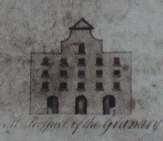
Baldonnell House on the left . . . . . . . and the façade of the Granary in Navan on the rightThe gable front on Baldonnell House may not be authentic, but that configuration of a pedimented curvilinear gable as a centre piece of a broad, otherwise ‘Georgian’, façade, did occur in the early-to-mid 18th century building record [as we saw before at the Granary in Navan] and it may even have been quite widespread before a change in taste resulted in it being cropped off, or trimmed back to look more like a classical pediment.
A house in the same category was ‘Whitehall’ in Rathfarnham which, according to Ball, was built about 1742 by a Major Hall who also built the nearby conical barn that still survives. A 1900s photograph in Weston St. John Joyce’s ‘The Neighbourhood of Dublin’ shows the barn with the rear of the house, complete with a cruciform roof, just visible behind.

the rear of the house can be seen to the left of the conical barn with another smaller outbuilding, also with a cruciform roof, in between.
This is the print of the front of Whitehall dating to 1795 and reproduced in Ball’s ‘History of County Dublin’, this time with the barn just visible in the trees to the left.
Just visible behind the tree on the right you can make out how the curvilinear gable steps down to a lower flat parapet, or simple eaves, on either side. The curvilinear gable does look improbably wide and flattened in this print and, in contrast, the entrance door looks improbably tall.

A seemingly more accurate 20th century drawing shows the house again although at this time the gable has been reduced to a simple triangle. In this later drawing, the gable windows are shown clustered tightly together which would have given the original curvilinear gable a much more compact profile and one that would have been much more in line with the proportions that we’re used to, as at Baldonnell and Navan above.
-
May 24, 2011 at 12:03 am #799759Inactive

The 18th Century Dublin Town House
The Forward, by Mary Daly, is sharp and concise, as you’d expect, but it does immediately throw up that old word association that continues to bedevil and obscure Dublin’s distinctive architectural record from the first half of the eighteenth century.
Before we even get to page one proper of a book purporting to tell the story of ‘The Eighteenth Century Dublin Town House’, we encounter phrases like: ‘This book succeeds splendidly in making Georgian Dublin interesting and relevant for a new generation of readers . . . ’.
‘Eighteenth century Dublin’ and ‘Georgian Dublin’ are not the same thing.
Devising terminology may be an broad brush exercise at best and labelling architectural epochs for the reigning monarch is just asking for trouble, nevertheless in the English architectural record, the broad term ‘Georgian architecture’ and the reigns of four successive Kings, George [from 1714 to 1830] just happens to form a near perfect fit.
This is not the case however in Ireland.
If ‘Georgian Architecture’ is defined by the Neo-Palladianism most obviously promoted by the compelling images contained in Vitruvius Britannicus [first volume published in 1715 – in the second year of George I] and is understood to be a term used to distinguish that architecture from; a the preceding ‘English Baroque’ architecture of the great public building programmes under Wren, Hawksmoor and Archer etc. and; b the preceding domestic architectural formula characterized by the steeply pitched dominant roofs of the ‘Queen Ann’ phase, itself a successor to the ‘Artisan Mannerist’ gables of the 17th century, then what was being built in Dublin in the first half of the eighteenth century was not ‘Georgian’, or at least it was only very occasionally ‘Georgian’.
There’s not going to be any future in us picking this point up every time we encounter it, we’d getting nothing else done for a start, and we’d all lose the will to live. Let’s just say that this book, no more than our architectural history culture in general, is riddled with the notion that the terms 18th century and Georgian are interchangeable, and no matter how hard we tug on the wheel, it may take us some time to turn this tanker around.
Moving on to the Introduction, this is written by a Toby Barnard who is no mug and is apparently a duel citizen of both British and Irish Academia.
The Introduction is in two sections. Section I is bubble wrap, but Section II contains a couple of interesting observations:
‘The proud but humiliated Irish, it has sometimes been argued, asserted themselves through architectural braggadocio. This was expressed more obviously in the scale of the public buildings – the Parliament House and later the Customs [sic] House and Law Courts – than in urban residences’.
OK, I think ‘the proud but humiliated Irish’ [this must be the Catholics] no longer owned property at this stage, perhaps T.B. is thinking of the proud and triumphant Irish [the Protestants]. These are the lads that we’ve noted before were clearly out and about and asserting themselves with a touch of architectural swagger. Either way, it is the next point that is probably of more relevance:
‘Just as the Irish resisted constitutional subjugation to Britain, so they selected architectural forms and decorative idioms that had not always been mediated through their nearest neighbour and entrusted commissions to those who had arrived directly from continental Europe’.
This could be quite a challenging statement, but the footnotes suggest that it is aimed at explaining the fabled Irish attachment to Rococo plasterwork rather than anything connected with curvilinear gabled streetscapes. Nevertheless, it is a crumb from the top table and we’ll take it and give it a chew.
In adopting the ‘Dutch’ gable, the Irish propertied classes certainly selected an architectural form that was not destined to remain current in the realm of their nearest neighbour, but, as Peter Walsh has pointed out, it was an Anglo version of a Dutch gable that we appear to have adopted and to that extent it seems unlikely that the tradition here was influenced to any great degree by input ‘directly from continental Europe’ however tempting it might be to hand this one to the Huguenots.
Just how conscious the Irish propertied classes were that their chosen architectural expression [in the first half of the 18th century] had become set on a dramatically divergent path from current British architectural expression, is the big question that this book doesn’t begin to ask, let alone answer.
‘Fashion, as has been noted already, although a vital factor in explaining changes in the look and uses of the houses, remains an imponderable’, T.B. concedes, lowering expectation for the remaining two hundred and eighty odd pages.
-
June 2, 2011 at 12:53 am #799760Inactive

Essay no. 1 is by Niall McCullough and is entitled simply; ‘The Dublin House’.
This essay concentrates on the ordinary terraced houses of the city and explores the variety of typologies found in the building record. These are compared and contrasted and a particular light shone on the more off-standard, site specific, solutions devised for trickier locations like corner plots or the junctions between estates. Illustrated examples demonstrate that frequently there was a gulf in urban ambition in Dublin where one corner plot might be developed to the absolute maximum with full elevations addressing both streets, often facilitated by fiendishly complex internal planning, while another corner plot might terminate with nothing more ambitious than a blank flanking wall.
As always with McCullough the threads of the story are expertly interwoven and well illustrated with decent photographs, including the obligatory misidentified shot just to keep everyone on their toes.
Nobody since Maurice Craig has done more than McCullough to reveal and celebrate the architectural development of the city. In addition to setting out, in considerable clarity, many aspects of the development of the city, ‘Dublin, an Urban History’ left nobody in any doubt about the extent of the gabled tradition in Dublin in the early 18th century where before there was probably a lingering perception in many quarters that gabled houses were just some odd quirk in the Georgian record.
If there is a criticism to be made of this essay it is that McCullough doesn’t really expand on those memorable turns of phrase that lit up ‘an Urban History’;
‘In purely stylistic terms, the image of riotously gabled houses form a part of folk-memory in Dublin’
– and;
‘Dinely’s drawings of the city show Holborn gables in the 1670s, Place shows curvilinear ones – more obviously redolent of the Dutch phase of influence, and perhaps by then imbued with a political cachet in loyal Dublin’.
To a large extent in this essay the story of the 18th century town house is left to be told by the typological studies which are detailed and extensive, but we have to be extraordinarily careful with typological studies that we don’t start to give equal weight in the story to each variation found, no matter how occasionally, and thereby create the impression perhaps that there were a myriad of plan forms and house typologies bursting out all over Dublin throughout the 18th century, when in fact there were really only two primary typologies;
a] The terraced ‘Dutch Billy’, planned with front and back rooms [the latter having a rear closet return] with the stairwell located at the rear and to one side.
b] The terraced ‘Georgian’ planned with front and back rooms with the stairwell located at the rear and to one side.
In reality, these two, closely related, house types completely dominated their respective halves of the 18th century and this fact is somewhat lost in a deluge of information on the other intriguing, but far less common, variations.
What I think is revealed in an exploration of 18th century Dublin house typologies is not so much that there was enormous variety, but that there was extraordinary consistency, and that the intriguing variations in plan form, as charted by McCullough, nearly all belong to the experimental phase in the uncertain years between the abandonment of the gabled tradition and the re-emergence of almost exactly the same basic floor plan a little later on, at which point it becomes the absolute standard template for the vast majority of the houses built to line the streets and squares of the Georgian city, but now without the corner fireplaces and closet returns [and the gabled elevations] of the earlier standard ‘Billy’.
That many Dublin property owners went to extraordinary lengths in the later 18th century to transform a ‘Billy’ into a ‘Georgian’, and in the process mess with the heads of anyone attempting to carry out a typological study, is a fact that is only beginning to become apparent.
Take South Frederick Street for example;

Above is a 1950s aerial view from the east showing the street when it was still intact, and below; the street as depicted on Rocque’s map in 1757. The houses on South Frederick Street were virtually all identical in size and design and it is probable that the elevations were also uniformly gabled, before being altered to flat parapets in a widely varied programme of Georgian modernisation.


This is McCullough’s photograph of a house being demolished on the west side of South Frederick Street in 1983.
In all probability, this house started out as a standard Dutch Billy, just like at least 34 of the other 36 houses on the street. What I think we’re looking at in the unusual configuration, revealed in section by the demolition, is the tamperings of a later 18th century owner of the house [and its neighbour beyond] who has decided to modernise the front half of the houses, i.e. the bit visible from the street, eliminating the front gable, replicating Georgian fenestration, and taking out the front half of the shared corner chimney stack in favour of building a completely new flat chimney stack to serve the remodelled front rooms, but leaving the roof and the rear half of the house untouched.
Even if the right hand chimney stack had become truncated somewhat over the years, it would still be hard to believe that the guy who built the right hand chimney also built the left hand chimney. I think a later alteration is a more plausible explanation. We know that precisely this scale of alteration occurred in an effort to modernise no-longer-fashionable gabled houses, we have a surviving example just around the corner at no. 20 Molesworth Street.
The fact that the new flat chimney stack is at least two meters higher than it needed to be is probably precisely so that the expensive modernisation would be visible from the street, an action which slightly misses the point about the non-importance of roofscape in the new style regime.
-
June 25, 2011 at 5:29 am #799761Inactive
I was wandering through Setanta Place marvelling at how gloomy that canyon of a street is even on a sunny day, lamenting the sheer vandalism that occurred on that block, when looking up as in a vision of the past I saw clear skies and gabled rears of the houses on the East side of South Fredrick St. Cheered me right up. Kinda.


-
June 26, 2011 at 1:41 am #799762Inactive

I thought we’d lost Boooooog, and yes this is one of the few locations left in Dublin where you can still get a feel for our lost gabled streetscapes.


no. 27 South Frederick St. with its ‘Georgianized’ facade, and the doorway of no. 24, the design of which was probably originally common to most houses on the streetThe trouble that the owners of no. 27 went to to Georgianize their house never fails to raise a smile. When everyone else was content just to dump the front gable and squeeze in a pair of windows into the attic storey under a flat parapet, and maybe replace the original old-fashioned door, these guys went the extra mile and replaced the whole cruciform roof with a pair of little lateral roofs. Even the tiny gable on the return had to go.
-
June 27, 2011 at 12:06 am #799763Inactive
You will never lose me Gunter, we had a baby on new years eve and she’s not too interested in Billys at present. I was trying to get a documentary produced on this great subject but was turned down because it was considered too niche for our broadcasters. I will persist.
-
June 29, 2011 at 2:50 pm #799764Inactive
I don’t know how it could be ‘too niche’ Boooooog, did you point out all the cooking and gardening programmes on the air these days. Who, in their right mind, sits down to watch that stuff? . . . . or have I answered my own question
Congrats on your recent reproduction. I had a look at that big red brick house in Harold’s Cross, posted a while back.

Everything about the house is chunky, the door surround, the window cills and even the brick itself is a larger unit than we’re familial with. Obviously the house has had a serious Victorian make-over, but those later 19th century alterations stand out on their own and don’t explain the oddly clumsy features which appear to well pre-date any Victorian intervention.
In dividing the house into two, the lower flights of stairs have been taken out and replaced by a pair of mean stairs, but the hall retains a panelled timber partition on one side, with a nice shouldered door case.

view from entrance door with panelled hall partition on the right


internal details that look consistent with a 1740s sort of dateI agree with you that the window arrangement, no matter how Victorianized, is still strongly indicative of a façade that was originally triple gabled. We have growing evidence that that particular typology was very popular in the early to mid 18th century in exactly this kind of location.

The very fact that the original roof structure was so comprehensibly replaced by a new high Victorian affair [print above], in advance of the subsequent extensions that might have otherwise been thought to have prompted it, is itself a good indication that the original roof structure was perhaps more outdated than a standard Georgian roof might have been considered.
According to local history records, the house, which was subsequently an orphanage, was the birthplace in 1803 of the Quaker Richard Allen. Allen was a prominent, and subsequently London-based, slavery abolitionist, human rights activist, and noted traveller to exotic places. I’ll dig around a bit and see if following the Allen family back in the records yields anything like a construction date for the house.

The little vernacular terrace adjoining the big house to the south could have a gabled heritage too, it is certainly [twin/triple?] gabled to the rear.
-
June 29, 2011 at 9:44 pm #799765Keymaster
I seem to recall that house is supposedly haunted.
-
July 5, 2011 at 9:34 pm #799766Inactive

If there is anyone haunting the house, there’s a good chance that it’s the mother, Ellen Allen.
According to ‘A Christian Philanthropist of Dublin – a memoir of Richard Allen’, by Hannah Maria Wigham, published in 1886 and available on-line [from which the Victorian print on the last page was plundered], despite being of ‘delicate health’, Ellen produced roughly a child a year for the first fifteen years following her marriage in 1798, before climbing into her grave in 1819, where she may – or may not – rest in peace.
I don’t know Boooooog if I’d mention that to Mrs. Boooooog.
-
July 5, 2011 at 11:38 pm #799767Inactive
Chilling, and pretty much ends all my hopes of ever living in it, and indeed, courting Mrs Allen… Shame.. One of the most interesting houses on that stretch. There’s another building further on, which I can’t recall right now, that always had me curious.. will return with more info when I’ve stopped moping.
-
July 25, 2011 at 4:27 am #799768Inactive
The second paper is by Brendan Twomey who comes from a banking background and is entitled ‘Speculative property development in eighteenth century Dublin’.
In the first half of the paper, Twomey outlines the rapid growth of Dublin in the crucial first half of the 18th century and illustrates the unfolding scene with quotes from contemporary commentators who frequently noted, not always approvingly, the dramatic scale of the city’s expansion and, in the case of Swift in particular, the financial recklessness with which groups of tradesmen seemed to be going about the place borrowing heavily to build houses that they often didn’t have the financial means to finish. As always with Swift, the commentary in the piece is almost incidental to the target of the piece, which in that instance was ‘a certain fanatic brewer’ identified subsequently as Joseph Leeson of Stephen’s Green, who, according to Swift, was busy amassing a vast property portfolio by picking up these unfinished speculative houses at distressed selling prices.
In the second part of his paper, Twomey follows the financial trail of William Hendrick, an ambitious but inexperienced property developer, in what ultimately became a tale of riches to rags. Hendrick’s stomping ground was the area between the Royal Barracks and Smithfield, where the construction of Bloody Bridge and land reclamation between it and Bridewell Bridge had opened up development opportunities. At this time, the early decades of the 18th century, Smithfield would have been fairly comprehensively developed following the initiative of Dublin Corporation forty years earlier and was occupied mostly by merchant types availing of the proximity to the markets. Queen Street, with a parade of grand houses looking westward over the grounds of the Blue Coat School and the Bowling Green complex with its Banqueting house pavilions was perhaps the most prestigious address in the district, however by the time Hendrick appeared on the scene around 1718, there were already clear indications that Queen Street had begun to lose its fashionability and house construction in the area in general was settling into the lower to middle income bracket, with just a couple of exceptions. Barrack Street and its continuation eastward, Tighe Street, [Gravel walk on Rocque] were filling out with largely three storey houses on 18 – 21 foot wide plots almost from the moment the Barracks project began in 1701, with a high percentage of houses distinguishable in the records as inns or taverns, all of them with conspicuously English signs such as The Robin Hood, The Star and Garter, The White Lyon, The Three Crowns etc.
What only slightly comes across in Twomey’s account is that Hendrick was a pinky in a pond full of sharks.
The land that Hendrick set out to develop, and which included Hendrick Street, was a part of the Bowling Green site which the sharp-as-nails Tighe family had contrived to acquire title to from Dublin Corporation. Presumably this acquisition had originally been intended to comprise some kind of stewardship role over one of the city’s grandest recreational amenities, but by 1724 Richard Tighe, ‘one of his majesty’s most honourable Privy Council of the Kingdom of Ireland’ had succeeded in having all the restrictive covenants on the property lifted and before you could say ‘rezoning bonanza’ he was flogging the site for residential development.
What Tighe sold Hendrick [John] in 1724 was a leasehold of a part of the Bowling Green site, subject to an annual rent of £180 sterling. Servicing an annual debt of that magnitude was a big ask for a novice property developer and to be a successful venture it would have required the off-loading of a substantial number of building plot leases quickly, given that individual building leases typically started out with at least the first half year at a peppercorn rent.
Leaving the Hendricks to assemble the infrastructure and market the development, in May 1728 Tighe sold on what amounted to the freehold of the entire Bowling Green site [excluding the site on which the city stables had previously been built] to Luke Gardiner for £4,020 sterling [RD 57, 165 37830], passing the Hendricks on to a new ground landlord in the process.
Luke Gardiner; the Dutch Billy Years, remains an unexplored episode, so we’ll have to wait awhile to find out whether L.G. was an active developer of the Bowling Green site or still just a money man and property speculator at this time. Not having the deep pockets of Luke Gardiner, Twomey explains Hendrick’s subsequent financial difficulties in the late 1720s on bad timing; ‘. . . the Irish economy experienced several years of recession which culminated in the famine of 1729’ and while there may be something to this, the conspicuously boom years of the mid 1720s would have brought their own perils in the form of intense competition. The impression given in Registry of Deeds records for the mid 1720s is of a city in a frenzy of speculative development, perhaps not unlike our own recent brush with insanity.
The eastward expansion of the city was becoming relentless in the 1720s with Henry Street, Abbey Street and Jervis Quay [Bachelor’s Walk] stretching development ever eastward on the north side of the river and with Sir John Rogerson’s Quay, Poolbeg Street and Lazer’s Hill [Townsend Street] stretching development eastward on the south side of the river. South of the College, urban development had reached the line of Dawson Street and in June 1726 Richard, Lord Molesworth, launched the development of the ‘Molesworth Fields’ with an advertisement in the Dublin Weekly Journal where punters were enticed with 99 years leases [for which he didn’t yet have parliamentary approval] and invited to view a ‘plan of the lotts, streets etc’ at his agent’s offices in Peter Street. Further to the southwest, even the dormant Aungier Estate had suddenly kicked back into life in 1725 with the Longford inheritance finally settled on Michael Cuffe and Robert Macartney and where new streets and densification was spear-headed by the arrival of major development figures; Jacob Poole and David Diggs LaTouche. All of this outward expansion was in addition to the on-going renewal and densification of the city centre and the on-going filling out of the streets in the Liberties where the most recent additions, Poole Street and Braithwaite Street were newly laid out in the early 1720s.
Add into the mixture the aforementioned Luke Gardiner fermenting his plans for the Bolton Street area and it’s not hard to see how Hendrick might have had a job on his hands at the best of times getting attention for his little development venture westward of Smithfield, in a location now primarily associated with the Barracks, live animal markets, service yards, middle income housing and a Temple Bar density of pubs.
Whether it was a general recession in the economy or intense competition from more fashionably located developments, William Hendrick appears to have been caught with development plots he couldn’t sell and with exposure to both his ground landlord and his private financial backers [the Bury family from Limerick]. By 1731 his goose was cooked and Hendrick was cooling his heels in Debtor’s Prison.
In fairness to Twomey, this is gripping stuff, but what we don’t get from Twomey’s account is any tangible information on the actual houses that all these development energies and financial speculations were producing, and there are worrying indications that Twomey is under the impression that these houses were Georgian.
This is a statement from early on in Twomey’s paper;
‘Most of the domestic buildings built prior to 1720 were of the Dutch Billy type. However from that date the form, which is now seen as the epitome of Georgian Dublin, began to appear.’
Straight away, this statement is decades wide of the mark and a glance at pictures of the six earliest Hendrick Street houses or the three longest surviving Haymarket houses, illustrates that point clearly. The Haymarket houses are perhaps even more interesting because of the involvement of the Tighes.


Images of Robert Tighe’s house at no. 4 Haymarket [the tall one] with the two Billys to the west also developed by Robert Tighe and sold to John Stones and Adam Blomfield respectively. In the last image, no 4 has lost its roof and attic storey and nos. 5 + 6 have been re-fronted as two-bay housesThese three Haymarket houses were originally classic Dutch Billys, developed by Robert Tighe in 1724 and incorporating all the characteristic features; shared corner chimney stacks, cruciform roofs, tidy closet returns and [originally] three bay facades reducing to a single window in the attic storey which [we can conjecture from typological studies] were each framed in a curvilinear and pedimented gable. Grainy 19th century images suggest that nos. 5 and 6 featured that peculiarity often seen in pairs [examples on Longford St. and Stephen’s Green South] where one of the pair was given a two bay arrangement on the first floor [of a wider window dimension] in an otherwise three-bay composition. This pair of Billys adjoined Robert Tighe’s taller house to the east, which itself adjoined the colourfully named ‘Cat and Bagpipes’ inn. The three houses had extensive vaults underneath not just the houses themselves but under the back yards and coach houses as well, vault structures that may conceivably still exist under the 20th century layers.
Whether it is by coincidence or not, the houses developed or acquired by at least two of the sons of Richard Tighe were among the sharpest Billys for which records survive. Robert Tighe, as we’ve seen, lived at the exceptionally tall gabled house at no. 4 Haymarket, the one which subsequently had Robert Emmet associations and which, with its two neighbours, was demolished in the 1980s for the blank concrete block wall of the Tully’s Tiles emporium. Robert’s younger brother, Stern Tighe, lived at no. 12 Usher’s Quay [illustrated elsewhere in the book]. The latter house featured not just, precision crafted, limestone downpipes, but also a richly carved stairs to complement its beautifully panelled interior.


Images of Stern Tighe’s house at no. 12 Usher’s QuayDespite their abundant architectural merit, it was perhaps the very fact that these formerly gabled houses, and hundreds more like them, did not perfectly fit the Georgian profile that they were so readily swept away for the most mundane of replacements.
With the couple of misgivings noted above, Brendan Twomey’s article sheds valuable light on a period that has been neglected for too long.
-
September 7, 2011 at 9:58 pm #799769Keymaster
Get your anoraks ready gentlemen
-
September 7, 2011 at 11:41 pm #799770Inactive
. . . . as if we ever take them off.
-
September 8, 2011 at 11:12 pm #799771Inactive
@Paul Clerkin wrote:
Get your anoraks ready gentlemen
https://archiseek.com/2011/dublins-dutch-billys-the-conference/Is there a date, or do my eyes deceive me?
***
Just spent a most intriguing evening catching up on the last few pages of this thread. Hats off to all concerned.
-
September 9, 2011 at 12:19 am #799772Inactive
12th October http://www.dublincivictrust.ie
Be there or be square!
-
October 4, 2011 at 11:37 pm #799773Inactive
The final few available seats are filling up quickly, so interested parties are advised to book over the next couple of days!


-
October 9, 2011 at 11:10 am #799774Inactive
I would have loved to have gone, but this is held midweek during work hours.
Is trua é sin….
-
October 14, 2011 at 1:56 pm #799775Keymaster
-
October 14, 2011 at 10:11 pm #799776Inactive
That wasn’t a bad synopsis . . . . for an archaeologist.
Can’t wait to read ‘Dutch Billys, the clay pipe evidence’, z z z z z z , I just hope we’re not witnessing the first sods of a turf war.
-
October 22, 2011 at 3:03 am #799777Inactive
There was a lot of interesting new material aired in that seminar which we should have a look back at in due course.

We looked at this pair of former Billys at 27 and 28 South Anne Street before. It appears from lease records that they were amongst the earliest houses built on South Anne Street in late 1724 or early 1725.

The large corner site [outlined in red] was sold by Joshua Dawson to William Wilde in January 1718 under a 999 year lease which contained a covenant that required Wilde to build, ’within seven years from the date of the lease . . . . good fashionable houses to all that part fronting Anne Street’.
It seems that Wilde initially developed four houses on the Grafton Street frontage adjoining the house of a retired Huguenot soldier, Colonel Blosset, at no. 43, but it wasn’t until close to the seven year deadline in 1725 that he completed the first two houses on the South Anne Street frontage. These two houses were the pair at nos. 27 and 28.
In Sept. 1725 Wilde sold on the remainder of the site [outlined in blue] to a bricklayer, Ralph Evans, granting him ‘free liberty of building and resting timber in all the walls and gable ends of the said William Wilde’s house, backside, yard or garden, coach house or stable on the east . . . and a like liberty of bearing timber in Captain Pechell’s gable end [no. 39 Grafton St.] on the south’. Capt. Samuel de Pechels was another retired Huguenot officer who had served in Schomberg’s Regiment during the Williamite campaign.

Pechell’s house, in modernized 3-bay Georgian form, shows up in a late 19th century stereo image of Grafton Street [second house on the right], but the house beyond it, no. 38, was still recognisably a Billy at this stage with its characteristic window arrangement and low hopper heads.
Wilde seems to have had a preference for clean-cut, two-bay, Billys with uncomplicated, single bay, attic storeys under cruciform roofs and a good 19th century image of the east corner house on Molesworth Street / South Frederick Street, developed by Wilde in 1733 or shortly thereafter, survives although the house itself was rebuilt shortly afterwards.

This, along with the neighbouring terrace, also developed by Wilde and afterwards Georgianized, was swept away in the 1970s for the bland office block that now houses the Passport Office. Nevertheless, the Molesworth Street image gives us a pretty clear idea what the pair of Anne Street houses originally looked like.
-
November 1, 2011 at 1:15 am #799778Inactive
The same house type as the pair of Wilde houses on South Anne Street is this survivor at no. 50 Mary Street opposite St Mary’s Church.

No. 50, outlined on Rocque’s map of 1756.

The house is just hidden by the church in this Lawrence photograph that shows the adjoining house at no. 51 with its characteristic Georgianized version of a two-bay Billy façade.

Despite the loss of it roof and attic storey, the house is included on the list of Protected Structures, probably due to the fact that it [until recently] retained a significant amount of its original internal panelling.
Dublin City Council’s Conservation officer objected to a recent planning application for a new shop-front to a Polish shop across the facades of nos. 49 and 50 Mary Street on the basis of a withering report on the destructive effect of unauthorised works being undertaken at the premises.
The Conservation Officer’s report records;
The removal of surviving sections of historic panelling on the left and right hand side of the staircase [internal spine wall] at ground floor level.
Damage to surviving lath and plaster internal walls and insertion of unauthorised steel works to internal spine walls.
The removal of a round-headed surviving section of timber sash window, frame and architrave to landing located between ground and first floor levels.
The removal of surviving sections of historic panelling and surviving section of box cornice along staircase particularly along internal spine wall where panelling was largely intact.
The removal of original window architraves to rear room windows located at first and second floor levels.
The insertion of two steel beams to the front and rear rooms which also resulted in damaging a section of original cornice to the rear room at first floor level.
Damage to section of surviving base of former panelled rear room at second floor level.
The steel bracing straps located on the upper floor levels have not been fitted to best conservation practice. The associated connection bolts are standing proud of the wall.
The internal staircase was not adequately protected during works which were ongoing at the time of my inspection.
Notwithstanding the objections of the conservation officer and the fact that the structure is the subject of ‘Live enforcement’ proceedings, the Planning Dept. merrily granted planning permission for the new shop-front two weeks ago.
From peeking through the fanlight the extent of the internal hacking is clear as is the quality of the original panelling and timber cornice where it has survived in the hallway.


A view of the rear showing the characteristic return now largely sheeted in plastic to protect the fabric from weather damage while somebody works out what to do with the building.

I’ve ghosted in the probable original profile of the front gable, based on the known precedents we’ve been looking at above. Unfortunately, I haven’t so far found any photographic records showing the original roof.
-
November 27, 2011 at 11:08 pm #799779Inactive
The recent one-day Dutch Billy conference was hugely enjoyable and very useful in many ways, but it was a pity there wasn’t a bit more time for discussion.
The irrepressible Kevin B Nowlan, in top form after a recent trip to northern Poland, dominated what discussion there was with a typically strident assertion that the gabled tradition here was definitively a branch of the pan-Northern-European gabled tradition, an assertion which would be wonderful, if it were true.
It was clear from the tone of several speakers that ‘Billy’ himself, despite the fact that he was observing proceedings from tapestries on both sides of the room, wasn’t getting a look in. In fact I think it would be fair to say that a certain amount of scorn was poured on the very notion that the primary subject matter of the conference, the ‘Dutch Billy’, owed anything at all to King Billy, in its origins as a architectural tradition. I think even Peter Walsh confessed to a slight embarrassment at having perpetuated the use of the term Dutch Billy in his writings on the subject which remain the authoritative texts. The problem of course arises because nobody knows for sure how Maurice Craig came up with the term, whether he rescued it from impending oblivion as an authentic piece of folk-memory, or whether it was just a witty invention.
If it was the prevailing view of the conference; that William of Orange is a red herring in all of this, which it did appear to be, then I suspect that we may be re-visiting this issue next year, provided the Civic Trust do the decent thing and turn this into an annual event.
Personally, I think the King-Billy-factor is absolutely critical to the popularity of the curvilinear gabled tradition here. In my opinion, the gabled tradition cannot be satisfactorily explained by any combination of the other factors at play; trade links, immigration, continuance of antique forms etc. etc. any one of which almost everyone present at the conference seemed to be infinitely more comfortable with as explanation enough.
I didn’t want to let this issue pass without comment.
-
December 7, 2011 at 11:14 pm #799780Inactive
So little attention has been paid to the tradition of gabled street-architecture in Britain that, against this background, it is difficult to gauge just how distinctive the Dutch Billy tradition is here.
We’ve looked at images from Kipp, Hollar and others before and we’ve found examples of English streetscape with a sprinkling of curvilinear gabled houses in them, in the second half of the 17th century. However, in general in England it would probably be fair to say that street-architecture is thought to follow a steady progression:
– post-medieval cagework houses with gable-fronts to the street [including twin and multiple gabled examples],
– through brick house types with ornamental ‘shaped’ gables,
– to houses with a parallel-to-the-street roof alignment featuring dormers and projecting eaves,
– to [by the early decades of the 18th century] the ubiquitous flat parapet terraced house template of the Georgian era.In this sequence, the characteristically simple, concave curvilinear and pedimented, gable we recognise as a ‘Dutch’ profile [as opposed to the more complex, multiply curved, ‘Shaped’, ‘Mannerist’ or ‘Holborn’ gable] makes only a fleeting appearance.
Outside the main urban centres, hundreds of examples of manor houses and farmhouses with shaped gables survive dotted around the countryside, particularly in the brick areas of eastern England, but also occasionally in the stone built regions of Scotland and Wales, but again it is the exception rather than the rule to find the Dutch profile in this rural wing of the British gabled tradition. In Britain these ‘Mannerist’ tendencies in architectural taste tend to be explained by architectural historians as a manifestation of the Tory faction’s attachment to comfortable nostalgia, in stark contrast to the Whig preference for grand antique classicism, and its sober streetscape counterpart, soon to manifest itself in the all-conquering English Palladianism of the 18th century.
Yet however fleeting the appearance of the ‘Dutch’ gabled house was in the record of English street-architecture, given the similarities of form and the overwhelmingly English background of the property owning and artisan craft communities in Dublin at this time it is probably an inescapable conclusion that it is from this English source and not directly from Holland or some more far flung northern European gabled source that the Irish ‘Dutch Billy’ tradition grew.
I think it’s important to acknowledge this, not least because we need to know how consistent with prevailing English building practice Irish street-architecture was at a point, late in the 17th century, if we’re to grapple with just how distinctive Irish street-architecture then became in the first half of the 18th century.
Below is a detail of Francis Place’s view of Greenwich circa 1700, which gives us a glimpse of a reasonably fashionable 17th century streetscape that should be neither too provincial, nor too metropolitan [nor directly bound by London building regulations] to stand comparison with Dublin.

This is the south end of Crooms Hill on the western boundary of the Greenwich Hospital grounds with – left-to-right – a house known as ‘Belvedere’ featuring a balustraded platform and cupola on the roof [somewhat similar to houses depicted in Brookings view of Stephens Green], in the middle, there is a terrace of three ‘Dutch’ gabled houses that would have sat equally comfortably into Place’s view of Dublin from the north and, on the right, a double gabled house with a pillastered façade. Only the latter structure survives today and it is described by English Heritage as dating to 1630.

As depicted by Place, this last house, which is now the Presbytery to the adjoining 19th century church, is shown with ornamental ‘shaped’ gables, which would represent an elaboration of its current less ornamental form. Conversely, Place has apparently simplified the fenestration and reduced the number of pillasters on the facade, if this is in fact the same house that survives at that approximate location today, which I think it must be.

A further complication arises in that there is a detailed drawing of the house as it stood in 1808 which shows a curvilinear gabled treatment that is very close in profile to the twin gabled, 5-bay, Mill-Street-type house that we’re familiar with over here, a good example of which was also to be found on Stephen’s Green.

A detail of an early 19th century painting of the College of Surgeons showing the adjoining doubled gabled, 5-bay, house that originally bounded the north side of the old Quaker burial ground on the corner of York Street
Brookings depiction of Stephen’s Green in 1728. I can’t remember which side of the Green this is thought to be, artistic licence has definitely been taken, but the house types are probably representative. -
February 28, 2012 at 12:04 am #799781Inactive

This is nos. 52 and 53 Dawson Street.
Dawson Street, as we know, was laid out for development by Joshua Dawson in 1705, or thereabouts, but although the venture was a success from the start, it took nearly twenty years for several of the plots to be developed.

One plot that seems to have taken a while to develop was this one outlined in red on Rocque’s map of 1756, containing 44 foot to Dawson St. and 114 foot to Duke Street. In June 1725, Charles McEvers, carpenter, mortgaged the property to a John Darragh, silk dyer, for two sums amounting to 110 pounds ‘together with the two new houses thereon’.
The corner house [no. 52], already let by McEvers to Robert Nixon, shoemaker, and afterwards sub-let by Nixon to John Thompson, whip maker, in December 1729, was demolished in the 1950s and replaced by the present brick and concrete structure with the roundy corner.
No. 53, however, substantially survives behind a stuccoed 19th century façade.

From the rear we can see that the roof pitch has been lowered [or the wall plates raised], but otherwise the characteristic Billy elements; single large composite chimney, closet return with corresponding signature step-in in the plane of the rear gable wall, and particularly fine flush-framed and slightly arched window, are all there.

On the Duke Street frontage of this block, two houses with substantial Billy fabric survive at ‘The Duke’ [nos. 8 + 9]

These two were never quite the pair that they appear on Rocque. No. 8 appears to have been developed by Robert Arthur, who had held the adjoining, double house, plot on Dawson Street since 1709 and the appended Duke Street plot was certainly developed prior to 1722 when this house on the corner of the Stable Lane was in the occupation of a Mr. Painter.

Again the main Billy elements are in evidence, despite a nineteenth century make-over that has added at least one additional storey to the house accentuating the contrast between this and its little three storey neighbour at no. 9.
No. 9 Duke Street retains almost dolls-house proportions and while the upper façade has clearly been rebuilt, the original cruciform roof appears to survive substantially intact.

the roof of no. 9 from the front
the roof of no. 9 from the rearProbably using the funds raised by the Darragh mortgage of the two prestigious, four storey, houses on Dawson Street, McEvers developed the remainder of the property constructing four modest houses on the Duke Street frontage between 1725 and 1729. These latter houses were leased by McEvers at an annual rent of between 11 and 16 pounds in a property market suddenly stalled by a combination of over-supply and a series of country wide crop failures. With the balance of advantage shifting to the buyer, William Perry, who leased one of these modest new houses [probably no. 9] from McEvers in Jan 1728, had the temerity to insist in the lease that McEvers ‘put a door to the front cellar of the said house, with a lock and key, and put the pump belonging to the said house in order, as also to clear the said house from all taxes and other encumbrances whatsoever . . . ’
-
February 28, 2012 at 2:58 pm #799782Inactive
In a friend’s place recently i saw a photo framed on the wall. took some pics for you guys… don’t know cork well, don’t know if this place has been discussed here… but anyway…
photo titled “Paddy’s Market, Cork, 1904”
sorry about the poor quality photos of a photo…
photos too big to embed and i’m too lazy to resize them right now..
-
February 28, 2012 at 10:22 pm #799783Inactive
That’s a nice photograph there cravings

Cork is a bit of a mystery to the rest of us too, no worries there.
Your ‘Paddy’s Market’ appears to be a colloquial name for Corn Market Street, previously Potato Quay and that interesting house was on the south eastern corner with Paul [Paul’s] Street. I’ve outlined the site in red on Rocque’s map of Cork, circa 1760.

The house is gone now and replaced by a three storey structure with a flat roof which I don’t think incorporates any early fabric.

In this aerial view from the 1950s the tall corner house was still there, if apparently held together with steel girders. The house had a double roof structure, but the roof volumes don’t look quite equal and given the comparatively tall floor to ceiling heights, compared to the three-bay Georgian next door [which survives], I’d be more inclined to think of this house as perhaps an early 19th century commercial structure rather than an early 18th century merchant house, but that’s not to say the one may not have evolved out of the other. I’ve dotted in the line of Paul Street in yellow for orientation, The junction of Patrick Street and Grand Parade is on the right.

An extract from Chearnley’s view of Cork from the north-east shows a good sprinkling of ‘Dutch’ gabled houses in this vicinity in the 1740s. The number key on Chearnley’s view identifies St. Paul’s Church, off Paul Street [no. 11], the old Market House on Corn Market St. [no. 12], and the cupola of the Exchange [no. 13] at the junction of North and South Main Street in the distance beyond, all of which can also be picked out on Rocque.
-
February 29, 2012 at 11:43 am #799784Inactive
interesting, nice one. it just caught my eye.
-
March 5, 2012 at 4:38 pm #799785Keymaster
Molesworth Street – early 1970s

-
March 5, 2012 at 6:47 pm #799786Inactive
God, just before the wrecker’s ball. Terrible shame. Is that a public house on the corner?
-
March 6, 2012 at 1:02 am #799787Inactive
@Paul Clerkin wrote:
Molesworth Street – early 1970s

Brilliant, I’ve been looking for a really good view of that stretch of Molesworth Street, and yes that was a pub on the corner of South Fredrick Street, which itself was an 1880s rebuilding of the original 1730s structure.

This is the same group captured before the rebuilding of the pub. Originally, the two adjoining ‘Georgians’ would have matched the ‘Billy’ design of the corner house.
I have to correct some bad information I gave previously on Lord Rosse’s mansion on Molesworth Street, but I’ll have to dig out the notes or I’ll end up getting the correction wrong too.
-
March 14, 2012 at 5:30 pm #799788Keymaster
The pub was rebuilt around 1876 I believe…
Here’s one I don’t recall seeing but which is possibly already here
[attachment=0:17roar1z]430278_289719607766597_100001856790210_681616_1787219719_n.jpg[/attachment:17roar1z]
-
March 20, 2012 at 8:37 pm #799789Keymaster
Fire destroys Dutch Billy
-
March 21, 2012 at 1:01 am #799790Inactive
Yes a tragic event – another conservation disaster that could and should have been avoided.

More information and pictures here:
Fantastic Dawson Street material there by gunter – how do I miss these posts! Requires careful devouring…
-
March 21, 2012 at 1:07 am #799791Inactive
In the old days, these two houses would have been dumped in a skip before the smoke had cleared, so, if we’re searching for positives here, at least everyone involved [from the Corpo to Hegarty] have been taking their time with this.

As altered as these two houses were, they were still probably the least altered former Billys in this whole Oxmanstown Green quarter of the city, and that redbrick façade of no. 6 was the absolute highlight of Benburb Street [no offence intended].
 . . .
. . . 
the facades of the two houses taken a couple of years agoIn terms of Billy typologies, this pair had most of the standard features of the two-bay, three storey over basement, a type which used to be very common particularly in secondary locations, the likes of Bolton Street, Georges Quay etc. One feature that is missing is the half brick step-in to the rear gable above the roof of the closet return, but the reason for this seems to be that the Benburb Street houses were built with external walls of just one brick thickness in the first place instead of the usual brick and a half. This impressive level of frugality hasn’t helped with the rigidity of the structures which, it has to be said, were showing signs of some bulging and sagging a long time before the fire.

rocque’s map 1756This section of Benburb Street was originally called Tighe Street, presumably after Richard Tighe who, we discussed before, had acquired the site, previously the old Bowling Green, from the Corporation, of which he was a prominent member. Rocque shows a complete terrace of 17 houses on the North side of Tighe Street [then called Gravel Walk] in 1756, and the eastern six of these houses essentially survive in one form or another as nos. 1 – 6 Benburb Street.
That the Benburb Street houses originally featured standard cruciform roofs is very probable on typological grounds and it is also indicated on the ground in a pattern in the brickwork of the party wall with no. 4 to the east, however this is one element that should reveal itself much more clearly in the brickwork of the party wall between the two houses if the process of partial demolition is conducted with enough care.

I think the pair of returns must be kept to their full height, the damage here is not extensive and the fabric of the returns appears to be substantially original and largely unaffected by the 19th/20th century alterations.
What with these later alterations being out of the way and all that, one could see how this could yet turn into a good news story . . . . if we can get everyone singing from the same hymn sheet.
Although I can already think of a few people who will want to pour cold water . . . and I’m not thinking here especially of the fire brigade.
-
March 23, 2012 at 1:23 pm #799792Inactive
Hmm DCC Architects suggesting the day before this post that the buildings would be demolished down to first floor level…and the presumably closed up and left to rot.
http://www.dublincityarchitects.ie/?p=210#more-210
I heard a few years ago (not sure how reliably) that this stretch of Benburb Street was entangled to a great degree with the Criminal Assets Bureau and that ownership of much of the street could not be fully determined, I am not sure if these buildings fall into a wider site or have stand alone owners who just haven’t been able/bothered to maintain the buildings. Regardless, Benburb Street isn’t exactly a shiny beacon for urban regeneration stimulated by largescale infrastructural investment is it.
-
March 23, 2012 at 10:42 pm #799793Inactive
Haven’t been down there yet. Have they been demolished?
-
March 24, 2012 at 4:31 pm #799794Inactive
Dublin City Council have ‘undertaken repair works’ …. ie demolished
http://www.thejournal.ie/red-line-luas-remains-severely-disrupted-after-fire-395221-Mar2012/
You gotta love Dublin.
-
March 25, 2012 at 5:39 pm #799795Inactive
Yup…well and truly repaired. It was much too depressing to photograph…particularly on such a lovely day. With the extent of destruction now undertaken it really makes little sense to retain whats left. Its such a shame, two interesting little buildings lost to the city. How much of that due to negelct.
Something stood out at me on reading an otherwise unrelated article in yesterday’s IT – MEET OUR RESCUERS:
ACROSS TOWN, FAR from the hip and edgy Eastern Comfort hostel boat, lies the sedate neighbourhood of Wilmersdorf. On a busy street the sign for the Kegel-König promises “German food and bowling”.
Inside the decor is tired 1980s: canary-yellow walls and wood-effect vinyl flooring. In a backroom overlooking a car park, six men and two women, mostly pensioners, sit at two tables of four, engrossed in their game of cards. They are playing the popular game of skat, which some suggest is a close fit with the German character.
In the basement, the lights flicker on to reveal a sizeable bowling alley, anno 1960. Wolfgang ran this bar and bowling alley for a decade but gave up when the new owners – Irish investors – jacked up the rent.
“I understand they want to make a return on their investment, but they wanted too much money,” he says. Pointing at a sizeable hole in the basement roof, he adds: “I had to battle with things like this for years. I don’t understand why the new owners don’t invest in their property.”
I dunno..maybe its generalising, but looking around our city, on this fine spring day, I cant help wonder why even the basics cant be done…window cleaning, painting, basic upkeep. We celebrate our design culture with PIVOT Dublin but our design professional seem to have deserted ship…merchanising, interior design, architecture, building presentation, shopfront design.
Perhaps if these two had been better cared for…with responsible usage we might not be looking at a pile of bricks right now. -
March 26, 2012 at 11:57 am #799796Inactive
What we’ve ended up with here is the worst possible outcome; the two houses have been demolished, we’ve found out almost nothing about them that we didn’t know before, and the value that this city puts on its pre-Georgian stock is demonstrated to still be at or near zero.

If you have a pair of houses [one of them a Protected Structure] and they are the least altered surviving structures that date to the original development of a three hundred year old street and, after fire damage has burnt off a good part of their non-original roof timbers, the local authority can’t be bothered to devise a structural cage to secure the intact walls of these houses, I think it’s time to conclude that many of the people drawing pay-cheques in this city, in positions of heritage protection, just don’t get the whole Dutch Billy thing.
All we can do now is pick through the rubble.

This is a view down the hall to the stairs of no. 6 after the fire, but before demolition. It’s interesting that the stairs clearly had winders, an early feature that almost never appears in later houses.

The same stairwell from the rear during demolition. The remains of one of the stair timbers, cut off with a chain saw, can be seen on the right and square mortise holes can be seen in the trimmer beam and in the beam on the left built into the stairwell wall to receive the tenon of the first floor beam that would have originally divided the span of the small, square section, joists in the back room. All the floor joists and support beams had been replaced in no. 6, some may have survived in no. 5.

One of the sawn off flights of stairs can be seen dumped on the pile of rubble in the yard.

The charred remains of one of the newel posts and a lone surviving banister demonstrate that the well crafted stairwells in these houses had survived the later modernisations.

This is a photo of the stairs in the five-bay orphanage house in Harold’s Cross, discussed earlier, which is a very close match for the banister and newel post detail in the Benburb Street houses . . . . orangey-red paint included.
-
March 26, 2012 at 7:00 pm #799797Inactive
Always strikes me how expeditiously these things are dealt with by Dangerous Buildings. Not a lot of time given over to the whys and whens. Did anyone document the buildings for posterity, I wonder?..a regular condition on permissions that include demolition of older buildings. I know things had to move quickly (danger of falling masonry to pedestrians, situation affecting Luas services etc) but it would seem to have been all done with unseemly haste. A big shame.
-
March 30, 2012 at 12:36 am #799798Inactive
Anyone who attended Peter Walsh’s superb lecture on the subject of ‘Dutch Billy and the lost gabled tradition’ in the Gilbert on Wednesday evening will have noted that these two houses at nos. 5 and 6 Benburb Street had been identified as altered Billys as far back as 1973.
It could be argued that the replacement roof structures gave these houses a later appearance, but the evidence for the original cruciform roof profile was there in the fabric, if the characteristic plan form, stair detail, and shared corner chimney stack weren’t in themselves enough to trigger the identification.

A high level view from the rear taken immediately after the fire. Under the satelite dish on the adjoining roof to the left [between the later yellow brick gables of the new roof on no. 4] you can just make out an area of roughly finished red brick and stone corresponding to the central gable that would have originally completed the party wall separation between the cruciform roofs of nos. 4 and 5.

another view with the outline of the internal gable outlined in red . . . and in more detail below

Why would you go to the trouble of replacing the entire roof structure?

In all probability the roofs of these two Benburb Street houses probably looked a lot like this surviving cruciform roof at no. 92 Camden Street, with tiny slates patched and repaired repeatedly over the course of nearly two hundred years before someone decided [probably around 1900] to strip the lot and replace them with a pair of simpler roofs.
A drastic decision certainly, but not quite as drastic as the decision taken last week to deal with the fire damage by knocking the two houses down.
-
March 30, 2012 at 12:24 pm #799799Inactive
We’ve come so far…
-
April 2, 2012 at 12:45 am #799800Inactive
Dutch Billy on Eden Quay
DeVeres art auction house are selling an interesting painting by William Sadler at the moment [as advertised in Saturday’s Irish Times]. It shows a glimpse of Gandon’s new Carlisle Bridge and the vista down Eden Quay towards Gandon’s new Custom House.

Eden Quay was a creature of the Wide Streets Commissioners, but in the Sadler painting, it hadn’t been fully realized yet with a hoarding evident around the quay wall and one of a stepped terrace of seven Billys [depicted by Rocque on what had previously been the east end of Bachelor’s Walk] still standing in the middle distance, beyond the first two five-bay arcaded blocks constructed eastward of the corner with the new Lower Sackville Street.

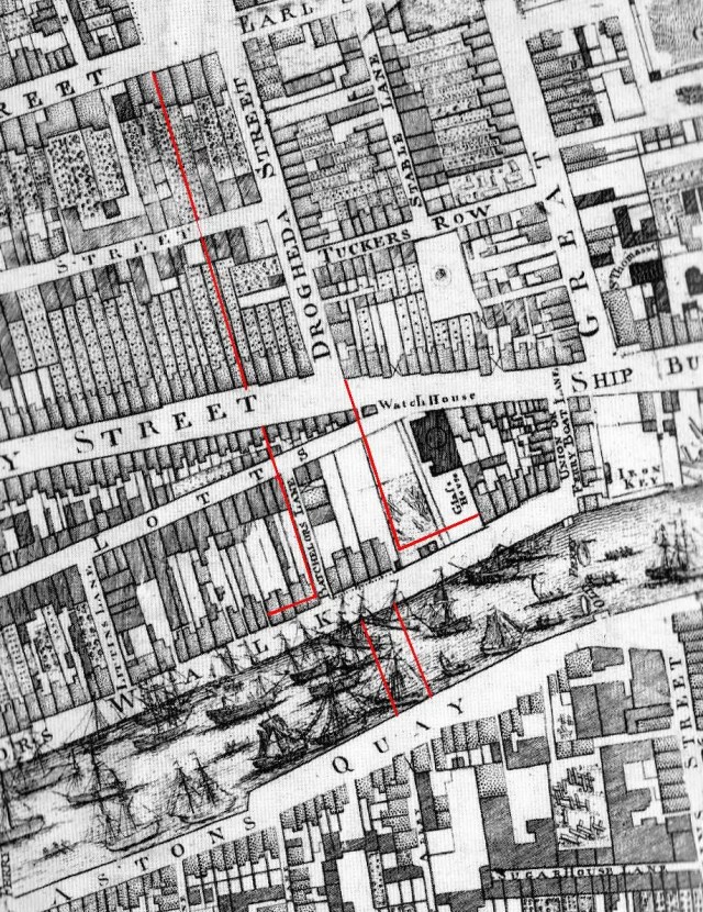
The future Sackville/O’Connell Street and Bridge outlined on Rocque’s map. A WSC map, published in McCullough’s Urban History of Dublin shows this intervention in more detail and clearly shows the intended set-back to Eden Quay that necessitated the demolition of the seven Billys [six in the WSC map].
The Wide Street Commissioners were the arch destroyers of Billys in the days before the baton was passed to Dublin Corporation.
-
April 2, 2012 at 10:10 am #799801Inactive
Wow, rare moment just before Eden Quay was developed …. and with an old gabled house still standing. The Georgian terrace looks smart. The Wide Streets Commissioners had a fantastic vision, whatever about the rights and wrongs of redeveloping an area.
-
April 3, 2012 at 2:18 pm #799802Inactive
On the subject of paintings of Dublin streetscapes, this is a Harry Kernoff painting of Georges Quay with the Loop Line Bridge just visible on the right, Luke Street running back from the quay on the left, and Tara Street Fire Station tower in the distance.
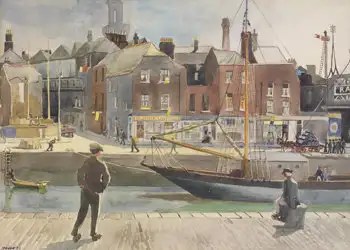
The three storey houses on Georges’ Quay were apparently known as ‘old Flemish houses’ at the time and are recognisably the same house type that we were discussing on Benburb Street. Georges’ Quay was developed at the same time as Barrack St./Tighe St [Benburb Street] and was just called the ‘New Quay’ until the opportunity to honour the new monarch, George I, arrived in 1714.

No disrespect to Kernoff, but fortunately we also have a photograph of the same terrace from a little earlier. Cruciform roofs, chunky chimneys and, in one case, pinched-in upper floor windows, tell the story that the Georgian flat parapets do their best to conceal.
-
April 3, 2012 at 4:43 pm #799803Keymaster
Oh nice work Gunter.
Here’s another for ya – Aungier Street.
[attachment=0:w0jwrok7]420254_348272361879168_100000892215045_1060488_1115591215_n.jpg[/attachment:w0jwrok7] -
May 20, 2012 at 10:59 pm #799804Inactive
Any thoughts on this building in Lady Lane, Waterford? Triple gabled Billy Facade?

-
May 21, 2012 at 4:29 pm #799805Inactive
These dutch billy buildings on Parnell Street have been mentioned before on this thread. Looking through the Dublin City Library website I saw these images taken in the aftermath of the Dublin bombings in 1974. I hadnt seen them on this thread before and thought it might be worth bringing them to attention. Images 14 and 22 refer.
http://dublincitypubliclibraries.com/image-galleries/digital-collections/1974-dublin-bombings?page=1
-
May 21, 2012 at 10:50 pm #799806Inactive
Another two candidates on Barronstrand street, both demolised.. Note the pinched upper storey windows, implying a prior front facing gable… The one on the right was only knocked a couple of years ago to make way for a Penny’s enlargement…

-
May 25, 2012 at 12:40 am #799807Inactive

It is difficult to know for sure about the Baronstrand Street houses, you’d like there to be at least one other characteristic.

As we looked at before, Chernley shows Baronstrand Street fully gabled in his c 1748 view, but then again he shows the houses to be three storey, including attic.
On the other hand the two houses south of the RC cathedral are on the side of the street hidden from Chearnley’s view and, pinched-in top storey windows are otherwise difficult to explain especially in the case of four storey houses that were clearly built with some prestige in mind.
The Lady Lane house will definitely merit a closer look, pity it seems to be ‘sale agreed’ or we could probably masquerade as potential buyers and book a viewing. There appear to have been a number of high profile residents of Lady Lane in the 18th century, at least two of them holding the position of ‘Recorder’ in Waterford Corporation, perhaps no. 22 belonged to one of these gents. I don’t suppose anyone down there in the sunny south east has some local knowledge they’d like to share . . . maybe narrow the search down a little bit.

Still in Waterford, that five-bay house that was rebuilt three times and now forms part of the Granville Hotel, and which we postulated was originally one of the broad single-gabled mansions shown in Van der Hagen’s view of the Waterford Quays, it turns out originally had one of those scrolled pediment doorways like no. 10 Mill Street, as seen in this view of a Bianconi coach pulling up to Commin’s Hotel as it then was in the 1850s.

It’s a pity the artist couldn’t have stood back another few feet [OK I know there’s a drop] and shown us the top of the house.
-
May 27, 2012 at 11:06 pm #799808Inactive

This is a clearer print version of that Bianconi coach picture, with the scrolled pediment to original Commin’s Hotel door more clearly depicted, although it is still missing an entabliture which may be down to provincialism or more likely, dodgy draughtsmanship.
This in another view of Commin’s Hotel in the 1880s with its new wider doorway and gawky unconvincing pediment, as well as a enough luggage piled up on the pavement in front to send Michael O’Leary into spasm.

-
June 3, 2012 at 8:24 pm #799809Inactive
@gunter wrote:
The Lady Lane house will definitely merit a closer look, pity it seems to be ‘sale agreed’ or we could probably masquerade as potential buyers and book a viewing. There appear to have been a number of high profile residents of Lady Lane in the 18th century, at least two of them holding the position of ‘Recorder’ in Waterford Corporation, perhaps no. 22 belonged to one of these gents. I don’t suppose anyone down there in the sunny south east has some local knowledge they’d like to share . . . maybe narrow the search down a little bit.
Just noticed this today.. Below is a detail from a sketch drawn in 1774 by S. Wynne.. I’ve got a feeling the building to the left of the Bishops Palace is the rear of that house on Lady Lane.. Not shown clearly but Looks like there’s at least two large rear facing gables, and artist could have omitted the third..

-
June 5, 2012 at 1:49 am #799810Inactive
As it turns out Simon, it is emerging that these triple gabled houses tended to be double gabled to the rear.
We know this from a remarkable survivor in Rathmines which, with its Regency façade, is a doppelganger for your Lady Lane house in Waterford.

22 Lady Lane, Waterford
5-bay house on Summerville Park, Upper Rathmines RoadDespite its superficially Regency appearance, the Rathmines house probably dates to the 1730s and importantly about two thirds of the original roof structure survives behind an altered flat parapet, which, together with the particular window spacing of the façade, reveals that the house was originally one of the series of triple gabled houses built on the outskirts of Dublin that we discussed before. The rear elevation here, and probably in the case of many triple gabled houses, was double gabled with a central dip over the half landing of the stairwell where headroom was not a problem.

a ramped staircase with a square newel post detail featuring engaged half banisters of distinctly hand made appearance would be consistent with a 1730s date
the aerial view from the south shows the steeply pitched pair of roof projections at the rear that originally would have been joined at the ridge by three similar roof projections to the front, linking to the triple curvilinear gabled façade
another view of the rear from the roof of an adjacent apartment blockThis is a rough photo-shop of the Rathmines house with its gabled profiles restored and showing the logic of the window spacing as originally set out, but without going to the trouble of removing the Regency render and new doorway.

The plaster wreaths on the present facade exactly match where the rain-water outlets would originally have been and, if we’re very lucky, this may be an indication that the original brick facade survives substantially intact behind the later render with the plaster features added to hide these bumps in the brickwork.
-
June 6, 2012 at 10:32 pm #799811Inactive
Thanks for that gunter, that Rathmines building is extremely similar, and a great reconstruction… Any idea what the original render would have been like?
@gunter wrote:
As it turns out Simon, it is emerging that these triple gabled houses tended to be double gabled to the rear.
We know this from a remarkable survivor in Rathmines which, with its Regency façade, is a doppelganger for your Lady Lane house in Waterford.
I dunno if that’s the case with the lady lane one…. The sketch seems to suggest the rear was three bay.. As the two gables portrayed are skewed to one side, and I think you can make out the tip of the third gable… But not sure.. It was one grand building in it’s day standing out against the Bishops palace (an extremely grand building!) as it does in that sketch above.. And some very wealthy person I’m sure lived there, be nice to know more of the history…..
-
June 9, 2012 at 4:01 pm #799812Inactive
@gunter wrote:
As it turns out Simon, it is emerging that these triple gabled houses tended to be double gabled to the rear.
Looks like you’re right… Found another depiction with a clearer outline of the gables by W.H. Bartlett..

-
June 10, 2012 at 1:18 am #799813Inactive
If anything, I think the earlier image is the more convincing as a representation. Where did you find that Wynne drawing? If this is the Rev. Samuel Wynne, his draughtsmanship seems to be pretty accurate even if the late Knight was a bit dismissive of his ‘feathery’ watercolour style.
If you can find it, Sautelle Roberts [son of Waterford’s favourite son; John Roberts] is supposed to have painted a view of Waterford City from the east to go with his dodgy 1795 view of the city from the west. There’s a chance he may have splodged in something to represent the rear of the Lady Lane houses.
We may be homing in on the owner/builder of the Lady Lane house [no. 22, outlined in red on the 1834 town map and 25 inch O.S. map], but it will take a bit more digging to be sure.

the 1834 town map showing Lady Lane with no. 22 closing the vista down St. Francis Lane
the 25 inch O.S map showing Lady Lane again with the parish boundaries marked between St. Michael’s, St. Peter’s, St. Olav’s and Trinity ParishAlderman Ambrose Congreve is recorded as being resident on the south side of the street in 1732 in a dwelling house three properties from the Presbyterian Meeting house [outlined in blue] in St. Olav’s Parish. Unusually for a relatively small street, the houses on Lady Lane divide into four different parishes with only a handful being in St. Olav’s.
Congreve became mayor of Waterford in 1736 and was also M.P. for both the county and the city in the 1730s. If no. 22 does turn out to have been Congreve’s town house, and if we can confirm that it was originally triple gabled, that would be a particularly good fit as I think it is emerging that the curvilinear gabled tradition here was especially strong in the 1720s and 30s among the members of city and town corporations and among the prosperous merchant classes, two groups that were systemically inter-linked.
In a Waterford context, the Corporation commissioned Van der Hagan painting of 1736, depicting the Corporation’s grant project to extend the Waterford Quays, illustrates the status of the gabled tradition as something of a corporate style at this time.
-
June 10, 2012 at 9:26 am #799814Inactive
@gunter wrote:
If anything, I think the earlier image is the more convincing as a representation. Where did you find that Wynne drawing? If this is the Rev. Samuel Wynne, his draughtsmanship seems to be pretty accurate even if the late Knight was a bit dismissive of his ‘feathery’ watercolour style.
If you can find it, Sautelle Roberts [son of Waterford’s favourite son; John Roberts] is supposed to have painted a view of Waterford City from the east to go with his dodgy 1795 view of the city from the west. There’s a chance he may have splodged in something to represent the rear of the Lady Lane houses.
Here’s Sautelles Painting… It’s seems to be very vague about the features of the various buildings..

-
June 10, 2012 at 12:30 pm #799815Inactive
I was afraid that might be what we’d be looking at with Sautelle, he’s even managed to make the father’s Georgian cathedral look like a gothic revival parish church.
On the positive side, he does indicate – in his own way – gabled terraces in the general William Street/Lombard Street area that Chearnley drew with a bit more vigour fifty years earlier.

What else have you got in that attic of yours Simon?
-
June 18, 2012 at 11:13 pm #799816Inactive
Are these some of the previously mentioned buildings in West street, Drogheda, that are more than likely of Dutch Billy origin?

http://www.greatirishphotos.com/2008/02/west-street-drogheda-louth-postcard.html
-
June 20, 2012 at 11:42 pm #799817Inactive
Apelles, until about three years ago I had no idea that Drogheda retained a treasure trove of houses belonging to the gabled tradition, none of the histories of the town make any mention of it. It was almost as if the street architecture of Drogheda was thought to skip straight from the elaborate half-timber cagework tradition of the celebrated Boate House to the stoic Georgian of the Grammar School, Singleton House and the like.
Without doubling the length of the Dutch Billy thread, I don’t know if we’re going to be able to put that record straight, but, as a first step, it certainly wouldn’t do any harm to point out that only the façade of the house you’ve highlighted [no. 106 West Street] is actually a ‘Protected Structure’ and neither of the two identical former Billys at nos. 5 and 8 almost directly opposite on the south side of the street even have that minimal level of protection . . . and these – the magnolia three – are only the tip of the gabled iceberg on West Street.

no. 106 West street
no. 5 West street, the right hand half of Dunnes Stores
no. 8 West Street, with its heavy parapet moulding which almost certainly replaced an original curvilinear gable
The rear of no. 8 West street, which was built over a medieval lane running down to Dyer Street
A view of the roofscape of the stretch of West Street from no 3 to no. 12 taken from the church parapet showing not just the former gabled houses at nos. 5 and 8, but also less obvious, two-bay, former Billys at nos. 4. 9 and 12 also. The roofs of nos 105 and 106 can be seen in the foregroundI don’t know what features the interior of these houses may retain, none of them are Protected Structures, but unfortunately I can confirm that the interior of no. 106 was recently, and comprehensively, plasterboarded out complete with a replacement stairs straight out of B+Q, all of which works take advantage of the fact that, unusually for Drogheda, only the façade of this particular house was Protected.

the top landing of no. 106
a beautiful pair of late Georgian curved windows are preserved on the rear elevation of no. 106, other features may survive behind the plasterboard.Ironically, the house next door at 105 – the Victorian redbrick in Apelles pic. – enjoys full Protected Structure status even though it was only built in 1895.
-
July 1, 2012 at 6:14 pm #799818Inactive
Not sure if you like coincidence’s Gunter, well anyway, I was browsing through the ghostsigns project & found this pic of ‘Shop street’ also in Drogheda.


-
July 1, 2012 at 11:22 pm #799819Inactive
You’re spot on again there Apelles.
The present site of the Wogan Interiors premises was formerly a terrage of four particularly smart Billys that we’re fortunate to have quite a lot of information on.
The site was packaged for development in 1727 by Drogheda Corporation and divided into four plots of 21 foot frontage and 128 foot depth. The site appears to have previously been occupied by a Guild Hall and at least one old house adjoining the north west corner of the bridge.
The Bike shop was actually a re-gabled version of the formerly gabled house built in 1727, or shortly afterwards, by Alderman Henry Ackland. The shallower pitched roof and ornate curvilinear gable in the Bike Shop view were added to the house circa 1900 after its original cruciform roof and its replacement flat parapet, which had succeeded the original gable, had themselves been replaced.

a view of Shop Street when the facades were still brickNote that the adjoining house [no. 23] had the same window arrangement as the cluster of houses on West Street that we were discussing earl
-
July 4, 2012 at 11:22 pm #799820Inactive
Head of the Orange Order addresses the Seanad

a new Muriel of King Billy replacing a UFF one in Sandy Row, BelfastWhatever may turn out to be the true extent of any connection between the Dutch Billy tradition that we discuss on this forum and other manifestations of Orangism, every year – in the lead up to the 12th – we miss the opportunity to engage in any meaningful exploration of the cultural legacy of Orangism and instead settle into a predictable pattern of reporting the conflicts and tensions that attend its celebration in the North.
Notwithstanding the visit of the Head of the Orange Order to Dublin yesterday, there is every indication that we will miss the opportunity again this year.
Even allowing for the possibility that Mr. Drew Nelson, the Head of the Orange Order, may have dumbed down his potted history of Orangism [as reported] to reach his audience in the Seanad yesterday, there remains the suspicion that even those steeped in the heritage of Orangism, as one imagines Mr. Nelson must be, may not fully understand the cultural phenomenon that they belong to and its legacy throughout the island of Ireland.
As reported, Mr. Nelson took the opportunity to highlight the two fundamental tenets of the Orange Order in his address to the Seanad; its avowed Protestantism and, its unshakable commitment to the union with Britain. This may be a statement of fact, backed by two hundred years plus of unrelenting observance, but it is also the sectarian cocktail that raises the hackles of even the mildest among the nationally minded community with whom the membership and supporters of the Orange Order share this island.
Clearly there is absolutely nothing wrong with an organisation being avowedly Protestant, if the organisation is exclusively, or at least primarily, religious in mission. Equally, there can be no legitimate issue, in a democratic society, with an organisation dedicating itself to pursuing a political objective, such as maintaining what remains of Ireland’s political and cultural union with Britain. It is the combination of these religious and political objectives that, perhaps even more so than the appearance of bowler hats among the King Billy banners, gives the Orange Order the appearance of a body from a different era . . . . a different, sectarian riven, era.
Orangism did not start with the foundation of the Orange Order in 1795, Orangism was a hundred years old by then and it would be a lot easier for the rest of us to explore the extraordinary cultural legacy of Orangism, and maybe begin to celebrate its many cultural achievements in Ireland, if the Orange Order put down some of its baggage.
-
August 11, 2012 at 3:47 pm #799821Inactive

Above is another view of those Dutch gables on Meat Market Lane junction with Sheep Street.
I came across it on the Limerick City Library website where they have uploaded journals from the Limerick Field Club from 1897-1908.
Their photographic section (here Rev. T. F. Abbott and Miss Ebrill) must have taken many images of old Limerick.
I know Limerick Museum has some but I would not be surprised if many others still exist, stored up in old attics?

Meat Market Lane junction with Sheep Street

Sarsfield’s House – Somewhere on Sheep Street.

Street Map 1840
-
August 31, 2012 at 12:29 am #799822Inactive
One would imagine that the terrace of three Billys at a nice corner location at the junction of Meat Market Lane and Sheep Street would jump out of the records handy enough, but no, no no no, it’s the usual needle in a haystack operation.
For a start, Meat Market Lane seems to have gone under a number of different names in the 18th century, Shambles Lane, Bonifield Lane and possibly also the Main street of the Abbey.

On this 1752 map, Sheep Street clings to the east side of the, still standing, city wall with the former lands of the dissolved St. Francis Abbey [Franciscan friary] occupying the lands outside the walled city and extending to the Abbey River.
Of the several property owners recorded in this vicinity in the 18th century the only one I can find in possession of three houses is a Henry Holland, hardware merchant. By a deed, coincidentally of 1752, Holland leased, or more likely re-leased, a property comprising three houses, two cabins and a garden plot to an Ignatius Coleman of St. Francis Abbey, chandle, the three houses being then in the possession of Coleman, Patrick Mowney and John Hurly respectively. Coleman’s house, or at least the garden to the rear of his house ‘adjoined the town wall’.
I wouldn’t be confident yet that this is a record of the three Meat Market Lane Billys, but the anual rent of £16 that Holland charged suggests that Coleman was leasing three substantial enough houses and the three Billys would fit that description.
The site is now completely absorbed by a major apartment development constructed in 2003-4 and this end of Meat Market Lane no longer exists
There was an archaeological investigation in advance of the development, carried out by a local practice; Aegis Archaeology. What are the chances that the floor plans of these three important and distincrtive houses were recovered in the archaeological investigation enroute to the medieval goodies underneath?


pictures from excavations.ie showing the site and the excavated city wallNo, I don’t think so either.
-
September 4, 2012 at 12:04 am #799823Inactive
I’m cooling on the Henry Holland connection, this looks more promising:
Limerick City Museum hold a collection of maps relating to the estate of Edward Hoare, which were surveyed and drawn by John Appleyard in 1747.
No. 8 in that collection appears to be the plot of ground at the junction of Bonifield Lane [Meat Market Lane] and Sheep Street on which the three Billys recorded in the 1899 photographs stood. Appleyards survey, which he takes the trouble to tell us includes ‘dimensions and boundaries of the said premises . . . exactly taken & marked on the above map’ is dated 1 August 1747.
These documents are available on the museum web site, although the resolution isn’t great.
The interesting thing is that the Appleyard survey depicts a large square site mostly occupied by a ‘large new shambles’ which had a gate onto Bonifield Lane. There were three stables fronting Sheep Street at the northern end of the site, but of the three Billys, only the corner house, described as ‘one large house’ had been built by this time, the occupant being a John Casy, carpenter, who rented the house from David Bindon Esq. [likely to be the David Bindon, who was M.P. For Ennis and brother of the the amateur architect Francis Bindon].
This would mean that the other two Billys date to after August 1747.
That will come as interesting news to them that thought that the Billy tradition all died out in the 1730s!
This doesn’t tell us who built the houses, but at least we have a couple of candidates now, the carpenter John Casy and the Bindon brothers.
Francis Bindon of course has rock solid Georgian credentials, but, on the other hand, he is associated with the John’s Square development in Limerick of 1751, which might be all dull-as-dishwater Cassellsesque to the front, but which we know featured a couple of delicate little Dutch gables on at least one of the rear elevations.
-
October 1, 2012 at 3:22 pm #799824Keymaster
[attachment=0:2rwq97b7]$(KGrHqF,!hcE1iIvgPizBNdtcL5+2Q~~_32.jpg[/attachment:2rwq97b7]
Small view of the original Leslie house at Glaslough, before Lanyon, Lynn and Lanyon
-
November 13, 2012 at 11:53 pm #799825Inactive
Glaslough appears to be a strange case whatever way you look at it. Mark Bence-Jones, who is normally a fund on information on country houses, gives us nothing on the early history of Castle Leslie [Glaslough].
That little [Maynooth Studies] history, records that Sir Thomas Ridgeway constructed a square castle on the site in the wake of the Ulster Plantation and the house then grew up around that, possibly constructed by Bishop John Leslie in the 1660s. The estate then passed in 1671 to John’s eldest son, also John Leslie, who was Dean or Dromore and who died in 1721. John’s brother, Charles, was a controversial character, being both an Anglican clergyman and also a supporter of the Stuart cause and this created some discomfiture for the Leslies during the reign of William & Mary and subsequently. Charles was an energetic pamphleteer against all non-Anglican sects including Quakers, Jews, Deists and Roman Catholics. He must have cut a strange figure at the Stuart Court in exile, steeped as it was in all the trappings of Popery, when he found refuge there in 1710 after his pamphleteering activities finally crossed a line the authorities couldn’t ignor.
It’s a pity that more information on the pre-1860s Glaslough House hasn’t emerged yet, the religious/political conflicts in the Leslie family would make an investigation of its architectural expression a particularly fascinating case study.

that Glaslough House image again

a photo of Turvey House, North County Dublin, before its demolition in 1972All we can tell from that one image is that there are some distinct similarities with Turvey, not only in the fact that it was built around an earlier tower house, but also in that there are obvious grounds for believing that Turvey was also triple gabled. A further parallel can be found in the fact that successive owners of Turvey were also beset with troubles relating to their religious allegiance.
-
November 15, 2012 at 4:02 am #799826Keymaster
And then there’s Richhill, in Co. Armagh

-
November 15, 2012 at 4:05 am #799827Keymaster
Actually I came across something else in the last few days whih reminded me of the Glaslough image… need to remember where, but it wasn’t that far away.
-
November 15, 2012 at 5:03 pm #799828Inactive
@Paul Clerkin wrote:
And then there’s Richhill, in Co. Armagh
A place i know well that and its famous gates… and the ongoing fight between the owners of Richill Castle and the Northern Ireland Office.
Also quite close in Portdown was Carrick Blacker House, since demolished which despite being Queen Anne, kept the dutch gables for good measure.
-
November 15, 2012 at 5:41 pm #799829Keymaster
Carrick Blacker House was what I was thinking off, I think, or maybe it was something else…. hmmm seen too many pictures of places in Armagh this week
-
November 15, 2012 at 11:33 pm #799830Inactive

Carrickblacker House
I’m not sure that Carrickblacker House was ever in the same category as Richhill and the house was so heavily Victorianized that it’s difficult to say whether the gable feature on the front facade was any earlier than 19th century in origin. It is unlikely that the N.I. Dept. of Environment would have permitted its demolition as recently, as 1988, if the structure retained any substantial late 17th century fabric. Nevertheless Carrickblacker is still an interesting case and worth investigating.Richhill is an extremely inportant house that was originally one of a group of similar structures that also included Waringstown House, in neighbouring Co. Down. These houses demonstrate that the ‘Dutch’ gable – as an architectural feature – had been transmitted to Ireland by English settler families by the 1660s, but the curvilinear gable was to appear only rarely in urban locations at this time and the trend was then away from gable fronts and towards an architecture of projecting eaves with carved console brackets and small discreet dormers.

another view of Richhill House, Co. Armagh

a detail of one of the side dormers at Waringstown House, which has the same profile as Richhill and was built shortly afterwards in about 1667. The front facade of Waringstown was altered and extended less than fifty years after it was first built and the gabled features we presume it had were removed at this timeThe story of the Dutch Billy is the story of how [and why] the the curvilinear ‘Dutch’ gable made a dramatic return to popularity in the 1690s and sustained that popularity, particularly in the realm of street-architecture, for the next several decades.
-
November 26, 2012 at 11:37 pm #799831Inactive
This may well have been posted here before…I thought it was a great find

-
December 2, 2012 at 5:32 pm #799832Inactive
Here’s one from before Devo bought it.

Jesus, the last time I saw Mill St it was held together with a pigeon-shit and feather render. Wonder what the inside is like?
On the subject of three bays, saw this lovely one in Carlingford.

Not far from the above is Ghan House, 1720’s ish, more on it later, but it contains lovely shouldered door cases, dog legs and mouldings. I know nothing about plasterwork but they look pretty early.


Nice panels behind the bannister too. Speaking of which any ideas on how old the panelling in the Long Hall is?
-
December 8, 2012 at 1:14 pm #799833Inactive
Yikes! Obviously I should have said triple gabled, not three bay regarding that Carlingford House.
-
December 9, 2012 at 1:23 am #799834Inactive
There was also a category of three storey house, that turns up mostly in provincial centres, which had a facade that reduced from five bay to three on the top floor, but which was probably not originally gabled. Below are examples from Dyer Street in Drogheda and just over the bridge in Leixlip. I think these houses are related to the triple gabled house type, but in houses of this type the outer windows on the top storey are invariably centred over the space between the windows below in a way that didn’t happen too often in the case of altered gabled houses where the priority was to match the attic storey windows to the centre of the gable locations above, regardless of the fenestration spacing below.


I think these houses relate to the gabled tradition in that if the triple gabled house type hadn’t existed, it’s unlikely that the reduction in windows on the top floor of a five bay house of this type, in Georgian times, would have been deemed acceptable.
-
December 10, 2012 at 12:04 am #799835Inactive

This is a tasty triple gabled house called Barnham Court in West Sussex that illustrates the point about the attic storey fenestration being dependant on the gable positioning and how this often meant that the outer windows had to drift in respect of the five bay fenestration below.
Note how the tricky challenge of dealing with the rain water outlets from the valleys between gables was resolved by concealing a channel above the strong projecting string course below the attic storey, a devise that also deflected attention away from the imperfections in the window spacing.
Barnham Court is an immaculately preserved Grade 1 listed building, as you’d imagine, but unfortunately more contemporary images of the front are partially obcured now by trees. English Heritate date the house to circa 1640 and the brickwork has been linked to that at the Dutch House at Kew, built in 1631. These dates are a good eighty to ninty years earlier than Irish examples of triple gabled houses and for this reason it is unlikely that there is any direct link between the two traditions, although a handful of under-studied English examples may approach a bit nearer to 1700.
-
December 13, 2012 at 12:45 am #799836Inactive
Here’s another view of that triple gabled house at Barnham Court, west Sussex, with its clever rain water disposal system tucked away around the corner from the front facade.

That prominant projecting, indented, cornice, here executed in brickwork, reappears in timber as the classic eaves detail to a dormered roof in the next phase of English domestic architecture, a tradition that we shared for a good twenty years before we unexpectedly took up the curvilinear gable and ran with it for the bulk of the next fifty years. Both traditions were ultimately killed off by the questionable charms of the flat parapet.

Above is a view [circa 1760], by Thomas Sandby, of Beaufort Buildings, a residential development built on the site of Buaufort House just south of the Strand in London in the 1680s. Several of the houses may have been remodelled in the interim and some dormers certainly look enlarged, but the general streetscape with its repeating pattern of projecting eaves and ranks of dormers is probably substantially original and gives a good idea what a post-gabled [London] and a pre-gabled [Dublin] streetscape looked like.
-
January 25, 2013 at 1:51 pm #799837Inactive
@gunter wrote:
Orangism did not start with the foundation of the Orange Order in 1795, Orangism was a hundred years old by then and it would be a lot easier for the rest of us to explore the extraordinary cultural legacy of Orangism, and maybe begin to celebrate its many cultural achievements in Ireland, if the Orange Order put down some of its baggage.
Are we sure that “Dutch” billies are part of this Orange tradition.. My perception on the matter is that this building style was near pan-european in the 18th century, and it’s just the Dutch happened to retain the style to the modern day, while the trend fell out of fashion almost everywhere else in the 19th century.
-
January 30, 2013 at 12:29 am #799838Inactive
@simon.d wrote:
Are we sure that ‘ Dutch’ Billies are part of the Orange tradition?
Actually Simon, there would be no consensus at all that the Dutch Billy is part of the Orange tradition, and most people seem inclined to dismiss the notion as nothing more than a simplistic interpretation of a whimsical nickname whose provenance has not been established. If it does emerge that the Dutch Billy was an early expression of ‘Orangism’, one of the surprising things will be that the Orange tradition itself is completely unaware of the fact.
None of which means it wasn’t so.Niall McCullough had a typically elegant formula for addressing the appearance of Dutch gables in late 17th and early 18th century illustrations of the city, in Dublin, an Urban History including those of Francis Place; ‘Place shows curvilinear ones – more obviously redolent of a Dutch phase of influence, and perhaps by then imbued with a political cachet in loyal Dublin.’
A combination of Dutch influence with a loyal cachet is probably as far as most people will go with the Orange factor, but this may be because of a certain distaste for the idea, or maybe a disinclination to believe that such an explanation could possibly be credible, or just the belief that there is sufficient explanation for the sources of the Billy tradition elsewhere.
To my mind, there are four potential sources for the Billy tradition:
1. Immigration, especially of builders and tradesmen familiar with similar gabled house traditions in provincial England, but also occasionally in Holland and elsewhere.
2. ‘The persistence of antique forms’, i-e continuity from known indigenous [ – or previously imported – ] gabled traditions of medieval origin, flowering, as it did elsewhere, into a curvilinear gabled phase.
3. Transfer by trade or other commercial or cultural links [including dissemination by pattern book] with places where the curvilinear gabled tradition was strong, i-e Holland, the Baltic, northern France and provincial England.
4. The Orange celebratory factor.
The question is; what weight is to be attached to each source?
In my opinion, there is a definite case for no. 1 being an important factor, given the fact that the bulk of the builders, developers and tradesmen that we have records for are English, with a high proportion being evidently first or second generation immigrants, i-e prime candidates for being in a position to transfer a building tradition.
The problem with this explanation is the absence of a clearly defined parent tradition; many areas of Britain can offer one or two elements that made up the Billy tradition, but nowhere seems to have the full package in sufficient strength to be a completely convincing source location.
Personally, I’d rate this factor as probably not more than 25% of the explanation.
No. 2 is a compelling factor for only a comparatively small number of known examples and some of these could equally be vernacular simplifications of full blown Billys, rather than the other way round. The bigger problem with the continuity argument is the fact that, across the whole spectrum of Dublin street-architecture, from the speculative terrace to the high status town house, the gabled continuity was clearly interrupted by a phase of development in the 1670s and ‘80s that did not feature gable frontages and which, as far as we can tell, was indistinguishable from contemporary building practice in the fashionable areas of London – and built by the people that we talked about at no. 1 above.
10% of the explanation, at best.
Frankly, no. 3 is unlikely to be a particularly significant factor, much as it might be an attractive idea to see ourselves retrospectively in a European context.
@simon.d wrote:My perception on the matter is that this building style was near pan-European in the 18th century
Yes, ‘pan-European’ . . . . except London and the fashionable urban centres of England, on which Dublin society styled itself in every other aspect of its material culture, [see anything published by Toby Bernard].
Expecting architectural pollination of the order required to explain an entire building tradition as distinctive and as geographically contained as the Dutch Billy is asking a lot of trade or cultural links that don’t appear to have been either, especially remarkable, or in any way peculiar to Ireland.
Again, 10% of the explanation at best.
Which brings us to No. 4 and back to that contentious ‘Orange’ explanation.
To me, the compelling factors here are:
[a] The time line, is a near perfect fit;
Before 1690, the handful of examples we have of curvilinear gables can each be seen as a special case and their distribution is consistent with new money flirting with stylistic experimentation, not the emergence of a new tradition. After 1690, the situation reverses, the curvilinear gable becomes ubiquitous in new urban construction, establishing a new tradition, while new money starts experimenting with typologies beyond the gabled tradition, e.g. Joshua Dawson’s Mansion House, or Speaker Connolly’s Vitruvian Castletown.
The distinctiveness of the geographical spread;
Just as the Williamite conflict enveloped, and was confined to, the island of Ireland, so the Dutch Billy tradition was distinctively Irish in distribution and while Dublin was evidently the cradle of the tradition and always had the greatest concentration, it is clear that the tradition quickly spread to most of the other urban centres of Ireland, each of which had been transformed, in one way or another, by the conflict.
[c] Popularity across the full social spectrum;
The Billy tradition displays an unusual degree of common purpose across the social spectrum as though a shared peril overcome had given rise to a shared method of expressing relief/joy at the outcome. From the very small house of the shopkeeper or artisan craftsman to the great house of the brewery magnet or the city alderman, the architecture was essentially the same, distinguished only by scale, expenditure on detail, or, in some cases, a multiplicity of gables.
[d] Evidence of a Williamite cult;
Orangism didn’t drop out of a clear blue sky in 1795, the practice of celebrating King William clearly began almost immediately following William’s triumphant entry into the city where the King’s birthday and the date of the Battle of the Boyne quickly eclipsing all previous protestant festivities commemorating the 1641 rebellion. Even Swift was moved to compose an ode in gushing praise of the deliverer. In England, William’s star may have slowly faded as the country seemed to be embroiled in perpetual continental war and people remembered that he was Dutch, but in Ireland, despite some mean spirited new restrictions on the wool trade, there were few obstacles on the path to idolization. Commentators were struck by the contrast. Writing in 1751 [three monarchs later], the ever reliable Mrs. Delany, still grumpy from a cold she had contracted while attending the 4th Nov. celebration of King William’s birthday on College Green, observed that ‘King William’s . . . memory is idolized here almost to superstition.’
Did an idolization of the deliverer and a desire to put an indelible stamp on the city, combine with other factors to create the Dutch Billy tradition?
I think it probably did.
-
February 13, 2013 at 4:19 pm #799839Inactive
The significance of the remains of Riversdale House had been flagged repeatedly in representations to Dublin City council over the years, yet the last visible remains of the house were swept away recently during the course of adjacent flood defence works to the Camac River in Kilmainham.

The façade of Riversdale house, Kilmainham, prior to demolition in the 1960sRiversdale House was an extremely rare example of a high status house from the 18th century gabled tradition [probably originally including Dutch Billy gables] constructed entirely in stone rather than brick. The house was constructed about 1725 by a Dublin lawyer called John Fitzpatrick who sold it shortly afterwards to a legal colleague, Simon Bradstreet. The Bradstreets resplendently resided in the mansion throughout the 18th century, adding to their holding and tending the formal gardens that stretched out in front of the house up to a splendid wrought iron gateway fronting the highway at Old Kilmainham.

O.S. map showing Riversdale House [outlined in red] set at the rear of formal gardens.
The entrance gate on Old Kilmainham disappeared early in the 20th century and was reportedly shipped off to Malahide, where I haven’t yet been able to find itAt what point the uber refined entrance door of the house acquired its signature statue of Shakespeare is still unclear, but the great house, long since converted into a tenement with a plain 19th century roof, was substantially demolished in the mid-1960s.

The entrance door of Riversdale House with the statue of Shakespeare above it.What remained until recent weeks was the lower half of the west gable wall, which formed the property boundary and the party wall with a slightly later house called Millbrook House which had been constructed on the adjoining site entered from Lady Lane. Importantly, the remaining section of gable wall included the south-west corner with the front façade of which the first 1170mm survived including the jam of the westernmost window. This visible window jam belonged to the first floor not the ground floor as the ground level had been built up at the time of the demolition, probably using the rubble of the house for this purpose.

The remains of the west gable wall of Riversdale House before its recent demolition with Kilmainham Mills in the distance beyond to the west
The replacement wall looking eastHad the will been there, an excavation of what should be the guts of a full ground floor, together with the evidence of construction detail that a close examination of the remaining gable wall could have provided, would have formed the basis for a reconstruction of the old house as part of a wider redevelopment of the site. For a discussion of reconstructing lost buildings, see thread of that title.

A sketch section of one of the reconstruction proposals in the ‘90s that didn’t come offThe current Dublin City Development Plan states:
FC037
‘It is an objective of Dublin City Council to carry out a survey and study of the remains of the ‘gabled tradition’ of buildings and assist in the conservation, recording and in some cases the restoration of representative examples of these houses so as to prevent this legacy being lost’Empty words to put in an empty space.
-
May 14, 2013 at 3:52 pm #799840Keymaster
Apologies if already here – just dont recall seeing it…. the former Stafford St, now Wolfe Tone
[attachment=0:1imphcui]wolfetone.jpg[/attachment:1imphcui]
-
May 18, 2013 at 2:31 pm #799841Keymaster
And Haymarket
[attachment=0:14cwbvr7]haymarket.jpg[/attachment:14cwbvr7]
-
August 21, 2013 at 11:27 am #799842Inactive
A rare view of those reproductions on Lamb Alley. They almost look authentic from this distance.

http://www.maxlearning.net/Mike/BI-Travel_htm/Ireland_Dublin.htm
-
September 2, 2013 at 3:44 pm #799843Inactive
Have we seen this one?
http://www.dominateinternetmarketing.co.uk/brochure/Adams/3109/3109.html#91
-
September 5, 2013 at 12:59 am #799844Inactive
I hadn’t seen the Flora Mitchell version before, very cute.
Flora Mitchell was drawn to all those crumbling parts of Dublin where remnants of the gabled tradition could still be found in the 1950s and ’60s. In this case, as the caption says, the subject mater of her painting was long gone and she had to base her representation of the Swift birth-place on a 19th century print, which itself may have been partly conjectural. It’s interesting how she rationalized the profile of the curvilinear gable, a feature which is less clearly represented in the original print.
Whether the house in question was the actual house in which Swift was born in 1667 is open to speculation. Swift had the advantage of being venerated in his own time so it is possible that his birthplace was widely known to his contemporaries and never subsequently forgotten. On the other hand, in high-lighting the birth place of a notable citizen there is a vererable urban tradition of fixing on the nearest presentable house and letting time and repetition do the rest.
Could the house depicted in the Hoey’s Court print date to the 1660s?
It is just possible. Brick construction was well established in the city by the mid-17 century and was becoming the norm in the grand expansion of the Restoration period which was occurring at exactly the time of Swift’s birth and if the various claims we’ve made in recent times for the Clancarty House on College Green are true, then sophisticated curvilinear gabled houses were being built in Dublin in the mid-1660s, but whether this sophistication would have infiltrated the street-architecture scene in back-land locations like Hoey’s Court already by the mid 1660s is another matter.
Even allowing for the uncertainty about the original gable profile, and the roof structure behind it, in most respects the elevation of the Hoey’s Court house looks more likely to date to 1700 than 1660. If we’re looking for parallels, the house that the Hoey’s Court house most closely resembles, in the density of its façade fenestration and general detail and proportion, is the ‘Ireton’ house in Limerick [albeit a storey taller] which was a circa 1700 rebuilding and re-fronting of an older house and there is the suspicion of a re-fronting too about the Hoey’s Court house, with the odd stepping of the first floor string course as though a pre-existing step in the floor levels inside had to be accommodated. Also the unusual profile of the gable might conceivably have derived from the need to screen some untidy existing roof profiles belonging to an earlier house.


the 19th century print on which the Flora Mitchell painting is based compared with the façade of the ‘Ireton’ house on Nicholas Street in LimerickCertainly, the heavy sash windows and the relieving arches over the windows in the attic storey would seem to link the façade to the main phase of the Dutch Billy tradition, which still leaves open the possibility the house behind this new façade may well have been mid 17th century and conceivably therefore the house that himself might have been born in.
In any other city, this would all have been researched and resolved and there’d be access to the excavated basement from the delightful little museum and coffee shop now sitting on the site.
-
September 12, 2013 at 11:17 am #799845Inactive
Further to the discussion we’ve been having on the Thomas Street thread about the, so called, ‘Protected Structure’ at 37 Thomas Street, the hugely important house at 91 Camden Street is currently being subjected to similar unauthorized works.
Dublin City Council were notified last Friday that these works were under way and of the significance of the house, but, to date, no notices have been served on the property and no effective action has been taken, either to halt the unauthorized works, or assess the damage already done.


unauthorised works under way on Friday 6th Sept, with the rare, stone-built rear gable already partially rebuilt in blockwork and the cruciform roof stripped.
unauthorised works still on-going this morning.Photographs from two years ago show the remarkable completeness of the original roof structure, the last cruciform roof in Dublin to retain this level of original fabric.

the interior of the attic storey looking towards the rear gable
the interior of the attic storey looking towards the crossing from the rear
a section of the original slating
a view through the crossing to the lunette window on the front façade. The front and back attic spaces can only be accessed by crawling under the primary cross beams that form the main structure of the cruciform roof, suggesting that these spaces were only ever intended for storage -
September 12, 2013 at 5:50 pm #799846Inactive
Work proceeding this afternoon, full throttle, with the rear elevation being given a nice coat of cement render!

Although there has been something of a breakthrough on the legalities front, with some of the boys now wearing high-vis jackets . . . . possible evidence of a Corpo visit??
You couldn’t make this stuff up
-
September 17, 2013 at 1:01 pm #799847Inactive
What is the problem with DCC enforcement dept?
People need to start making formal complaints instead of just accepting thats the way it is. -
September 18, 2013 at 10:41 pm #799848Inactive
The damage to 91 Camden Street may be far more extensive than we feared. There are disturbing reports that the entire original cruciform roof structure may have been ripped out.
If this is the case and the owner, builder and architect responsible for this act of cultural vandalism are not held to account by the local authority, then it is the local authority who must be held to account.
-
September 19, 2013 at 1:27 pm #799849Inactive
This would be a tragedy if true – the damage detailed above was enough, but for the whole interior structure to be binned too is a total disgrace, and a sad, sad loss for Dublin.
-
September 20, 2013 at 3:35 pm #799850Keymaster
is there an architect involved Gunter?
-
September 21, 2013 at 9:59 pm #799851Inactive
Has there been any response from Enforcement, given the inertia of that department on Thomas Street?
-
September 21, 2013 at 11:38 pm #799852Inactive
The enforcement section apparently finally gained access to the building a week after the City Council were notified of the unauthorised works. It is through DCC that word has filtered out that the entire original roof structure is gone and a new roof structure erected. Since the original roof sprang from about 450mm below the second floor ceiling level, I can only assume that the damage extends to the second floor also.
The guy I talked to in enforcement was very pleasant, which, frankly, is not what you want from an enforcement officer. He claimed to have no knowledge of what the original roof structure would have been and therefore had nothing to compare the new roof structure with, although even with this limited insight he could observe that all the timbers were new.
My understanding is that there is an architect of some kind engaged in the unauthorised works currently under way at 91 Camden Street.
The legislation pertaining to ‘Protected Structures’ is crystal clear.
None of the works of repair and renewal that can be assumed to be exempted development in the case of ordinary buildings can be assumed to be exempted development in the case of Protected Structures.
To avoid any doubt, Section 57 of the Planning & Development Act sets out the procedures by which the owner of a Protected Structure may apply for a Declaration from the local authority determining whether certain specified works are, or are not, exempted development.
In the case of works to a building on the ‘Protected Structure Register’, only works specifically detailed in a Section 57 Declaration, issued by the local authority, can be claimed to be exempted development.
In making that determination, the only works that can be considered permissible as exempted development are ”. . those works [that] would not materially affect the character of: (a) the structure, or (b) any element of the structure which contributes to its special architectural, historical, archaeological, artistic, cultural, scientific, social or technical interest.”
The roof structure of no. 91 Camden Street was the defining characteristic of the house, there was no other cruciform roof in Dublin that was comparable to it in terms of the survival of original fabric, it is inconceivable that any layman, let alone any professional, could have misunderstood that.
Knowing the the removal of the original roof structure could never be deemed exempted development, it was the clear obligation of the owner of 91 Camden Street, and his architect, to apply for planning permission if they intended to carry out any works to the structure and particularly any works to its distinctive roof.
Because the building is a Protected Structure, such a planning application would always be preceded by a number of consultations with the local authority conservation officer where the scope of the works would be discussed and any misunderstandings on the value of the structure put to rest. As the works pertain to a Protected Structure, the local authority would have advised the owner that the planning application itself would need to be assembled by an architect specifically accredited in conservation and be accompanied by a detailed appraisal of the historic/architectural value of the structure and accompanied also by a detailed method statement setting out the case for the proposed works and the manner in which they are proposed to be carried out so as to specifically minimise any loss of original fabric, or loss of character, in the structure.
What is happening to 91 Camden Street is the exact opposite of what is set out in the legislation and it is impossible not to conclude from the manner in which the works have been carried out, without any visible scaffolding, protective mesh or site signage, that it was entirely the intention of the owner and his crew to carry out these works under the radar and thereby avoid all the obligations that pertain to Protected Structures detailed above.
This will keep happening in Dublin until the local authority are forced to make a stand.
The legislation says:
58. (4) Any person who, without lawful authority, causes damage to a protected structure or a proposed protected structure shall be guilty of an offence.
If the local authority do not take effective action against the people who have caused this damage to 91 Camden Street, then they will be among the people directly responsible for the damage to the next Protected Structure that the cowboys gut.
-
September 24, 2013 at 11:40 am #799853Inactive
What is going on at this building is a scandal. Red cessation of works notices have been slapped on two-up two-downs in Portobello when the will was there, while here on Camden Street, on one of the most important buildings in the city, things merrily chug along as they always do with the proud new owners of this building. The well known czars of Camden Street. In any civilised city, there would be a team of officials and the police down at a site of this significance. Here, as we speak, two and a half weeks after being brought to the planning authority’s attention, a team of operatives continue to crawl over the roof, full steam ahead, finalising their gut job, while the crisp Section 152 warning letter sits on a doormat out in Lucan of the ‘architects’ involved in this unholy debacle.
What a complete farce. This is beyond GUBU stuff. Not least as it’s contrived from all sides.
-
September 29, 2013 at 12:47 am #799185Inactive
Anyone with an interest in the Dutch Billy tradition and the place it should hold in the record of Irish street-architecture, would have been well advised to steer clear of the ‘Street View: Urban Domestic Architectures 1700 – 1900’ symposium in Trinity today .
It wasn’t just that no aspect of the entire gabled tradition featured in any of the papers presented, or that the first presentation appeared to chronologically pick the development of a house on Henrietta Street as the day’s starting point, as though B.H. [before Henrietta Street] was some kind of primordial ooze out of which the classical Dublin town house magically emerged, it was that the whole significance of the 18th century gabled tradition, as a distinctive native phenomenon and as a critical factor in influencing the street-architecture that followed it, simply hasn’t registered.
The pre-lunch discussion was almost comical in its absurdity. Something like two hundred of the best minds in the field of Irish architectural history floundering on the question; why was it that the façades of Georgian houses in Dublin were so plain, compared to the façades of contemporary Georgian houses in Britain?
This is the same question that the morning chair, Christine Casey, had herself posed in her chapter of ‘The Eighteenth Century Dublin Town House,’ published in 2010, to which there is no satisfactory answer . . . . unless one considers the exuberantly banded and gabled houses of the typical Dublin streetscape that immediately preceded the emergence of the dull brick box. This is precisely the comparison that everyone in the field seems bound and determined not to make
Every exuberant phase in architecture is followed by a phase of deliberate restraint, we all know this. In turn, every minimalist phase succumbs eventually to a renewed interest in more elaborate or decorated forms. Dublin began to adopt a distinctly plain form of Georgian architecture in the middle years of the 18th century in a deliberate reaction against, what a small coterie of Dublin developers portrayed as, the excesses and irregularity of the prevailing gabled tradition.
We can justifiably fume against the cowboys who illegally butchered the original cruciform roof of 91 Camden Street in the last few week, but if our academic classes continue to under value the extent and significance of the tradition that this house belongs to, as this symposium did, are we in any position to point the finger at the cultural vandals in the yellow jackets?
-
November 9, 2013 at 3:55 pm #799854Inactive
Planning notice just posted at No 91 (for retention obviously)

-
December 27, 2013 at 9:33 pm #799855Inactive

Sean Curtin (Limerick – A Stroll Down Memory Lane Vol. 13) has managed to get hold of the best version of this particular photo.
The other versions of the Tholsel along with the three buildings that I have seen to date were very blurred (Limerick Museum).
Even the watercolour from Thomas Ryan was based on a poorer one.
This documents nicely the existence of yet another Dutch gable on Mary Street / Gaol Lane.
-
February 18, 2014 at 6:35 pm #799857Keymaster
Platten Hall, Co. Meath
https://archiseek.com/2014/1700-platten-hall-co-meath/#.UwOnZ_ldX3QDescribed in a publication of 1907 as “It is an ugly building now, in spite of its rich red colouring; but in formelr days, when it was a story higher, and had a gabled roof, its appearance was doubtless more attractive. “
-
February 18, 2014 at 6:59 pm #799856Keymaster
Ànd more on Turvey, images and a description from 1906
-
June 11, 2014 at 11:23 pm #799858Inactive

Platten Hall was certainly a fascinating house and if the house was originally gable-fronted, prior to the removal of the top storey in the mid-19th century, that would link it stylistically to Pallas Anne in Co. Cork, with which it shared a rich red brickwork and crisp stone detailing. The builder of Platten Hall, Ald. Graham of Drogheda, prospered after the ejection of the Jacobite council in 1690 and is linked to several properties in the town whose redevelopment about this time clearly belonged to the gabled tradition.

There has to be a sketch, or a fuller description, of Platten Hall slumbering on a shelf somewhere. The future Mrs Delany, who spent forty years twittering relentlessly about every detail of 18th trivia, spent several weeks as a guest of her cousins, the Grahams, in Platten Hall in early 1732, but managed to record no observations on the architecture of the house. She repeated this feat as a visitor to the important, and then newly built, Hamilton house on Molesworth Street, although on that occassion she did note that the Hamilto house ‘. . looks cheerful and neat.’
Yes well, moving on, Seafield, in it’s original form, and the re-modelling of Turvey, both in north Co. Dublin, would seem to belong to this putative group of gable-fronted country houses. This group would soon be stylistically overwhelmed by a tide of country-house building in the sturdy Palladian formula of Cassells and others. It was left to a group of modest, single and multi-gabled, five-bay, houses, mostly on the perimeter of the city, to continue the curvilinear gabled tradition, in rural locations, into the late 1720s, although, as we know, the gabled tradition continued to dominate the street-architecture of the city into the late 1740s and indeed lingered on in less fashionable areas for another twenty years after that.
The recorded Dublin townhouse that most closely fits the characteristics of this early 18th century gabled, country-house, group is probably the Ward’s Hill house which Peter Walsh has long speculated may also have been originally gable fronted.

The Ward’s Hill house off NewmarketThe measured proportions of the facades of these houses, the use of stone quoins, plat bands and segmental headed windows in combination with flat headed windows and the presence, in each case, of a particularly elegant classical doorway, all suggest that the houses of this group were the product of a high level of architectural involvement.
But which of our architectural practitioners were indulging in pedimented, curvilinear, gables at this time when all the books tell us they should have been transitioning smoothly out of Anglo-Dutch classism straight into pure Palladianism?
-
June 13, 2014 at 12:46 am #799859Inactive
Back to urban matters, many artists made a career out of painting the appalling dereliction in Dublin, in the 20th century. Seamus O’Colmain [1925 – 1990] was one such artist who practiced in a sort of gloomy impressionist style that was well suited to the subject matter.
This is one of O’Colmain’s paintings which popped up on a art auction web site recently:

The painting is just entitled; ‘Old Dublin Street’, and it appears to depict what might be a twin-gabled house along side another gabled house that might also have been originally twin-gabled, but has had some kind of bite taken out of it. Normally I wouldn’t put a lot of store in an image such as this having a whole lot of topographical value, especially since the location is so vague in the title, but images of twin gabled houses are hard to come by and we have to take what we can find.
I’m struggling to put a location on this streetscape, if in fact it existed at all outside of the O’Colmain’s imagination, would anyone have any idea?
-
June 15, 2014 at 1:01 pm #799860Inactive
Streets with an elbow in them are not that common in Dublin. One location that could be a possible match is Fishamble Street, looking south, up the hill from about the junction with Essex Street west.

a poor quality image taken from google maps of that location now.The ‘Kennan’s’ house [yellow brick] was reduced to three storey for most of the 20th century, but obviously there is a discrepancy in that the painting shows the house in this position to be three-bay wide, not two-bay as it actually is. A large shed, the Kennan’s steel warehouse, occupied the site of the adjoining houses in any images I can find going back to the 1960s, but if we could find even distant images of the houses that were there before, it might be possible to confirm that this is the location.
Note that there is a lamp post at about the same spot depicted in O’Colmain’s painting. Lamp posts remained doggedly resistant to re-location, no matter what scale of redevelopment was happening around them.
-
June 16, 2014 at 12:06 pm #799861Keymaster
Kennans at an earlier time
[attachment=0:zdqkvwfc]kennans.jpg[/attachment:zdqkvwfc]
-
June 22, 2014 at 7:47 pm #799862Inactive
There’s good news and bad news on the Seamus O’Colmain front.
The good news is that, some of his other sketches and paintings suggest that he could, on occassion, hold one or two lines of perspective together, which is encouraging if we’re hoping to establish that his ‘Old Dublin Street’ view contains anything like accurate streetscape information.
The bad news is that O’Colmain never seems to have had much of a clue himself where any of the streetscapes that he depicted in his paintings actually were.
Take this painting, apparently entitled; ‘the Bellman, Meath Street’

Meath Street!
Even the lowest council official in the comatose wing of the conservation department could tell you that this streetscape is the north side of Back Lane, featuring, as it does, the great baroque entrance to Tailors Hall.

In fact, O’Colmain’s painting exhibits a remarkable resemblence to the above photograph of the same scene in the Old Dublin Society’s collection, which rather leads to the suspicion that O’Colmain may not have been trudging down the grubby streets of 1940s Dublin, sketch book in hand, but instead, taking the slightly easier route of lifting his views from old photographs.
This may not be particularly welcome news to anyone who may have bought one of O’Colmain’s paintings, at around €4,000 a pop, but it’s good news for us, if it means that there may be a corresponding photograph of that ‘Old Dublin Street’ with those, apparently twin-gabled houses, slumbering in a collection somewhere.
-
August 30, 2014 at 2:53 pm #824378Keymaster
Any further thoughts on the painting location Gunter
-
September 5, 2014 at 11:52 pm #904316
gunter
ParticipantI’m working on the assumption that O’Colmain based his painting on an old photograph of the elbow in Fishamble Street, for now. I can’t find a better match for the particular characteristics of the streetscape.
It would be a great photograph to find, if it can be found. I imagine a photograph like that would have surfaced by now if it was in any of the usual places, so it could take a while to ferret out.
If the houses O’Colmain depicted were indeed on the Kennan’s site and were twin-gabled, as it appears, it may be possible to tentatively corroborate the accuracy of the depiction without necessarily finding the photograph it’s based on. Comparatively few Dublin builder/developers were associated with the construction of twin-gabled houses, it was a variation of a type and specialization, most had a background in the roofing trades, unsurprisingly.
As it happens the particular builder/developer who is probably most associated with the construction of twin-gabled houses did develop a pair of new houses on the east side of Fishamble Street in 1728. He had acquired the lease of a site the previous December that then contained two old houses, which he knocked down. We have some quite detailed information on the dimensions of the property, but not many clues as to its exact location on the east side of the street.
The same developer repeated the exercise in 1736, again buying a site with two old houses on it and redeveloping it as ‘two new large brick houses’. Again the location is on the east side of the street, but again the exact location is difficult to pinpoint. Essentially you have to identify the position of all the houses on one side of a street before you can be certain of the exact position of any individual house.
I can think of a few people who will not be persuaded by this kind of construction on top of a supposition based on a dodgy, semi-impressionist, painting of an unidentified location, but that’s never stopped us before.
http://imagizer.imageshack.us/v2/640x480q90/674/M6PNQw.jpg
Fishamble Street from Rocque’s map. The Kennan’s site is just below the ‘R’ in STREET -
November 22, 2014 at 1:05 pm #924847
Gnidleif
ParticipantAn aerial photo of Dublin from a source that Paul mentioned. http://www.britainfromabove.org.uk
Taking in Lower Exchange Street, and Fishamble Street before the re development of the Keenan’s iron works site.
http://www.britainfromabove.org.uk/image/xpw043444
The same photo at zoom over the Lower Exchange street section.

-
November 28, 2014 at 7:02 pm #924952
Dab
ParticipantCould be on to something there…
What a dense, beautiful city Dublin once was
-
December 2, 2014 at 1:07 am #924961Participant
I think Lower Exchange Street, or Blind Quay as it used to be, is probably a less likely match for the O’Colmain streetscape than Fishamble Street, based on the width of the street, among other things.
There is a Flora Mitchell view of Exchange Street, looking eastward towards the bend, which would also tend to suggest that O’Colmain’s view is not of that particular streetscape.

-
December 9, 2014 at 8:50 pm #925138Participant
I agree that Fishamble Street is the more likely location.
I had seen that Flora Mitchell view before so I had my doubts, but you never know how accurate a painting is. I’m still not entirely convinced it matches up with the aerial photo.
What was leading me toward Blind Quay was the three ‘gable’ fronted buildings shown in the aerial view – that lead up to where the Czech Inn bar is today – they’re not on Rocque, I was thinking they were built over the house in O’Colmain’s painting that had been reduced to single story.
Am I correct in saying this one is also looking eastward along Blind Quay? With Smock Alley theatre in the distance.

-
-
December 12, 2014 at 3:11 pm #925149Keymaster
Keenans as existing in 1866
-
December 17, 2014 at 12:33 am #925178Participant
Your location is spot on, that pair of Billys faced westward onto Wood Quay. They featured in an article by Peter Walsh in ‘Viking Dublin Exposed, The Wood quay Saga’ published in 1984. The houses were located a little to the west of the medieval ‘Fyan’s Castle’, a rectangular tower on the circuit of the city walls.
The house on the left was rebuilt in a Victorian gabled warehouse style soon after the picture was taken and both were subsequently demolished after Fishamble Street was extended to the quays.
Interestingly the site had been occupied by one of Dublin’s first public jacks [Jakes] erected in the 1650s and when a Mr. Connor, gent, took a lease of the ground from the Corpo in 1674 he was obliged to reserve ‘the house of office in good condition for public use as heretofore’
A ‘house of office’ or more descriptively a ‘house of ease’ being the polite term then in use for a toilet.
_ _ _ _ _ _ _ _ _ _ _ _ _
That print of Kennans from the 1860s rather pours cold water on Fishamble Street being the location of the O’Colmain streetscape. Back to square one on that I think.
-
December 18, 2014 at 3:58 pm #925185Keymaster
Yup thats what I thought Gunter – just wanted to rain on your parade 😀
-
December 19, 2014 at 5:37 pm #925193Participant
Could we be looking at it from the wrong end? What about from the Castle St corner, looking North?? The dog-leg is repeated here
-
December 23, 2014 at 12:17 pm #925195Participant
I like that description ‘house of ease’!
Thanks for the information Gunter, very interesting. I had forgot about a photo I seen before in the NLI catalogue of Wood Quay, and wondered then about the building on the left being in the Victorian style, so that makes sense now.
Dab, are you thinking maybe to the left of the ‘S’ in the section of Rocque posted above?
-
-
January 8, 2015 at 10:35 pm #925232Participant
Gnidleif, reluctantly I think we have to accept that we could be both barking up the wrong tree with this, at either the Blind Quay or the Fishamble Street location. Also, I don’t think Dab’s idea works either.

We know quite a lot about that part of the west side of Fishamble Street and most of the houses at this location were either earlier or later than we’re looking for. The one house in that block that looks to be from our period clearly had a single cruciform roof and therefore would have had a only single conventional gable. The photograph comes again from Peter Walsh’s excellent article we mentioned above, from thirty years ago.

The same stretch in the late ’60s or so with a Corpo block on the site of the four storey house and showing the entrance to Fleece Alley in the distance.


These street views show the gradient of the street dropping away, whereas the O’Colmain painting rather shows it rising, which is one of the reasons I was originally keen on the other side of Fishamble Street being the possible location.
In the view below, note also the location of the two former Billys that faced west onto Wood Quay, with the northern one now made over in the Victorian warehouse style we talked about before.

Damn Paul and his inexhaustible supply of dodgy 19th century
etchings.There a couple of other locations in the city where there is an elbow in the street and which once would have had houses of the right period, but I don’t really like any of them for it.
I’m beginning to think O’Colmain was pulling our chain.
-
January 12, 2015 at 10:47 pm #925256Participant
A wild goose chase, but an interesting one all the same.
That’s the problem with art, it can be a useful record in one sense, but in another, you can never be certain it was an accurate reflection (or in this case whether it existed at all).
These Flora Mitchel paintings from the 1950’s depicting Bride Street.


You might assume then, that the two houses of interest had truncated gables right up to the 1950s. However, this photograph of the same stretch in 1900 shows the houses with flat parapets.

Same photograph at zoom.

Reference:
http://www.theiveaghtrust.ie/?page_id=644Now the gables may have been partially re-instated at some point in between, but more likely, the artist appreciated the houses for what they were, applied ‘licence’, and re-instated some aspects of their past.
The strange thing is, ‘Bride street’ as depicted by Flora Mitchel is not unlike O’Colmains ‘Old Dublin street’. I wouldn’t be surprised if he re-worked it, incorporating aspects of Fishamble Street – The elbow, incline, lamp post etc.
But I don’t think I want to go there! I reluctantly agree to move on.
-
-
February 5, 2015 at 7:10 pm #926102Keymaster
Good image of No.12 Aungier Street
-
January 21, 2016 at 5:40 pm #943694Keymaster
Just noticed the window layout on these houses on Clarendon Street
1876 – Additions to St. Teresa’s Church, Clarendon Street, Dublin
-
July 14, 2016 at 4:02 pm #947110
helvera
ParticipantTestimony o :
I am Mrs HELVERA which has sought a loan for more than 3 months. I was often made have by false lenders. But one day, fortunately, I fell on a simple and honest Christian man who helped me by granting a loan of 32.000€ to me toa rate of 3% that I received on my account last Saturday without protocol
Therefore, if you need personal credit for your projects, or to refund your debts and the banks refuse to grant a loan to you, you can write directly with his email address: iserphilippe4@gmail.com -
July 14, 2016 at 4:04 pm #947111Participant
I am Mrs HELVERA which has sought a loan for more than 3 months. I was often made have by false lenders. But one day, fortunately, I fell on a simple and honest Christian man who helped me by granting a loan of 32.000€ to me toa rate of 3% that I received on my account last Saturday without protocol
Therefore, if you need personal credit for your projects, or to refund your debts and the banks refuse to grant a loan to you, you can write directly with his email address: iserphilippe4@gmail.com
-
-
AuthorPosts


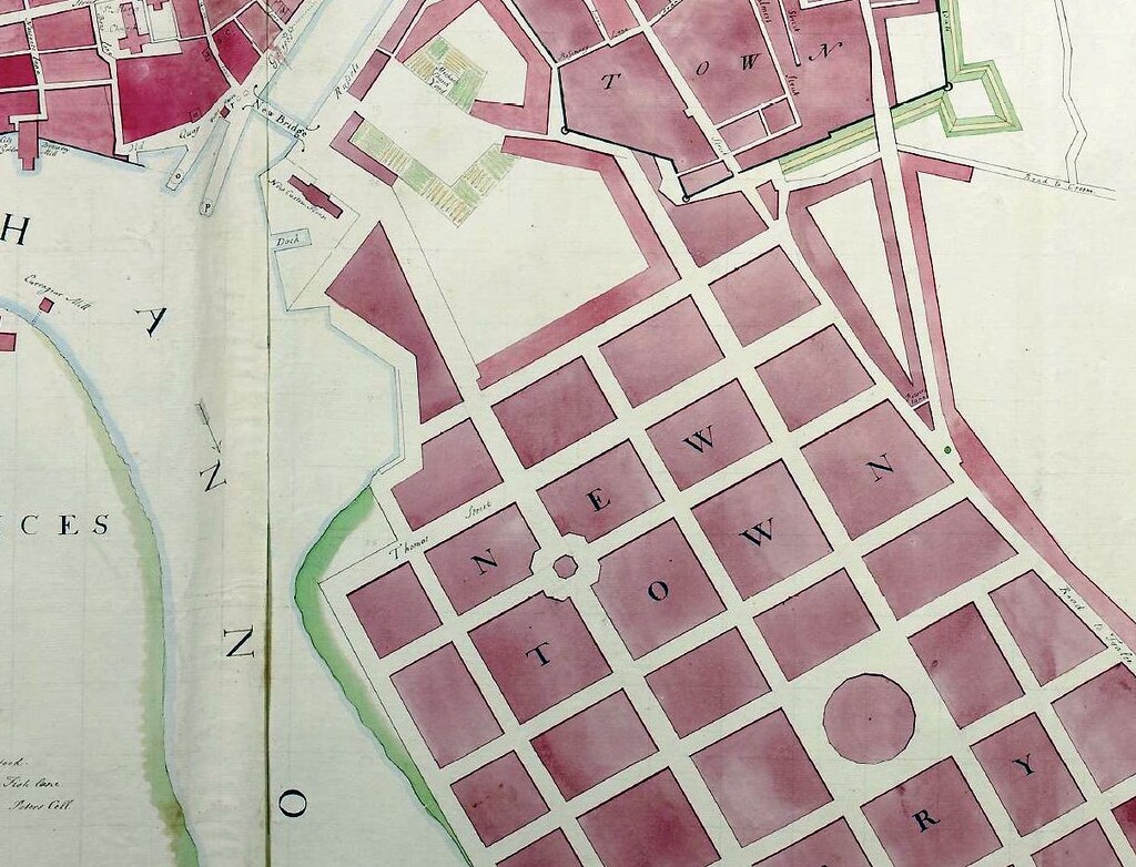
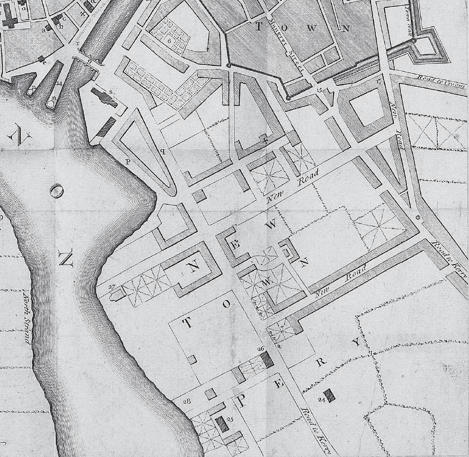
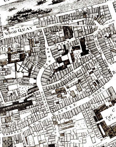
- You must be logged in to reply to this topic.